


Lassithi Plateau

There are many ways to the Lassithi plateau at about 900 Meter altitude. The main routes start from the east at Napoli or from the north at Malia or Chersonisou via Potamies and Kera to Lassithi.
The more adventurous tracks lead on tarmac and tens of kilometres of washed out dirt road, on a forgotten Turkish military track through the canyons, via Lythos and Kastamonitsa to the Lassithi plateau and if you love your racing bike, you have to walk it for a while.
Or you climb via ancient Lato, through the unique village of Kritsa, up to Avdeliako and Katharo, crossing the Katharo Plateau from south to north and then entering the Lassithi Plateau at the village of Mesa Lassithi.

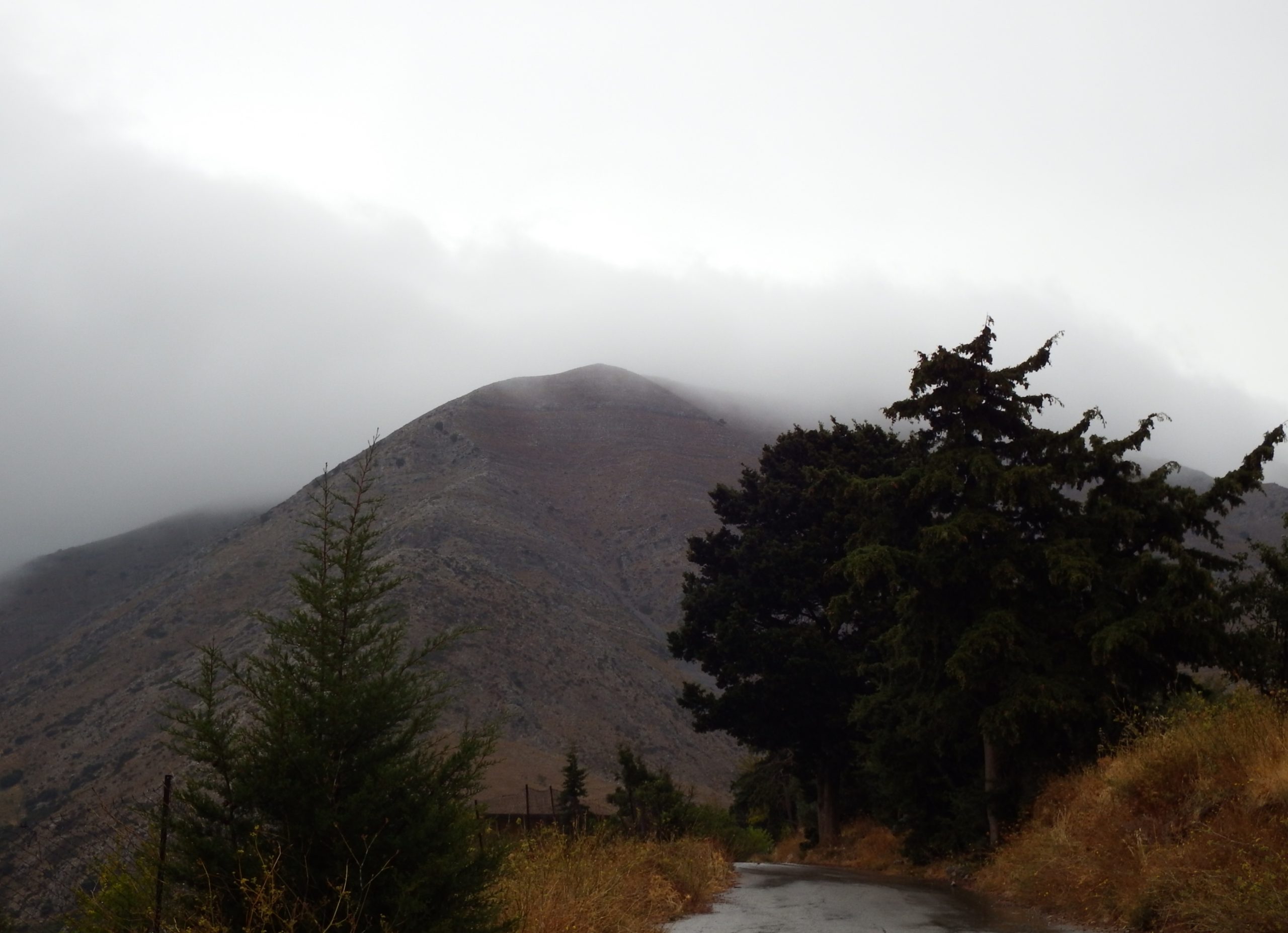
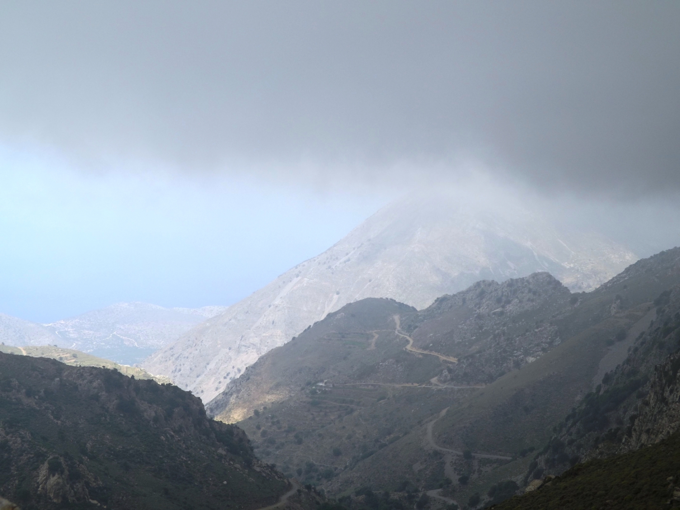
You ride through the clouds and over the pass at an altitude of 1.100m and if you are lucky enough to arrive in spring, you can smell the scent of blooms on fruit trees with every breath you take and marvel at it. The potato- and cornfields, bright rows of vegetables, and blooms on the apple and pear trees look as if they were painted on canvas.
The lofty Lassithi plateau is an impressive size, and the villages on its fringes, as well as the unrivalled haggardness of the surrounding mountains and valleys, make it my favourite garden.
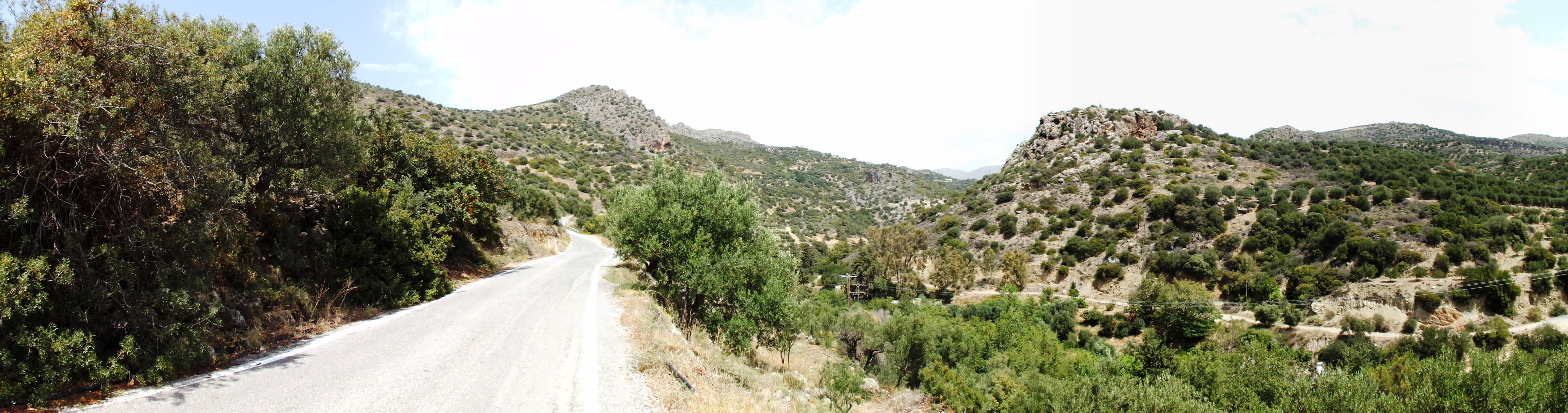
But the today’s ride is an approach to Lassithi from the South, featuring asphalt all the way and if you go by racing bike, you are perfectly equipped. This climb is at least as adventurous as the above-mentioned tours. Short sections of the road can be eroded and there may be some parts of unpaved road.
8.0 Mirtos- Geraki- Kaminaki- Lassithi | 81 km | 2.479 Vertical meter | Hors catégorie
81 km | 2.479 vertical meters | Hors catégorie

But come, let me tell you now of the grief-laden homecoming that Zeus afflicted me with on my way back home from Troy.
From Ilion the wind drove me , brought me to the Kikones, to Ismaros. There I sacked the city, slaughtered the men.
From the city we took both the wives and a heap of gods and divided them.
I made sure none got less than a fair share.
Then I was all for us light-footing it out of there,
And so urged; but the rest, the great fools, refused to listen.
The much wine was drunk, and many a sheep they slew
along the shore, many crumple-horned shambling steers.
[Homer, The Odyssey ix, 39-46 – An New Translation By Peter Green]
Stormy Mirtos – For all those adventurers who appreciate a stormy day to start their journey, this would have been a good day – the waves of the Mediterranean Sea crashed against the promenade of the village Mirtos with a gruesome roar. The salty splashes and foamscraps even fly up to the 2nd floor of the hotel „Paradise„, located directly on the sea.

With unease, the skeptic in me gazed at the churning sea, while the squalls whistled and howled, rattling the windows, uprooting tables and benches on the promenade, driving torn tamarisk trees across the beach and enveloping everything in a murky, milky haze, whereby the small balcony, with a view on the sea, is covered by the spray of the storming waves.
But out of this din you hear a whisper, sending a holy shiver down your spine, a voice, the challenging call of the road: “Come on baby, step on the racetrack, this is your day! Feel the gray ribbon of asphalt speeding along under your wheels. It’s going to be a good ride, just you against the wind and God against us all“. An eerie tension takes hold of you and makes you shudder. You feel an inner turmoil that can only be soothed when the wheels touch the road and whirr along on the asphalt.
Perhaps you are the one who smiles, when your heartbeat widens the arteries on the never-ending climbs with a headwind of 8 BFT, when the quadriceps of your thigh and the calf muscles swell and cramp, painfully blocking every movement. Wild gusts grab you, hold you tight and try to push you off the road into the abyss. That’s not enough? Well, then Poseidon will be ordering a couple of heavy showers, which send you freezing on the slippery downhills.

8.0 Minoan Settlement Mirtos Fornou Korifi

On an island in the vast sea, fires blaze on the beach, illuminating the black, bulbous ships that were pulled out of the water, their heavy bodies resting on the sand like behemoths that rose from the sea. Sheep and goats are slaughtered, their thighs wrapped in fat, burned, and sacrificed to the gods. The helmsman mixes the wine and everyone drinks. This feast lasts for three days until a favorable wind reminds them to set sail. Provisions are carried onto the ships and Jars of wine and barley flour in sacks are stowed away under the oar benches. The spruce mast is erected, the stays and shrouds are attached to the wooden frames and the white sail is fastened to the boom. Grasping the cleats and pulling on two hawsers, the men push the ships into the water. There they lay and swayed slightly in the wind.

Mirtos Fornou Korifi – Waves rise from the great blue sea and rush onto the sands of the far shore. With tongues of foam, they hiss and roar between the rocks, shoot up the cliffs, only to tumble and gurgle back out of the stone basins into the sea. Trying not to be caught by the salty water, children are playing and collecting the conches of the surf zone into a bowl. Cooked with herbs and salt, the pointed conical limpet, keyhole limpet, or lamellated haliotis are delicious to eat in oil.
But suddenly their game freezes. From the small village high up on the marl cliff, dull drums and loud shouts can be heard. Driven by the wind, the dark smoke from a warning fire drifts to the north. It is a warning to all those who tend the sheep and goats, gather plants, draw water from the wells and cultivate the small gardens or the fields on the plain and in the valley.
The animals are driven to the north, towards the mountains, into the prepared hiding places. Everyone else hurries to the village. The women gather a few belongings in cloths and flee with the children towards the inaccessible heights in the north. Only a few old people remain behind.
Three white sails have appeared out of the haze above the horizon, stirring everyone on the two high towers and walls of the village fortifications. These are not the stolid, pot-bellied sailing ships of the merchants who trade dyed wool, woven blankets, and cloths for household goods and pottery, bronze weapons, sickles, and jewelry along the coast. No, these ships bring suffering and death.
Two hours remain to gather the weapons, arrows, and sling stones on the bastion wall and the towers to the south. At the main entrance to the village, the bastion with the tower, in the narrow lanes of the village as well as at the western rear entrance, the firmly fixed wooden gates are closed. The village is ready for defense.
Warriors armed with stabbing swords, shields and bows jump from the black ships onto the flat beach. They rush through the western valley and climb up the steep slope to the village.
There is a dull, hammer-like thud each time a sling stone hits an attacker’s head, while he raises his hands, he feels that his knees are going weak and he’s already falling to the ground. A hard thump when an arrow pierces the leather armor, stopping the running fighter and robbing him of the air to breathe. A scream, another cough, and he, too, wallows in the dust. There is a whirring of arrows, which soon cover the narrow alleys and roofs with their chert arrowheads. The defenders on the walls and bastions are only armed with slingshots and a few bows, which have little effect on the attackers, who approach quickly from the sides and run directly from the beach to the village.
The villagers are hit by well-aimed arrows, while the enemy has already taken the wall from the side and the west gate is forced open with axes. All those who can no longer flee are slain. On the roofs, the intruders run into the village, and as the sun sets above the sea the south bastion is reached and the gate is opened from the inside. The place is doomed. Looking for loot, the invaders ransack the village. They collect all metal objects, tools, weapons, and arrows, look for more provisions, drive the remaining cattle to the beach and smash everything that seems to be of no value. Wood is piled up and set on fire with bundled pine shavings, oil is poured in, and quickly the flames rise high.
8.0 Defensive Site Mirtos Fornou Korifi

From 1967 to 1968, the English archaeologist Peter Warren excavated the village of Mirtos Fornou Korifi dating from the Early Bronze Age (EM II). He documented the location of the buildings and described the pottery and the finds illuminating the life and household activities of the villagers. About 3.6 km east of present-day Mirtos, the ancient village is located on a sea-facing, ca. 66 m high Pliocene cliff built up of marl, calcareous sandstone, conglomerate layers, and thin limestone beds. It can be reached directly from the coastal road to Ierapetra, which runs south of the excavation site.
The choice of the settlement site represents several considerations: the nearby sea as a transportation route, the possibility of defending the settlement from a steep hill surrounded by a wall, but also the utilization of two neighboring valleys to the east and west for agriculture and livestock farming, as well as for olive and vine cultivation. Assuming an overall wetter climate than today, groundwater wells provided a good water supply to the valleys. Across two settlement phases (EM IIA / EM IIB) from about 2,600 BC to 2,170 BC, the village existed for some 400 years.
Agriculture and livestock: Wheat and barley were cultivated, as well as grapes for winemaking and olives for nutritional oil production. Sheep were bred for wool production, so it can be concluded from the findings that the production of undyed and dyed wool, as well as garments, was a major gainful occupation of the village community. Goats were kept for dairy products, pigs for supplementary meat supplies, and the few cattle for tilling the fields. The plain directly north of the village, the land obtained by terracing the hill morphology, and the valleys (cattle breeding, arable farming) were used for agriculture. Fruits, nuts and herbs, wild vegetables such as wild cabbage, leaf spinach, dandelion, carrots, and sprouts were collected.
Architecture: The rooms of the individual houses were equipped with benches attached to the walls, horizontal workspaces, and platforms made of stone, stands for pots, crockery racks, and looms. Larger pottery workshops indicate that the pottery trade was another line of business. With the production of burnt lime for plaster and other purposes, water-bound mineral wall plasters and the stabilization of floors and ceilings could be achieved.

In the pottery industry, amphoras, pithoi, vases, jars, bowls, and jugs were made on hand-operated potter’s wheels. The production of sheep wool included sheep breeding, shearing, dyeing, and weaving. Beforehand, the wool had to be cleaned and washed, for example with the highly alkaline extract of the prickly saltwort plant.
Water requirements: All these activities required water. Due to the geological situation with layers of marl, conglomerate, and sandstone, and with their large drainage catchment area extending into the mountains, the valleys to the west and east were able to store water as groundwater. These underground water reservoirs can be identified by the growth of vegetation and tapped by simple water well construction. The villagers will have brought the wool to the wells in the valley for washing and dyeing rather than carrying the amount of water needed for this purpose to the village.
Based on the required water quantities for the above-mentioned activities, it can be assumed that the climate was altogether more humid than today, as it is already documented for the period from 1938-1947, especially for 1944, 1945, and 1946. The mean annual rainfall here reaches a maximum of 728 mm (O. Rackham in „Myrtos in early Bronze Age Settlement in Crete,“ Peter Waren, 1972). Even though the runoff from seasonal heavy precipitation events has a lower seepage tendency into groundwater, it will have contributed to the groundwater input, especially in the coastal valleys, where lower gradients make for a longer retention time in depressions and valley incisions.
Social organization: Concerning the initial construction of the defense system, as well as food preparation, tool production, and the industrial production of wool and pottery by specialists, a differentiated social organization based on labor division is assumed for the EM II settlement Mirtos Fornou Korifi.

Mirtos Fornou Korifi was a small village where several families lived together in single households. Its estimated number of inhabitants ranges between up to 50 people (Krzysztof Nowicki) and up to 120 people (Peter Warren).
[The current village of Mirtos has a small museum situated at the center, in the old schoolhouse next to the church, with an amazing model of the Bronze Age EMII- site „Myrtos Fournou Korifi“. When looking at the highly detailed and scenic animated model, the everyday life of the villagers comes to life. The viewer immerses himself in this time, now more than 4000 years ago. Katerina Aspradaki- Skaramagas and John Atkinson did a great job of bringing the architecture, the organization and the daily activities of the villagers to life. https://www.mirtoscrete.gr/the-museum-of-mirtos
Opening times: Monday 10:00 am to 02:00 pm, Wednesday 05:00 pm to 08:00 pm and Friday 10:00 am to 02:00 pm. For information contact Mr. John Atkinson Mobile: 6934116199; Home: 2842051143 as far as known and still valid.]
8.0 From Mirtos To Ano Vianos And Through The Iraklion Trench To Geraki


In wide curves, the road from Mirtos leads steeply uphill through the limestones, marls, and sandstones of the Pliocene to the first terrain level at 315 meters above sea level, where the village of Mournies welcomes you. Olive groves, oleanders, and low shrubs line the road, and a single Cretan cedar tree stands tall in the distance.
Featuring two more terrain levels at 430 (after 8 km) and 570 meters above sea level (after 11 km), this route proceeds past the abandoned village of Kalami, and leads you through marl and limestone until you reach the plateau at Pefkos at about 700 meters above sea level after a 14km- ride.
The village road is lined with shady poplars, fig trees, myrtles, plane trees, bright yellow weaver‘s broom and oleander bushes. Shortly afterward, an extensive stock of pine trees follows in the Pindos limestone area.
At Amiras, another heavy rainstorm briefly turns the road into a raging torrent. The road continues uphill through marl, slate, and phyllite until you reach the bare ridge after 20 km of cycling. From here, it’s just a 2.5-kilometer downhill ride on the „Old Road“ along the slopes of Mount Dikti to the picturesque district capital of Ano Vianos. Meanwhile, you’ll see a large bypass road below the town.
Situated at an altitude of 550 meters, Ano Vianos is a tranquil place that invites you to have a coffee at the large plane tree in the village center. The sun comes out briefly so that you can warm up a little. There is an ATM on the main road.

From Ano Vianos to the Iraklion Trench: For the next 20 kilometers, your route leads through the stony Phrygana and features two hills, each about 120 meters high. Due to the rainy haze, the steaming road is steeped in an intense scent of sage, while Cretan ebony bush and yellow broom gleam in the dusk.
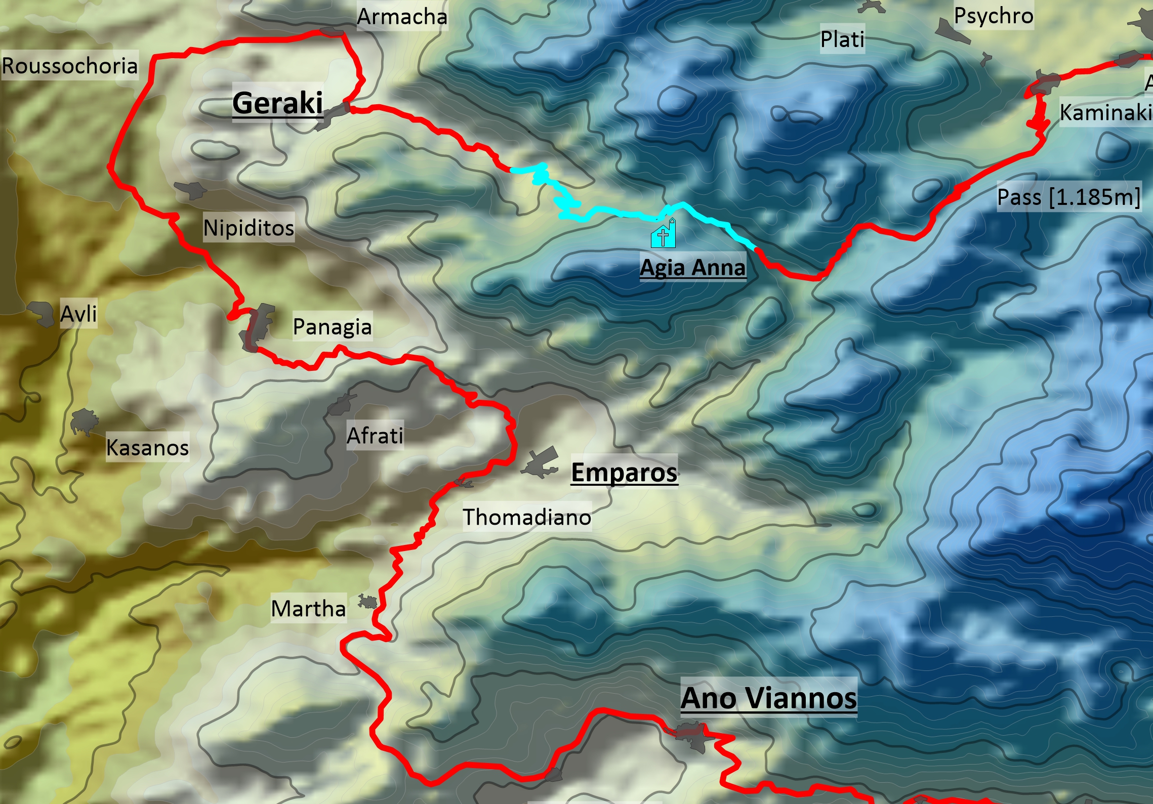
Mastic shrub, kermes oak, cistus, and juniper flit by as you pass the villages of Martha, Thomadiano, Emparos, Afrati, and Panagia on your way to Nipiditos, where you descend through olive groves into the north-south running Iraklion Trench at about 310 meters above sea level.
Two kilometers behind the northbound turnoff to the village of Nipiditos and about 50 meters behind the small chapel (Xōkklḗsi), you turn right onto asphalt towards the villages of Armacha and Geraki.

Geraki: Surrounded by olive groves, fields, and gardens, Geraki is situated at the foot of the Dikti Mountains at an altitude of 500 meters, „like a hawk sitting and looking at the plain“ (G. Saitakis).
A first village further to the southwest and mentioned as early as the 13th century, was destroyed during the Venetian rule. Founded in 1514 and built on this site, Geraki was presumably named after its first settlers.
The villagers make a living from agriculture in the fertile plain and the neighboring mountain slopes, as well as livestock farming. They grow crops like wheat and barley, vegetables, olives for nutritional oil, and grapes for wine, produce honey, and collect nuts. In the summer months, the flocks of sheep and goats are driven to the pastures of Mount Dikti.
On the ascent to the village, two aggressive dogs dashed out of the driveway of a goat shed and onto the road right in front of me. It actually took some targeted stone throws until they let me pass, but they kept on barking and pursued me in the pouring rain, all the way up to the village. Phew, that definitely got my adrenalin flowing.
8.0 From Geraki To The Lassithi Plateau
Geraki is an original Cretan mountain village. Its main street is lined with plane trees, fig trees, vines, and oleanders, and there is a minimarket in the village center. Twice a year, typical Cretan festivals are held here in honor of the local saints Agia Paraskevi (on July 26) and Michail Archangelos (on November 8).
Geraki is also famous for its locally produced cheese, which is offered to visitors at an annual cheese festival.
Water points in Geraki: I recommended that you refill your water bottles here for the remaining 20 kilometers to the Lassithi plateau. There is a water tap at the village entrance below the church and a spring at the village exit, where the road turns off to the northwest and Lassithi.
To get to the Lassithi plateau, turn left at the village entrance before you reach the church (there are two single houses on the left and right) and ride steeply uphill. After about 150 meters take a sharp left turn again and proceed through two hairpin bends for another 200 meters to get to the beginning of the road to Lassithi.
If you prefer a more comfortable route and wish to visit the village, ride uphill through the whole village in a south-western direction, take a sharp left turn at the village exit (the spring is on the left in the bend), and ride back in a northeastern direction above the village, past the small church Agia Anna on the right and straight on until you reach the beginning of the road up to the Lassithi plateau, which has some pleasant asphalted sections.

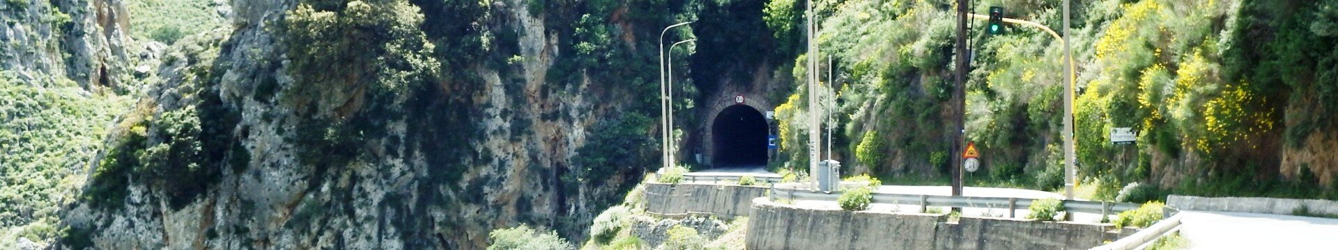
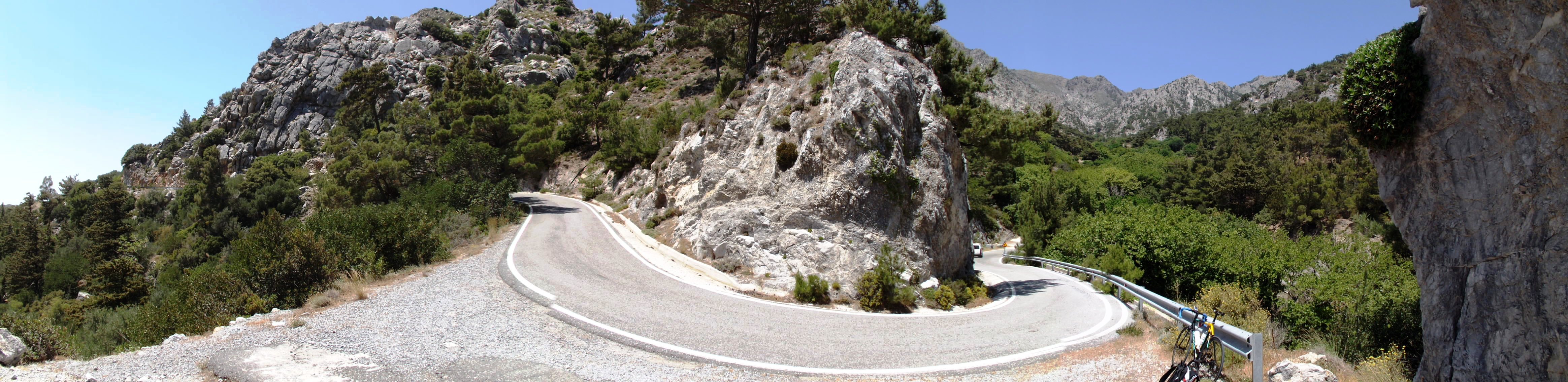
One more bend, and you’ll no longer be rattling away on an old worn-out village road full of cracks and holes but enter the enchanting world of the Dikti Mountains on a brand-new asphalt road built from 2014 to 2020, complete with flawless road markings and 30 km/h speed limit signs.
For a ragged biker like me, this unexpected change of scenery conjured up memories of a domestic Olympic Airways flight in a cool air-conditioned aircraft, where a lovely stewardess attended to the passengers in an off-the-shoulder dress and white kid gloves.

The Agia Anna chapel: With Mount Vourgiomeno, Mount Sarakino, and Mount Afendi as a backdrop, this dream road ascends at a moderate gradient of 4% for about three kilometers until the asphalt turns into a winding gravel path at the first steep valley spur.

For the next two kilometers, the road climbs steeply in narrow switchbacks, first at gradients of 8%, then 12%.
After another 2.5 kilometers at a gradient of 9%, you’ll reach the beautifully situated little Agia Anna chapel at an altitude of 1,000 meters. A spring provides deliciously fresh and cool water. On a small rock plateau, the church was built on the ruins of an older church around 1850 and is one of the most beautiful places to rest and reflect in this sublime landscape.
Coming from Geraki on the gravel road, you’ll cross the first pass at an altitude of 1,070 meters after eight kilometers, and reach the beginning of the completely asphalted road to the next pass and the Lassithi plateau after about ten kilometers.

A wide valley is crossed for two kilometers in a dreamlike, alpine mountain scenery with meadows of flowers, walnut, oak, carob and fruit trees now shining in the sunlight. Then the last ascent begins, leading you through a steep valley with limestone of the plattenkalk nappe and tripolitza nappe, up to the mountain ridge and its pass at an altitude of 1,185 m, delimiting the Lassithi plateau in the south .
On the flower meadow, leaves sway in the light breeze, stalks whisper, stretch towards the sky and asters gleam into the darkness. Mold, decay, putrefaction, honey-sweet a touch like flowers, this is the scent in the grass forest and above everything rises a hum, a hum of a thousand busy bees.
There, in the realm of shadows, a mouse is hiding, with a racing heartbeat carrying a hazelnut by its stalk. In a moment she will be safe under the big stone there. It’ll gnaw a small hole into the shell so its tiny tongue can reach the pulp.


A body falls steeply from the sky, briefly a shadow over the mouse and the claws of the kestrel pierce through the soft plum of its fur. One more scream and the mouse is carried aloft.
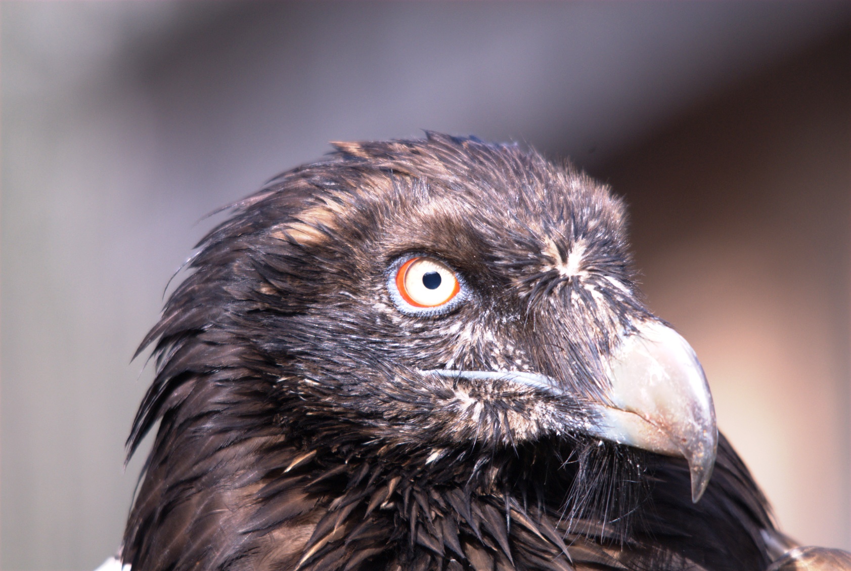
Above the pass, bearded vultures are circling in the updraft, and you can let your eyes wander all the way down to the plain, the surrounding mountains, and the narrow serpentines of the downhill road on which you’ll make our final 5-kilometer descent to the plateau and the village of Kaminaki.
8.1 Mirtos- Embaros- Katofigi- Kaminaki- Lassithi | 69km | 2.727 Vertical meter | Hors catégorie
69 km | 2.727 vertical meters | Hors catégorie

“I resolved to open a little – a very, very little crevice in the lantern – until, at length, a single dim ray, like the thread of the spider, shot from out of the crevice and fell upon the vulture eye. It was open – wide, wide open – and I grew furious as I gazed upon it. I saw it with perfect distinctness – all a dull blue, with a hideous veil over it that chilled the very marrow in my bones” [The Tell-Tale Heart, Edgar Allen Poe, 1843]

Mirtos: Where the southern foothills of the Dikti mountains slope towards the plain around Irapetra, lies the small village of Mirtos. Marked by prosperity and usually buzzing with agricultural activity, the road leading from Irapetra to the west loses its dusty and noisy character here where it turns off into the mountains and towards Ano Vianos.
Away from the road, this peaceful place is an excellent base for exploring the beautiful mountain scenery to the north and east, as well as for tours to the west till the coast at Tsoutsouros.
The alleys facing the sea are lined with white houses, a couple of restaurants and coffee bars, mini-markets as well as souvenir and arts and crafts shops. At lunchtime and in the evening, the beach promenade, where the powerful waves occasionally surge with a roar, is the most popular place for resting and enjoying a meal. The western outskirts of the village merge into the pebble beach and make this holiday resort a perfect spot for sailing (boat rental available) and bathing in the sea.
Accommodation: Big Blue Apartments, located up the hill at the western end of the beach promenade, offer functionally furnished rooms with a kitchenette, refrigerator, bathroom and balcony. The larger apartments, featuring up to two bedrooms and a large balcony or terrace, are lovingly decorated. With a unique view across the sea, you can imagine yourself standing on the bridge of an ocean liner (www.big-blue.gr). The tip for this tour came from the likeable owner, Pavlos Daskalakis: The shortest road connection from the south via Embaros and Katofigi to the Lassithi Plateau was developed into an asphalt road between 2007 and 2013, and was largely asphalted in 2012.

Ano Vianos: From Mirtos, take the well-developed road that goes steeply uphill to the west via Mournies, Pefkos and Amiras. After some 20 kilometres you will reach a plateau at 730 metres above sea level. Then dash down in a fast descent to the big village of Ano Vianos, beautifully situated on a steep slope. Be careful not to miss it, there is a new bypass!
The Byzantine churches of Aghia Georgios and Aghia Pelagia are worth a visit and offer a wonderful view of the valley from the small cemetery. Aghia Pelagia (signposted on the main square) boasts impressive wall paintings dating from 1360. Also interesting is the folklore museum at the western end of the village where you can see a collection dealing with the daily life of the last 200 years. There are two ATMs in town.
Was it today that I had to atone for my sins? I must confess that the images of the „Punishment Of The Damned In Hell“, which I had studied in the church of Aghia Pelagia, were stuck in my head. As I drove through the olive groves, up and down through hills and valleys, I was haunted by the increasingly strong headwind. Sneaky as a snake, it came at me with enhanced force on the ascents, while the midday heat singed me on the descents. The poison of fatigue crept into my body and increasingly diminished the strength I would all too soon desperately need on the mountain.


Embaros: After 38 kilometres in total, turn right towards Embaros (spot the large sign saying „Lassithi“). At the crossroads in the town centre of Embaros, follow the street with the pharmacy, the church and the small, blue „Katofigi“ direction sign. The next village of Xeniakos has another big signpost directing you to Katofigi and Lassithi.
The climb: A big S-bend with an ascent of 8% at the village exit of Kaminaki marks the beginning of the actual climb. The road continues to rise steadily on a straight stretch and further on, on a steep ramp with a pitch of up to 16%, you leave the last houses of Xeniakos behind you. Then it becomes quiet and you are alone, surrounded by the breathtaking scenery of the Dikti mountain range.
Your senses sharpen in this barren mountain landscape. The scent of chamomile is overwhelming; it blends with smell of sun-dried thyme, wild sage and rosemary, and is overlaid by the stench of a decaying goat. The road goes uphill, first in steep curves, then in narrow hairpin bends cut deep into the limestone and marl layers of the Plattenkalk, sometimes featuring unimaginably steep passages with pitches of up to 20%.

The falcon‘s eye – In my silent struggle, accompanied only by the sound of my breathing, I suddenly heard a noise. It was a soft humming, then a buzz, clearly different from the surrounding sounds. Getting louder, it seemed to come from right above me. With a quiet „swish“, a shadow flashed over me and across the street in front of me.
I looked up into the sky in shivers and saw an eye gazing at me. Just like this eye stared straight at me, I only peered hard into this eye.
And from this big eye, surrounded by a bright red sclerotic ring, a beam hit me as if it came from a burning glass.
Directly above me, a huge falcon with a wingspan of almost three metres drew its course in circles. And not just him – ten giant birds of prey sailed higher and higher on the upwind, hovering weightlessly above a breathless human insect that crawled up the mountain at walking pace.


Six kilometres from Xenaikos, behind a first mountain pass at an altitude of 950 metres, the scenery changes. You enter a new world where steep ascents lead through picturesque valleys of the alpine mountains. Surrounded by the high peaks of Mounts Dikti (2.148m), Lazaro (2.085m) and Madara (1.783m), your route leads along eroded gullies, in which the road threatens to sink.
Then further on, an Alp embedded in a small valley with lush meadows. This is where they wave and shout „Ελάτε εδώ. Από πού είσαι; Γερμανικά … Έλα, πάρτε ένα ποτό νερό… – come and drink some water.“ There, the white pearl of the chapel of Ag. Manouil flashes up from its green surroundings. What a fantastic trip.
The next mountain pass at an altitude of 1.300 metres is the last one to master after a challenging 12 kilometre climb with an average gradient of 10%. And there they are again: The huge hawks of the Dikti Mountains now sail over the pass and sweep across the valley lined by sheer rock walls – farewell and have a good flight, you bearded vultures.


Accomodation Agios Georgios: Taverna Maria-Rea is located on the main street opposite the school and offers guest rooms with a small bathroom above the tavern as well as traditional Greek hospitality. Maria herself is the chef, don’t miss her moussaka.
The rooms facing the street provide a great view over the Lassithi plain and St. George’s Church. For larger rooms and studios, visit her „Hotel Maria“, which is slightly hidden in a side street on the western outskirts of the village, 200 metres from the folklore museum (Hotel Maria – Agios Georgios, Lassithi).

8.2 Mirtos- Kastelli- Avdou- Lassithi - The Prologue
„A likely story – and probably true”. – Groucho Marx (1949)

During their vacation, many travelers long to catch up on things that they cannot do in everyday life. In addition to the usual beach life, alcohol-drenched jeep safaris, buggy tours, scooter trips, hikes and boat adventures, these include riding crocodiles and swimming with horses. And nothing could be easier!
There is an aircraft on the runway headed for Crete, and it will take off as soon as the engine problem is solved. A goose, now deceased, had strayed into the fan. Since everyone is already on board the plane, all passengers are able to witness the necessary operation performed by the technical staff. Thanks to the airline for this!

Dr. Livingston: And among all these waiting people, there is one who has fallen asleep and set off into the realms of dreams – an elderly gentleman in the company of his young wife who affectionately calls him „Daddy“. Just now, coming from the beach, he steps through three huge stone gates and into a jungle. You can tell by his equipment, including a tropical suit, a Stetson Troutdalen hat, long stout boots, a vasculum and a rifle, that he is on a scientific mission as an explorer of the caliber of a Dr. Livingston.
From the sea the surf is roaring, in the background you can see a volcano throwing clouds of glowing ash into the sky, and the whole scenery is bathed in a mystical light and the fog of steaming fumaroles. The jungle is filled with the chirping, trilling and calling of birds and the rushing water of a nearby waterfall. Hummingbirds fly around and you can’t imagine a more peaceful atmosphere.

Caught in the quicksand: But suddenly, as he explores the area off the trail, our adventurer sinks into a quicksand layer. His companions retreat in horror as a giant spider – obviously the experiment of a mad professor – crawls out of the forest towards „Daddy“, ready to devour him. Immediately a pair of hairy legs gropes for the victim whose life is no longer worth a bulrush. But at this critical moment, „Daddy“ manages to get firm ground under his feet, pulls up the rifle and fires a well-aimed shot at the monster – the mad professor will not be amused.
But „Daddy’s“ situation has not really improved – on the one hand he is up to his chest in quicksand, in a jungle full of dangerous mutants, far away from civilization and potential help, while dusk falls, on the other hand he sits in an airplane and balances a glass of coke above his crotch. Daddy must have nerves of steel. For hours he now fights on two fronts, but in his efforts to free himself from the quicksand the glass of coke gets out of balance.
Take Off: The good news is that the plane has finally taken off. The engines are humming, the pilots are smiling and winking at each other, because the goose is no longer stuck in the fan, and, high above the clouds and shining in the sun, the airplane is heading for its destination. Cheerfully rattling away, the cabin crew prepares the service.

Then a scream that can’t escape from the plane bounces off the walls, and its amplified echo races through the cabin, threateningly high and shrill: „Daaaddy, you wet yourself”!
And so it is. Daddy has lost the fight. His pants show an annoying, big dark stain of spilled coke in the area of the fly, and it has spread to the seat.
Had this all happened in zero gravity, in a spaceship, our hero would have had another chance, but now „Daddy“ and „Mousie“ are trying not to stick to the seat forever, so as not to jeopardize their chance to leave the plane and to avert an early end of their vacation. Daddy’s efforts to free himself from the quicksand could not have been performed more vigorously.
The attack of the attacking things: We are not traveling in times of cholera, so a general two-week quarantine in Crete is unnecessary. No, what we are currently dealing with is a infuenza with a beautiful name. It lurks on German pork hocks, in chewed-out chewing gum, on discarded school sandwiches, in speech bubbles, and it threatens those who like to roll around in the gutter. It crawls from your shopping cart over the rubber hand guard until it finds a piece of unprotected human skin to bite on to, and then sneaks up your sleeve to your nose where it starts to itch awfully.
Virus screening: After we happily landed in Heraklion, everyone coming from the airfield lined up in the queue in front of the airport building, but thirty of us were lured away by the beguiling chants of sirens in white coats who then tormented them with cotton swabs. I will never forget their moan and groan while everyone else was mercilessly driven to the baggage claim.
Nobody was interested in the QR code of the „Passenger Locater Form“ required for entry (there were no scanners either). The second digit, 1 or 2, of the printed numerical code determines whether, after a day of self-isolation, you will enjoy a carefree vacation or a two-week quarantine locked up in a hotel room assigned by the Greek authorities.

The rental car – and I do not recommend the following incident for imitation – was prepared in line with the requirements of infection protection: Steering wheel, gearshift lever, indicators and other levers on the steering wheel, as well as the digital display (being a touch screen) were thickly wrapped up in cling film. I first thought that it was a new car and the factory had forgotten to remove its delivery protection.
No need to say that it was impossible to operate all the delicate switches for wipers and dipped headlights, but what the heck, it never rains in Crete and the sun (or moon) is always shining. Only a lunar eclipse would have caused a problem. When my conversation with the employee of the car rental agency had progressed so far, I tore out the complete plastic mesh and drove off – accompanied by the horrified moans of this well-meaning person. I will probably stay on Crete for a bit longer now: in jail. But hey, prisoners usually work in a quarry, which corresponds perfectly with my professional background.

8.2 Mirtos- Kastelli- Avdou- Lassithi | 88km | 2.483 Vertical meter | Catégorie 1 - THE TOUR
The Tour – 88 km | 2.483 vertical meters | Catégorie 1
„The cholera had broken out; Quarantines were used everywhere, and the devastation caused by the great floods made all travel … impossible. But „alea jacta erat“ – and who was ever able to escape his kismet? I voluntarily forego the countless advantages and enjoyments that my life in the eternal city offered me in order to open up a new field for my literary work in the distant, unknown south.“ [Elpis Melena – Erlebnisse und Beobachtungen eines mehr als 20jährigen Aufenthaltes auf Kreta – , Hannover 1892]
Newton’s law of universal gravitation is a fine thing. The pull that a bar of chocolate, for example, exerts on us is reciprocated by us attracting the mass of the chocolate. This is certainly one of the reasons why chocolate is so popular. On the other hand, events that lie in the future can also exert a pull through a sequence of directed actions, increasing their probability of occurrence and bending reality in a certain direction.
Alone in weightlessness: For example, let’s watch a bike messenger in a narrow street. Pretty annoyed, he rides behind a car, starting and stopping in search of a parking space, becoming increasingly impatient, accelerating and braking abruptly as well. In the event of an emergency stop, he is catapulted into the air via the front wheel, until he hovers weightlessly high above the car at the apex of its trajectory. Here he clearly feels the mass attraction that the car exerts on him and falling down he sees himself falling onto the roof of the car. Due to the unexpected impact, the driver of the car panics, fully floored the throttle and races through the city with the bike messeger, clinging to the roof of the car.
But no, it turned out differently – the car drove away. And at that moment our biker, like Icarus once, gravitationally messed with the whole earth. He crashes towards the center of the earth onto the pavement of the street. That’s called bad luck!


Mirtos: And when the traveler went over the sunlit promenade of Mirtos, up from the waterside through alleys that are adorned with flowers and entwined by wine. And when our adventurer headed for the exit of the town, in order to climb the 20km in westerly direction on hot asphalt – up to the pass, and to the village of Ano Viannos – in this moment he did not know what was written for him in the future, what burden was imposed for him on this trip.
And as the traveler left the sweet life of this sunny place behind and stepped out of the shadow into the light, through golden and white daisies, he had no idea that the pull of something big and sinister was already about to take effect. The air pressure and temperature dropped abruptly and a strong wind came up.


The Tour: On the southern slope of the Dikti Mountains, the road from Mirtos to Ano Viannos starts off steeply with a 10% gradient, then ascends further in wide arches with gradients of 6-7%, featuring three terrain levels until you reach the plateau and the pass at 730 meters in altitude. Through olive groves and past vegetable gardens, past outcrops of phyllite schist, marl, limestone, mafites of oceanic crust and occasional pillow lavas, this well-developed, varied 22-kilometer route from Mirtos to the west takes you into the increasingly barren Garique, to Ano Viannos (560 meters above sea level).
But already at Amiras, dark clouds came over the mountains and several short showers pelt down.


[For days, cold air masses have been coming from the north, from the mountainous regions of the Balkans, across the Adriatic, the Ionian and the Aegean sea, absorbing water vapor over the Mediterranean.
The strong temperature difference between the warm temperatures of the sea surface (> 24 ° C) and the very low temperatures of the higher atmosphere creates a strong buoyancy. The warm and humid air masses rise rapidly and condense in dense cloud eddies that transport considerable amounts of water.]
From Ano Viannos, heading west, the 10-kilometer route to Martha only features two short climbs and take you 150 meters in altitude downhil. At the roadside, a carpet of pink thyme, yellow and red gorse lights up on an ocher-colored marl ground and there is a fine odor of sage.
Upon reaching Martha at the southeastern end of the Iraklion Trench, the track turns to the north. Via the village of Thomadiano, and past Embaros to the village of Panagia, then passing Nipiditos, Agia Paraskevi and the military airport, proceed for another 22 kilometers from Martha to the larger village of Kastelli at 340 meters above sea level. The new Kastelli International Airport is under construction on the western side of the valley.

The beauty and magic of the Cretan alpine mountains are now revealed in the ascent from the Iraklion Basin near Kastelli to the east. On this 15 kilometer long, remote route – via Lythos and Aski into the mountains, to the pass and back down to Avdou – you drive through the soft terrain of the phyllite-quartzite nappe with outcrops of slate, phyllite, quartzite, limestone and the Mesozoic Tripolitza – Limestone, for 300 meters in altitude uphill. The diverse cultivation areas for olives, crops, fruit, and wine bear witness to the richness of the soil.
Almond and fig trees line the path, the colorful beehives shine brightly from the lush greenery and the mimosas are still in bloom in October. Lythos rises like a castle above the ridge against the backdrop of the steep Dikti Mountains.

Roaring thunder from the mountains are followed by heavy thunderstorms, so that the cyclist soon trembles for his life in the warm embrace of an olive tree in the thunderstorm.
Back on the rain-soaked road, it takes artistic driving skills to stay in control of your slithering tires and manage the downhill stretch from Aski to Avdou in the valley.
Avdou is a tranquil place that has retained it rural, typical Cretan character. In the narrow alleys, Vine tendrils and Bougainvillea grows from the houses, and all-around you can feel that the inhabitants take pride in the floral splendor of their gardens.
8.2 The Aposelemis Lake And The Sunken Village Of Sfentili
The Aposelemis Lake And The Sunken Village Of Sfentili

At the right-hand bend at the entrance to Avdou, just at a level with the olive mill on the right side (visit possible), the approach to Lake Aposelemis and the submerged village of Sfentili branches off sharply to the left. About 3.5km, you drive first on asphalt, then along the lake, on a well-developed gravel road to the sunken village.
An unreal atmosphere emanates from this place, a scenery that is really worth seeing.

Located between Avdou and the village Potamies the artificial Aposelemis lake, extends from the southeast to the northwest. With a usable water volume of 27.3 million m³ and a surface area of 1.6 square kilometers, it currently forms the largest water reservoir on Crete.
The dam (type rockfill with clay core) with a length of 660m and a height of 56 meters is founded on the phyllite rock of the phyllite-quartzite nappe. The lake is fed with the tributary of the Aposelemis River and with water from the Lassithi Plateau, which is supplied via a 3.5 kilometer long pipeline.
Sfentili: After the dam was completed and the lake was successively filled up in 2012, the 13th-century village of Sfentili, presumably named after its first inhabitants, the Sfendilos family, sank into the floods.
Depending on the fill level, the houses and the church of Agios Theodoros emerge from the waters of the lake like an old whale overgrown with shells. During the relatively dry period around 2019/2020, when the water level of the lake was low, the former inhabitants cleaned up the interior of the small 14th-century Byzantine church which features murals by the Fokas brothers, and held a service.
8.2 A Ride On The Crocodile And Swimming With Horses
A Ride On The Crocodile And Swimming With Horses

Cycling from Rethimno to Meronas in the summer of 2014, the path led me past the Potamies reservoir near the town of Voleones. It was hot, the birds were chirping so cheerfully, the grass swayed gently in the breeze, and on the shore of the lake I found an inviting place to linger. Nothing was more tempting than a refreshing dip in the splashing waves.

Just about to step into the shallow waters, I noticed a crocodile in the reeds. At about two meters in length, it was about the same size as the inflatable bathing utensil so popular with children, but it looked very real and was obviously very much alive.
Okay, I must admit that even small dogs scare me – you never know what they’re up to. The good thing is, that dogs swimming in the water aren’t quite that dangerous. Though, mean as they are, they could swim up to a rubber dinghy from behind, then bite and pffffffffhhhhh!, bring the passengers into distress. But what about a sneaky crocodile that is in its element in the water and also feels at home?

His name was Sifis (Cretan for Joseph) and was of the finest, aristocratic descent, probably from the Nile and had been abandoned here in the reservoir. At that time, it already had a Facebook page with 10,000 fans. Perfectly aware of its celebrity status, it turned away indignantly, and disappeared in the lake with just a few slow tail movements.
I did without a bath in the lake. [Sifis died in the spring of 2015, probably due to a cold snap, or for another reason, because crocodiles, unlike other reptiles, are conditionally warm-blooded, so they can regulate their body heat within limits.]
A swim in the Aposelemis reservoir near Avdou is also not recommended. Its banks are very steep, partly covered with sharp stones, so, if you have to leave the water quickly to flee from crocodiles, this will not be easy to do.
Odysseia or swimming with horses

But Crete provides an alternative for you. If you don’t want to ride on crocodiles, you can swim with horses instead. So if you are finally fed up with pedaling, cycling and climbing, Avdou offers the opportunity to ride in a sporty and technical demanding manner AND to swim with horses.
The sympathetic and ingenious entrepreneur Manolis Fragkakis and his lovely wife Sabine have created a wonderful oasis with a hotel and top restaurant at the foot of the Dikti Mountains near Avdou – The Country Hotel Velani: https://www.countryhotel.gr/.
The kind Maitre de Hotel Nikos, provides excellent food and, as an intimate connoisseur of Greek and Cretan wines, will advise you on your choice.
Sabine is the head of the posh riding stable and riding school. So, if you have ever served in the cavalry, you will find an equivalent interlocutor with outstandig level of expertise. Horse riding in Crete – Odysseia Stables: https://www.horseriding.gr/.
The sympathetic riding trainer and tour guide Vladimir will teach you all you need to know about horse riding, equestrian sports and will show you clearly where the rubber meets the road!. You won’t miss the crocodiles! Go for the adventure.
8.2 Mirtos- Kastelli- Avdou- Lassithi - Thunder Storm And End - Up To The Lassithi Plateau
Thunder Storm and End – Up to the Lassithi Plateau
Dark clouds pile up on the Dikti mountains and when the water-saturated warm air from the sea hit upon the cold air layer from the mountains, severe thunder storms raged at night.

The rumble and roll of thunder increased steadily and for an hour after midnight, the sky and the mountain ranges around were, as bright as day, bathed in the dazzling light of a gigantic, flickering neon lamp while the lightning bolts crashed down all around.
A nearby tree exploded into dust and arrow-like splinters and from the haze of ozone, sulfur and smoke the bizarrely twisted trunk of the felled tree appeared like a black silhouette.
Torrential rain poured into the coastal plain in the north. From the motorway bridges near Heraklion, an impenetrable curtain of water and mud was stretched from one side to the other, from which stones rained down on the cars. Streams of mud flooded the streets and pushed all belongings aside like a gigantic bulldozer, moved cars, crushed doors and shop windows, flooded cellars, and destroyed olive, fruit and vegetable plantations. Hailstones the size of table tennis balls fell on the north coast and on Heraklion, so that in the morning a 40cm layer of snow remained and made traffic impossible until it was cleared. The airfield was closed. People cried in the streets because the end of the world had come.
To the Lassithi Plateau
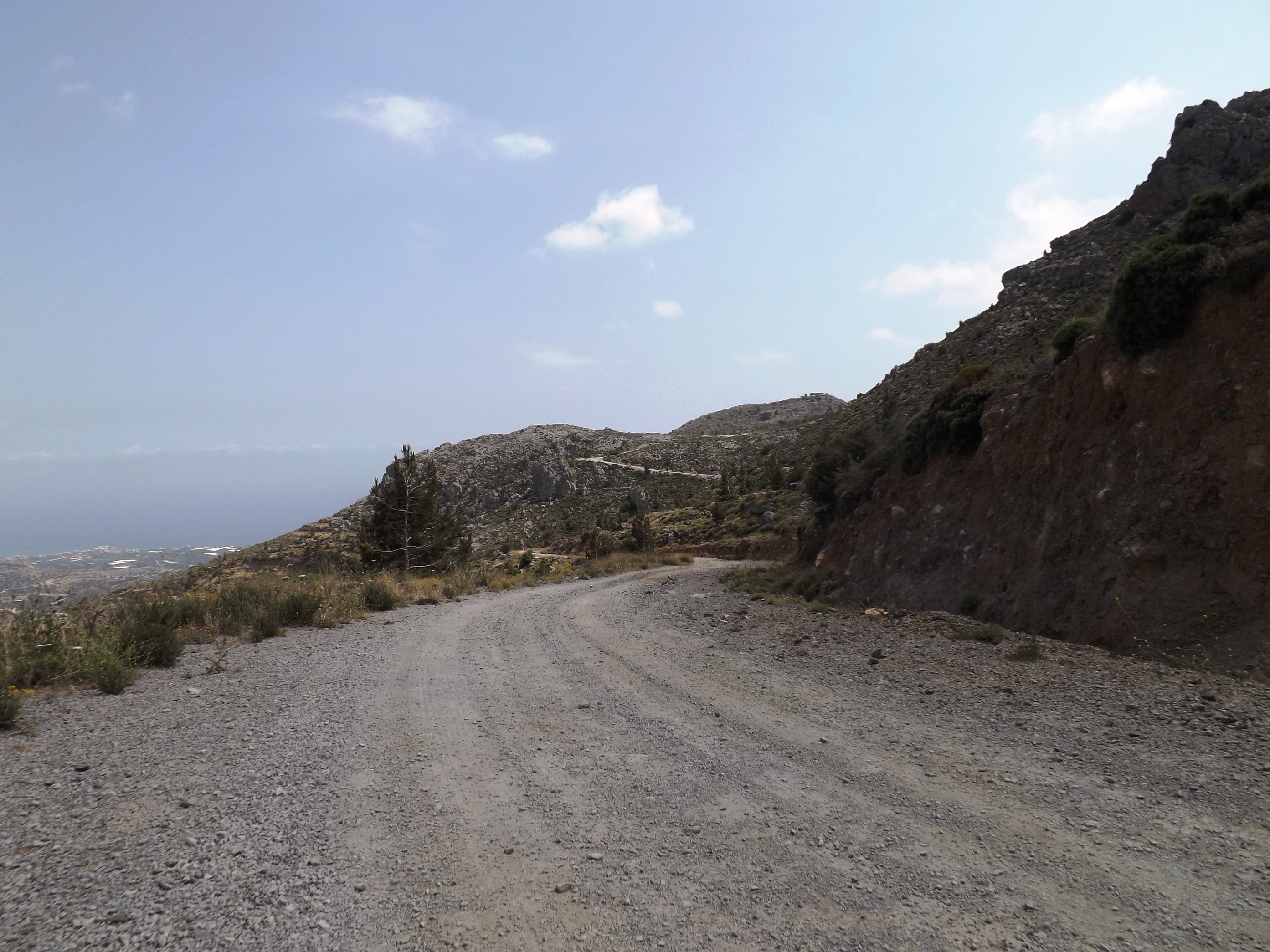
As you leave the village of Avdou at 220 meters above sea level, the steep and winding ascent to the pass at 890 meters in altitude and the Lassithi Plateau lies ahead of you.
On this 13-kilometer stretch, the road leads through the rocks of the phyllite-quartzite nappe and features two terrain levels with gradients of 6-7%. The last 4-kilometer road section up to the pass, where gradients of up to 10% provide a final challenge, is cut into the Tripolitza limestone.
After crossing the pass, the winding 1-kilometer descent will send you dashing down to the plateau at high speed, and soon the first houses of Tzermiado come into sight.
8.3 Mirtos- Orino- Chrysopigi- Sitia | 87km | 2.502 Vertical meter | Hors catégorie
87 km | 2.502 vertical meters | Hors catégorie

A black cat crossing your path signifies that the animal is going somewhere. [Groucho Marx]
A black cat scurried across the way. I followed the broken path of concrete, asphalt and sand that led steeply down to the lonely bay. After an enduring tour, I planned to complete my daily training in the mountains from there for another week.
Perhaps the bay was a bit too lonely: At 5:00 p.m. the owner of the apartments sitting directly by the sea closed his small office and rushed away to a more urban realm. At 6 p.m. the few bathers left the beach. Spring had just begun, and the sun set at 8 p.m. At 9 p.m. it was dark, or rather pitch-black, because there was no further lighting in the bay. Only the windows of the small tavern, not much more than a snack bar, provided a bit of pale light until around 10 p.m. At incredible speed, and accompanied by the roar of engines, the last signs of life faded away.
I, the only guest, remained behind in the darkness. Like a remote little lighthouse, the lamps in my room sent out a beam of light to the sea and to the odd fishing boat, whose position lights slowly crept along the horizon.
On the second day, when I had just returned from training, I saw an unlikely couple sitting in the small tavern. They checked me out with piercing eyes that absorbed every detail – greedy glances from „killer eyes“ seemed to virtually undress me. I was worried because of their smeared make-up and that they were conspicuously prowling around my apartment.
On the first night in my lighthouse above the bay I had slept with the window and patio door open.
On the second day, however, I checked the lock of the entrance door, attached with just two tiny screws, as well as the locks of the window and the patio door. One kick, one push, even leaning against them was enough, and they flew open. That night, the window and doors remained completely closed.
On the third day the situation was unchanged, but that night I also pushed the bed in front of the room door to block it.
On the fourth day, the outrageous intentions of the killers and my own strategies mingled in my head. They had to be separated, disguised, and be kept secret from the other party, so that nothing became obvious to them. Obviously, I was going a little mental. The hundreds of kilometers and thousands of meters in altitude of the last week had left their mark.
On the fifth day I left the lonely bay where I was constantly in danger of mulling over such gloomy thoughts – thoughts that spun around in my head until they got out of control. I felt as if I was pulled into a maelstrom. It was like a mad ride on roaring merry-go-round, where faces are distorted to horrible masks, accompanied by increasingly shrill sounds.
I had to get out of this labyrinth and back to the starting point, preferably in a city. There I could drink my morning coffee in the hustle and bustle of a coffee house, and after the training I could choose one of the taverns lined up on the waterfront promenade. There would be a smell of roast kid, sage, thyme, garlic and wine – the glowing red wine of the Liatiko-Mandilaria, made from the grapes of the Ziros plain. In the evenings, I could enjoy the Vólta – a buzzing of engines, lyre sounds, shouts and chatter – and take in the yellow and white, red-roofed houses adorning the stairs and steep alleys crawling up the slope. The old fortress would tower above it all, and deep down in the harbor a ferry ship would elegantly detach itself from the quay. I needed a lively city whose pulse would take me back to normality – in one word: Sitia.

To Ierapetra: Built on the tertiary coastal terraces near the sea, the bustling main road heads east towards the plain around Ierapetra. On the left and right, tomatoes, cucumbers and bananas grow in the greenhouses scattered along the way.

Thanks to the prevailing tailwind from the northwest you will cover the 14 kilometers to sunny Ierapetra at a fast pace. Europe’s southernmost city, which enjoys the most hours of sunshine, is a lively coastal town and the commercial center of the area. Here you can buy everything from tools to agricultural machinery, including all supplies and spare parts. Even the small grocer, where I bought a rare dessert wine from the monastery of Toplou, offers great wines from the region around Lassithi and Sitia.
Follow the coastal road from Ierapetra for another ten kilometers further east, and then turn left at Koutsinari, where the route takes you into the mountains and to Agios Ioannis in the north.

Up to Aigos Ioannis: Now you’ll leave the Anthropocene behind and dive into the beautiful mountain world of the Thripti mountains. With gradients of 8%- 10%, the first three kilometers provide a challenging warm-up session, while the remaining five kilometers to Agios Ioannis feature moderate gradients. Leading through the conglomerates and marls of the Agia Fotia formation, the road passes olive groves, pine trees and a few oaks as it majestically winds its way up from a wide valley. At the roadside, hundreds of beautiful yellow-brown lucerne flowers (medicago sativa) are in bloom.
In wide curves, the road proceeds through the bright marls and thin-banked limestone of the Sitia formation, followed by more conglomerates. Going further uphill until you reach the level of the Tripolitzakalk at about the level of the church of St. Anthony, you’ll soon see Agios Ioannis, nestled on a hilltop of limestone high above you.

Through the clean, white alleys of the village, its houses crowned with bougainvillea and tendrils of vine, you can walk up to the hilltop at 500 meters, where you can look far down into the valley and to the south coast between Koutsonari and Ferma.
In the old, abandoned stone houses time has stood still. Providing insight to the simple and modest life of its former inhabitants who resided here until about 100 years ago, they comprise a kitchen and bedroom, brick cornice, cupboard and open fireplace, as well as a small crawling cellar that you can access through a hatch. The cellar is lined with pithoi for storing supplies as it has been done thousands of years ago.
Ride through the village and a short way up to the pass to enjoy the most beautiful and varied landscape on a 10-kilometre descend via Schinokapsala until you reach the ascent to Orino.
As if visiting a chamber of curiosities, you gaze in amazement at the glitter and sparkle, the ever-changing artistry of the alpine mountain world. The tops of the Tripolitzakalk are shaped like faces and seem to lean down to speak to you. Between them, the clouds move quickly across the sky, casting their shadows on me and the winding road.
Over here, the rocks feature a soaring shear plane, over there you can spot a spring, a derelict water mill or a place of worship that invits you to linger, such as the single-nave Venetian chapel of St. George dating from the 17th century, located at the foot of Mount Afendis, to which one ascends through an enchanted forest of pines, sycamores and oaks.
Orino: About 2.5 kilometers from Shinokapsala, turn left at the crossroads and cross the small hilltop to proceed uphill towards Orino. The increasingly steep mountain road now turns north and follows the western edge of the Orino Koutsouras Gorge (Koutsouras Communal Park).

The winding road to the pass above Orino does not allow for a breather. It is a mission for every climber on this grueling, steep ascent to climb the next slope, to climb the next bend, tirelessly keep your eyes fixed on the road immediately in front of you and start your powerful climb uphill – curve by curve, and from one ascent to the next, climbing uphill – feeling powerful, indefatigable, indestructible.
An average gradient of 8% and short, steep ramps of up to 18% make you feel as if you were fighting your way up a whitewater stream. Water rushes and gurgles downhill inside the large PE-HD water pipe laid on the side of the road. Make sure to fill your water bottles before you approach the ascent, otherwise you’ll constantly wish to drill this pipe to quench your terrible thirst.

Detour Butterfly Gorge: Two kilometers (1.2 miles) after you turn into the mountain road to Orino, there is a path branching off to the Butterfly Gorge. Why not make a slight detour of about one kilometer (0.6 miles) and descend to the gorge for a little excursion? Go downhill on the gravel road for 300 meters (0.2 miles), keep to the left at the Y-junction of the path and follow the narrowing trail up to the bend to the north.
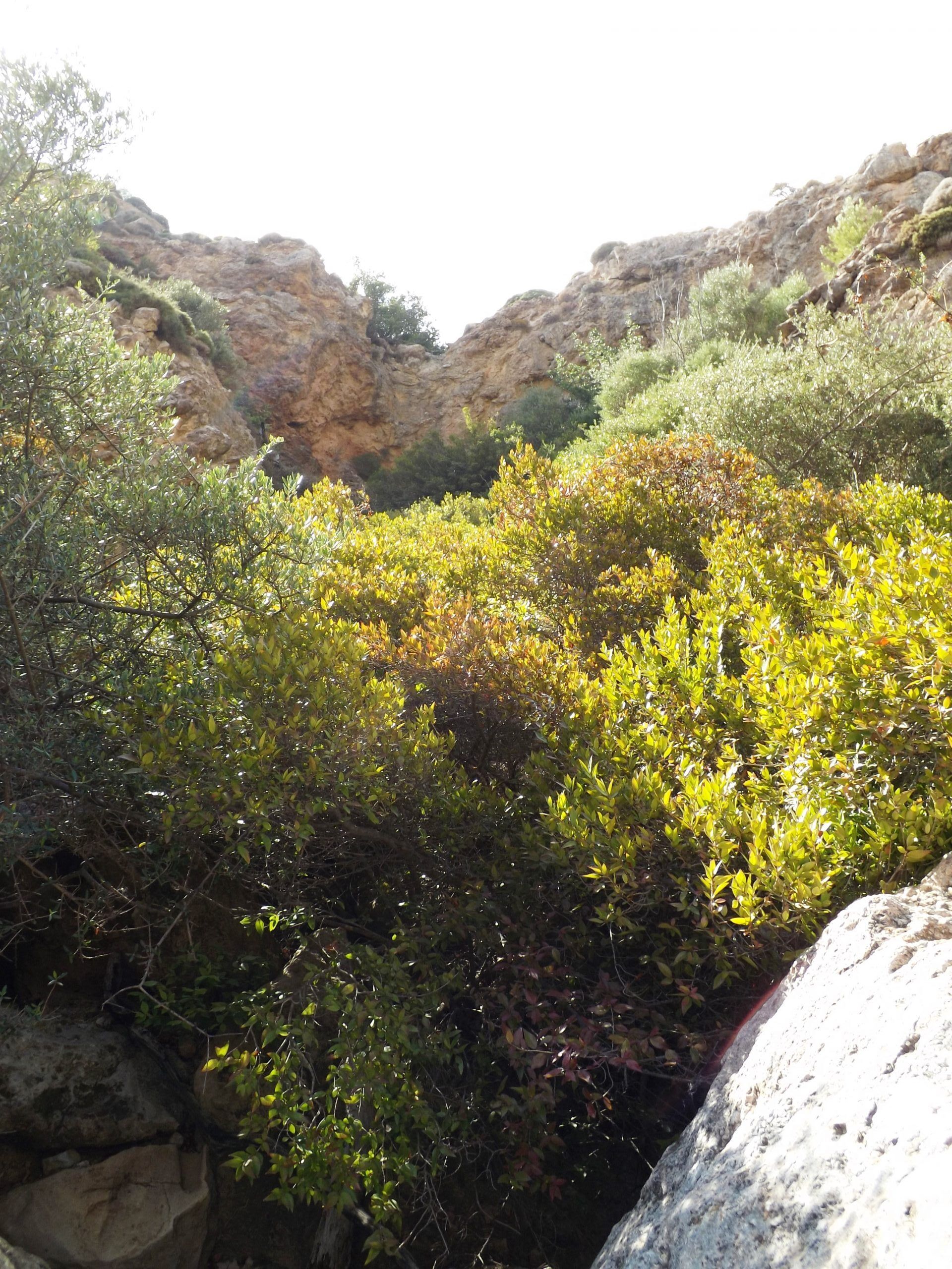
Parallel to the gorge, the hiking trail now goes relatively steep uphill again. There are some short passages where you’ll have to climb over stone ribs. After about 600 meters (0.4 miles) a path branches off to the right and into the gorge. Follow it to see one of the picturesquely situated waterfalls around here.
Sadly, the eponymous butterflies (Red Admiral or Vanessa atalanta) have largely disappeared, as the water of the waterfall. This is where they could be admired in large numbers more than 20 years ago.
At the branch of the regional road (keep left here) our route proceeds steeply uphill in narrow curves until we reach the village.


After a short break at the highly recommendable Kafenion, we climb from the village exit up to the pass, now heading east for about two kilometers. Stop to take in sweeping views of the gorge, the steep mountain road and Mount Afendis Stavromenos. Its peak up in the clouds, the mountain towers above the village, which is beautifully situated on the hillside and surrounded by olive trees, oaks and plane trees.
Downhill to Stavrochori: Next are three kilometers on a curvy asphalt road and your bike will swing downhill like a pendulum. Rushing through the soft valley shapes of the Tripolitzakalk, past juniper and pines, it traces the artistic course of the road and scurries along the ribbon that is the street, like the needle of a barograph. The vegetation of thorn cushion plants around here includes colorful splashes of yellow spiny mullein (verbascum spinosum), tree spurge (euphorbia dendroides), wild carrots (daucus carota) with white blossoms, and flowering orchid. Some crocuses also greet you with their bright colors.
Leading down to Stavrochori, the asphalt road then turns into a gravel road for about three kilometers. This part of the gravel track from Orino to Stavrochori is certainly not suitable for racing tires, but you can easily ride on it when using Cyclecross tires. Their road bike version, up to a width of 31 mm (1.22 in), is the perfect tyre for this tough job. There are a few eroded stretches where you have to get off your bike and push it for a short while. I recommend you carry a pair of light sports shoes in your backpack, so that you can comfortably stretch your legs for a while. Long cycling shorts, a fleece shirt, a wind vest and rain jacket are also recommended for the weather conditions and low temperatures in the mountains.

Soon you will see Stavrochori in the valley below you, surrounded by olive groves, and its houses arranged around the large two-aisled church in the center. The alleys are adorned with white and purple bougainvilla, and the inviting tavern on the platia is shaded by plane trees. Step inside and take a break, while the hospitable landlady will look after you in the old Cretan tradition.
Sitia: We leave Stavrochori to the east and enjoy another 1-kilometer downhill ride before the varied ascent to the pass begins near of the village of Lapithos. The ascent actually features two passes. The first part of the route leads along the south-eastern slope of the Orno Oros mountain range with its Plattenkalk (platy limestone) rocks.
We proceed via Chrysopigi, which means we will cover 500 meters in altitude. At a moderate gradient, we will then ride uphill and downhill through the green valleys of marl and limestone with their shiny white, embedded gypsum cliffs. And yet, we are going constantly uphill on this 12-kilometer route, until we cross the pass at 640 meters in altitude.

The landscape between Sita, Chrysopigi, Stavrochori and the south coast as well as on the route back to Sitia via Makrigialos, Lithines, Epano Episkopi and Piskokefalo provides a perfect training environment for cyclists. You hardly encounter any cars in the mountains, the gradients are moderate, and the long, hilly passages are perfect for fast rides and sprints. So nowadays, you will meet other cyclists more often, mainly from Sitia and the tourist hotspots along the eastern south coast around Koutsouras and Makriguialos.

Sitia is a small, tranquil harbour town that has retained its Cretan character. Restaurants and cafes line the coastal promenade. Head to the south-eastern part of the harbour to find some excellent eateries. Cretan snails with rosemary in olive oil and wine as well as the fish specialities are highly recommended, along with wine from the monastery of Toplou. In the evening, when people stroll in to party and have dinner, the tranquility transforms into a lively buzz.
Accomodation: Itanos – Platia Iróon Polytehniou. Sober hotel atmosphere, centrally located on the main square, rooms predominantly featuring sea and city views.

8.4 Mirtos- Thrypti- Orino- Chrysopigi- Bemponas- Sitia | 93km | 2.801 Vertical meter | Hors catégorie
93 km | 2.801 vertical meters | Hors catégorie

When shall we three meet again, In thunder, lightning, or in rain?
When the hurly-burly’s done, When the battle’s lost and won.
That will be ere the set of sun. Where the place?
Upon the heath. There to meet with Macbeth.
I come, Graymalkin! Paddock calls. Anon.
Fair is foul, and foul is fair.
Hover through the fog and filthy air.
(Macbeth; William Shakespeare)
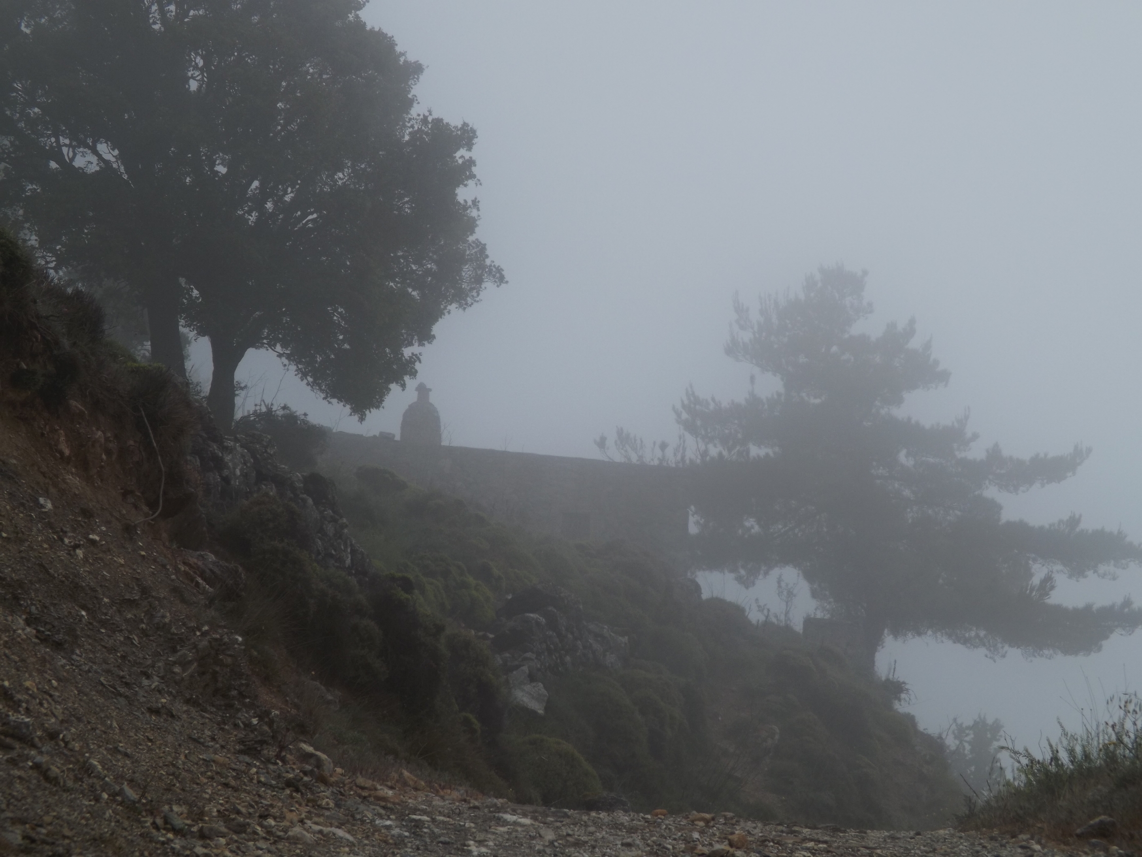

The path is lost in the darkness, the pines veiled by the mist. The wind is like a whisper from the cobweb, that is the forest. The prophecy must be fulfilled, there’s no way back. Too steep the narrow ridge, so close to the abyss, and slippery the wet ground. You are trapped in Cobweb Castle.
Up to Thrypti: In a magnificent landscape, the rough concrete road coming from Kato Chorio winds upwards in narrow curves from the Ierapetra ditch into the Thrypti mountains in the north-east. As if the route wished to prevent your ascent, fissures, cracks and deep tracks pull at the wheel and handlebars. The ribbed concrete road seems to breast those who embark on the adventure.


Leaning closely towards the steep wall of Tripolitza limestone, the road climbs up the rock wall leading into the mountains with gradients of eight to ten percent. After six kilometres of exhausting climbing, the rough path turns into an asphalt road, which now swings eastwards for another four kilometres to the Thrypti alp at 850 metres in altitude. The pine forest is covered in fog, with young oaks glowing brightly in the green surrounds.
Nestled in lush gardens where fruit, vegetables, and, most importantly, wine grows, the houses of Thrypti pop up from the mist. Suddenly i had a taste impression of spice and fruit flavours next to alcohol, and I was close to ordering a glass of local Vilanawine in Thrypti’s only tavern to refresh my palate.

To Orino: From the car park with the water tap and the map, the E4 signs point the way through the village to Orino. For about one and a half kilometres, the concrete road still leads you through the village, then the gravel road begins, just ahead of a bend with a signpost to Mount Afendis. Proceed straight ahead on the dirt road with the power poles and do not follow the right-hand bend.
Through the slate of the phyllite- quartzite- unit, the route goes steadily uphill on the gravel road until, to the north, and through the deep, steep-edged Kavousi Gorge, the view opens up far down to the Ierapetra ditch and into the plain of the northern coast around Pachia- Amos.
After another one and a half kilometres you reach the pass at an altitude of about 1,000 metres where the gravel road branches off to Mount Afendis Stavromenos [1.476 metres]. A hike up there means an ascent of 500 metres in height, and you’ll have to manage about five kilometres in each direction.
The gravel road from Thrypti to Orino is certainly not suitable for racing tires, but you can easily ride on it when using Cyclecross tires. Their road bike version, up to a width of 31 mm, is the perfect tyre for this tough job. Uphill gradients and narrow bends are often concreted, but there are a few eroded stretches, especially on the descent to Orino, where you have to get off your bike and push it for a short while.

I recommend you carry a pair of light sports shoes in your backpack, so that you can comfortably stretch your legs for a while. Long cycling shorts, a fleece shirt, a wind vest and rain jacket are also recommended for the weather conditions and low temperatures in the mountains.
Orino: The fog rises, the sun bathes the beautiful landscape in a warm light, and after a four and a half kilometre descent from the windy pass, the first white houses of Orino stand out against the green surrounds.
Irises and violets bloom along the way, and there is a smells of sage, mint and thyme. From the slopes, you can hear shepherds shouting and sheep bells ringing all over the place as the sheep run down to the watering holes.
Make a short stop at the highly recommended Kafenion, then leave Orino at the northern end of the village and turn east.
Taking in the magnificent panorama of Mount Afendis Stavromenos and the mountain plateau around Orino, you will now climb some 100 metres in altitude in wide serpentines leading to the pass at 740 meters. The asphalt band bends down from the heights into the valley, and you rush through the fantastic alpine landscape of the Thrypti mountains, gently embedded in the soft shapes of Tripolitza limestone, past juniper, flowering orchid and crocuses.


It is like a dance with a recurring sequence of steps you have to take: Adjust the speed before you enter the bend, keep an eye on the inner curve, and, more inclined than actually steering, start at the very outer edge, then pull inwards towards the centre of the curve, firmly clamping your buzzing racing bike with your knees, and, gently held by the centripetal force, glide back to the outer edge and out of the curve with increasing speed.
Since you left Orino, you have covered five kilometres on asphalt. Next are another three kilometres of gravel road, largely easy to drive on when using cross tyres. Only in the steep hairpin bends with eroded draws and loose gravel it may be necessary to get off your bike briefly.
A short break at the little church of Panagia Kapari, shaded by oak- and cypress trees, situated only 100 meters off the path in the vineyards and olive groves. From here, you can look far down into the valley and to the south coast around Koutsounari and to the foothills of the Thrypti Mountains.

Stavrochori: Finally you will spot the village of Stavrochori in the valley below.
It’s very quiet, everything has calmed down. Then the sound of voices is carried up from underneath. A mother and her child playing, a dog, a motorcycle, a call, and the birds are singing again. Time stood still for a short while.

Chrysopigi – Bemponas: At the village entrance to Chrysopigi I had a short tête-à-tête with a ready-mix truck, which left me powdered with dust, as I was trapped between the truck and the garbage bin. The dust caused me to choke up while, when I was breathing again, I was next to the garbage bin and inhaled a full load of indescribable scents.
I was longing for some fresh air. Fresh and crisp as on a mountain alp. For those who started early in the morning and still have enough energy, the six kilometre drive and 400 metres of altitude difference up to the Bemponas Alp and the pass at 800 metres are worthwhile. On the outskirts of Chrysopigi the gravel road branches off to the west. The first serpentines are not passable, but then the path improves. Cross tyres are also required here.
From the western slope of Mount Askordlia [1.237m], passing juniper, olive, fig, and carob trees, the path leads up through the picturesque valley that rises up steeply to the west, enclosed by the surrounding mountain ranges.
The limestone flanks of the Thrypti mountains in the southwest and the Orno Oros mountain range in the northeast directly rise up to 1,200 metres. At the end of the valley you reach the village of Bemponas: a small church, a few houses with vegetable gardens, vineyards, and olive trees on the terraced slopes. Boasting wonderful views of the northern coast but also eroded stretches, the last 500 metres (0.3 miles) of the route from Bemponas up to the pass are a real challenge again. The view down into the Kavousi gorge and to the north coast is simply fantastic. Like in a big theatre, the gorge opens up to the Gulf of Mirambello, where the coastline from Pachia Amos via Kalo Chorio and Ammoudara to Agios Nikolaos is dotted with sparkling bays.

Over The Pass To Sitia: Leaving Stavrochori to the east, the route proceeds downhill for another kilometre. Next, along the south-eastern flank of the Orno Oros mountain range via Chrysopigi, is a 12 kilometre passage featuring moderate gradients.

You’ll ride up and down through green valleys, but always uphill until you cross the pass at 640 metres. Now you can look forward to a winding 18-kilometre descent. From the limestone mountain range, the road now leads through the soft landscape of the phyllite- quartzite- unit, then deeper down into marl and sand layers. For about 45 minutes, a fast descent takes you constantly downhill via Skordilo, Paraspori, Achladia, and Piskokefalo until you reach Sitia.
Sitia is a small, tranquil harbour town that has retained its Cretan character. Restaurants and cafes line the coastal promenade. Head to the south-eastern part of the harbour to find some excellent eateries. Cretan snails with rosemary in olive oil and wine as well as the fish specialities are highly recommended, along with wine from the monastery of Toplou. In the evening, when people stroll in to party and have dinner, the tranquility transforms into a lively buzz.

Accomodation: Itanos – Platia Iróon Polytehniou. Sober hotel atmosphere, centrally located on the main square, rooms predominantly featuring sea and city views.

8.5 Mirtos- Koutsouras- Chrysopigi-Sitia | 75 km km | 1.427 Vertical meters | Category 3
75 km | 1.427 vertical meters | Category 3

Odysseus: … For seventeen days he sailed on over the sea, and on the eighteens there showed up the shadow mountains of the Phaiakian’s land, where it came closest to him, resembling a shield laid out on the misty sea.
But the mighty Earth-Shaker, coming back from the Aithiopians, saw him far off, from the Solymoi’s mountains, visible sailing over the deep, and waxed wrathful at the sight, and shook his head, and thus cummuned with himself: „Damn it, the gods have certainly changed their minds as regards Odysseus while I was away with the Aithiopians! Now he‘s near the Phaiakians‘ land, where it‘s his destiny to escape the great crisis of suffering that‘s come on him. Even so, I think I’ll yet give him his fill of trouble!“
[The Odyssey, Book 5, Homer – A New Translation by Peter Green; University Of California Press, 2018]


Poseidon: The relationship between godlike Odysseus and Poseidon, the mighty Earth- Shaker, can clearly be regarded as destroyed. Poseidon was angry with Odysseus, because he had blinded his son Polyphemos, the Cyclops. Polyphemos had captured and imprisoned Odysseus and his comrades-in-arms, and they were only able to save themselves thanks to Odysseus‘ cunning. After all, Polyphemus had been ignoring the laws of hospitality, and had already devoured six of Odysseus companions in a very unappetizing way, so Odysseus feared to meet the same fate.
And yet, the gods were angry with Odysseus, so Cyclops Polyphemus demanded of his father, Poseidon, that Odysseus was not to return home until after a long odyssey. Lonely and naked, having lost of all his companions and belongings, Odysseus survived his odyssey, but in the meantime, many suitors had blown away Odysseus‘ belongings, and courted his wife, the wise Penelope, to gain rule and kingship of Kephallenia. Had mermaid Leukothea, the goddess of the sea, not taken pity on him, Odysseus would have drowned off the coast of the Land of the Phaiakians and never returned to Kephallenia.

Stormy morning: Imagine waking up in the middle of the night, because the first gusts of an approaching storm rattle and shake the windows of your small apartment high above the sea. You completed a very exhausting tour the day before, and it’s much too early, so you doze off again and wake up late in the morning. You can’t immediately decide to get up and continue your tour to the east, so it’s almost noon when you eventually drink your first coffee on the small balcony. The wind is stormy, but the sun still warms you up.
Spring storms on Crete are of a special nature. The skies are blue, and the sun shines brightly while squalls fiercely whip across the sea, causing the waves to pile up high. No fishing boat, no ferry, and none of the small ships that supply the coast dares to go out to sea.
The wrath of the gods: Days like these require particular caution, for you have obviously directed the wrath of the gods upon you. Maybe your all too small and shabby offering was rejected. Or, in your rush of speed, you spurned Hermes, the messenger of the gods, as lazy and lame. As you know, the gods take the shape of humans or animals to mingle with us. And the little mangy cat that begged you for a bite yesterday at the restaurant, the cat that you scared away with a splash from your drinking bottle (although the other guests disapproved of your behavior), was perhaps Evadne, the daughter of Poseidon himself. The gods will send you a sign.
And that’s exactly what happens after Zeus sent thunder, lightning, wind and rain: Sticky from yesterday’s ride, the drinking bottles are still attached to the frame of your bike. You have to clean them and fill them with the important mixture of apple juice, soluble hemp flakes, water, and a teaspoon of salt.
The contents of the three little bags for household items, medicine and personal care products that you keep in your backpack and that are a must for a well-organized tour, are completely mixed up. Where did that damn razor go? Where are the sunscreen and the chamois cream?
Your one – and for space reasons only – cycling set is still damp from the rain at night, and now you have to put it on wet. Yuck!
To top it all off, you discover a nasty jag in the rear tire that went undetected during inspection the night before and now requires a tire change.
Departure: Your tour to Sitia in the east of the island eventually starts at late noon. There are three possible routes of up to 100 kilometers, thousands of meters in altitude and many kilometers of gravel road. Due to your late departure, your only option is the straight-forward route, a 75-kilometer distance featuring 1,400 meters in altitude. Asphalted throughout, it starts at the village of Mirtos and takes you eastwards along the coast to Koutsouras. Then it turns northwards and crosses the island, taking you all the way to Sitia via Stavorchori, Chrysopigi, and Skordilo.
But, if need be, Poseidon has a special ordeal in store for this mountainous section. Typical of the spring storms with a low pressure area around Crete and a high pressure area above the Middle East is a stormy wind with hurricane-like gusts from the northeast. The tour goes in the exact opposite direction, which means strong gusty headwind all the way. Constantly pulling at you, it will wear you out and can lead to total exhaustion, despair and agony.

Mirtos – Koutsouras: From Mirtos, we follow the coastal road in an easterly direction. Once we have climbed the small hill near Nea Mirtos, we can pick up speed and will soon reach Irapetra on our route via Amoudares, Stomio, and Gra Lygia. The plain stretching out to Irapetra, the largest city on the south coast of Crete, is characterized by the cultivation of grapes, olives and vegetables. Tomatoes, bananas and cucumbers grow in countless large greenhouses that dominate the landscape to the left and right of the road.
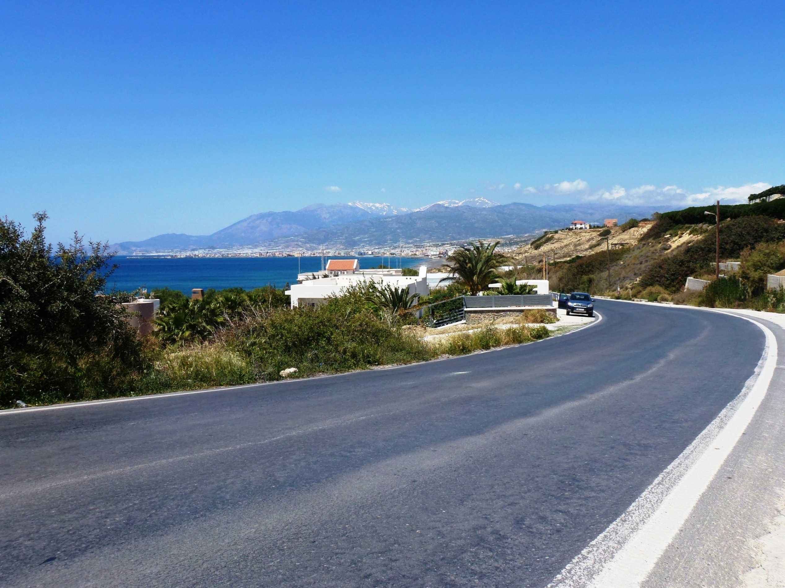
Fortunately, Irapetra has retained the charm of a lively Greek small town where agricultural trade is more important than tourism. You can explore the port with the Venetian fortress Kales, the narrow old town alleys, a house where Napoleon spent a night in 1798, the archaeological museum, the 14th century church of Afendis Christos, as well as a fountain and a mosque dating from the era of Ottoman rule. Several restaurants and bars along the coastal promenade invite you to linger.
Like a blue ribbon, the coastal road first leads straight out of Irapetra. Then, following the 40-meter contour line on the tertiary coastal terrace, it passes Koutsonari and leads to the east via Ferma, Agia Fotia, Mavros Kolimbos and Koutsouras, winding itself from bay to bay and from valley to valley. This is the only highway on the south coast leading to the east, and at times many trucks, coaches and cars are on the road. On this sparsely populated coastline there used to be just a few fishing huts with storage and accommodation. But today, the section between Koutsounari and Makrigialos is lined with hotels and apartment houses.

Head north and into the mountains: Just before you reach Koutsouras, don’t follow the expressway, but take the „Old Road“ to the center of the village, then turn sharp left to head north to Sitia, and use the underpass below the new expressway which runs further to the east and proceeds in the direction of Sitia. Leading through a narrow valley, past the abandoned houses of Tsiklalaria, the road gets steeper and turns off into the foothills of the Tripti Mountains. Exposed along the embankments are fluviatile sands, marl and fine limestone layers, soon to be followed by the mighty conglomerates of the Agia Fotia formation.
After 40 kilometers on flat to moderately hilly terrain along the coast and the easy ascent from Koutsouras to Tsikalaria, the actual mountain route begins: first along the eastern side of the slope, then crossing the valley at a small stream, it follows the wide, open mountain slopes in wide curves.
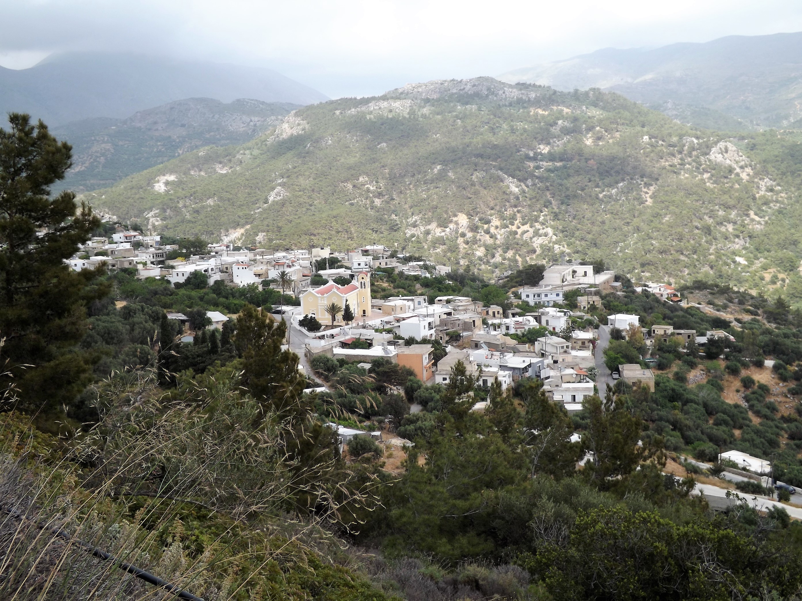
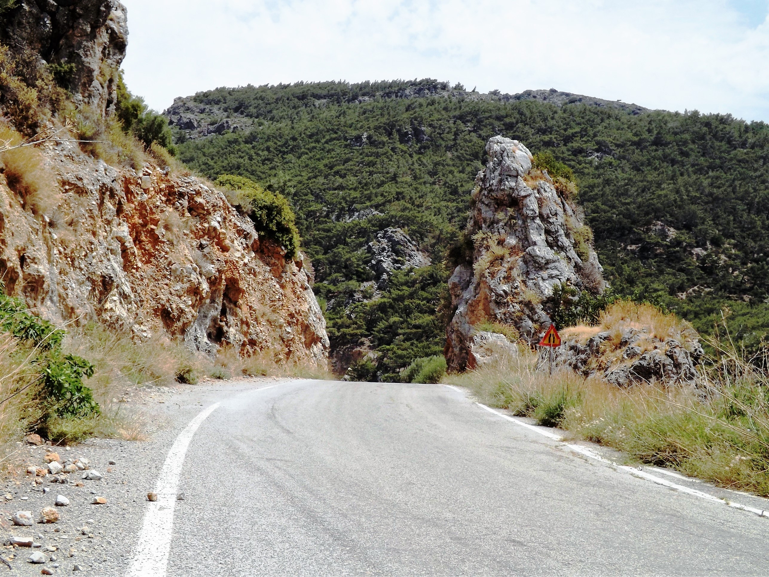
On these four kilometers to Stavrochori, featuring an average gradient of 7% and short ramps of up to 13%, the route now leads through a varied landscape, and we’ll climb 250 meters in altitude.
Leaving Stavrochori, we enjoy a short descent through the Tripolitzakalk and down into the valley. Next is an uphill section of six kilometers at 300 meters on the eastern flank of the Orno Mountains. Leading past banks of limestones, gypsum cliffs, slate, and marl, it takes us through the village of Chrysopigi and up to the first pass at 600 meters.
Perfect training terrain: At least the gods were merciful to me on this day. The headwind was not nearly as strong as expected, probably because the high passes provide an excellent wind shield. Riding this terrain is a pleasure for every racing cyclist. You’ll climb softly shaped mountain slopes featuring moderate gradients, and enjoy a 2.5-kilometre descend through beautiful, wide valleys on a road lined with brooms, olive trees and colorful spring flowers, before you ride uphill again for another 3.5 kilometers to reach the last pass ahead of Sitia at 650 meters.


It is pure bliss to feel your own body take a powerful ascent, race through the curves while balancing like a cat, and then complete the mountain sprint up to the pass on the opposite slope.
Downhill to Sitia: Once we have arrived on the pass, we can look forward to a winding 18-kilometer descent. From the limestone mountains, the road now leads through the soft landscapes of the phyllite-quartzite-unit, then deeper down into the marl and sand layers. Get ready for a gusty headwind in the curves, though.
Just outside Paraspori I experience a rare natural spectacle: A swarm of cicadas crosses the road like a dark cloud and disappears into a grove of kermes oaks near Ekklisia Agios Alexandros. A couple of misguided insects hit my helmet and neck. I follow their deafening song and climb up to the little church. They fall silent for seconds, only to sound again, almost simultaneously. You need to take a very close look to spot them, because their color is very similar to that of the tree trunks. Their grey to silvery-black bodies are three centimeters long. Hundreds of them are sitting on the bark of the trees.
Leaving the pass, the route proceeds constantly downhill. We enjoy our fast ride via Achladia and Piskokefalo, and reach Sitia in just under 45 minutes.
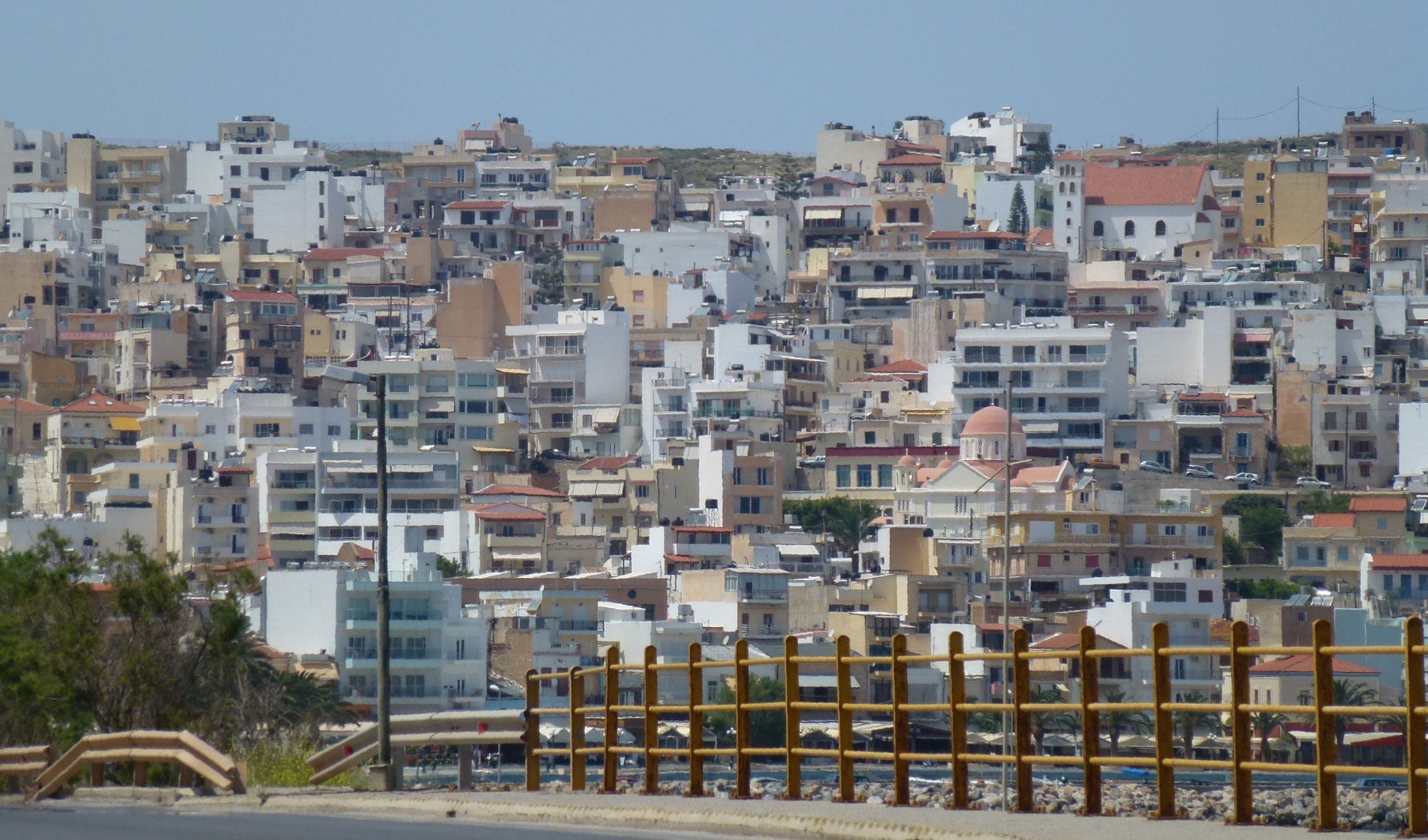
Sitia: To me, Sitia is a town of true beauty. It may lack the patina and baroque splendor that Chania exudes due to its several thousands of years of history, and it may also not be prettied up for the tourists and you won’t find there, the exaggerated makeup of the town as in Rethimno. But that’s exactly why the zest for life, the music of lyre and laouto (lute), the arts and crafts, and the objectivity of science add to the special grace of this truly authentic, charming town. If you, like most visitors, are looking for a pretty little harbor town featuring picturesque taverns, a lively promenade lined with cafés, and a one-kilometer sandy beach with perfect bathing spots, you will definitely fall in love with this typical cretan town. Enjoy the relaxed, hospitable atmosphere of a small world of its own.


Walk towards the big semicircle of houses that line the bay, and take a stroll uphill through the alleys. You will pass small shops, including old-fashioned general stores like the ones you can find in a Cretan mountain village. Walk past the workshop, the tool shop where you can find pumps, hoses and hydraulic equipment, and the little tavern. Even further uphill, leaving the Kafenion behind, you’ll reach the Venetian fortress, where you are rewarded with panoramic views across the bay and the mountains to the south.
Now you know why you were climbing these passes by bike today – to be right here, enjoying the view, invited to linger.
Kiriamadi Peninsula – Cap Sideros: Tomorrow we will be back on the race track of passion and contemplation. We’ll go up to the monastery of Toplou, up into the barren highlands of the eastern part of the island, where the beautiful winding ribbon of the road becomes blurred by the flickering heat, and seems to hover above the ground, as if you were riding the large training circuit in an airship.
Again and again, you’ll enjoy a new view of the landscape or the sea, while you race down to the valleys, from hill to hill, past the palm grove of Vai on the long straight passage to Itanos, and to the restricted military area of Cape Sideros, far out on the Kiriamadi peninsula. As you return through the steep hairpin bends leading up to the Greek naval helipad, you’ll head towards Sitia via Paleokastro, where the monastery of Toplou provides a new ascent, and invites you to go for another round through this unique landscape between the two oceans.

For a detailled Tourdiscription see 10.0 „Kato Zakros- Vai- Sitia“.

8.6 Mirtos-Goudouras-Xerokambos-KatoZakros | 100km | 1.689 Vertical meter | Catégorie 1
100 km | 1.689 vertical meters | Catégorie 1

(…) As Noahs Ark came to rest on Mount Ararat, itself in the Caucasus.
There, as soon he unloaded his animals, the bible tells us,
he began to be an husband man
and he planted a vineyard, and he drank oft the wine,
and was drunk! (Julian Curry, A Guide To Wine, 2003)
The place for which I can say that I was a wine drinker from then on, is not in the classic wine regions of Bordeaux or in Friuli. No, from the moment I left the plateau around the small village of Ziros in Eastern Crete, on a swaying bike and an uncertain course, I had become a wine drinker. The circumstances were similarly dramatic as for Noah, and involved a flood, as well – a flood of wine, that is. And just as the Bible in the Book of Genesis tells of the Flood and Noah, we now know the reasons for this, ultimately geological event that led to Noah becoming a wine drinker.

The talking map: It all began with the purchase of a map. An ordinary road map you will assume, but there is more to it. Just like Harry Potter, who bought his magical books at „Flourish and Blotts“ on Diagonal Road, I chanced upon a small bookstore in Chania with creaking wooden floorboards and old-fashioned shelves packed with tons of books. Standing at the long table in the middle of the store, I immersed myself in an issue of the Cretan Journal by Edward Lear. Soon, however, I noticed a faint rustling and shuffling, and heard a soft whispering sound behind me. More precisely, it was a buzz of noises and quarrelling voices of unknown origin.
None of the customers was responsible for this hubbub, nor the sounds of the bustling town coming in from the street, nor did anyone seem to share my perception. From the corner of my eye I saw the books’ cloth and leather-bound backbones puffing up and prancing up and down the shelves. The guidebooks at the entrance were the main speakers, and the geographical maps of Crete crept out of their covers. Horror struck me, and I even tried to push one of the maps back into its envelope to prevent it from escaping, whereupon it protested loudly.
Like me, you will never have heard of talking maps. And yet there it was there, right in front of me: my first talking map. Today, I take this helpful resource for granted and am no longer the kind of traveler who painstakingly plans his trips down to the smallest detail. No, the ether alone, as medium of my dreams, thoughts and all occurrences, is enough to tell the map my wishes and to determine the next route. If I imagine, for example, a huge gorge where a daring man has built a castle or a palace with a menagerie full of exotic animals, surrounded by the most beautiful gardens, the map will infallibly guide me to this place of marvel. And then, as a guest of these magical places, I find it difficult to elude their warm hospitality and to continue my way on.

The Maps Advice: So, when I wished to visit Kato Zakros in the east of the island, the map led me from Chania to Kissamos in the west instead, to Sougia in the south, up to Spili in the north via Argiroupoli, then to Kalamaki, Lendas, and, finally, to Mirtos further east in the south.
During this quite confusing but eventful first week, I did not get any closer to my destination. There was still a distance of 100 kilometers to cover until I would reach it. So I asked my map quite frankly when I would finally arrive in Kato Zakros. The answer was: „Ziros tomorrow.“ This was not my desired destination, but it was close to it.
Mirtos – Irapetra – Ziros Plateau: Let me tell you in advance that I have no pleasant memories of the ride from Mirtos to Ierapetra and along the coast further east.
Imagine you commute to your workplace early in the morning as you do every day. You are sitting on the train, and from the neighboring track the illuminated windows of the opposite train shine through the foggy gray and displays the same scene day after day: A group of dock workers with their beer bottles, dozing off after a long shift, one of them leaning his head against the steamed-up window pane, his derailed face turned towards you like a distorted image of his fatigue, and all of them are trapped in a somber absentmindedness.
In this exhausted state I tediously swung my leg over the saddle, lifted the rucksack from the ground. I squirmed and tortured myself to stretch my arms into the straps, fixed them and left the enchanting village of Mirtos behind me.

Against all odds: After crossing the river, the road from Mirtos to the east leads along fine layers of limestone and marl and ascends a narrow hill some 60 meters in altitude. (Outcrops of evaporites with gypsum north of the road).
Ramrod straight and across a few hills, the road proceeds through the coastal plain with the villages of Neos Mirtos, Ammoudares, Stomio, Gra Lygia, and Potami. The area is packed with greenhouses for bananas and tomatoes, and you will pass arable fields for cucumbers, peppers, zucchini, eggplant, chili and pepperoni.
Fruit wholesalers, silo plants, stores for agricultural, soil cultivation and irrigation technology, as well as petrol stations, car dealers, repair shops, supermarkets, cafés, furniture stores and timber merchants line the road. Between them, you can catch a glimpse of the sea, the stony beach and a few dust-covered tamarisks. Dimmed by the exhaust clouds of the trucks in the gray of dawn, this 15-kilometer artery of the local land trade stretches all the way to Ierapetra.

Just behind Ierapetra, the road swings eastwards to the 20-meter high coastal terrace, then proceeds parallel to the coast via Koutsinari and Ferma until it eventually unveils its beauty at Agia Fotia, featuring two 50-meter climbs and downhill passages along grandiose conglomerates and marls of the Neogene. Towards the coast, holiday resorts line up, accompanied by restaurants, supermarkets and car rental agencies. On the rising coastal terraces, olive groves and greenhouses dominate the scenery.
Traffic- Madness: The level of traffic is mad. Vans, buses and cars will constantly overtake you at high speed. The huge trucks transferring goods along the coast towards the east and as far as Sitia are scary, and their overtaking maneuvers can be life-threatening. It is advisable to pull out and brake in time to let these monsters pass each time you hear their diesel engines roar behind you.

Further To The East: Following a 35-kilometre ride, the highway to Lithines and Sitia branches off to the north coast just ahead of Koutsouras. Turn right at this junction and take the old coastal road leading eastward along the villages of Koutsouras, Makry Gialos, and Analispi. Once you have passed these popular tourist regions and left Analispi, traffic decreases significantly.
As a harbinger of the nearby mountains, the road now rises to the 40-meter elevation line and proceeds along the coast via the villages of Lagkada, Kato Nero, and past the monastery of Kapsa. Enjoy the short downhill section to the beach at Goudouras before heading north into the mountains. You will now perform a magnificent climb of 1,000 meters in altitude, surrounded by the barren mountain landscape, all the way up to the Ziros plateau.
Attack in Ziros: Both water bottles were empty, and my thirst forced me to the nearby village of Ziros. Coming directly from the south, I approached the village via the plateau through the wheat fields and vineyards. I entered Ziros, went across the main square and past the gas station, then turned left and had already shot past a small cafe restaurant and a mini market, the actual destination, and the last houses of the village were already insight.
So, I braked heavily, and when I turned my bike around, the front tire so unfortunately hit a stone that its high tire pressure of 120 psi accelerated the stone like David’s slingshot and sent it off on a fateful journey.
The sinister „plop“ sound as the stone wedged under the tire flew up, and its impact on one of the café tables merged into one event. Glasses, coffee cups, a carafe of wine – everything crashed to the ground. Even a small bouquet of marguerite flowers lay there, like a sad symbol of senseless destruction, murdered by a stranger.

Don Quixote in Ziros: The stoutly built Cretan farmers who sat at the table jumped up in anger, their hands clenched to fists, because it was all too obvious that I was responsible for this attack.
Fully aware of this incredible and unfortunate series of events, I was paralyzed. I put my bike on the ground at the side of the road, raised my hands, more to show that I did not carry any other weapons, and approached the table, smattering excuses in my poor Greek, humbly bowing and asking for forgiveness – but without success.
Meanwhile, a woman had started to pick up the shards. I followed her into the café, got out of my rucksack, the wallet, the next bigger bill, and unmistakably told her to put on whatever those poor victims wanted to order, to becalm those who were shamefully insulted by me.
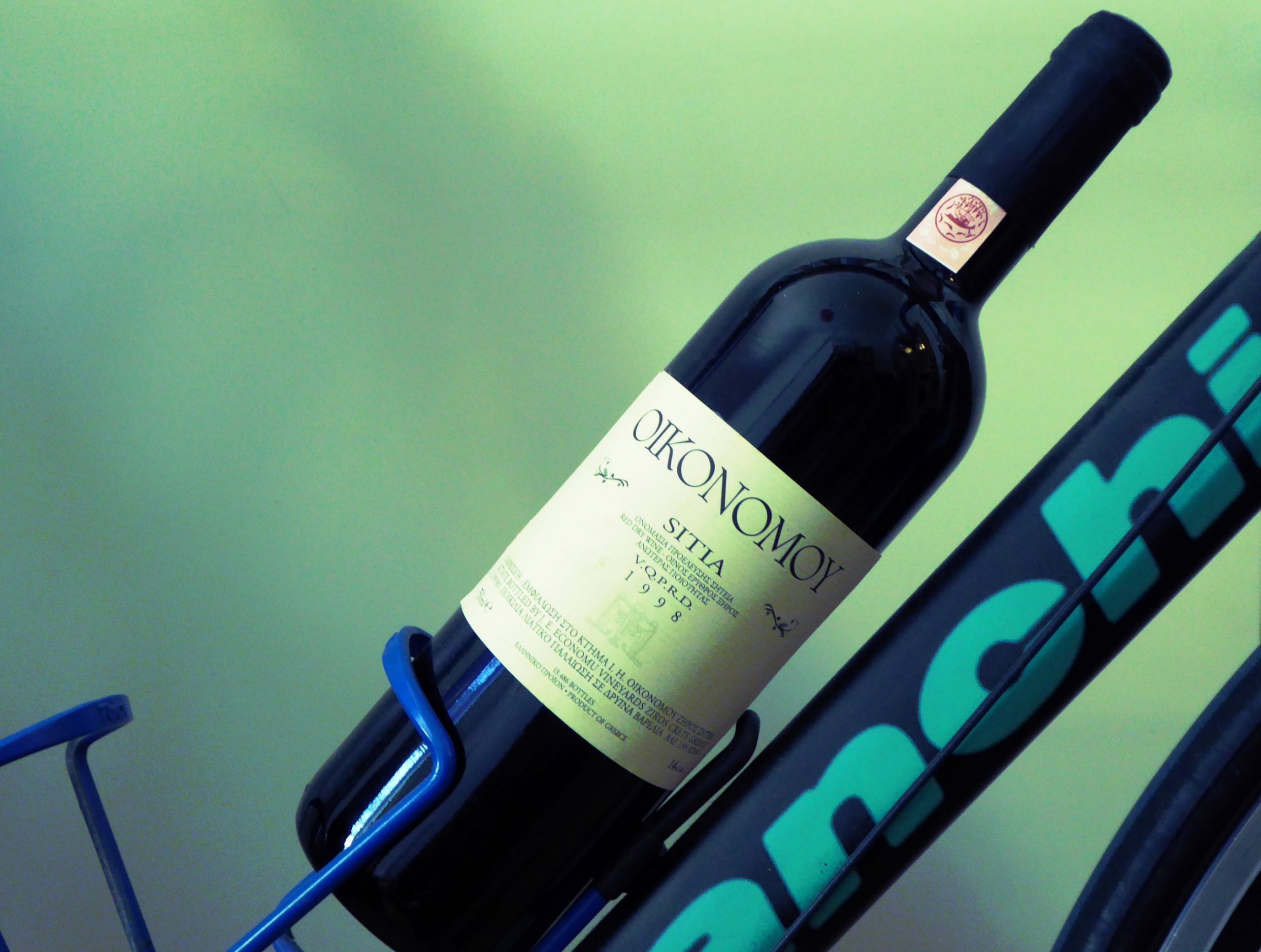
Saving my life and getting drunk: So, it happened that I too – undeservedly – found a seat in this narrow street on a chair. Once out of a deep exhaustion and emptiness, a tiredness of the mind and absolute depression, on the other hand, to wait and see how the situation with my opponents would develop. Just a minute ago I had entered this place as a proud knight, now my future seemed to resemble that of beaten and battered Don Quixote, who’d be expelled from the village.
But the Cretans calmed down, and the catering probably helped them to understand that I had not thrown this stone on purpose. The farmers handed me a glass of wine, fetched my bicycle, and passed it around from one peasant paw to the next like a whimsical piece of bric-a-brac. They asked how much I had paid for it and whether I considered selling it. Soon enough, we were served a bottle of wine that outshone everything that had been drunk before and even managed to cheer me up again. The afternoon passed by, accompanied by lots of laughter and friendly gestures until, one by one, our little group went home. I eventually filled my water bottles, and left, as well.
Bismarck already knew that there is a providence that protects fools, drunkards, and children, and I definitely kept my guardian angel pretty busy as I raced down the serpentines to Xerokambos, elated by the wine, until I arrived safely in Kato Zakros that evening.

One more route option is recommendable. From Ziros to Kato Zakros through the Sitia Mountains: To complete the tour described above with starting point from Ziros, via Chandras, Voila and Sitanos to Kato Zakros, you may also continue to ride across the plateau to the west, heading to Chandras and through the magnificent Sitia Mountains.
At Chandras turn right at the roundabout, proceed uphill through the village, past the church and on to the little playground (road sign „Voila“). Here, turn right again and enjoy a short downhill passage on an easily accessible sand path that leads you to the southeast, as well as a rest at the medieval village of Voila. For this ride through a spectacular mountain scenery with challenging climbs and perfect downhills, refer to tour description 8.7 “Mirtos- Chandras- Voila- Kato Zakros”.

8.7 Mirtos- Chandras- Voila- Kato Zakros | 89km | 1.473 Vertical meter | Catégorie 2
89 km | 1.473 vertical meters | Catégorie 3

… But evil things, in robes of sorrow,
Asailed the monarch’s high estate.
(Ah, let us mourn! – for never morrow
Shall dawn upon him, desolate!)
And round about his home the glory
That blushed and bloomed,
Is but a dim-remembered story
Oft the old time entombed
(The Haunted Palace – Edgar Allen Poe; April 1839)
Coming from Mirtos and Ierapetra, leave the coastal road of the south behind the village of Analispi and turn northeast towards Sitia. Ride on for about 12.5 kms via Lithines until you reach the turn-off to the east at the little village of Pappagiannades. Turn right here and proceed to Chandras via Etia and past Armeni.

At Chandras turn right at the roundabout, proceed uphill through the village, past the church and on to the little playground (road sign „Voila“). Here, turn right again and enjoy a short downhill passage on an easily accessible sand path that leads you to the southeast, as well as a rest at the medieval village of Voila.
Voila: A mystical place where two fountains, adorned with ornaments from the Ottoman era, provide delicious, ice-cold water. One of the fountains is located directly on the path, while the other one, shaded by fig and almond trees, sits above a private garden at the southeastern end of the village.

The village is dominated by the massive fortified „Tower of Tzen Ali“. Dating back to the 16th century and first mentioned as a fortified residential tower of the Venetian Zeno family, it was repaired and decorated for Muslim purposes in 1740-41. The archway still reveals ornaments from this Ottoman period. The tower served as a country estate for utilizing the fertile Armenochantradon valley and as an outpost for the leader of the Janissaries, „Tzen Ali“.

Church of Agios Georgios: East of the path that leads through the surrounding village, you can find residential buildings, stables and warehouses, as well as the ruins of two churches. Situated on the eastern slope, the well-preserved twin-naved church of Agios Georgios houses the 16th century gravestone fresco of the Salomon family, a patrician family originating from the Veneto.
The fresco shows the Blessed Virgin Mary sitting on a throne, surrounded by the members of the family: Giorgio Salomon with a white beard, his wife with a bonnet, pink blouse and purple dress, the son of the family in traditional Cretan costume with wide trousers and boots, as well as their daughter-in-law and grandson. A small inscription on the western church wall refers to the death of their daughter, Maria Solomon, who died in 1510 at the age of ten. (From Candia Veneziana; Michele Buonsanti – Alberta Galla; 2012)
Oh bitter tomb so sorrowful, at once a friend and foe;
here in thy cold stone doth my beloved lie, thus art thou a friend withal;
yet foe shall I deem thee, when all her loveliness has thou devoured
(Inscription on the tomb of the Solomon family, Agios Georgios Church, Voila / from Candia Veneziana; Michele Buonsanti – Alberta Galla; 2012)
In the fields to the west of the path, you can see a protective wall, the remains of buildings and irrigation facilities. Enjoy the great view across this unique cultivated landscape, the wonderful valley and the vineyards, framed by the Sitia Mountains towering another 200 metres above it all. The grapes of the extraordinary Economou Liatiko PDO of the Domaine Economou in Ziros come from these vineyards. They are traditional ungrafted vines, up to 40 years old, as grape phylloxera is not common in the rather arid Ziros plain.


Wine was already produced in Crete as early as in Minoan times, more than 4,000 years ago. Today, most of the wine-growing regions are located north of the mountains. The relatively cool climate up there allows the grapes to maintain their refreshing effervescence and acidity along with deep, complex aromas ranging from apricots, plums, cherries, and almonds to exotic tobacco, coffee, and cedar wood. In addition to Chardonnay, the white wines include the grape varieties Vidiano, Vilana, Dafni, Plyto, Thrapsathari, Muscat of Spina, and Malyazia di Candia. Red wine grape vines include Kotsifali, Mandilari, Liatiko, Romeiko, and Syrah.
Limestone, slate, clay, red slate, and marl are the predominant soils on which the wines are grown.

In the Heraklion area: PDO Archanes (Kotsifali, Mandilaria), PDO Dafnes (Liatiko), PDO Chandakas-Candia (white: Vidiano, Assyrtiko, Athiri, Thrapsathiri, and red: Kotsifali, Mandilaria) and PDO Peza (white: Vilana, and red: Kotsifali, Mandilaria), as well as the PDO Sitia wines (white: Vilana, Thrapsathiri, and red: Liatiko, Mandilaria, Assyrtiko).
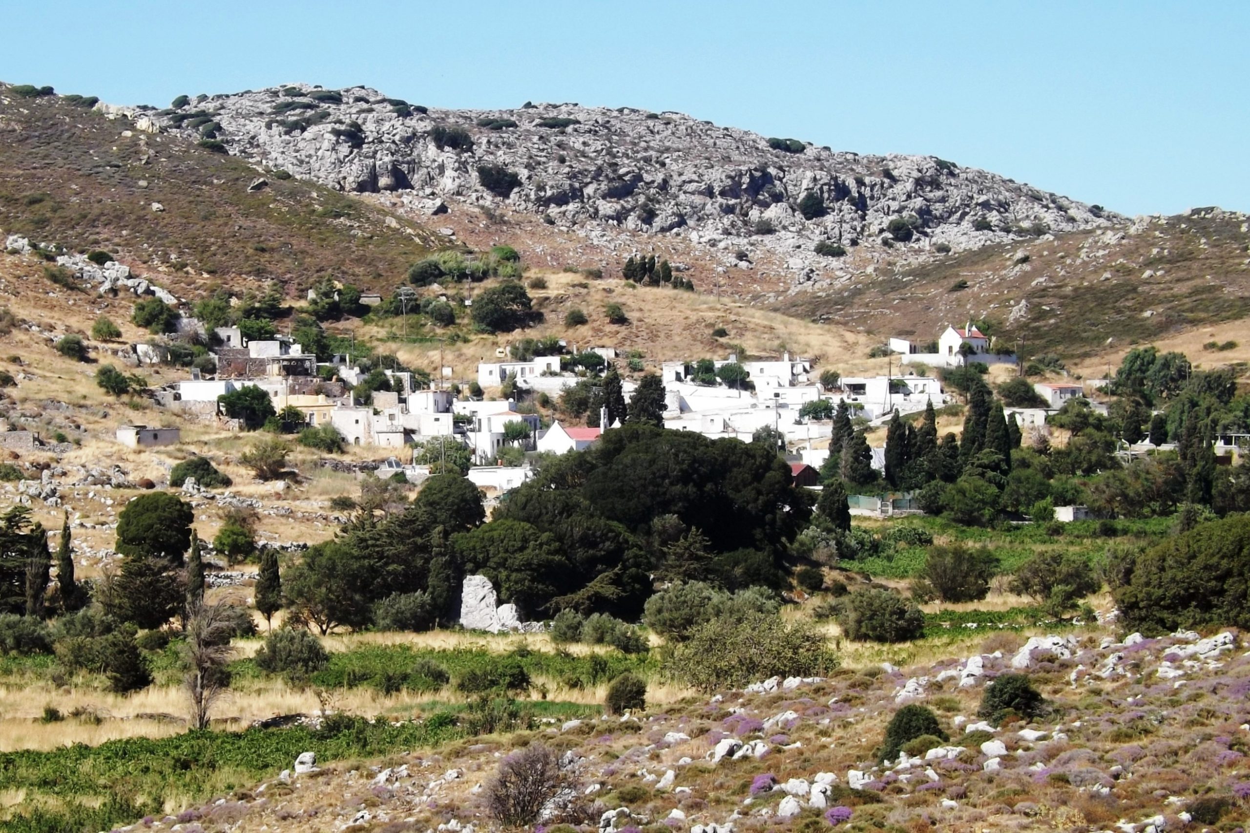
The route continues uphill for about five kilometers and 100 meters in altitude. It takes you through the sublime and barren landscape of the Sitia Mountains, past the largely deserted village of Katelionas and down to the farming village of Sitanos, situated in the fertile valley and surrounded by vineyards, olives and vegetable plantations.
Make a sharp right turn in the village, go left in the bend at the cemetery and right at the next crossroads to face the next ascent of 100 meters in altitude.
It will take you through vibrant purple slate and Tripolitza limestone until you reach the mountain plateau at 700 meters above sea level.
Next is a curvy ride as the road descends steeply to Karydi and Adravasti. Proceed eastwards to Zakros until you reach the coastal town of Kato Zakros after 35 kilometers.

8.8 Mirtos- Selakano- Prina- Mirtos | 76km | 2.041 Vertical meter | Category 3
76 km | 2,6km dirt road | 2.041 vertical meters | Category 3

„I have wandered the world, climbed the most treacherous mountains, crossed deserts, sailed the vast ocean, and sweet sleep has rarely softened my face.
I have worn myself out through ceaseless striving. I have filled my muscles with pain and anguish.
I have killed bear, lion, hyena, leopard, tiger, deer, antelope, ibex, I have eaten their meat and have wrapped their rough skins around me. And what in the end I achieved?“ The Epic Of Gilgamesh 2750 BCE – Book X, A new English version by Stephen Mitchell, S176, 2004.
We cycled up to Omalos in stormy weather with rain and snow. There we stopped at the Taverna Gigilos to warm up our freezing limbs. A couple of racing bikes were parked in front of the inn, covered with the kind of rain capes that French postmen usually wear. Inside the inn sat their owners, five ravenous Italian randonneurs who invited us to their table.
When they asked about our tour, I unfolded the map and started my remarks by saying: “From here to …”. But at the very moment my index finger hovered over the city of Chania, the chief randonneur lost his temper, jumped up from his chair and snatched the map away from underneath my hand with a rapid movement, so that my index finger did not land on the map, but in a greasy spot on the wooden table. A dull gargling sound crawled up from his chest, then a scream, sharp as a shepherd’s knife, a cry that made the marrow freeze in our bones: “WE BIKED ALL OF THIS”! And in wide sweeping gestures he moved his hand back and forth across the entire map, making the breadcrumbs fly off the table in all directions.
We had to admit that the 700 kilometers we covered in one week were paltry compared to the 3,000 kms of the Italians. Aside from their little mental quirks, we admired them. In only three weeks they had completely circumnavigated the island on the Old Road, then crossed it several times and conquered all the plateaus. I can still hear them ranting about our bikes, outside in the drifting snow: “Hollow section rims, pha! That’s the youth of today – hollow section rims in the mountains”.

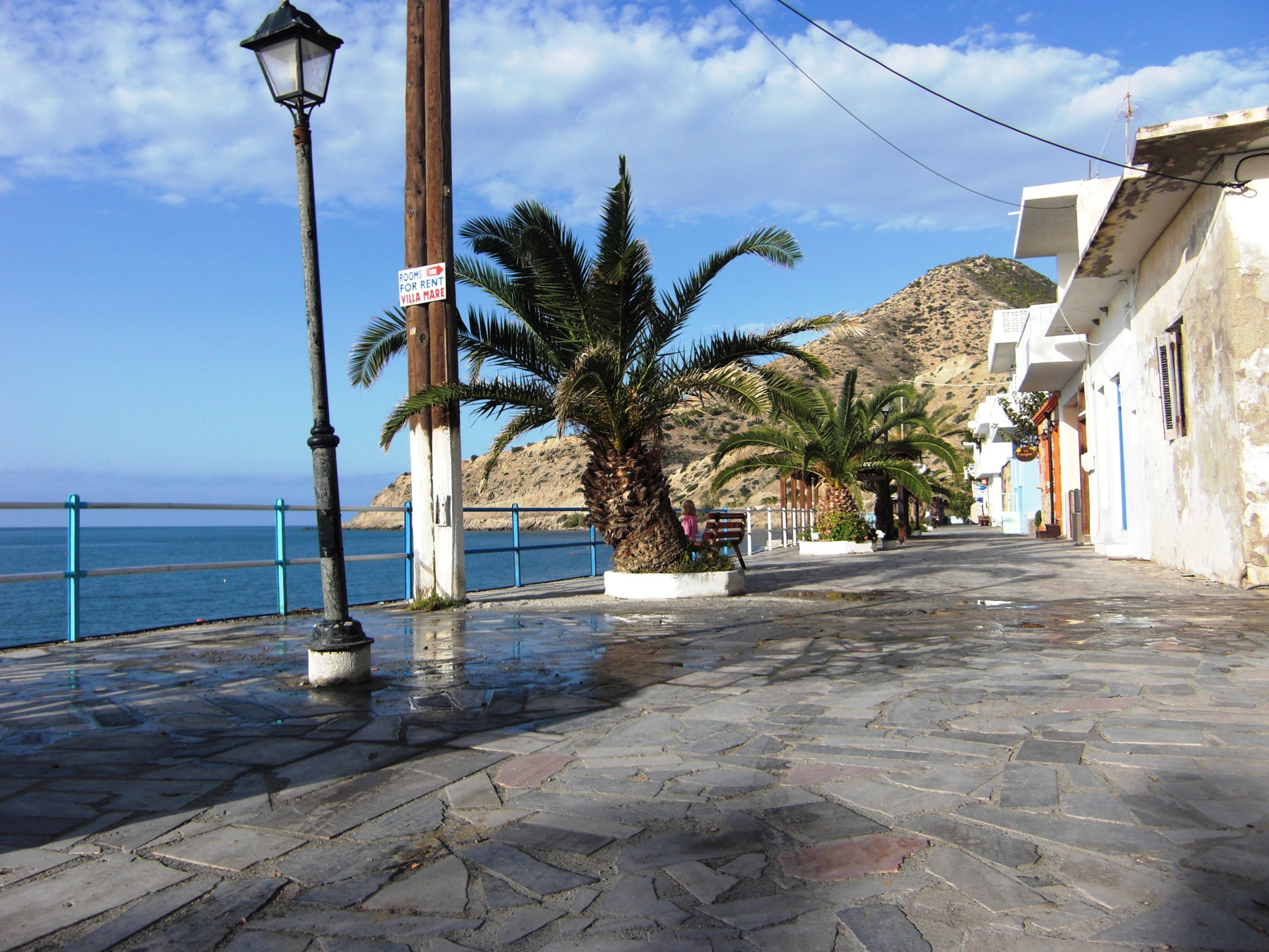
Well, not every cyclist shares the ambitious aims of a randonneur and ows a gladiatorial heart. So my description of this tour through the eastern part of the island goes out to the connoisseurs, to those who turn their faces towards the sun, enjoy the glittering of the big blue on a clear spring morning, spot the lone white sail on the horizon, and love a mild breeze. If you appreciate a hearty meal with the wine brought here from Touplo Monastery, when the evening air is filled with the buzz of laughter and voices, and the alleys of Mirtos are bathed in the golden light of the taverns and shops, this tour is for you.
If you approach Mirtos in spring via the coastal plain from the east, the first thing you’ll see is the peaks of the Dikti Mountains rising up above the horizon, and soon the whole mountain range seems to sway gently on the waves of the Aegean Sea. Like the banners of an army, the snow-capped peaks glow above the blue water and the valleys are filled with cold, fast-moving water. I wanted to see all this.

The first climb leads to the alp of Selakano, situated at 900 meters above sea level at the bottom of Mt Dikti. The main road towards Ano Vianos leaves the village in a northerly direction, parallel to the valley of the river Psoriaris which flows into the sea at Mirtos. After approx. 1,4 kms you turn right towards Mithi and Males. After another 3,5 kms you reach the village of Mithi on a steadily ascending road at 200 meters. For about 1.5 kms, the road now winds its way downhill through the Miocene marls, sands and conglomerates leading to the valley crossing of the Psoriaris.

Cut deep into the Pindos limestone, the Sarakino gorge follows to the west. Provided the water conditions in the gorge permit, this adventurous hike takes about 2,5 hours. In spring, sudden rainfalls can cause the water level to rise quickly and make climbing over the slippery rock blocks a dangerous challenge. For the complete ascent of the gorge, I recommend that you pack a pair of sturdy boots, a change of clothes, weather protection, a towel and a first aid kit. If need be, an alternative route back down to Mirtos is provided via the Males to Mithi road east of the gorge.
The beauty of the gorge with its steeply rising cliffs already unveils along the first 700 meters, which are easy to master. You can enter the gorge via the narrow path to the left of the Mirtos waterworks which is lined with reeds, olive, carob and fig trees.
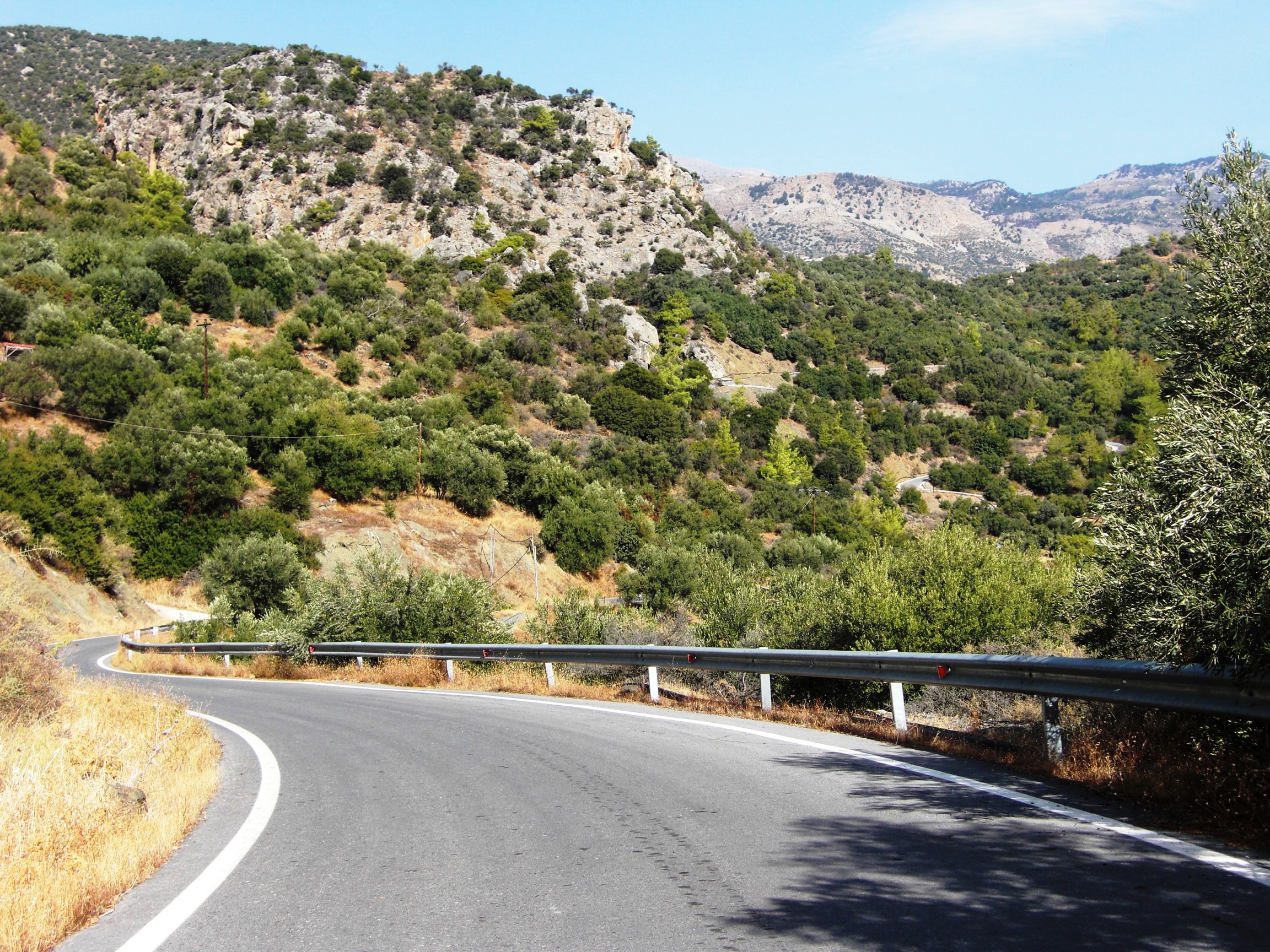
After crossing the river, the route proceeds uphill on a winding road through the olive groves that features ramps with gradients of 8-12%. Just before you reach the crossroads towards Males and Christos there are some challenging hairpin bends to be mastered, which are best done on the outer line. At the crossroads, turn left towards Christos and after 1,5 kms turn right into the steep ascent leading to the alp of Selakano.
The climb continues, but the surrounding landscape appears to have changed as if by magic. Only minutes ago you cycled through olive groves, past hissing irrigation pipes and small fruit and vegetable fields in blurred clayey marls and sands, and now you enter the alpine mountain world of the Pindos limestone where the air is crisp and cold.


In a narrow, arched curve, the road quickly rises up high above Christos and sticks to the steep slopes for the next few kilometers. Then, featuring an average gradient of 8%, it heads northwest towards the foot of the Dikti massif and the alp. A few pines and fir trees line the route which runs partly on asphalt and partly on short gravel roads with eroded sections and small offsets. Olive trees, grasses, herbs, autumn squill, sand crocus (romulea bulbocodium) and goatbeard (tragopogon sinuatus) now adorn the path.
Then the view opens up and in the circle of the snow-capped mountains you can see the scattered houses of the alp of Selakano. Proceed until you get close to the houses, then turn left and go past the small tavern “Stella” until you reach the fork in the village.


The alp itself is quite unspectacular. The true charm of the magnificent mountain scenery can only be discovered on a hike through the remaining pine forests above the village or on wanderings in the direction of Mt Afendis Christos (2.141 m), Mt Dikti (2.148m) and Mt Lazaro (2.085m). A connection to the Katharo plateau can be found at Males.
On the way back down to the road to Males and Christos and especially for the passage above Christos, mountain bike riding skills are required on the steep ramps. For racing bikes, it has proven useful to adjust the saddle height in such a way that you can also shift the center of gravity behind the saddle to maintain control when standing in the pedals.
Driving on a narrow ramp with a gradient of up to 20%, I tumbled into a sudden turn, just to encounter a huge truck driving uphill, loaded with precast concrete components. I have encountered such monsters carrying large chunks of lime or building supplies – including a road tanker – on several occasions and jumped off my bike or even off the road with my bike to avoid a crash. Once I fell on a scrub on a scarp, another time I was lucky to land among a group of goats at a watering hole three meters below the road. The truck tires grind on the side of the road and send behind some gravel and dust. And the truck engine roars: “There’s no room for a little worm like you!”

After reaching the road from Christos I proceed to Males. The large mountain village is beautifully situated on the north-eastern slope of the mountain range at approx. 600 meters above sea level. Greek tranquility and serenity characterize the atmosphere, and this attitude to life is best experienced when you stroll uphill and downhill through the narrow lanes and pay a visit to the Kafenion. At the church of Panajia Messochoritissa in the center of town you can admire some frescoes dating from 1413 which have faded somewhat over the years.
Connection to the Katharo plateau: Just before you reach the village of Males, a steep, ribbed concrete road on your left leads to the village of Katharo or the Katharo plateau respectively. It first takes you in a westerly direction and then towards the north. On this eight kilometer route to Katharo you have to master about 1.000 meters of altitude. After approximately three kilometers, the paved road turns into a gravel road.
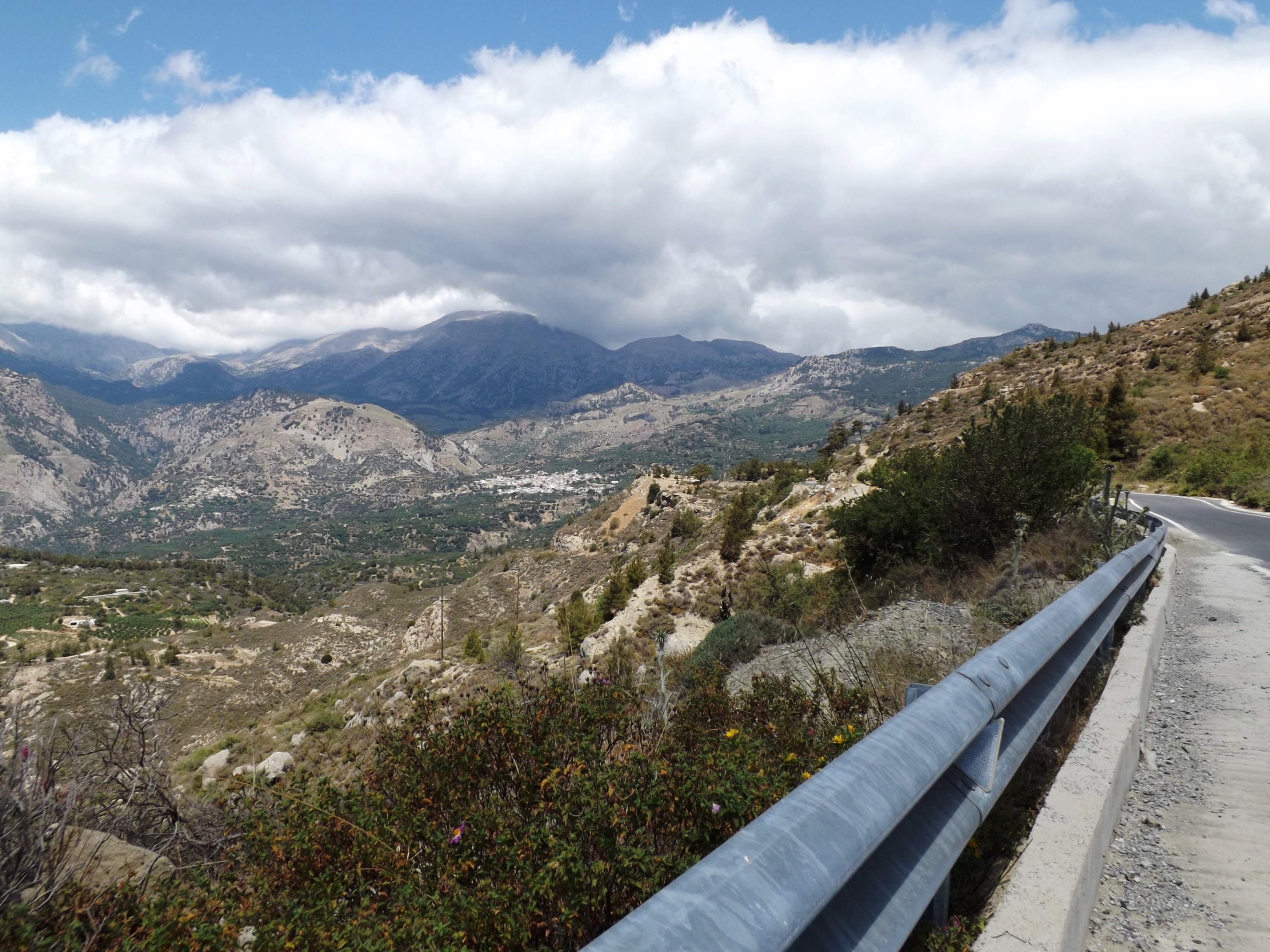
If you look out to the east and to the southern coast from Males, the grand “teatro spettacolo grandioso”, which our Italian colleagues had been raving about, will unveil. And it is truly spectacular! For the next 15 kilometers to Kalamafka, you will ride on the contour lines of 600 meters and 500 meters and discover one of the most varied and scenic training routes I have ever encountered. Featuring an average ascent of 3%, the first seven kilometers leading up to the pass at 700 meters take you steadily uphill. But the changing theater scenes are the ones that enchant you, while you master the uphill and downhill stretches.
Sometimes the impressive Lassithiotika mountains tower above you during an exhausting ascent, then the view opens up again, and you can look far across the coast and the sea while you rush along a curvy road at high speed, past the Miocene conglomerates and clayey marl.
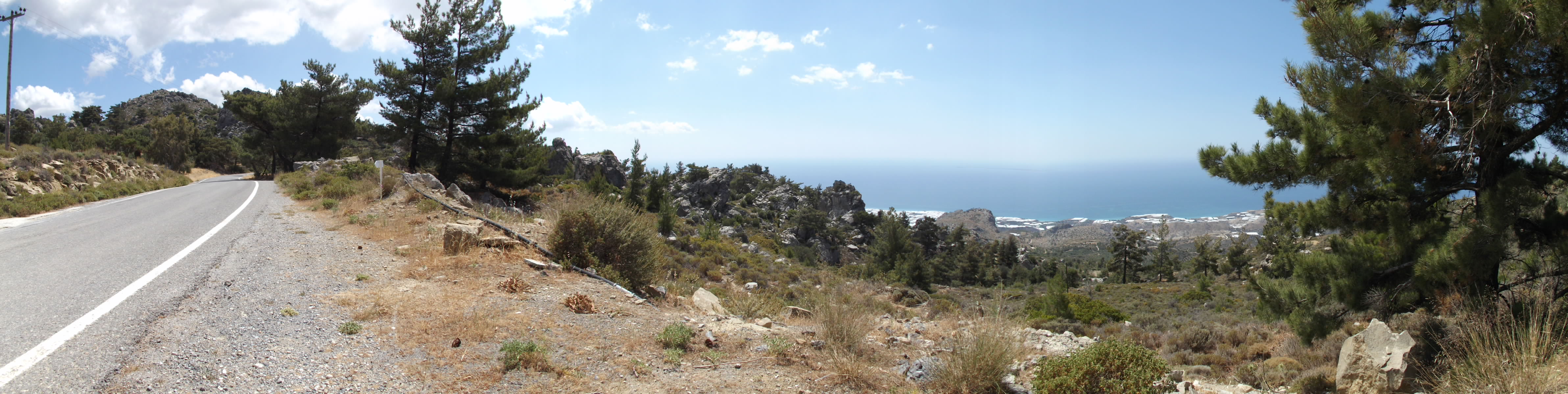
From the pass, the panoramic road runs downhill on a nine kilometer stretch via Anatoli to Kalamafka. Irapetra is located in the southeast and Crete’s largest reservoir is halfway up. The Bramiana dam was built in 1970 as a water reservoir for agriculture. Today it is an important biotope and wetland for plants and waterfowl.

Once you leave Kalamafka, a steep 10% slope will challenge you for about one kilometer. The marl, sandstone and limestone layers reveal themselves. Crossing the hilltop, you’ll rush down at high speed to the village of Prina and down to the T-junction at the well-developed road that leads from the north and from Istro to Meseleroi and Irapetra in the south. Turn right here and follow the wide curve to a 1,5 kilometer ramp that has a gradient of up to 10% in store for you. Knowing that this will be the last serious climb, a mountain sprint is now the order of the day.
The route proceeds quite unspectacularly via Meseleri and Makrilia, through olive groves and vegetable gardens, past old windmills, and down to the small town of Irapetra, which is surrounded by tomato and banana greenhouses.
Our big play has only one more scene to go, and it’s good that the curtain will come down soon because it unfortunately has an ugly modern ending. We immerse ourselves in the “Anthropocene”, whereas I prefer the geological synonym “Psychozoicum”. To be honest, it is more in keeping with my experiences in dealing with my fellow human beings.


The coastal road leading to Mirtos via Gra Ligia, Stomio, Nea Anatoli, and Ammodoures is the traffic artery of this agricultural area. It makes even an experienced bike messenger break out in sweat. The region’s prosperity is based on the agricultural trade; there are countless greenhouses, factories of fruit and vegetable merchants as well as car dealerships, workshops, furniture and electronics retailers. Large trucks line up at the warehouses – and unfortunately they also drive around like busy bees, searching for the next beehive, always wrapped in heavy, greasy clouds of exhaust fumes.
Ahead of me and behind me, engines roar and drivers honk their horn. Directly in front of me, cars turn into the street from the left and right – just like bumper cars at the fun fair.
To top it all off, a GIANT shepherd dog barked straight into my ear. His drooling mouth wide open, he stood on the loading area of a pickup truck and his sticky mucus hit my face and helmet when the driver made a reckless overtaking maneuver; exactly what I need to fit in with this new stage aesthetics. It’s a good thing that all of this happened inside a big cloud of dust that somehow calmed the chaos, otherwise I might simply have freaked out or something may have exploded inside of me. In a nutshell, the last 10 kilometers from Irapetra to the final 50 meter ascent just outside Mirtos are sheer hell, at least in the evening rush hour. But this last short elevation separates the chaos in the east from the tranquility in the west. So I cleaned up my face as well as I could and happily entered Mirtos.

8.9 Mirtos- Tsoutsouros- Arvi- Mirtos - The Chase | 102 km | 2.471 Vertical meter | Hors catégorie
102 km | 2.471 vertical meters | Hors catégorie
The Chase:

“The Truck was no closer, but it hadn’t lost ground, either. Mann’s eyes shifted. Up ahead were hills and mountains. He tried to reassure himself that upgrades were on his side, that he could climb them at the same speed he was going now. Yet all he could imagine were the downgrades, the immense truck close behind him, slamming violently into his car and knocking it across some cliff edge. He had a horrifying vision of dozens of broken, rusted cars, lying unseen in the canyons ahead, corpses in every one of them, all flung to shattering death … “ [Duell, Richard Matheson, Playboy 1971]
The Truck- And Tanker Drivers Go On Strike: In May 2008, lorry and fuel tanker drivers in Greece went on strike for higher transport tariffs. There were long queues at the petrol stations in Athens and Thessaloniki. The nerves of motorists were raw, and you could see fights over gasoline at Athenian gas stations on Greek national television.
The rental car I picked up at the airport in Heraklion to drive across the island to the southern coast still had a ¼ tank filling. Enough to reach the south coast at Ierapetra, as the friendly employee of the car rental company reassured me. She must have known that this information was only half the battle, but she told me that the strike would certainly be over by the time I got back, so I wouldn’t have to worry. But I was worried!

Considering my German origin – a person known to be worried about everything – she advised me to drive around Heraklion to find a gas station that still sells gasoline. Now, there’s nothing I “love” more than „driving around“ in Heraklion. Once – on foot, I went on a kind of scout mission and tried to figure out the route from the „Central Parking“ car park to the hotel in the center of Heraklion that I would have to take by car the next day, carefully taking into account all the one-way streets. It took all the tricks of my mnemotechnic verse to remember the mad two-kilometer route through Heraklion and I was on the road for almost half an hour. The linear distance between hotel and car park is just 100 meters, and it takes three minutes to get there directly.
The Big Void: Finally I found a petrol station, whose owner gave me another 20 liters of petrol, so that my expedition could begin.
The streets were swept clean. Crete is undoubtedly the only independent Mediterranean island in terms of its supply of drinking water and agricultural products – but no oil has yet been found there!
The Tanker Truck: Unfortunately I got used to this heavenly situation too quickly. Throughout that week I only encountered a couple of cars on my bike tours, until that memorable, stormy day when I saw a big tanker truck standing at the gas station by the crossroads just ahead of the village of Arvi.
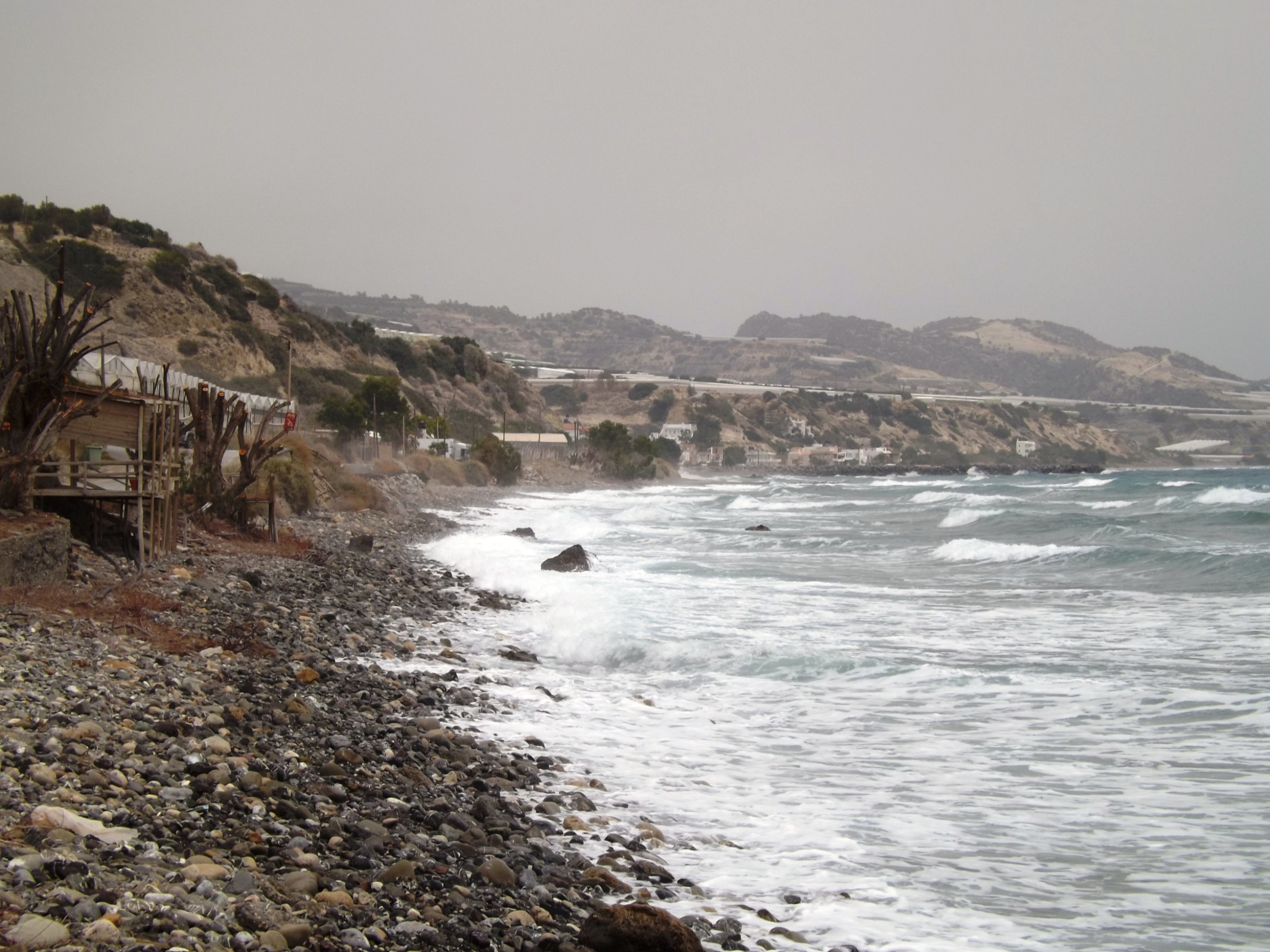
I was on my way back from Tsoutsouros via Keratokambos to Mirtos, and had just embarked on the eleven-kilometre stretch, leading 700 meters in altitude, steeply uphill to Amiras. The strike was over, and soon I heard the heavy engine of the truck roaring behind me. Now, these narrow mountain roads feature a rising road embankment on the one side, and grasp at virtually nothing on the other side – there is no space for an evasive move! I had to try to lose the truck.
Duell: In Steven Spielberg’s film Duell, based on a short story by Richard Matheson, travelling salesman Mr. Mann (Dennis Weaver) is chased and almost killed by a 40-ton monster of a fuel truck in a lethal cat-and-mouse game along a desert highway in California.

The truck driver tries to push him into a passing train at a closed level crossing, to force him off the road during an overtaking maneuver, and a telephone booth from which Mr. Mann wants to call the police is flattened by the truck. Mr. Mann can outpace the truck on an ascent towards the mountain pass, but then his car’s radiator hose bursts, the engine boils, and the truck approaches again.
Just in time, Mr. Mann manages to cross the pass, and the opponents chase down the mountains in close succession until the duel reaches its climax at the end of a dead end street in front of a gorge. The truck hits the car that Mr. Mann has just dropped out of, and, accompanied by a long, loud honk, the truck crashes into the abyss. The story is based on an incident that the author, Matheson, experienced himself. He was chased by a fuel truck on his way home through the desert.
The surviving „Duel“ (1971) Peterbilt Conventional 281 truck, restored, at the 2010 Virginia-Carolina Truck Show.

The Uphill Battle: Now I felt hunted, too. For six kilometers, the road keeps winding up to the first ridge with gradients of 7-12%, through sparse scrub, juniper, olive groves and past greenhouses. I felt the heat from the greenhouses scorching my skin, but reaching for the water bottle took time, and in every bend I heard the sound of the truck engine attack and ebb away as the driver shifted gears. Pure adrenaline flooded my body, because I had already covered 75 kilometers and approx. 2,000 meters in altitude, and I could feel them in my legs. I was clearly cycling at my limit, but another relentless ascent of 500 meters in altitude lay ahead of me, and the truck was on my tail.
You may wonder why I did not stop somewhere at the narrow side of the road. I SIMPLY COULDN’T STOP! I saw myself trapped in a film sequence where the plot is not yet complete and the story is not yet told to the end. The actor cannot leave the band of the street, the big stage that moves along, until the narrative takes a satisfying dramatic turn to reveal an exit strategy. Would I win this man against machine contest, or end up beaten, in the dust, a scorn to my fellow men, like Don Quijote?

The Bells Were Ringing For The Last Act: Fearful and horrified, I took a careful look at this howling, even roaring monster behind me. Just when I thought I had gained a lead, I could feel the truck’s soaring radiator front right behind me and heard its strained engine howling at high revs in every turn. This truck wanted to push me off the road, and – I still shudder today – I heard bells ringing. Somewhere in the distance, bells rang in the last act of this drama.
On the ridge I managed to gain some strength, so after about one kilometer I increased my speed on a stretch with a lower gradient in order to conquer the next ascent towards Amiras with gradients of up to 15%. But it was just a pie in the sky. The truck had obviously slowed down deliberately to start another overtaking maneuver at this ascent. Honking his horn, he was directly behind me and tried to get next to me.

Just ahead of Amiras, on a path branching off downhill, I rescued myself by jumping into the dust and the fuel truck passed by. Spontaneous applause went up, but as it turned out, not I was meant, nor it had anything to do with my landing in the dust – in my opinion an absolutely worth performance. A little further down, people were playing basketball, and the crowd cheered for their teams. In Greece, basketball is at least as popular as football.
Like Don Quixote – Battered In The Dust: After a few minutes of catching my breath I picked myself up again and brushed off the dirt. I looked up to the village of Amiras with the turnoff to the main road to Mirtos. And unlike in the film, the truck didn’t wait for me behind the next hilltop to continue the merciless hunt.

8.9 Mirtos- Tsoutsouros- Arvi- Mirtos - The Tour
The Tour:
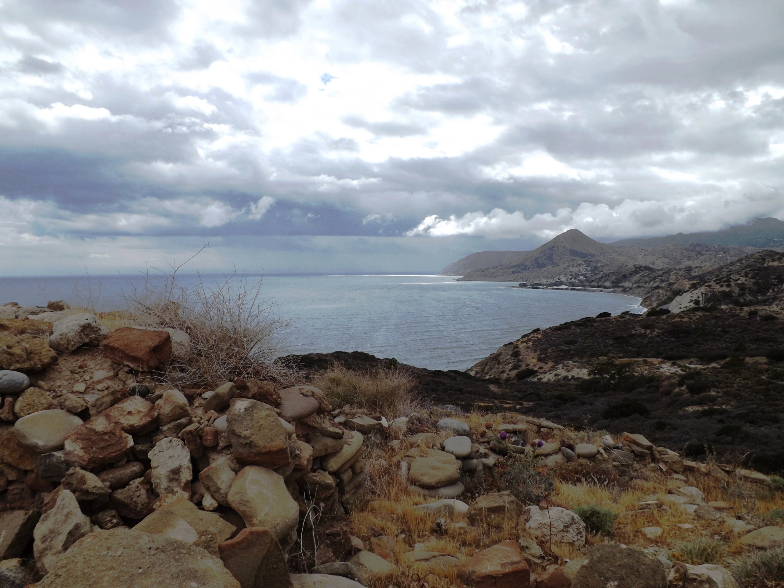
Early in the morning I left the lovely village of Mirtos and rode uphill into the mountains on a well-maintained, winding road – first in a northerly direction to Mournies, then to the west, where increasing, strong headwinds and gradients of 5- 7% provided a challenge while I went further uphill. After 14 kilometers I reached a plateau near the village of Pefkos at 680 meters in altitude.
The dense greenery by the roadside and on the slopes, including pines, zithers, ashes, oaks and olive trees, is dotted with the yellow blossoms of huge broom bushes. In a slight ascent, the road now climbs above Amiras and towards the pass at 730 meters. Next is a fast downhill ride on the picturesque mountain route along the southern foothills of the Dikti Mountains to Ano Viannos.
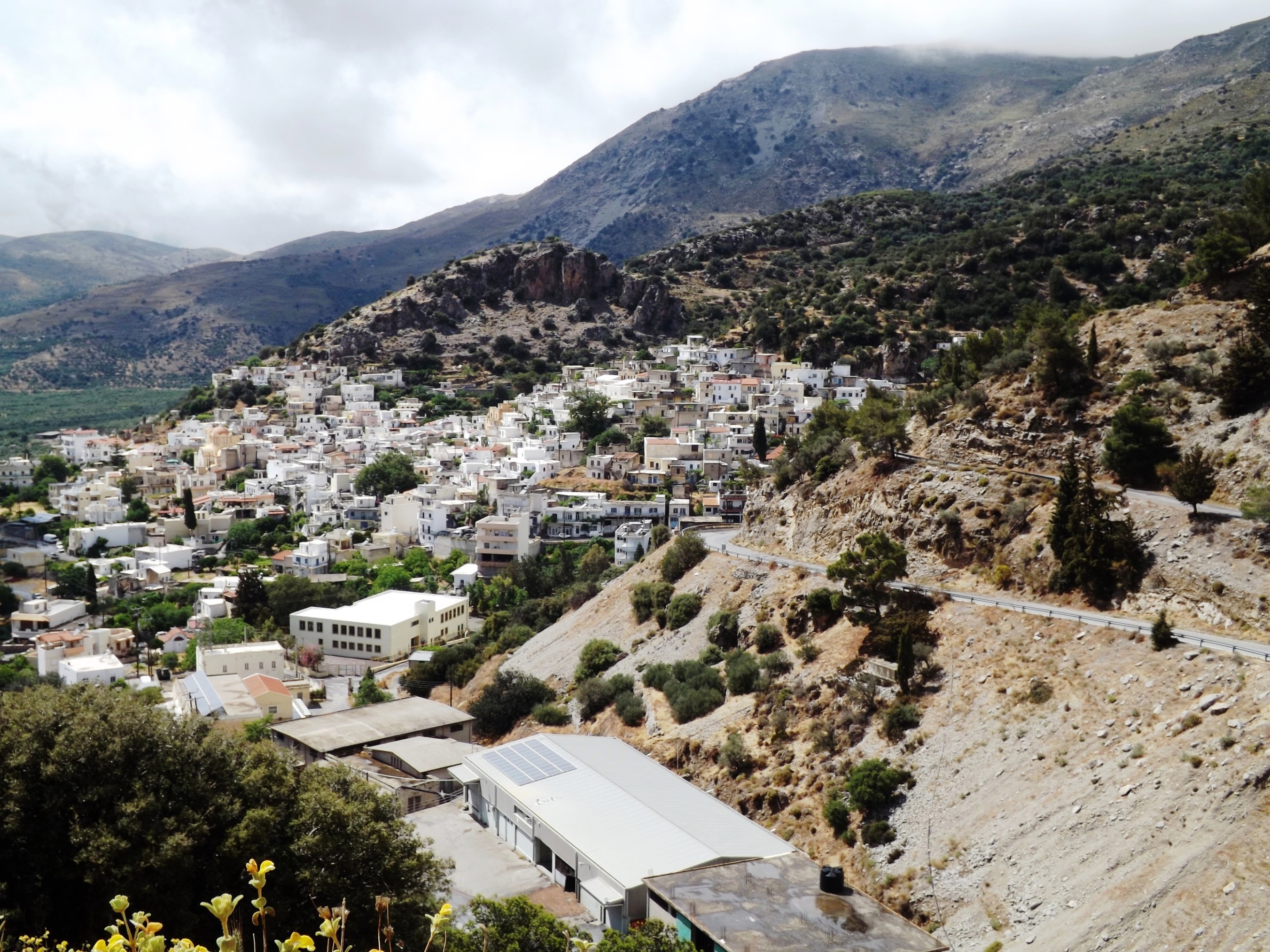
Ano Viannos: Surrounded by olive groves and beautifully situated on the slope, the white houses soon come into sight.
Enjoy a break here or take a short trip to the monastery of Agia Moni. Shaded by cypresses, you’ll find it just below the village. The abbot’s English is perfect, and you can beautifully argue Greeconomics with him.
From Ano Viannos you will now ride another 20 kilometers, first on a wide road leading downhill into the valley at Kato Vianos, then over a hilltop featuring a 100-metre ascent.
The route proceeds constantly downhill via the villages of Martha (turn left here) and Skinias, through the Messara plain, and towards the steeply rising Asterousia Mountains, until you reach the river crossing of the Anapodáris in the valley near Demati.
The Climb: Here begins the 6.5-kilometre ascent to cross the pass at 450 meters. Afterwards, we’ll go downhill towards the sea.


The route gets really steep after you turn south in Kato Kastelliana towards the coast and in the direction of Tsoutsouros.
At an average gradient of 9%, and in breathtaking scenery, you climb the winding road in narrow hairpin bends, and its very steep ramps with gradients of up to 15% towards the pass. The slopes are covered in maquis and lavishly adorned with the yellow blossoms of flowering spiny mullein (verbascum spinosum), a plant the goats avoid because of its hairy leaves.


Once you have crossed the pass, you reach the barren landscape of the southern slopes that descend steeply towards the sea. There are a few olive trees, a bit of juniper and holly, but the real gem adorning the mountains is the road that goes downhill in wide bends for six kilometers.
Tsoutsouros – Keratokambos: Above the coastal village of Tsoutsouros, the road turns back eastwards, and for 18 kilometers your route proceeds along the asphalted coastal road. You will cross the Anapodáris river valley again and climb another 300 meters in altitude while you ride over three peaks. Proceed via Ag. Ioannis, Kastri, and Keratokambos until you reach the intersection just ahead of the village of Arvi.

Accomodation: If you love to stay at this lovely spot Keratokambos for a while, I can recommend PAN APARTMENTS owned by Georgios Papadimitrakis and Charlotte Philipp. Wonderfully located on the hillside with a wide view over the sea. Lovingly designed studios and apartments with genuine Greek hospitality. Georgios lived in Munich in the 1990s and works as an innovative physiotherapist for the Bundesliga Football Club 1860 Munich. Treat yourself to a massage of the master!

The Coastal Road: This is certainly one of the most remote and most beautiful coastal roads in Europe. With every bend, and every height, a new, elaborately decorated landscape opens up. The panorama is dominated by the turquoise sea, set against the background of the steep, towering mountain range, and everything is immersed in the soft light of the clouds drifting before the sun.

Once you complete the last ascent of 200 meters and go downhill through a narrow valley towards the coast and Arvi, you will enter an unreal, tropical world. The spray of the stormy sea runs through the valley like a veil of mist, and rises up at the slopes of the mountain. It gets much warmer, and thousands of sweet-smelling bananas and large tomatoes ripen in the greenhouses. This is a lonely, quiet place – there is no hint to the creator of this tropical marvel, only the sea keeps on raging.
From here, you have to master another 500 meters on a gravel and sand road leading through the banana plantations down to the sea, and after you turn onto the coastal road towards Arvi, the circle is completed at the following crossing. Turn left to the north, and after eleven kilometers of exhausting climbing at Amiras and Kefalovrisi, you will be back on the Viannos-Mirtos-Ierapetra mountain road. Following a 17-kilometre descent in breathtaking scenery, you will reach the coastal town of Mirtos at the southern slopes of Mount Dikti.
9.0 Lassithi- Kritsa- Kroustas- Mirtos | 92 km | 1.642 Vertical meters | Category 2
I’m not feeling very well – I need a doctor immediately. Ring the nearest golf course. [Groucho Marx]

Imagine you have arrived at a remote hotel on the Lassithi plateau after a challenging climb high up into the mountains. It is a silent night. No sounds from the plain and the houses enter the room. Fog hovers above the fields and gardens all around. No bird sings, no dog barks, and no engine noise hums in the pitch-black night.

Frost At Lassithi: On this day in late October, everything is enveloped in frost. It’s such a cold night that you’ve donned all your warming clothes. The long thermal underpants, the fleece shirt, and also the two pairs of socks. That’s all the weight-optimized contents of your backpack will give you. Tightly wrapped up in the sheet and the wool blanket, you reach but a twilight sleep from which you wake up freezing again and again.
The Unexpected Guest: Until suddenly the door to your room opens, and a stranger staggers towards your bed. He wriggles out of his jacket and shirt and is about to undo his belt to get rid of his pants. There is no doubt, the aim of all these efforts is to find your bed! In no time you jump up to your feet, and in the dull neon light of the ceiling lamp, you face a complete stranger, who does not seem to notice you, while his clammy fingers proceed to unbuckle his belt.
A scream that had somehow been delayed on its way to your vocal cords is now released and with a loud „Hey! Hey, what are you doing here? What on earth are you doing in my room?!“, you finally have your guest’s attention. A thread of saliva dangles from the corner of his mouth, winding further down through his shaggy beard. His gaze is expressionless, glassy, and fixed, and the few scraps of words he can speak show that your question leaves him also perplexed. His breath fills the room with the distillation fumes of a liquor factory.

God Moves In Mysterious Ways: On this cold night, God fancied to test me and stranded this traveler from somewhere in the Eastern Baltic in my room. Either I had not locked the door or the room keys in this hotel were universal. Anyway, the stranger continued to undress, so that we faced each other in our underpants – he in short, formerly white knickers, and I in sporty cycling shorts. Discreetly, I picked up his pants that had slipped down, pulled them back up to his waist, put one of his hands on the waistband, and squeezed his shirt and jacket under his other arm. Looking at him encouragingly, I pushed him out of the room into the hotel corridor and wished him a good night.
Satisfied, I noted that he made a beeline for the door to the neighboring room and rumbled inside.
Back in bed, I fell into a dreamless sleep, but it was short-lived. A loud thump, as if a heavy object had fallen over, a scream, and a whimpering „Help! Help!“ startled me again. The whimpering from the neighboring room continued, so I climbed out of my warm nest whether I liked it or not. Unsure of what else fate would have in store for me that night, I made my way to the neighboring room.
Medical Treatment At 3 a.m.: There, in the bathroom, I was presented with a naked casualty lying on the floor. Still holding the showerhead with the torn end of the shower hose in his hand, he tried to pick himself up out of a puddle of water and blood, but his supporting hand slipped again and again. It was pathetic to see, especially because he had pulled half the shower paneling into the abyss with him. Obviously, he had leaned his back against the filigree shower door and had then crushed into the room with it.
Well, it’s not for nothing that I have worked in the hospital for four years. I know how to deal with recalcitrant patients. Reaching under his arms from behind, I lifted him onto a chair and wrapped him in a large bath sheet. His wish to call a doctor at three o’clock at night was difficult to fulfill in this remote part of Crete. So, I reassured him, referring to my wealth of experience as a scout and my clinical training, and was soon back with the first aid bag to clean and doctor a harmless head laceration and a few cuts on his hand. Having no will of his own, he allowed all this to happen, and his well-formulated thanks showed that he had sobered up a bit.
Sleep was out of the question that night, but the sonorous snoring from the room next door at least indicated that my patient was well.

9.0 Lassithi- Kritsa- Kroustas- Mirtos | 92 km | 1.642 Vertical meters | Category 2 - THE TOUR
THE TOUR – 92 km | 1.642 vertical meters | Category 2
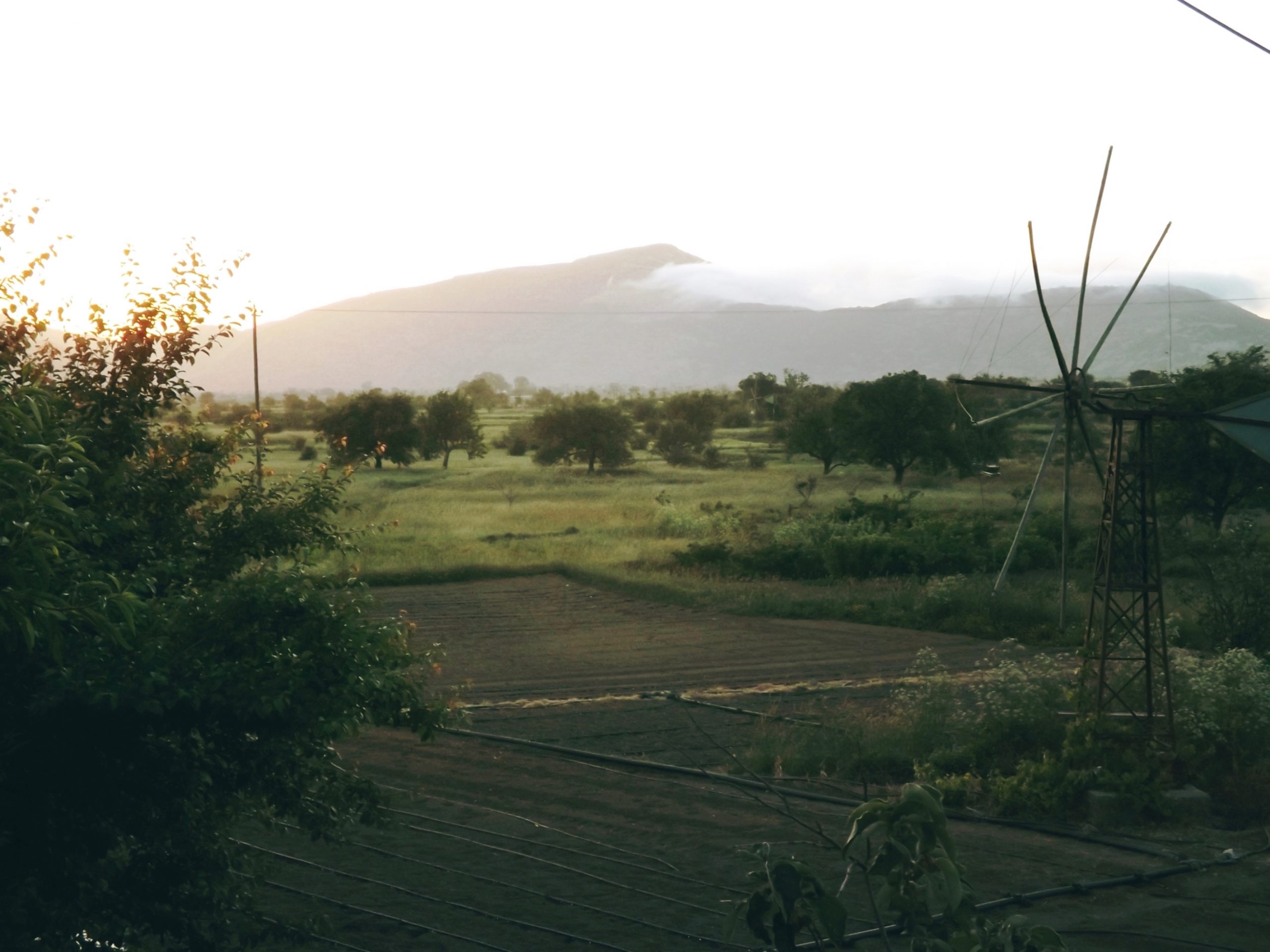
From The Lassithi- Plateau To The Pass: Early in the morning, as the sun was just rising above the mountain ridge, I stepped onto the metallic ribbon that is the road and watched the asphalt shimmer in the morning light and disappear in the early morning mist around the Lassithi plateau towards the southwest.
To get there, you start on a dead straight 2.5-kilometer stretch up to the monastery of Koimiseos Theotokou Krystallenias, turn left at the crossroads, head west via the village of Mesa Lassithi, and follow the wide, 5-kilometer arc to the north and up to the pass at 1,039 meters above sea level.
At The Race Track: You feel excitement, anticipation, and a thrill of joy – like a child at its first visit to the go-kart track at the fair. Everything is huge, and right in front of you, the race track stretches over hill and dale in wide figure eights. The ignition is on, the 11 HP Honda engine is cranked with the starter grip, and the choke is reset. Everything around you vibrates and roars. There is eerie suspense, and suddenly all that was static and lifeless just a moment ago is in motion and merges into a whizzing swirl of colors, accompanied by completely unfamiliar sounds like the squeaking and bumping of the car moving across the plank track and the smell of rubber abrasion and gasoline fumes.
This is an ecstatic dream, a speed rush. Here it is, right in front of you: the magnificent arena of the Cretan alpine mountains. Your tires are already whirring on the asphalt, the spokes swirling brightly through individual fans of sunlight.

The mountain crest featuring Mount Dikti [2,148m] and Mount Lazaros rises higher and higher out of the haze, and along the way gardens and fields flit by. All kinds of vegetables are grown here, including carrots and potatoes. Apples and peach trees line the path, and from the dissipating banks of fog, you can hear the roaring of an Ursus 3250 tractor plowing up the field.
Breathless like a skier on a steep slope, the biker dashes down the wide curves of the road at high speed. He clamps the jolting bike underneath him, leaning far toward the asphalt and almost touching the dangerous, slippery grit of the roadside, but he pulls it safely through the curve.
As I rush by the towns of Mesa Potamio, Rousakia, and Exo Potamio this morning, I see the bustling farmers, women waving at me from their juice and honey stall, and an old man, bent over his cane, relaxing in the kafenion. I make a full stop in the village of Zenia to return to a young boy for a hand slap. „Tour de France!“ he shouts, „Allez, Allez!“ I shout back. Moments later, I’m back on the magnetic ribbon of the road, going faster and faster downhill. For the past approximately 20 kilometers, I made a descent of almost 1,000 meters in altitude to the lowest point of the tour behind the village of Exo Lakonia and the technical university of Agiou Nikolau, where a sea of olive trees dominates the scenery.

To Lato And Kritsa: Keep to the right at the Y-fork behind the university, and you will enjoy a ride through the olive groves on a dead straight stretch across the plain before you proceed towards the southeast on an increasingly narrow road.
Continue straight ahead at the next crossroads, follow the signs for Lato and Kritsa, and proceed through the long s-shaped bend. Here, at the foot of the mountains, Tripolitza limestone and red marls mark the beginning of the ascent at a gradient of 10 %.

Providing a challenging climb through oak and olive groves, the road rises steeply for two kilometers. High above the vast plain, you’ll find the excavation site of the Doric city-state of Lato, whose foundation dates back to the late 8th century BC.
Lato – Administrative Information: Τ.Κ. 72051, Kritsa, Mirabello (Prefecture of Lasithi). Telephone: +30 28410 22462 – 28361 – 90511, Fax: +30 28410 25115, Email: efalas@culture.gr – Lato- Website

Impatiently, I get out of the saddle in Kritsa and dance on the pedals as I meander through the narrow streets and around idle groups of tourists.
At the village exit, the Tripolitza limestones of the eastern flank of Mount Varsami and Mount Katharo Tsivi [1,664m] which you have driven around from Lassithi in a wide sweep to the east, rise high above the village. Turn left at the crossroads and head south to the village of Kroustas.
Up To Kroustas: The wide curves of the road leading up to the village of Kroustas [520 meters above sea level] feature gradients of 5-8%. At first, they are lined with fine-grained crystalline of the Upper Cretaceous, then with slate and folds in the limestone (Prina Complex).

As you enter the village on a shady avenue of plane trees, you have completed half of the distance. Some 45 km more to go, and you’ll reach the south coast at Mirtos. Time to fill up the water bottles at the tap in the center and enjoy a Double Greek Coffee with lots of sugar and ice-cold water from a carafe in the kafenion.
The route from Kroustas to the village of Prina is a quick ten-kilometer downhill ride through hilly terrain with oak woods, olive tree terraces, and shady pine groves.

Yellow broom, large cistus, sage, and spurge bushes bloom, myrtle and laurel line the path, and amazing giant thorny gorse bushes glow golden in the sunlight. In between, you can take in the breathtaking sweeping view across the south coast, all the way to the sea at Ierapetra and the Bramiana reservoir.

Prina To Males And Mirtos: From the village of Prina, the route climbs again for 15 kilometers. Featuring an average gradient of 5% and three terrain levels with fine-banked Miocene limestones, marls, sandstones, and conglomerates, it takes you through the villages of Kalamafka and Anatoli [at 340m asl] and to the pass ridge at 675 meters above sea level.
For the remaining six kilometers to the village of Males, one of the most beautiful roads in Europe lies ahead of you. The Tripolitza limestone flanks of Mount Megali Koryfi and the Trapeze Mountains rise high into the sky above you. The soft landscape forms around the road and towards the sea feature Miocene conglomerates, marls, and thin-banked limestones.

Revealing a new view of this fairy-tale landscape behind each curve, the road winds uphill and downhill through the stock of pine trees and the Centaurea spinosa, lavender, spurge, and dwarf juniper that make up the macchia of the south coast.
Every new bend, every range of hills, every turn provides stunning views across the foreland of Mount Dikti with its steep rock formations and the great blue of the sea.
Males: The vegetation indicates the abundance of water in this area. You can see oleander, juniper, and laurel at the roadside, orchards and vegetable gardens, and small fields for olive culture and winegrowing. Soon, the village of Males comes into view, beautifully situated above the valley of Mirtos at 600 meters above sea level.

In the village itself, a trip through the narrow streets is worthwhile. Walk up to the little church Panagia Messochoritissa and admire its frescoes dating from 1413. Above the village, wild vines, fig trees, and fruit trees make up the picture-postcard scenery of the south coast and the sea at Mirtos.
At the village exit of Males, the winding road descends steeply into the water-rich valley. The irrigation pipes gurgle and hiss from the bushes as you ride through the dense olive groves and cross the Mirtos River until you reach the entrance to the Sarakina Gorge. Continue through the village of Mirthi until you get to the main road (Ierapetra-Ano Viannos) and turn left to ride down to the beach village of Mirtos.

9.0 THE SECRET GARDEN
There is one character, however, who is truly timeless – he was there in the Stone Age, Bronze Age, and all the ages since; he can be seen today and every day in the villages around Crete. On his back he carries a huge load of sticks, some of which he unknowingly deposits from time to time on the path behind him as he walks, so that his journey becomes longer his load becomes easier. One wonders how many sticks will be left when he reaches his destination … [John Atkinson – A Small-Scale Reconstruction of the Settlement at Myrtos Phournou Koryphi – ΣΤΕΓΑ: The Archaeology of Houses and Households in Ancient Crete, American School of Classical Studies at Athens, Princeton N.J.]

Just like the inconspicuous little church, which greets you in immaculate white after a long journey, shining familiarly from the height into the valley. Just like the houses of the distant village, dancing like little bright butterflies in the shimmering heat over the street. Just as the harbor welcomes the fisherman to the shore of his home after a long journey over the salty seas and the moving waves, a Honda F400 single-axle tractor with a trailer shone through the green of the street trees like a lantern – a well-acquainted friend from childhood days.
With its 5 hp single-cylinder four-stroke engine, this faithful companion of every mountain farmer is famous for its excellent cross-country mobility, maneuverability, and the possible use of a wide range of additional equipment.

A wonderful smell of oil, gasoline and hot rubber emanated from the tractor. Infatuated, I climbed into the seat as the driver. And so it happened that I simulated the exit with humming lips, imitating the engine noise and eagerly shifted gears to simulate the driving experience, while unnoticed by me, the owner stepped out of the neighboring olive grove into the street behind me .
Despite the load of sticks and firewood on his back, his facial expression clearly showed his astonishment at my vocal interest in his vehicle.
The scene was unsurpassed in its full scope of embarrassment. There the Cretan farmer in a battered woolen shirt, solid jerkin and traditional black Cretan pants tucked into his long gumboots, facing me, an infantile biker in a loud, colourful Tour-de-France jersey, who had just climbed on the bench of his tractor, humming loudly and fumbled around with the adjusting levers of this technical masterpiece.
It would be better to spread a merciful cloak of oblivion over this incident.
He slowly turned around, waved to me with an inviting gesture and shouted „Ελάτε να σας διασκεδάσουμε – Come on, so we can entertain you“. This was an extremely clever move to get someone obviously mental dissconfused away from his tractor.
I usually avoid such invitations with all sorts of excuses. There is still a long way to go, it will soon be dark, my family is expecting me and the like. But today I gladly accepted the generous offer in order to straighten out the image of mental disorder that had emerged.

So I got to know Stamatis and together we walked up the sandy path to his house, situated on the hill below the mountain cliff and, surrounded by orange, fig, and almond trees. In the garden we sat in front of his little summer house with a fireplace, gas stove, tables and chairs, beautifully woven blankets on two stone benches and all sorts of old-fashioned cookware hung on the wall and enjoyed olives, hot peppers, stuffed vine leaves, small meatballs, bread and wine.
The family originates from a mountain village north of the Nida Plateau, and Stamatis had been the shepherd of a flock of more than a hundred sheep there in his younger years. In the 1980s, when there were no longer enough men in the family to herd and protect the flock, he purchased several fields on the plain towards Rethimno, became a farmer, and attained certain prosperity due to his diligence.
Later on, their children moved south to Ierapetra, and Stamatis and his wife chose the little house high above the plain of the south coast as their retirement home. The air is bad and the south wind harmful, he says, but the family and grandchildren visit them frequently now, and Stamatis grows all kinds of vegetables and some wine. Some chickens and four goats keep them company, and his old Toyota pickup truck is parked in front of the house.

The remaining route to my destination, the village of Mirtos, was manageable and leads mainly downhill. Thanks to my hasty departure from Lassithi at dawn, it was only early afternoon, so I sat back and relaxed, enjoying the great Cretan hospitality, the conversation with the old couple (gesticulating with our hands and feet), and their daughter’s funny comments.
The Secret Garden: Preparing to leave, Stamatis beckoned me to the rear part of the garden, which is adjoined by massive natural stone walls of former, now ruined buildings. A small gate led into the ruins and here a fairytale garden revealed itself, in which the individual, open rooms were planted with the most beautiful Mediterranean flora.
First we approached the remaining window cave in the room to the north and breathed in the cold, clear air of the Megalo Koryfi and the Trapeza mountains. The mountain cliffs towered high in front of us. Gorse, laurel, juniper, lavender and myrtle rose above a purple-violet carpet of decaying blossoms, their appearance appropriate to the barreness of this mountain slopes, modest in their grace and simple beauty.
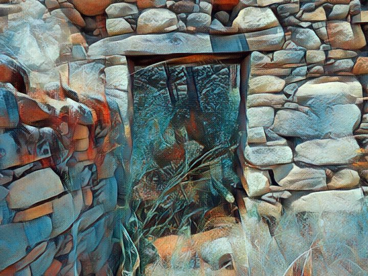
The second room was brimming with glowing bougainvillea, a fig tree and Mediteranean spurge. Just as we stepped up to the rudimentary window cave to the west, a sudden strong gust of wind pushed us back. Zeus sent a stormy wind down from the Dikti mountains. It scattered the blossoms of the bougainvilla, rushed through the leaves of the rockrose, the mastic and the ferns, rustled in the bushes and grasses and then slipped out the door in a whisper. A rumble of thunder followed, and the dark clouds of an approaching thunderstorm towered above the demolished roof of the ruin.
Heading south now, we immersed ourselfs in the blue depths and the haze of the sea. The warm air within the south room of the ruin was heavy with the scent of the loquat blooming here. A murmur, a rustle and a crackle out of the now impenetrable mist made us shiver. There we were, standing by a swamp from which a tropical rainforest with Carboniferous dragonflies and amphibians was growing. Hissing cockroaches came out of the the ground. A millipede, in search of a tasty meal, snaked its way out of the shade of horsetail and mosses through the rainforests undergrowth. And on the ground, in the moss, under the wide fronds of ferns, scorpions and spiders lurked. We slipped away with a shudder.
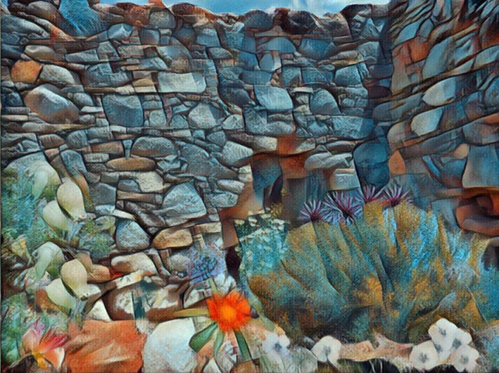
The east room of the ruins embraced us with warmth and the scent of rosemary. Delicate cyclamen flourished in the shelter of the ruins. We leaned comfortably against the warm stone walls by the window. But the walls grew warmer, no, hot, hotter, blazing hot and spat out ants, thousands of black long-legged soldiers came out of the rock crevices to attack and torment us. We tried to speak, but the tongue was stuck to the dry roof of the mouth, not even a gargle could be elicited from the parched throat – enough. The way back was cut off by the thorns of a fast growing firethorn hedge. Our clothes torn, scratches on arms and legs, bleeding and with burning skin, we made our way to the door and escaped out of the haunted building.
Stamatis looked at me triumphantly. „Well – this is my garden“.
9.1 Lassithi- Lato- Kritsa- Katharo Plateau- Lassithi | 84 km | 12km Dirtroad | 1.877 Vertical meter | Category 1
84 km | 1.877 vertical meters | Category 1
I was seeking for loneliness and solitude but I was not prepared to dance.
He was called „Il Falco“ and I admired him for his downhill driving skills. The limits of physics seemed to be suspended when Paolo Savoldelli raced down the mountains as he did when he achieved his victories at the Giro d‘ Italia in 2002 and 2005. As a mountain specialist and excellent timekeeper, he was able to win in this renowned competition, among other successes.
After I had left Mesa Lassithi behind me and climbed the pass at an altitude of 1,050 metres, I had pictures of the Giro in my mind as I embarked upon the winding descent – a 30 kilometer route leading almost 1,000 metres of altitude downhill into the plain around the ancient town of Lato.
The ribbon that is the road winds its way through the villages of Mesa Potami, Roussapidia, Zenia, and Amigdali, which are adorned in white. It runs on and on below apple and cherry trees, past fruit and vegetable gardens, descending further and further into an ocean of shiny silvery olive groves. And as this ribbon runs along the slopes of the Selena and Machera mountains, it constantly picks up speed and drags me along. The world races past as if distorted by a concave mirror. Accelerating on the straight passages and leaning into the headwind with all your force, you keep on sliding into the bends and onto the oncoming lane – much too fast and in a dangerously sloping position.

I was exhilarated by this exuberance until the inevitable happened, and it still makes my blood freeze in my veins today. Something big and fast popped painfully against my forehead at full speed. Tickling and dizzy, this something staggered across my forehead and tried to crawl under my helmet. From there, it proceeded to my glasses to seek shelter from the wind. It sat on the inside of the lens, between my eye and the glasses. The three segments of its red-brown body appeared to be huge, the abdomen with its large yellow ring pulsated right in front of my eye. It stretched out its wings for keeping balance, and every single hair on its shell was visible, looking way oversized in the glare of the backlight, while I was racing on at high speed.

Fear, abhorrence, horror – these are the feelings of the dreamer who awakens from a heavy nightmare. This here was not a monster of the night but a big hornet, and it recovered quickly. “Brake,” I thought, “for God’s sake, slow down!” The rear wheel hurled through the split, I almost ended up in a ditch by the rock face – no matter.
Just a moment ago I enjoyed the rush of speed, but now I was ever so careful, slow and gentle. I took off my glasses, rocked the insect like a baby and murmured some calming words until it flew up and away. I jumped off the bike and tore down my helmet, because my entire head seemed to tingle. I shuddered with disgust and then did a little happy dance on the road until an approaching car honked its horn and made me jump into the ditch again.
My mother used to carry a little flask of cognac in her handbag to be prepared for such cases of mental derailment. If need be, she drank from it with a bitter expression. Therefore, here’s a piece of advice for the inclined reader: Please keep your mouth shut at all times on downhill runs! And let me assure you that a small bottle of Cretan raki in my backpack has already defused many a critical situation and led to new, unexpected friendships.
However, my ambition was to travel light, so I had banished all the unnecessary stuff from my backpack for this tour. But I had obviously counted my chickens before they were hatched. Just before I departed, my hostess Maria gave me a big bag of sweets as provisions for the journey, a pack of Hotel Maria business cards she wanted her friend from Argyro Rent Rooms in Kritsa to display in her lobby, as well as six wonderful oranges for her relative Katharina of the Taverna Paradosiaki on the Katharo plateau. Equipped with these things, I cycled towards the pass of the Katharo Plateau at an altitude of 1.200 metres.
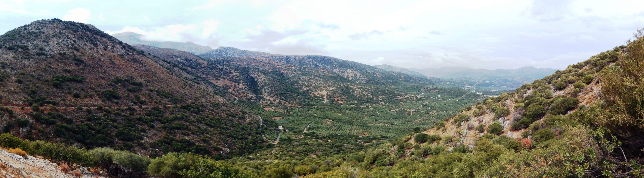
At the village of Drassi you leave the road to Neapoli and turn right towards the east. Proceed via Ag. Konstantinos, Karterides, and Exo Lakkonia, and enjoy the picturesque downhill route leading to the valley through fields and olive groves. After some 36 kilometres, you’ll pass the large building complex and sports field of the „Technological Educational Institute of Crete“ on the left hand side. Keep to the right, and soon after you’ll reach the lowest point of the descent at 120 metres above sea level. After another 2.5 kilometres with a slight ascent you’ll arrive at the north-facing turnoff to the ancient ruins of the city of Lato. The Doric town was founded in the 7th century BC. This marvelous location boasts a panoramic view ranging from the southern peak down into the plains and all the way to the east up to the coast, to Agios Nikolaos and the gulf of Mirabello.

Lato: “The ruins of a city more purely indicative of the early heroic time I have never seen in such a remarkable state of preservation, (nor one more singularly situated – occupying the hollow of a crater-like basin), where nearly every house can be traced out in its original length and breadth, the walls of many being still from six to ten feet high, and, as I before remarked, with their doorposts still erected. Some of the houses had two, and some three compartments, and varied from 10 t0 20 feet in length, but in generality seems to have consisted of but one room, like the habitations of the poorer peasants of Crete at the present time, the door also often serving both for light and air to all compartments, …[Thomas A. B. Spratt, Travels and researches in Crete, Volume I; S131- 133; London 1865 – Travels in Eastern Crete 1851- 52]

Kritsa: Leaving the site and descending by the terraced road leading from the ruins, we follow a narrow plain running to the south-east, and in half an hour arrive at Kritza, the largest village of Mirabella, picturesquely situated under some cliffy steeps, just where the valley begins to expand in its course towards the head of the Gulf of Mirabella, and where some fertilizing springs issue from beneath them. The valley is well cultivated with olive-trees and vineyards, and confined by ridges covered with brushwood. But high above Kritza a grove of cypress and wild oak forms a dark line between it and the bald summits of the Lasethe Mountains, encircling them as belt just below the snow-line.” [Thomas A. B. Spratt, Travels and researches in Crete, Volume I; S137; London 1865 – Travels in Eastern Crete 1851- 52]
This is where the movie „Celui qui doit mourir“ (The man who has to die) was made in 1956, based on Niko Kazantzakis‘ novel „Greek Passion“. Starring Melina Mercuri, it was filmed by Jules Dassin and has an astonishingly current relevance to today’s European reality. But the inhabitants of Kritsa are actually famous for their handicrafts, namely the weaving and dyeing of fabrics. Kritsa has four Byzantine churches with frescoes, the most famous of which is the fully decorated church of „I Panajia I Kerá“ with its magnificent Cretan-Byzantine paintings from the early 13th century. (It is situated just outside of the village on the road to Agios Nikolaos.)
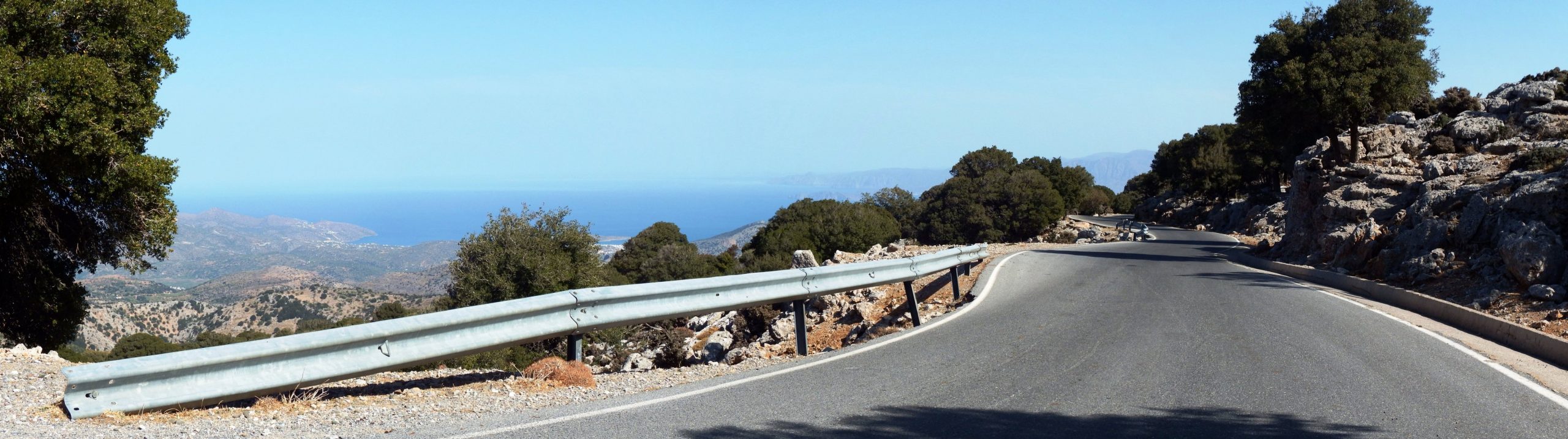
The route proceeds steeply uphill through the picturesque village. On a ramp with a gradient of up to 15% you leave the last houses behind you and turn right at the crossroads towards Avdeliakos and the Katharo plateau. There is a short straight passage, then several brutally steep bends with gradients of up to 20%, followed by another 8-10% gradient from terrace to terrace on the slopes of the Katharos Tsivi and Platia Korfi mountains build here from Tripolitza limestone. Pine trees, holm oaks and chestnuts line the path, white and purple crocuses (romulea bulbocodium) flash up at the roadside, and then there is a yellow glow again from the shrubs of spiny starwort. This scenery forms the backdrop for the gulf of Mirabello which you can see glittering in the distance.


After 13 kilometres of exhausting climbing you will be happy to reach the pass at an altitude of 1.230 metres. Now you can really enjoy the descent to the plateau and the village of Avdeliakos. There, I was finally able to hand over my oranges to Katherina at the tavern and to take three new ones back to Lassithi as a gift for Maria. Courier driving has rarely been so much fun.
Katharo Plateau: Overlooked by Mount Dikti (2.148 metres) in the west, the alpine pasture of Kritsa and Kroustas is situated at an altitude of about 1,100 meters. In the Pleistocene a large lake with pygmy hippopotamuses, elephants and big turtles on its shores. The dirt road leading towards Lassithi – Plateau is only partly practicable for a racing bike.

Leaving the small village Avdeliako, the road towards the Lassithi Plateau soon turns into an accessible dirt road. But once you reach the first ascents, this path becomes so stony and washed-out that you have to walk your racing bike for a while, so you may wish to take a pair of light sports shoes with you. In any case, it is advisable to adjust the rear derailleur at the end of the tour before you can ride on asphalt again.
Passing small fields with potatoes, vineyards, apple and almond trees, you look at the plains and envy the sheep, goats and the friendly donkeys that enjoy their pastures in the colorfully sprinkled green spring landscape. Pale flax, purple wild mallow, bladder campion, mandrake and Cretan dittany are in bloom by the roadside. This place is a perfect blend of wilderness, orderly cultural landscape and enchanting Cretan nature surrounded by the Tripolitza limestone.
The road to Lassithi follows the eastern edge of the

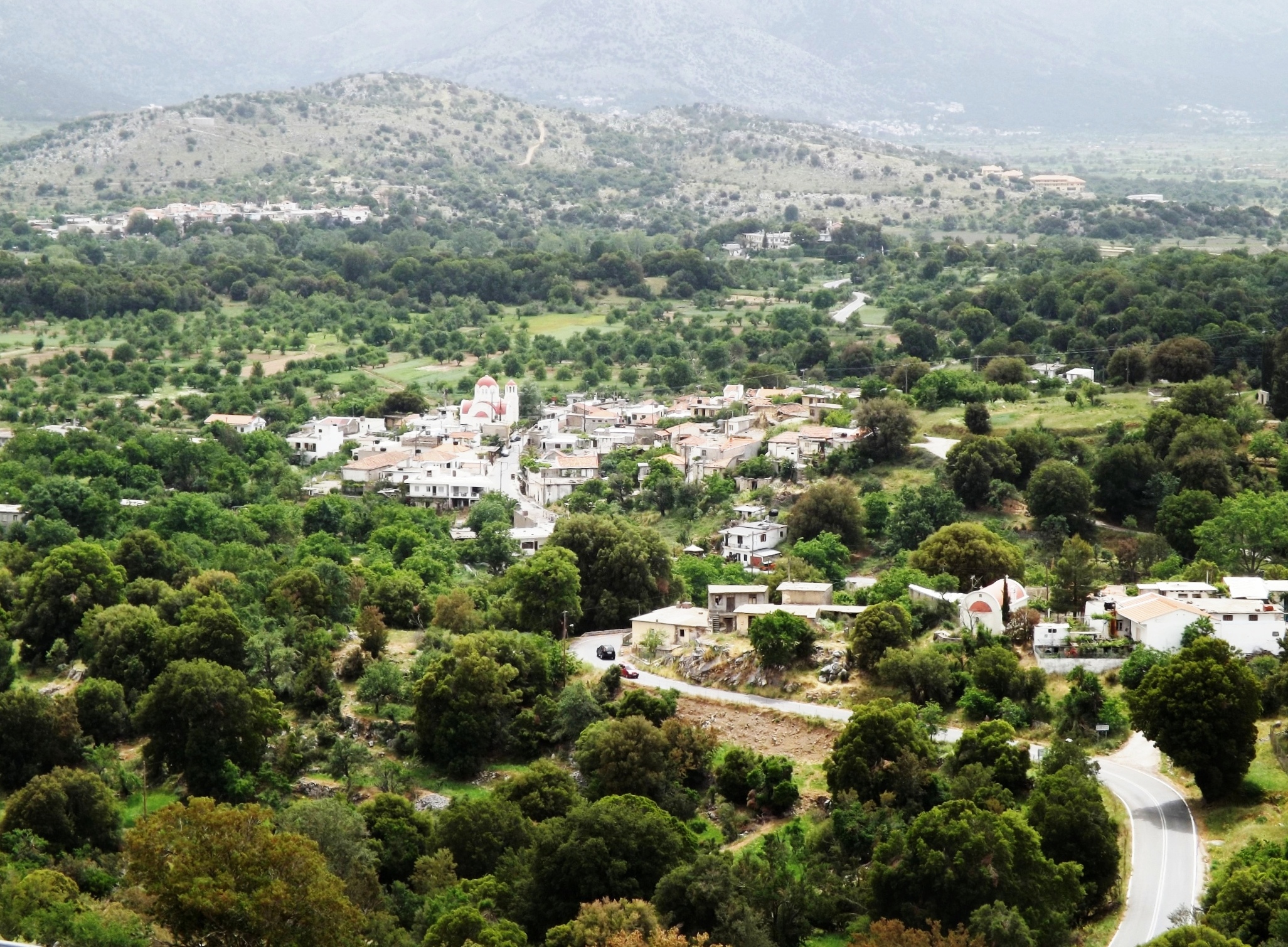
plateau, and then turns right towards the slope facing north. Running parallel to the western gorge, it climbs to a height of 1.230 metres. Taking a wide sweep to the northeast and back to the west you descend again and can already see a few white houses of the Lassithi Plateau flashing up in the distance.

10.0 Kato Zakros- Vai- Sitia | 60km - 75km | 1.428 - 1.672 Vertical meter | Category 3
60 km – 75km | 1.428 – 1.672 vertical meters | Category 3

“You want to wake up in the morning and think the future is going to be great – and that’s what being a spacefaring civilization is all about. It’s about believing in the future and thinking that the future will be better than the past. And I can’t think of anything more exciting than going out there and being among the stars.”– Elon Musk, SpaceX
Skywards: A loud rattling sound, as if the chain hoist of a roller coaster pulls the car skywards up the ramp of the steel colossus. Then there is a bright glow. Accompanied by a hissing sound, a gigantic welding torch is ignited at night and bathes the entire surroundings in glistening light. There is an indescribable roar, the deep, muffled rattle – rising to a thunder of a heavily loaded freight train which races past you for minutes, a pulsating pounding, a quietening noise, until this dies down, as well. With a speed of more than 11.2 kilometers (6.95 miles) per second, the spaceship leaves the gravity field of the earth after its launch and sets off on a new journey into our solar system.
The dark shadowed moon: Just a moment ago the full moon shone brightly above the Cretan sea, and now it wanders off into the darkness of the earth’s shadow reaching into space. For three hours there was a total lunar eclipse, and the stars in the sky appear to shine thousands of times more intensely. At the same time, shining brightly, a distinctly red colored celestial body rises above the horizon in the southeast and moves upward to the west, only to go down again in the morning in the east – planet Mars.

At the end of July 2018, Earth approached Mars at the shortest distance of 57.6 million kilometers (35.79 million miles). The next encounter will take place on October 6, 2020 (opposition date: October 13, 2020).
Cycling on Mars: Well, how about a bicycle tour on Mars? After a flight time of three quarters of a year, which is best spent on the bicycle ergometer, the treadmill and with strength training, you reach the red planet. After the safe landing, the construction of the modules of the space station which are stowed in the hold, the connection of the nuclear reactors for energy supply, the water and oxygen generators, the greenhouses and the exploration on water ice for water production begins.
The deep Ocean: There is a planet with a huge ocean, 160 kilometers (99.41 miles) deep, filled with heavy gas from the bottom to the border of space. Various creatures live at its bottom. And this gas exerts the considerable pressure of approx. 1 kg/cm². For the chest of a human being, with an area of about 1,000 cm², this would mean that the load of one ton of weight would be effective. The bodies of these ocean-diving planet inhabitants withstand the pressure.
On Mars, on the other hand, the pressure is only 0.6% of it, about 6 g/cm². After a few steps on Mars, the brave earthlings would collapse with bloated arms, legs, and bellies, their blood boiling. A pressure suit must prevent this. Not those puffed-up, white NASA things from the age of moon exploration, but carbon-fiber-reinforced, tight-fitting, elastic and motion-optimized Mars clothing. Furthermore, humans would have to protect themselves against the extreme cold and cosmic radiation and ensure a supply of breathing air. The average temperature ranges from -23°C at the equator to -140°C towards the polar caps. With temperatures around 20°C in summer, on the other hand, it can be comfortably warm at the equator on Mars.

SpaceX: So, I guess you have paid the $450,000 for a one-way ticket to Mars on board the BFR spaceship of SpaceX, bid farewell to all the trifles of your life so far, and now, like the legendary heroes of the North and South Polar expeditions, will begin your journey. But maybe after reading Apsley Cherry-Garrard’s „The Worst Journey in the World„, you’ve got a few concerns, and it’s all just a bad dream that you wake up from early in the morning, bathed in sweat in a rainy city in northern Europe.
You can also go cycling in Mars-like scenery on Earth. The Atacama Desert, which accompanies the Pacific coast in the west of Chile for 1,200 kilometers, looks like a landscape on Mars, and apart from the polar regions, is one of the most arid regions on Earth. The 19-hour flight from Europe to Chile costs around €1,000. Spain is closer and features the Tabernas Desert, the semi-desert of Cabo de Gata in the province of Almería, and the semi-desert Bardenas Reales in the northern Spanish province of Navarre, for which organized mountain bike tours are offered.
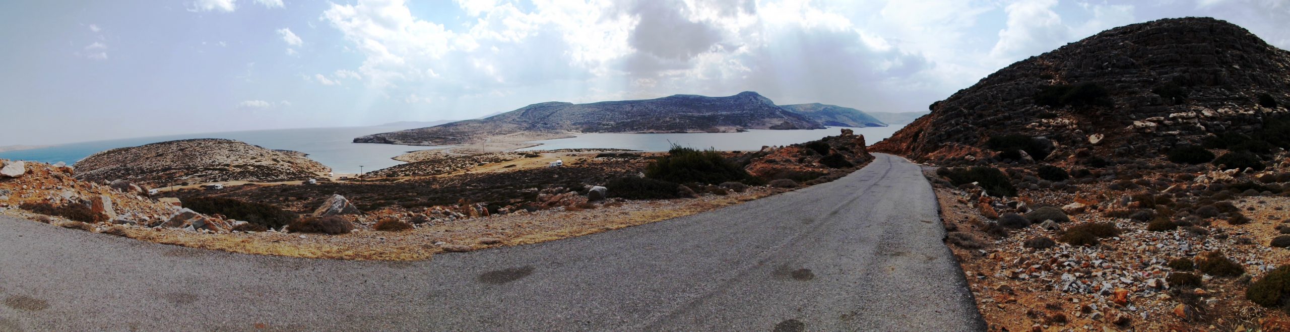
The whispered message: And then there is the Kiriamadi peninsula on Crete with Cap Sideros, an arid and barren natural beauty with an average annual precipitation of only 300 mm. I had asked my landlord Georgio if it was possible to explore the peninsula up to its furthest eastern tip, Cape Sideros, and the 15 m high lighthouse at the Cape dating from 1880 (The lighthouse was newly built in 1951, the lighthouse building 1963-64).
He doubtfully shook his head, knowing full well that this area, being a military restricted area with a naval base of the Greek army, is not accessible. „Listen Nick,“ he said, „on the 4th of February each year, in celebration of Saint Isidore, the gates of the naval base are opened so that people can visit the chapel at the small bay below the lighthouse. A shipwrecked monk, who had already spent several days in the sea, deprived of any hope of salvation, was washed ashore there and later built the small chapel as a gesture of appreciation for his salvation.
And even John Pendlebury, the hero of my youth, was shipwrecked here in 1934 and had to save himself on foot to Toplou Monastery accompanied by a mule.
And now …“ – he bowed his head close to me to continue in a hoarse whisper: „I know a fisherman from the area who goes fishing there at night. Maybe he would take you with him. You’d only have to swim for a while because there’s a dangerous reef just off the coast.“ Now, I had actually packed a neoprene shorty for swimming and a neoprene balaclava to protect myself against the cold while cycling in the mountains. So I would have been well equipped for this purpose, had it not been for his hint: „They have dogs there“.
The danish Mastiffs: Ever since I freely interpreted the right of public access in Sweden and crossed the Bälteberga manor several times on my way to the Kågeröd formation, until the day I met the owner’s two Great Danes, I have developed a strong aversion to this breed of dog and I don’t like to talk about this incident. My escape from them to the bull pasture was not unproblematic, either. Yes, I think I saw a certain malicious joy in their eyes. These animals are lacking in behavior and the simplest principles of courtesy are foreign to them.

The transfer stage from Kato Zakros to Sitia crosses the vast highlands of the Kiriamadi Peninsula in the very northeast of Crete, a barren, hilly landscape sparsely dotted with low Phrygana. With its red shades shimmering in the heat, it resembles a Martian landscape. From the ever narrowing band of the island, which carries the small road far to the northeast into the sea, you dive into the earth ages of the Upper Permian (260 million years ago), the Triassic and the Jurassic. The outcrops are marvelous, featuring the overthrust of the uniform limestones and dolomites of the tectonic structure of the Tripolitsa-nape over the slates and metamorphites of the phyllite-quartzite-unit at Erimoupolis, and the marbles of the Plattenkalk-nape as deepest tectonic unit in eastern Crete, with bright silicate bands and large fossil sponges at Plakoures.
Kato Zakros- Vai- Sitia: Leaving Kato Zakros, you quickly climb a winding road for eight kilometers and 300 meters in altitude, all the way up into the tranquil town of Zakros. Fill your water bottles at the spring in the center, and then proceed on the route which ascends for two and a half kilometers and another 100 meters in altitude, up to the summit of the tour at the mountain village of Adravasti.

In the varied, hilly terrain you now ride for 16 kilometers, passing the small villages of Azokeramos, Chochlakies, Kamara and Langada, going downhill for 450 meters, until you reach Paleokastro. The route runs largely through the valleys towards NNE, which are shielded from the wind. But for the last three kilometers, riding out of the windshield of the mountains towards Paleokastro, you’ll feel the gusty wind from the northwest. Intensified like in a wind tunnel, it constantly blows across this part of the island at speeds of 6 Bft in spring and summer.
Grand Circuit Kiriamadi: Turning north in the center of Paleokastro, you embark on a triangular course of a total length of approx. 44 km per round trip. It features the starting point of >Paleokastro< in the southeastern part of the peninsula, the ascent to the >Helipad of the Greek Navy< in the north, proceeds further northeast towards >Cape Sideros< and takes you back to the >Monastery of Toplou< in the north-west of Kiriamadi.
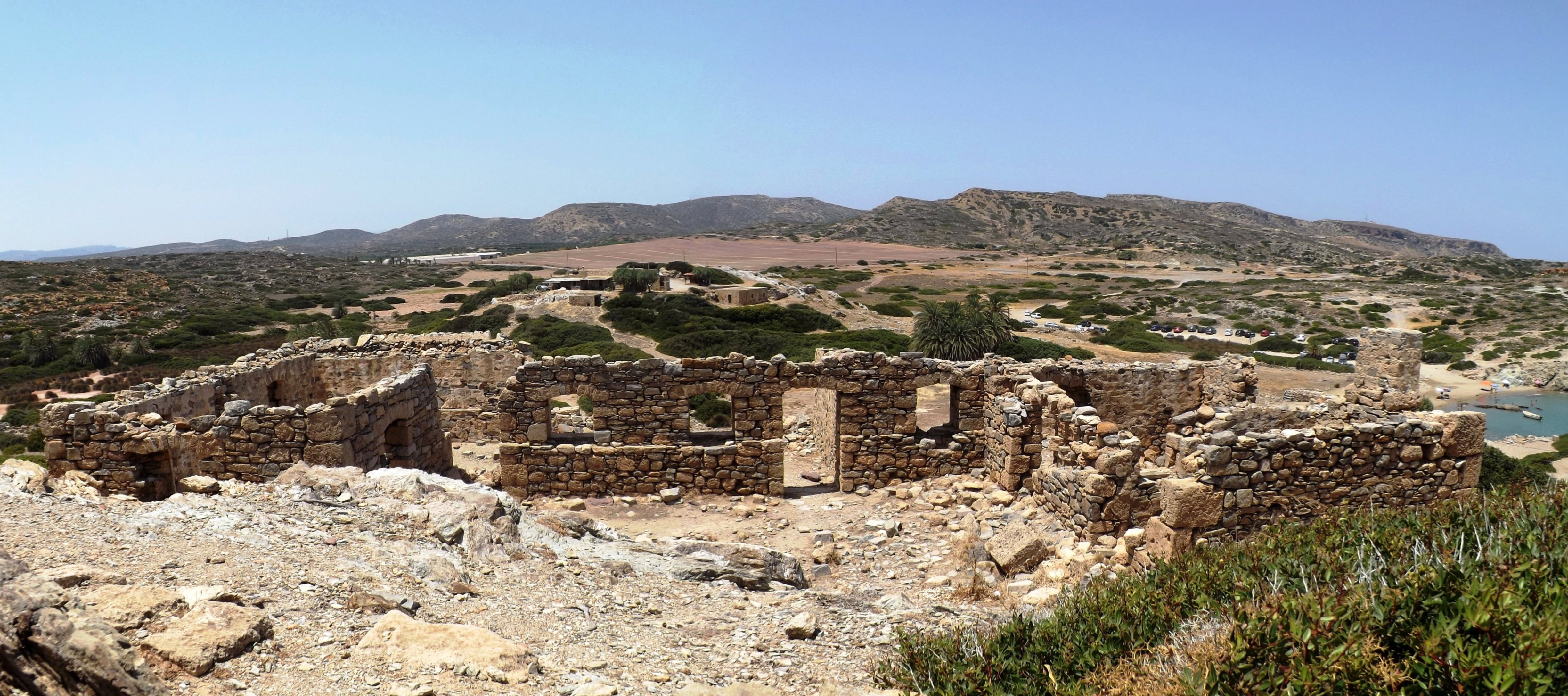
Vai: The eight kilometers to the north lead past the turnoff for Vai. Riding for one kilometer on a cul-de-sac leading through an extensive palm grove, you’ll get to the palm-covered bay of Vai, type locality of the Cretan date palm, Phoenix theophrasti. And if this is the turning point to Sitia for you, then you will reach the town after a total distance of 60 kilometers.
Straight on, you’ll reach ancient Itanos after another kilometer. Just ahead of Itanos, the turnoff to the left and towards the west leads to the Greek Navy helipad (military restricted area at the end of the road) and provides a steep 2 Kilometer/ 200-metre climb through a fantastic landscape. From here you have a breathtaking view across the sea to the offshore islands of Gianisada and Dragonadie and across the entire peninsula up to Cape Sideros.
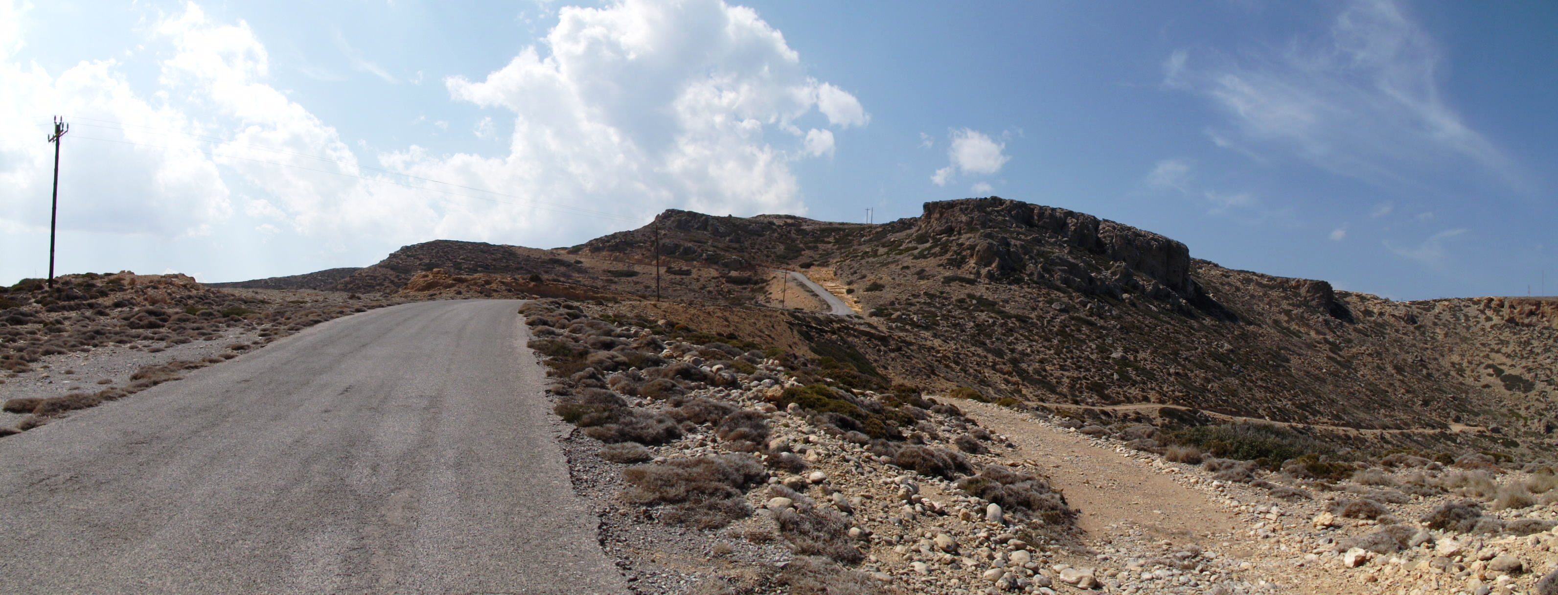
Between the two seas: Going back to the junction, you’ll ride for approximately five kilometer further northeast on the narrowing headland, uphill past the outcrop of the Erimoupolis overthrust, on a narrow ridge between the two seas of Crete and Libya, up to the next ascent, which is already located in the military restricted area, and then on to the outcrop of the deepest tectonic unit of Eastern Crete, the Plattenkalk near Plakoures. Another 500 meters further on, the fence of the military restricted area is already reached.

Moni Toplou: On your return journey to the monastery of Toplou, you first turn west after eight kilometers, and then head in a south-westerly direction a little later to follow the road leading to the monastery for five kilometers. In the shimmering heat, you climb up into the northern foothills at Sitia and through the barren highlands of Toplou with their deep valleys, until the first vines of Toplou and soon also the impressive monastery itself appear.
Not only is the impressive monastery worth a visit, but also the winery. Available are the red Liatiko Mandilari, the Toplou Merlot-Syrah, the red Liathiko dessert wine, and the excellent 2011 Toplou Syrah, matured in barrique barrels for 12 months.
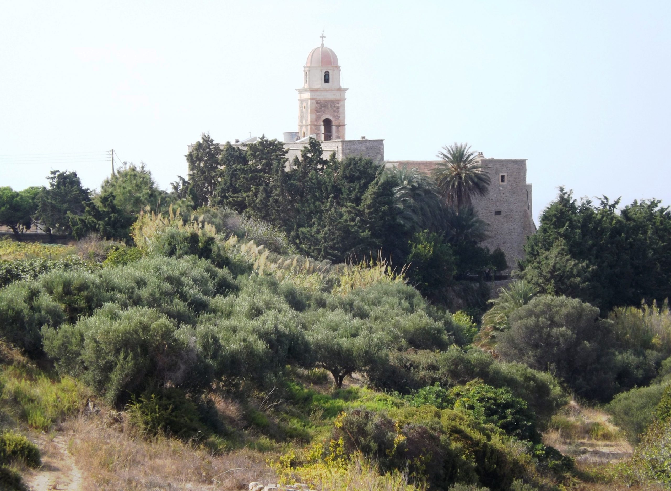

Leaving the monastery of Toplou, you can enjoy a spectacular descend taking you 100 meters in altitude downhill in wide serpentines and leading to the crossroads at the main road from Paleokastro to Sitia. Here, you can turn into a new round of the „Grand Circuit Kiriamadi“, or continue in the direction of Sitia, which you will reach via two hilltops after 15 kilometers of speedy riding.
Accomodation: Sitia Bay Hotel – The Sitia Bay Hotel is conveniently located in the low-traffic eastern part of Sitia, directly on the bay with crystal clear waters and the excellent sandy beach. Great location for biking the whole eastern part of crete, to explore the Kiriamadi Peninsula or climbing in the mountains.
The family run hotel offers guests the highest level of hospitality. All apartments have a magnificent view of the sea and are equipped with air-conditioning, double or single beds, a fully equipped kitchen, WIFI access, satellite TV, telephone, very well maintained and clean bathrooms and nice balconies. Top Pool (appr. 10*7m). Room cleaning service every day. Even now I miss the delicious Cretan almond cake, the pasta dumplings filled with feta cheese or spinach and other delicacies, which the room service left for me in my kitchen every day. Ask for Eric if you have any question concerning the surroundig area, the excursions you‘ ve planed, to visit nearby attactions or the ancient places.
Sitia Bay Hotel – Patriarhou Vartholomaiou 27 / Tritis Septemvriou 8 – 723 00, Sitia – Crete. http://www.sitiabay.com

10.0 Peninsula Kiriamadi- Cap Sideros- The Racetrack | 44km | 910 Vertical meter | Category 3
44 km | 910 vertical meters | Category 3
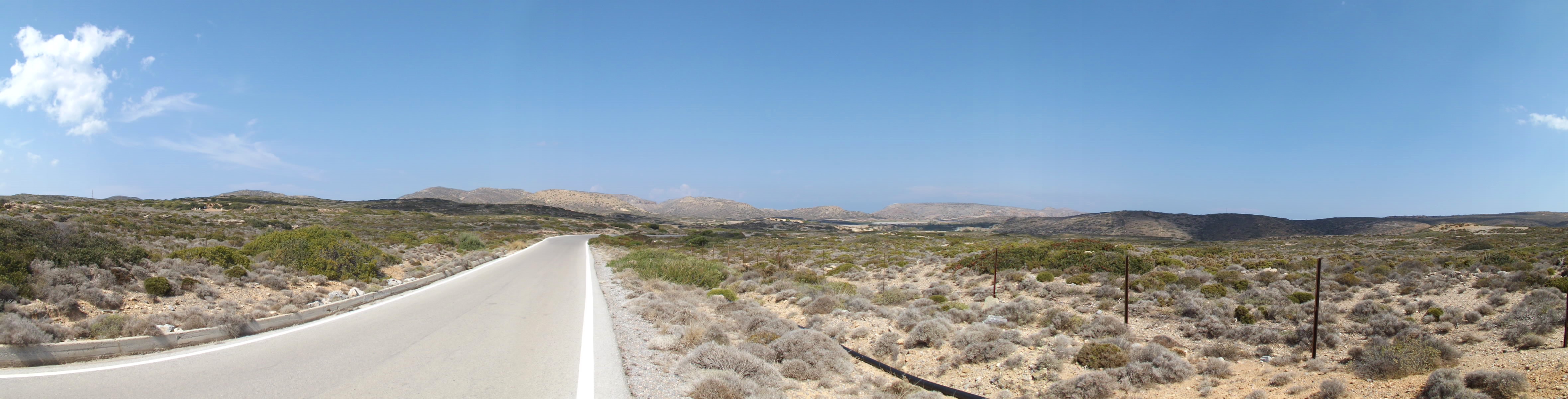
The Racetrack: Whether you drive here from Kato Zakros, Paleokastro or Sitia doesn’t matter. However, due to the jet effect of the terrain’s morphology, the prevailing wind from the northwest unfolds a distinct power, which means you’ll have most fun when completing the triangular course of roundabout 44 Kilometers counterclockwise, i.e. >Paleokastro -> Itanos-> Greek Navy Helipad -> Cap Sideros (Retour) -> Itanos -> Moni Toplou -> Paleokastro<. Otherwise you’ll have to fight against a strong headwind on the straight and rather monotonous 6-kilometer stretch from Paleokastro to the monastery of Toplou – a passage that you will usually cover at high speed when coming from the west and with the wind behind you.

Dionysos Greek Village At Análouka
Coming from the Touplo Monastery and a short ride on the main road Paleokastro to Sitia, on the right side of the road lies Análoukas beach and the Dionysos Greek Village, an investment ruin from the 90s, now largely abandoned.
In 1997, the SOE Investment Company, owned by Greek businessman Michalis Trochanas, developed a densely built holiday home complex here. It consists of approximately 400 houses and apartments as well as 70 shops, on a building area of approximately 38,000 m². The outdoor area facing the sea covers approximately 10,000 m².
The concept of a model settlement, originally one of seven planned holiday villages, with self-sufficient infrastructure, extensive swimming pool facilities and two tennis courts at the private SOE-Trochani Beach, located ten kilometers from Sitia on the northwest coast, was doomed to failure. It was apparently planned, to expand the facility at a later date, by constructing new buildings on the steep slope to the east, covering an area of 100,000m².
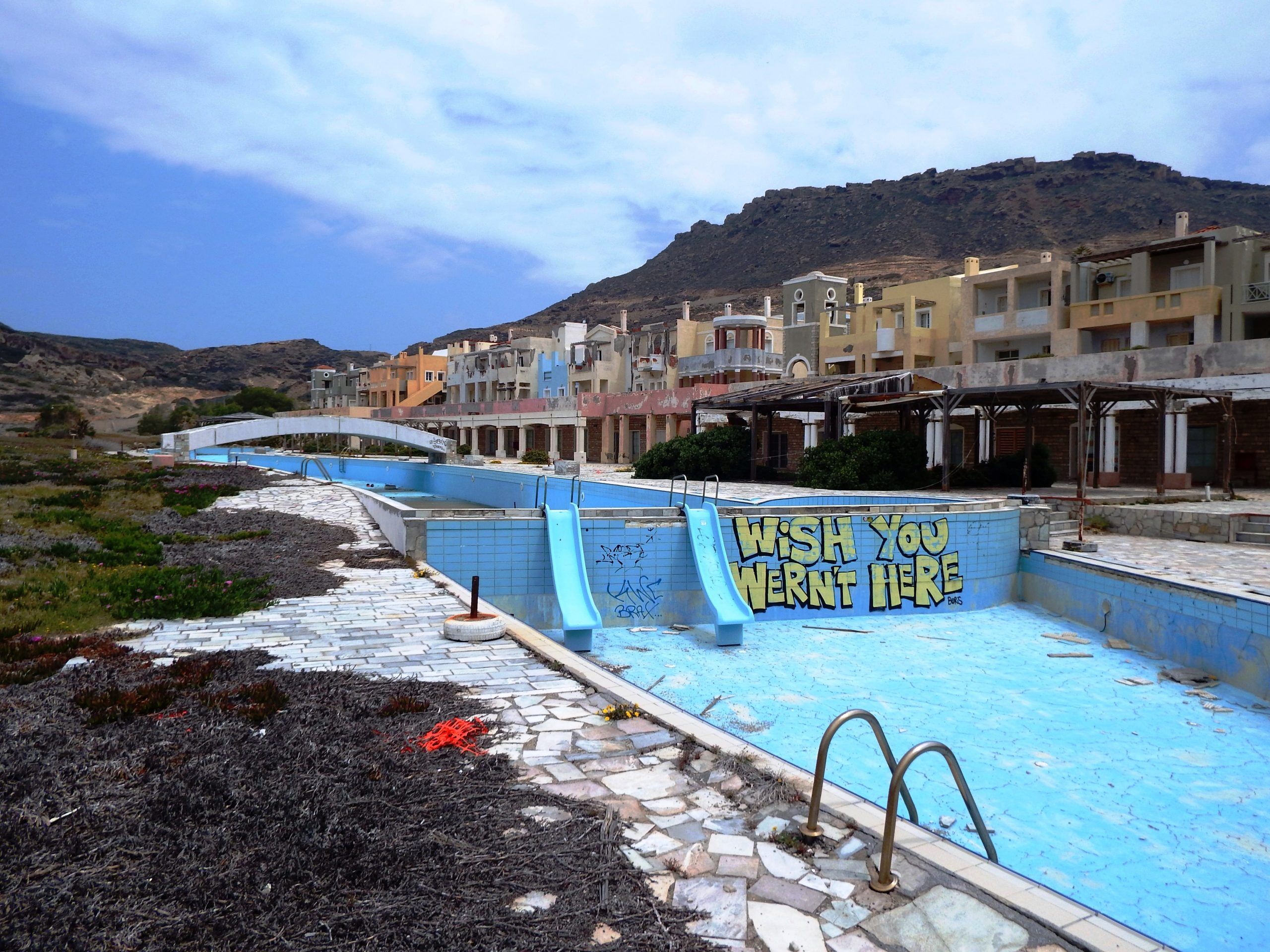
The buyers of the investment were predominantly small investors who also acted as representatives in a Ponzi scheme. It is no coincidence that the abbreviation of the company name is reminiscent of Investors Overseas Services (IOS) by Bernard (Bernie) Cornfeld, who defrauded mostly small investors of their money with a series of investment funds and a pyramid sales system he called „People’s Capitalism“.
Approximately 15% of the properties marketed by Michalis Trochanas‘ company „N. P. AKETE“ could not be sold and were seized by the banks. Michalis Trochanas became prominent in Greece as the main shareholder of the football club AEK Athens F.C. between 1995 and 1997.
Structural defects, an unsustainable concept of self-management of communal facilities by the owners, and the beach heavily polluted by the prevailing northwest winds make this place an unattractive holiday destination. The shops are deserted, the swimming pools are no longer operational, and the public spaces are neglected.
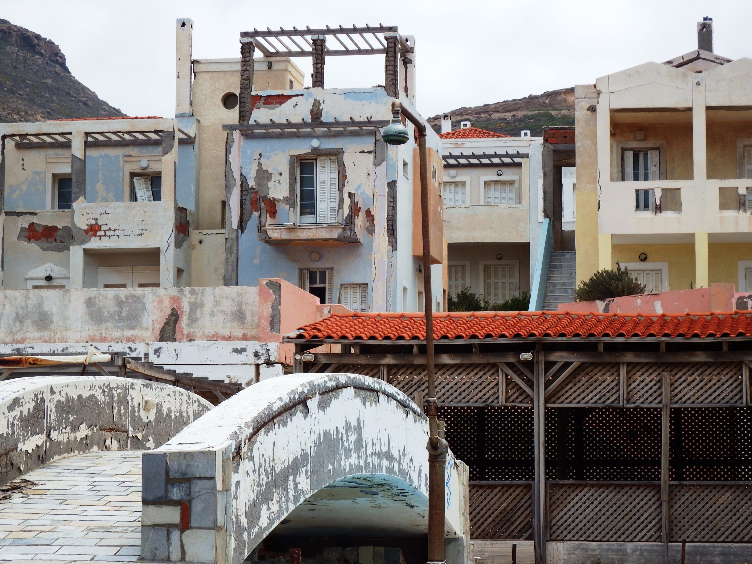
The serious construction defects, which must have been apparent shortly after completion, are striking. Inadequate foundations, structural deficiencies in the reinforced concrete frame construction, insufficient concrete cover, exposed reinforcement, and a lack of protection against chlorides and sulfates from the salty sea air have resulted in columns, beams, and ceiling slabs being severely damaged in some cases. Especially on the western front, several buildings exhibit gaping cracks running through their entire structure. There is a risk of collapse.
Nevertheless, the settlement is still only inhabited by a few residents today. A number of houses in the southern part of the complex have been renovated and are currently being marketed by a real estate company.
10.1 Kato Zakros- Karidi- Chonos- Vai- Paleokastro- Kato Zakros | 92km - 106km | 5km Dirt Road | 1.859 - 2.204 Vertical meter | Category 1
92km – 106km | 5km Dirt Road | 1.859 – 2.204 vertical meters | Category 1

A dark, black cloud appeares above the church, a touch of a breeze then a treacherous push from a gust, wild and wilder, whirling up the red dust. Then worst, spreads to a red veil, embraces the lonely wanderer. He has to keep his balance, leaned into the wind, has to breath in this suffocating gloom, he must. The storm moves on as a whirlwind, slides faster and faster, keeps him trapped in an impenetrable cloud, bewitched by Prospero the Master.

The cliff of the Zakros Mountains towers imposingly above the east coast at Kato Zakros. Only a few gorges break up the harsh rocks such as those at Agia Irini, Xerokambos and Kato Zakros and further north at Hohlakies. Going through steep bends you ride from Kato Zakros into the mountains, climb up to the pass at 620 meters in altitude and to the plateau at Karidi. Here a wide, dry plain follows to the north, extending relatively evenly on approx. 600 meters in altitude from Karidi up to the small villages of Mitato, Krioneri and Chonos.
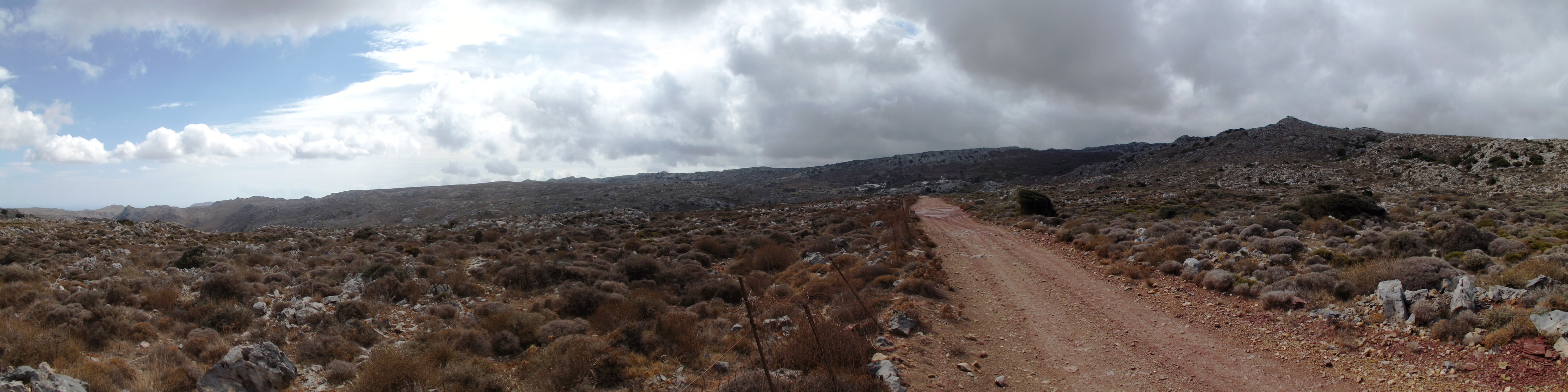
Karidi Plain: Gorges and large cave systems characterize this landscape of limestone and violet slate, a largely treeless plateau overgrown with round thorny shrubs of garrigue, the phrygana of Greece. In the dry summer climate of eastern Crete, with high temperatures and low precipitation, you can find the typical range of plants of the eastern Mediterranean around here – it’s a climate with predominant rainfall during the growing season of the plants in winter.
In spring, the prevalent yellow flower cushions of the round Greek spiny spurge (Euphorbia acanthothamnos) and the green thorny burnet (Sacropoterium spinosum) light up the landscape. Already flowering in autumn, the delicate and yet brilliant blue, towards the edge white blossom of Crown Friar (Globularia alypum) and the yellow flowers of Dwarf Jerusalem Sage (Phlomis lanata pygmi) can be admired.
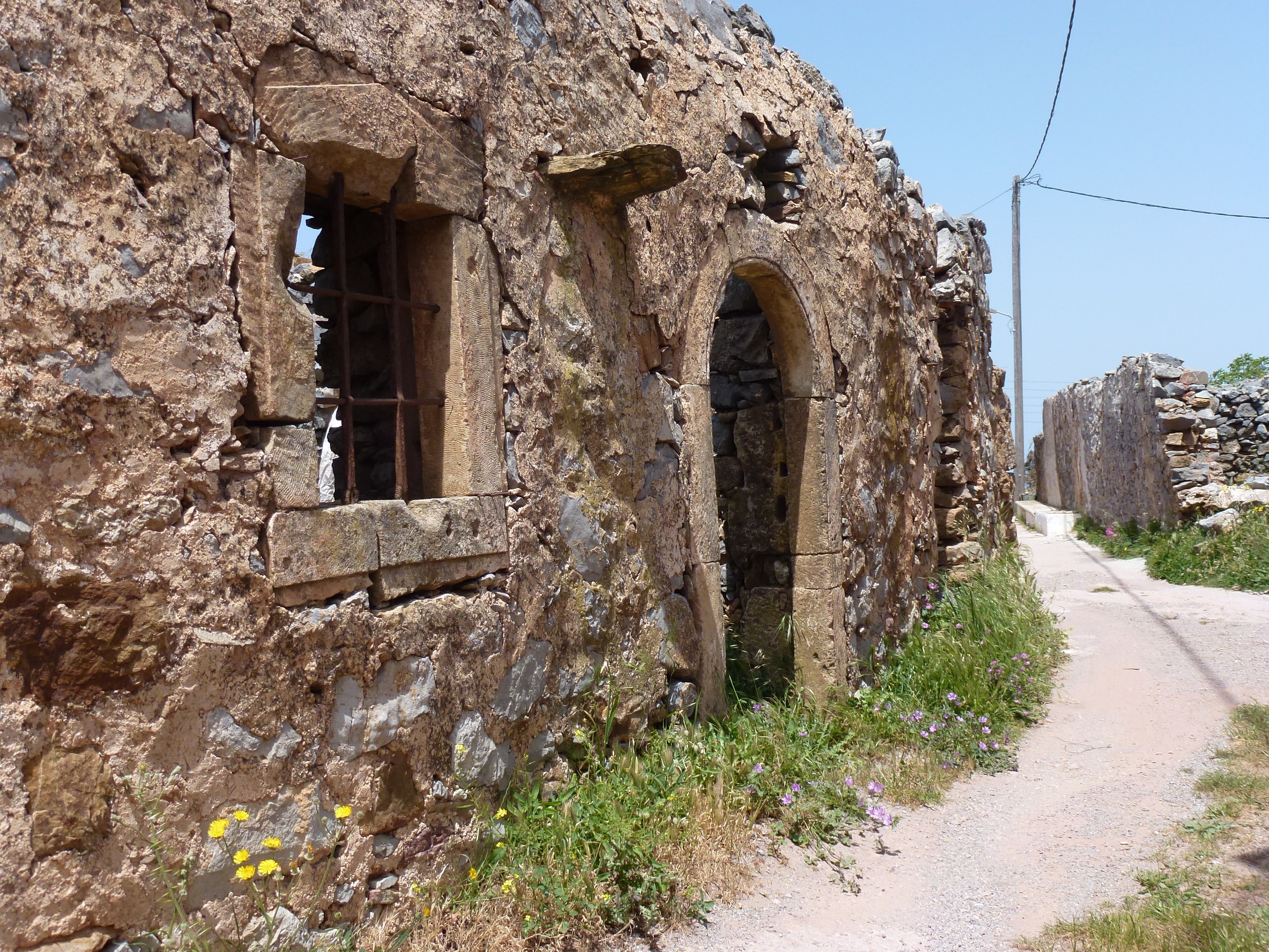
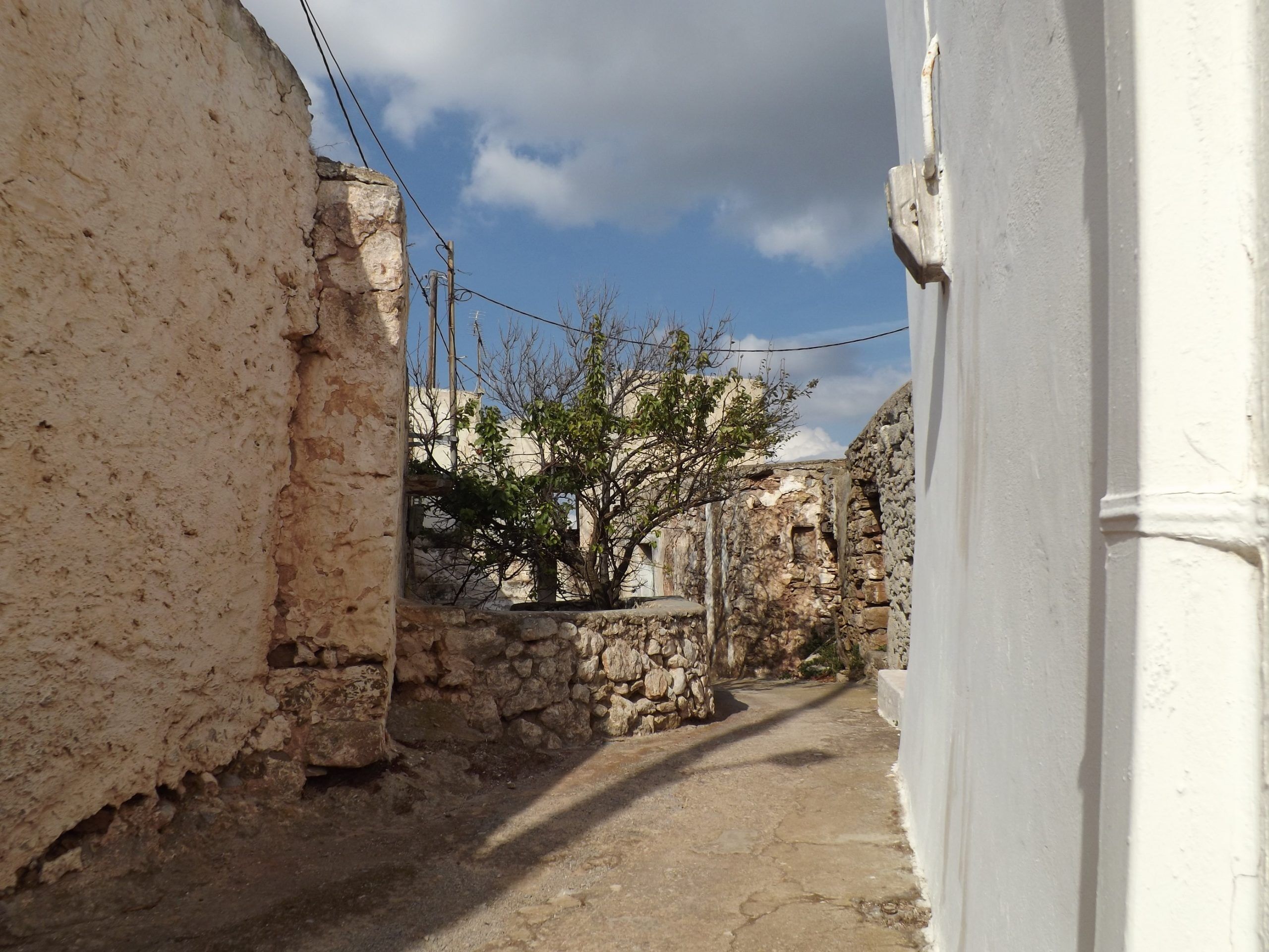
Shrubby herbs such as red flowering Autumn Heather (Erica manipuliflora), the thorny, widely branched, and strongly aromatic Conehead Thyme (Corydothymus capitatus), Silvery Spurge Flax (Thymeleae tartonraira) with its silky hair, Greek Sage (Salvia fruticosa), Cretan Oregano (Origanum onites), St. John’s Wort (Hypericum empetrifolium) which looks like dry heather around here, and the delicate touch of pink of the small-flowered Rockrose (Cistus parviflorus) turn the plain into a landscape of simple, devout beauty in spring.
The Old Villages: If you stroll through the alleys of the picturesque mountain villages such as Karidi, Magkasa (Vrisidi), Mitato, Krioneri, Chonos or Xirolimni and let your hand rest on the old stone walls of the abandoned houses entirely build in rough stone, take a look at the frame of stonework around the arched doors and windows, and the heavy woods and beams supporting the ceilings and the roof. These beautiful and architecturally well-designed natural stone houses kept their warm brown tint and probably date back to the 16th and 17th century, the time of the Venetian and Turkish occupation.
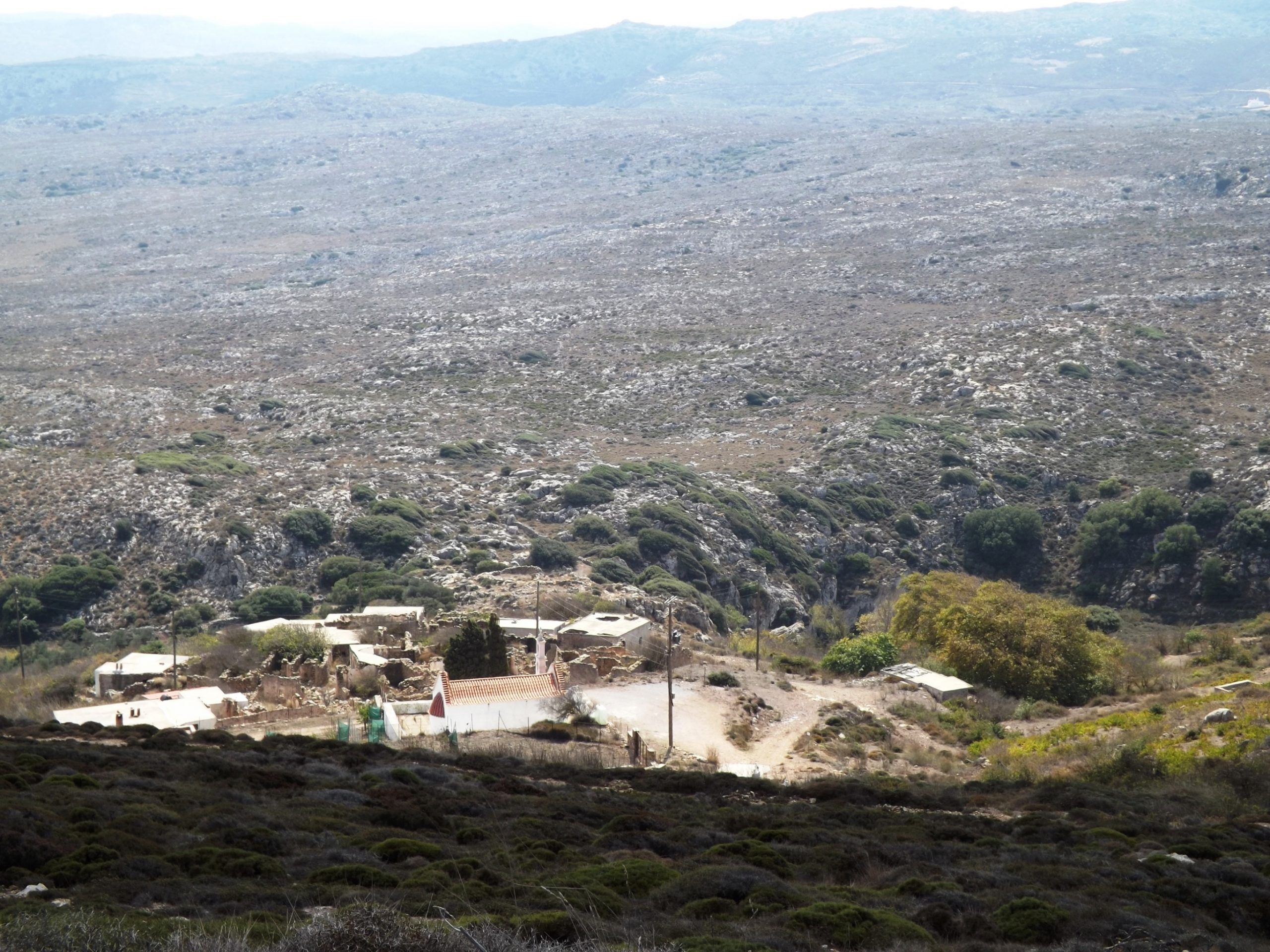

The same is true of the paths from the Venetian period, which still connect the villages. You can admire them just outside Karidi, in the direction of Agios Antonios and Chonos, on Georoute 5 of the Sitia Nature Park and between Mitato and Magasas. Figuratively speaking, you can go back in time for five centuries while you walk on their pavement, absorbed in dreams and thoughts of the past.
High above these places, Bearded Vultures (Gypaetus barbatus) circle around like harpies, transforming the wide plateau, where sunlight is so pale today, into an enraptured, fabulous dreamlike backdrop. Dark clouds advance from the north, and suddenly there is a heavy downpour. In an instant, tiny rivulets turn into small streams that rush down from the flanks of the purple slate.
The Secret Machinery: Just outside Karidi, on the way towards Mitato, when my foot touched the dark red surface of the Violet Slate for the first time at the end of the concrete road, marking the entrance to the Karidi gorge, the landscape started to vibrate. It seemed as if my step had triggered off a hidden mechanism. Deep below me, hidden in the caverns of the earth, an apparatus had been set in motion which, like stage machinery, would determine the further events in a predetermined sequence. There was a dull rumbling that sounded like a train making its way on iron rails, followed by a rolling sound like that of rope pulls and drums, and a grinding of hooks which elevated pieces of the landscape, if not a complete gloomy horizon, from its subsidence, while at the same time high above the scene, shreds of clouds swept away in a ghost-like dance.

Emerging from the shadow of Mount Prassokefalo, I was now fully exposed to the stormy wind. I shivered. From here I overlooked the whole plateau. Immersed in the grey pale light of the approaching storm, a completely new, threatening scenery unveiled.
Storm: On the horizon, nothing but the little white church of Mitato and the whirling windmills stood out against the dark, ink- colored sky. Everything in this stage set appeared to be tense. It looked as if the sky was about to be torn asunder like a worn out piece of canvas, and turn everything – the dark red ground, the grey limestones, the columns of this world – into a stagger, an unstoppable gliding and whirling, which would inevitably have dragged me along into the abyss.

The vibration was a result of the wind, which had steadily increased shortly after the rain had stopped. Every thorn bush, every karst cavity whistling like an organ pipe in the rock, every fence post, every harp of wire mesh seemed to vibrate and filled the air with a singing sound that accompanied the storm orchestrally in addition to my rattling windbreaker jacket. Blowing constantly from May to autumn, there is a strong northwesterly wind from the Aegean around here, anyway – the Meltemi. But this was a storm.
For minutes on end the gusts pulled at me so fiercely that, despite my greatest efforts, it was impossible to brace myself against the wind, in order to get away and keep my bike, my backpack and myself in balance. The air seemed to have turned into a flowing liquid which makes a swimmer, who desperately tries to reach the shore against the back-flooding waters of the heavy surf at the coast, pitifully fail over and over again with every wave. Even the ground seemed to lose its firm consistency. My feet, supposed to prevent me from flying away like a shred of cloth, were my only connection to the surface of the Earth – but as I looked down on them, I realized how ridiculously small they were.
Mitato: The next place to provide shelter was the quarry ahead of the village Mitato, and I tried to get to it. When I arrived there after an exhausting hike – it was all over.

In the village itself, I spotted a pair of bright canvas shoes in the courtyard in front of a house. Immaculate, tidy and clean, they had been put there by their owner. Standing there in the sunlight, faithfully side by side, they were such a peaceful and tranquil sight, as if to deny the chaos that had just raged.
A whirlwind that had formed between the Ionian Sea and the Aegean Sea had swept across Crete, its ridges reaching wind speeds of 90- 100km/h.
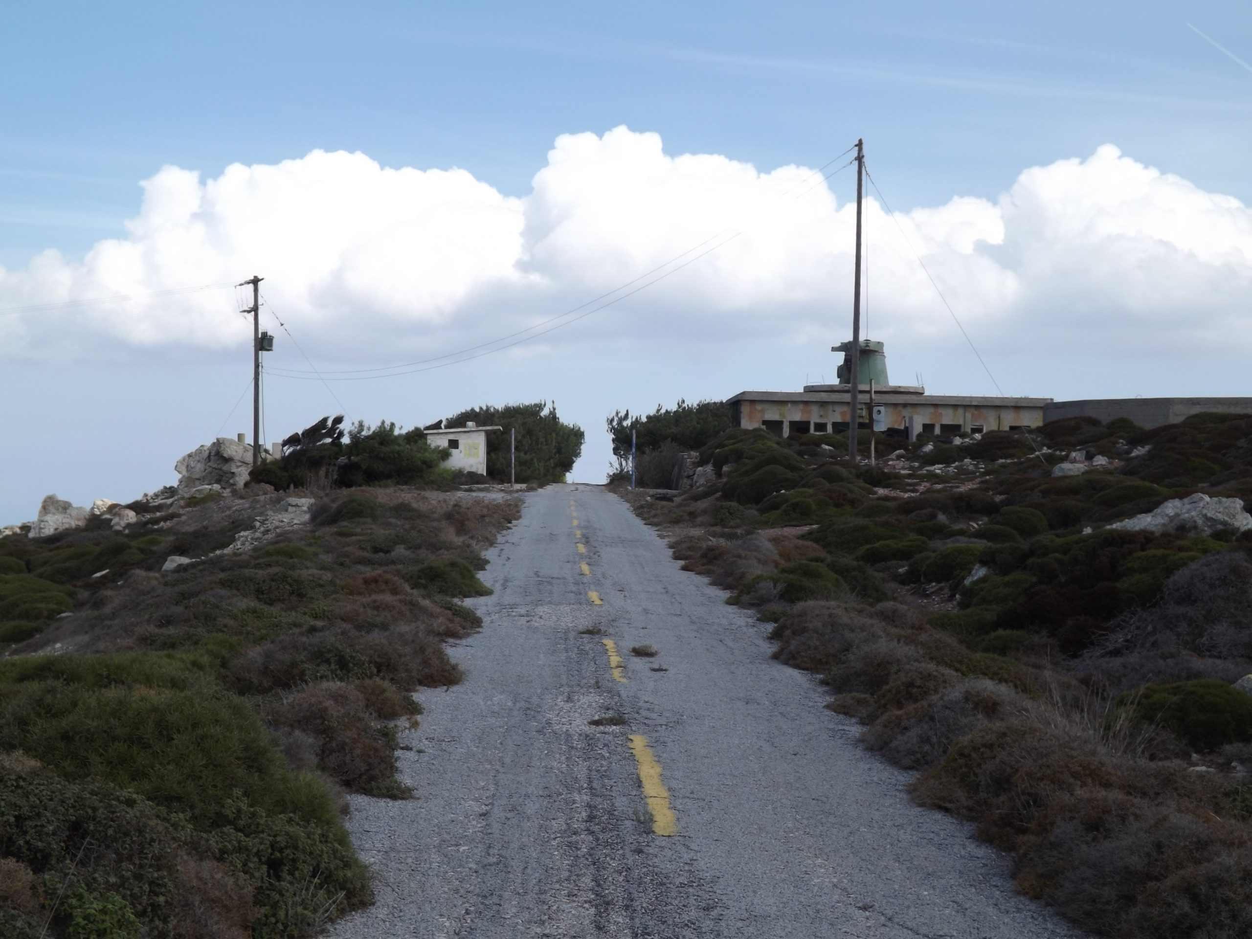
The Citadel: The wind was still stormy, but the sunbeams warmed me up. I embarked on the short struggle to climb the 3.5 kilometers and 200 meters in altitude from Mitato up to the „Citadel“, the ruins of the former radar station of the Greek Air Force on the summit of Mount Armi. Here the whole panorama of the plateau unveils its dreamlike beauty. The view stretches as far as Sitia and Mochlos in the west, the Kiriamadi peninsula in the north, the expanse of the sea in the east and the Ziros plain in the south.

Downhill To The North Coast: On the following 10.5 kilometers from the summit at 750 meters down to the coast, you pass by the village of Krioneri and ride through the grandiose mountain landscape. For 1.5 kilometers you face the stormy northwesterly wind. Then the road swings north for 5.5 kilometers, leading into the slipstream of the mountains and along the eastern slope of Mount Vothoni, then through the wind-protected valley. Just ahead of Roussa Ekklisia, you ride out onto the crest of the hill again and will have to keep your balance in the wind as the road winds down into the plain for another four kilometers until you reach the main road from Sitia to Paleokastro on the north coast.
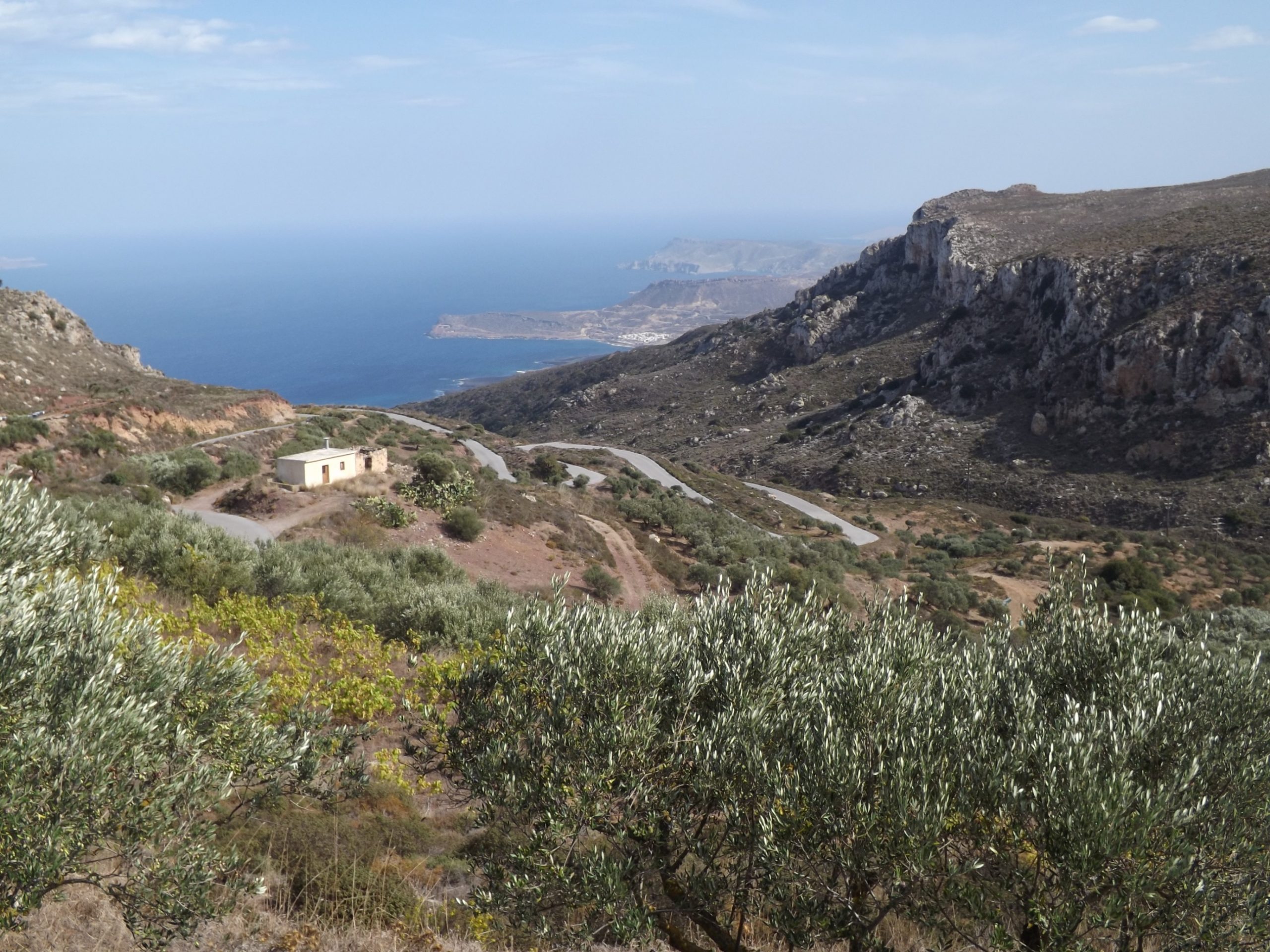
Along The Coast To The Northeast: Turning right to the east and with the northwesterly wind at your back, you’ll virtually fly along for 8.5 kilometers. Riding parallel to the coast, the sprint takes you across two smaller hills each of which features a 50-meter climb (at Aghia Fotia and at the abandoned quarry in the big bend), then past the thrust fault of the Tripolitzakalk above the Violet Slate, and then east towards Paleokastro until you reach the branch to Toplou Monastery and the Kiriamadi peninsula.

Up To Moni Toplou: In eight wide bends, the road ascends for 3.5 kilometers from the late Miocene sands, marls and clays to the monastery of Toplou in the dry, barren and stony landscape of the Kiriamadi peninsula. The annual average rainfall here is less than 300 mm, and the vegetation is sparse, featuring the odd round and spiny shrub. The ascending road bypasses the Toplou Gorge eastwards and leads from the soft Miocene strata hundreds of millions of years back into the rocky desert of the Triassic and Permian slates, marbles, and limestones.

[Crete forms a horst (ridge) within a fore- arc- region of the northward subduction zone of the African Plate. In the Oligocene to Miocene, different layer complexes were pushed over each other as tectonic structures contrary to their time of origin, so that older layers came to lie above younger ones. There is a lower and a higher pile of thrust sheets. Parts of the lower pile, the Plattenkalk layers, the Phyllite-Quartzite-Unit and the Tripolitza layer, were deformed in the course of the alpine mountain formation and exposed to strong pressure which metamorphically altered the rock. In Eastern Crete, the Tripolitza thrust lies above the Phyllite-Quartzite-Unit and the latter above the Plattenkalk as the lowest tectonic unit].

Kiriamadi Peninsula: Opposite the lush green idyll of the Toplou Gorge with its spring, brooks and water puddles, an unadorned stone desert opens up to the north. In this magnificent solitude, you’ll virtually glide through a rocky desert between the sea and the sky at fast speed, while the narrow asphalted crest you ride on reaches far out to the border of the continent in the northeast, surrounded by the salty haze of the sea.

And if you then look back across the narrow connection of the islands to the south and all the way up to the Zakro Mountains rising up at the horizon, inhalating the shimmering air, then you will perceive scents of dried grass, limestone and marl, exotic woods, fruits, thyme, sage, and rosemary – that’s the scent of the Kiriamadi peninsula.

Coming from Toplou Monastery, you’ll reach the turn-off to Vai after seven kilometers (The total distance of the tour from the turning point Vai is 92 kilometers). The ancient city of Itanos follows in the direction of Cape Sideros. Shortly afterwards, you’ll reach the geological outcrop at Ermoupolis with the overthrust of the Tripolitza layer above the Phyllite-Quartzite-Unit, and, closer to Plakoures, the outcrop of Plattenkalk, the deepest tectonic unit of eastern Crete (The total distance of the tour from the turning point Plakoures is 106 km). On your way back through hilly terrain, you’ll arrive in Paleokastro after some 14 kilometers of speedy cycling.
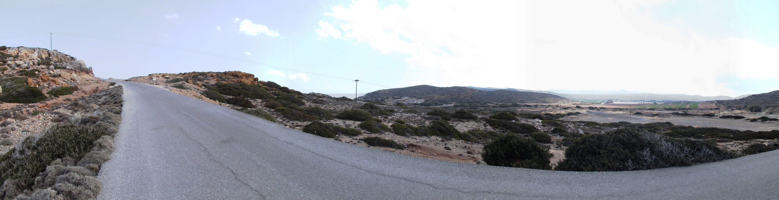
Back To The Starting Point At Kato Zakros: From Paleokastro to Adravasti your route follows the fault zone of the Zakros Basin from north to south. Riding over a first hill and a small plateau you’ll proceed uphill through extensive olive groves inside the valley for about four kilometers and 150 meters in altitude. Winding its way through slate and limestone layers, the road passes small vegetable gardens, where fruit and almond trees line the path. The next stage takes you downhill again. Via Lagkada, you’ll get to the small village of Hohlakies. To the east, the impressive Hohlakies gorge is located behind the village of Kamara. You can take a three-kilometer (1.86-mile) hike/ climb through the gorge, all the way to the beach of Karoumes.
The route now takes a wide sweep to the west and proceeds uphill and downhill through the Violet Slate via Azkeramos, providing a steady ascent to Kellaria. In the west and south, the impressive Zakros Mountains with the Karidi plateau tower up. Their peaks are up to 700 meters high. On the steep flanks of the mountains, the road leads to the pass at the beautiful village of Adravasti. You will reach the pass after about eight kilometers and 250 meters in altitude. For another eleven kilometers you’ll go southeast past Klisidi and down to the coast at Kato Zakros via Epano Zakros.

A giant has come above the seas and moored his ship on the northwestern shore, he quickly approaches over the hills and the plateau with terrible wrath. Then he sees this crawling insect, nothing more than a fluttering ghost, drags and pushes him more and more, grabs him and kicks him down to the bloody floor. Ariel, windy spirit and lord of the storm, out of the inky sky, you sent pouring rain and thundering roar, as I fought my way up to the ruins high above the plain, the landscape was torn apart, by a Skylla hidden in swirling clouds, fortunately, I remained unscathed.

10.2-10.3 Kato Zakros-Stavromenos-Sitia-Kato Zakros - PROLOGUE
It is said that a woman without a man is like a fish without a bicycle. And so it follows, that roses are red and violets are blue, and I am a schizophrenic, and so am I. [Leslie Nielsen in „Bad Golf My Way“ written by Henry Beard and David Fisher, 1994]

Well – not everyone travels for pleasure. You are on a mission and therefore ready to endure suffering and torment. Be it dangerous animals like cicadas that rob you of sleep at night with their love-filled chirping, a real Nile crocodile in the swimming pool or simply the presence of a myriad of insidious mosquitoes in the bedroom.
One rightly asks whether aliens are part of a tourist’s social life. As everyone knows, traveling is difficult for the common extraterrestrial, similar to the problem that the national railway has in reaching the desired destination. In the vastness of unmarked space, this is a challenge. The alien who loves to travel also has to overcome the gravity field of his home planet (Earth: rocket with 11.2 km/sec escape velocity) and he has to be prepared for what, by our standards, is a long journey.
If the planet Melmak hadn’t exploded, Alf would never have made the arduous journey through space and the dangers of an emergency landing and crash over the Tanners‘ garage. Every responsible citizen now knows about the danger posed by hair dryers. This also explains the psychopathology of those who predict the end of the world in the immediate future, but failed to order a few spaceships from Elon Musk’s Space X in time.
When it comes to aliens, we are dealing more with starving desperadoes, against whom a Nile crocodile appears rather well-mannered. However, over the course of time and travels through Crete, I have come across characters who, in terms of classification as unusual, desperate or lawless, appear as people who have nothing left to lose due to their condition.

There was the American who was suffering from advanced cancer. In the evening, at the hotel, he blocked our way with chairs in order to extort our daily experiences from us. Every lightly said word was questioned, every scene was illuminated anew and every detail about waves, wind and weather had to be described again and again in terms of why and wherefore. He was so light that I ended up carrying him with his chair into his room. He breathed his last gasp towards the sun, rising over the sea, after he had struggled to crawl out of his bed onto the balcony.
Two psychopaths should also be mentioned who rammed me off the road during a breakneck overtaking maneuver. A Greek priest, rattling up from the valley in his old pick-up truck, loaded me and my bike, took me to the next village, gave me a Greek Bible as a farewell gift and thereby saved my life in many ways.
There are old folk tales about vampires in Crete, but I haven’t met any yet. But there were fossil and mineral collectors who liked to crawl out of the bushes of the neighboring apartment in the evening at full moon and meet on the terrace to discuss extraordinary finds. Especially in Lendas, you shouldn’t pretend to be interested in geology if you don’t want to spend your vacation studying hexagonal quartz in a wide variety of colors, from amethyst to onyx.
Cretan life is often a tightrope walk between reality and superstition. A black cat crossing your path doesn’t bode well for your day if you forget to spit on the ground immediately, while the direction of its origin determining the extent of the misfortune. Three more important rules: Step on a crack, break your mother’s back, never walk under ladders and Tuesday the 13th, no gorge hikes.

An elderly gentleman on a gorge hike, which progressed from a walk along the valley floor to climbing passages over large boulders, was faced with an abnormally backward twisted foot. A picture that no one forgets so easily. With the cry “My hip is loose,” the guide was faced with the difficult task of bringing the injured man with a loose hip endoprosthesis through the gorge to the beach.

A single malt enthusiast from Scotland, whom we liked to visit in his room for a glass of golden heroin, stepped out to the pool while we were lounging in our deck chairs in the evening and disappeared splashing into the water. After some time he was found at the bottom of the pool, staring at the sky with his eyes wide open. One of us kept vigil at his bedside through the night.
Next Station Loutro: The next day we sat with him in a tavern in Loutro while the storm raged outside and pushed a large table past the window with a tremendous roar. He grabbed his neighbor’s arm in horror and shouted: „For God’s sake, the subway is coming.“
On the other hand, the Cretans initially suspect that every stranger is an alien whom they try to convict. The following dialog is an example:
Excuse me sir, how do I get from here to Tzermiado?
Hey stop, stop, wait a moment. Where do you come from?
From Mirtos.
From Mirtos by bike? He, he, ha, ha… I mean what country are you from?
Germania aha! How old are you? Are you married? How many children do you have?
And be careful! He does not shrink from taking the delinquent severely to task: What do you want in Tzermiado?
Don’t make any mistakes now, otherwise you’ll take the rockiest dirt road in the opposite direction. But quite unexpectedly the directions graciously follow.
Ultimately, however, everyone is good for something, even if only as a bad example. Because there is still the old grouch in me, whose mind was clouded by an evil genius, who stubbornly refused a Roma girl in Heraklion two euros for a few tissues. I still feel guilty today. All the best and good luck on your journey you magical child.
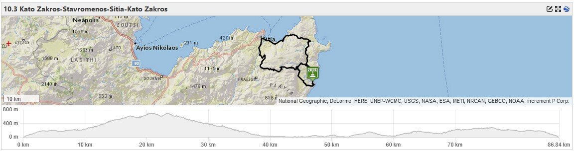
The Beginning
10.2-10.3 From Kato Zakros Up Into The Mountains To Sitanos

The coastal road from Kato Zakros into the mountains is steep. Leaving the village, you only have a few hundred meters left on the bike to get warm, then the climb begins. In three wide curves and over four marine terraces, the coastal road winds steeply up under towering Tripolitza limestone and through sparse Phrygana, higher and higher above the sea.
And it is precisely here that the bone remains of the Cretan pygmy hippopotamus Hippopotami of the Pleistocene were found in the Fangromouro Cave. Further finds of Pleistocene mammal fauna on the coast include deer (i.e. Candiacervus cretensis), hippopotamus (Hippopotamus creutzburgi), elephants (Elephas antiquus) and mice (i.e. Kritimys catreus). Another site with the elephant, Deinotherium giganteum from the Miocene, is on the way from Epano Zakros to Adravasti, east of the road, just before the hamlet of Klisidi.
After another six kilometers of road, the pass and the village Epano Zakros is reached at 220m. Quaternary limestone breccias and marls line the roadside, and the wide valley is now planted with olive trees all the way to the foot of the mountains on the horizon.

The asphalt is already glowing in the sun and the rising warmth mixes with the heavy scent of flowers and the spice of herbs. A wonderful, softly drawn landscape follows on the way to the hamlet Andravasti. Pines, plane trees and cedars line the narrow road that winds through valleys, over hills and ridges of a dreamy garden of Neogene sediments and purple shales.
A Glass Of Vines: Imagine it is already early evening and you are sitting in a narrow alley in front of a small, typical Cretan house with a glass of wine. Your chair is a bit old, it’s more of a scaffold and is therefore leaning against the plane tree and the seat is also missing. Through the door of the small room you can see a bed with a bedspread, a chair, a table, a stove and a sink in the semi-darkness. Pictures of Saint John, Jesus and the Virgin Mary, alongside a series of photos of relatives, are the modest decorations. The sun shines bright white from the opposite wall into the shady alley.

The Wooden Box: Like a beggar you count the gifts of the day, images of an unforgettable landscape, drifting shadows over the thorny paddocks, ships of clouds gliding low over the road and you fly along. Thyme, thorny burnet, sage, spurge, narrow-leaved milkvetch, mediterranean strawflower and St. John’s wort glow with white, pink, purple and yellow flowers from the roadside greenery.
All these memories are locked in a small wooden box. Prehistoric animals set in stone, dried herbs and flowers, minerals, stones, glowing phyllite, figurative wood and glittering quartzite, Clams and snail shells. And when the winter storm shakes the windows outside, the lid opens to this cabinet of curiosities, from which the smell of clayey earth, pine wood, tobacco and herbs emanates, like the scent of a wine matured in noble French oak.

Today’s ride was a rush, a journey into a vertical world of climbing where all that matters is the mountain, the incline and the asphalt racing into the past beneath your bike. Everything is narrowed down to what your heart, lungs, arteries, mitochondria and muscle contractions can do translate into power, speed and cadence.
Karidi: From the small hamlet Adravasti, the bright ribbon of the road winds over the first long serpentines up into the solitude and silence of the Alpine mountains. You pull your bike through tight curves, lined with Tripolitza limestone and violet slate through the barren landscape of the Phrygana, uphill over eight kilometers and 400 meters in altitude to the village of Karidi. Even from the pass, the white houses shine out from the green shrubs, the plane trees, figs and vineyards. At the village outskirts a narrow street with a concrete surface leads you past flower-decorated gardens with bougainvillea, lavender, oleander, milkwort and common myrtle to the Y-junction above the village. Turn sharp left here in the direction of the village of Sitanos.

Into The Fog: On this narrow mountain road you climb for another two kilometers and 100 meters altitude uphill into the realm of the cold and the fog. Out from the gray darkness of the drifting haze you hear bells ringing and the horned faun playing the flute. With a shudder one hastens down to Sitanos.
Three options for continuing from the village of Sitanos to Sitia and the north coast
Option 1: Kato Zakros-Stavromenos-Sitia-Kato Zakros | 87 km | 2.248 vertical meters | Hors Catègorie
[1] Kato Zakros- Stavromenos- Sitia- Kato Zakros: The easy option with driving on a well-developed road, on the eastern edge of the Sitia trench, from Sitanos to Sitia. You save ten kilometers compared to the next two options. At the Y- junction at the eastern outskirts of Sitanos, turn half right towards Katsidoni. This is followed by an approximately one kilometer long climb of 80 meters up to the pass at 690m. Then you cycle constantly downhill via Stavromenos and Piskokèfalo until you the reach the picturesque town of Sitia after a distance of 20 kilometers [Ascent 350m; Descent 960m].

Katsidoni Thrust: Shortly behind the hamlet of Katsidoni, the characteristic limestone of the Tripolitza unit lies as a tectonic nape thrust over the schists and metamorphic rock of the phyllite-quartzite unit. The outcrop is part of the Crete Detachment Fault and extends for about 50m parallel to the road.
The village Of Zou: Passing the villages of Sandali, Kato Dris and Stavromenos, after eight and a half kilometers and a descent of 500 meters, you reach the village of Zou.
Shortly before the village, in a long, sweeping U-curve, Miocene limestones of a shallow-marine facies of the Skopi Formation (lower to middle Tortonian / 12-10 million years ago) are exposed. Layered deposits of washed-up bivalve shells, some oyster shells, and a few sea urchin remains are revealed.
On the southern edge of Zou lies the abundant karst spring that has supplied Sitia with water since 1911. The spring originates at the interface between the water-bearing limestones and dolomites of the Tripolitsa Nappe, which were deposited as shallow marine sediments during the Alpine orogeny (Upper Triassic to Upper Cretaceous) and the phyllite-quartzite unit as an impermeable horizon. The limestones and dolomites have been subjected to intensive dissolution processes, with calcium and magnesium being leached out, resulting in the typical solution cavities of karst. The limestones thus constitute the most important aquifer of Crete.
Minoan villa Zou: Shortly after Zou, on the left, is the excavation site of a Minoan villa with more than 20 rooms. It dates to the New Palace period, Middle Minoan (MMIIIB) to Late Minoan (LMIA), and was first explored by Nikolaos Platon in 1955/56. A number of similar villas have been excavated in eastern Crete at Achladia, Prophitis Ilias Praisos, Klimataria, Makrygialos, and Epano Zakros.
Further south, on the western flank of the Sitia Graben, a Minoan villa of similar size and function lies on the hill of Prophitis Ilias, near the town of Agios Georgios (Tourtouloi). The finds suggest it was a country house that also served as the seat of the local government. Three wine presses, pithoi (mills), grinding tools, a number of cooking utensils, and loom weights were discovered there.
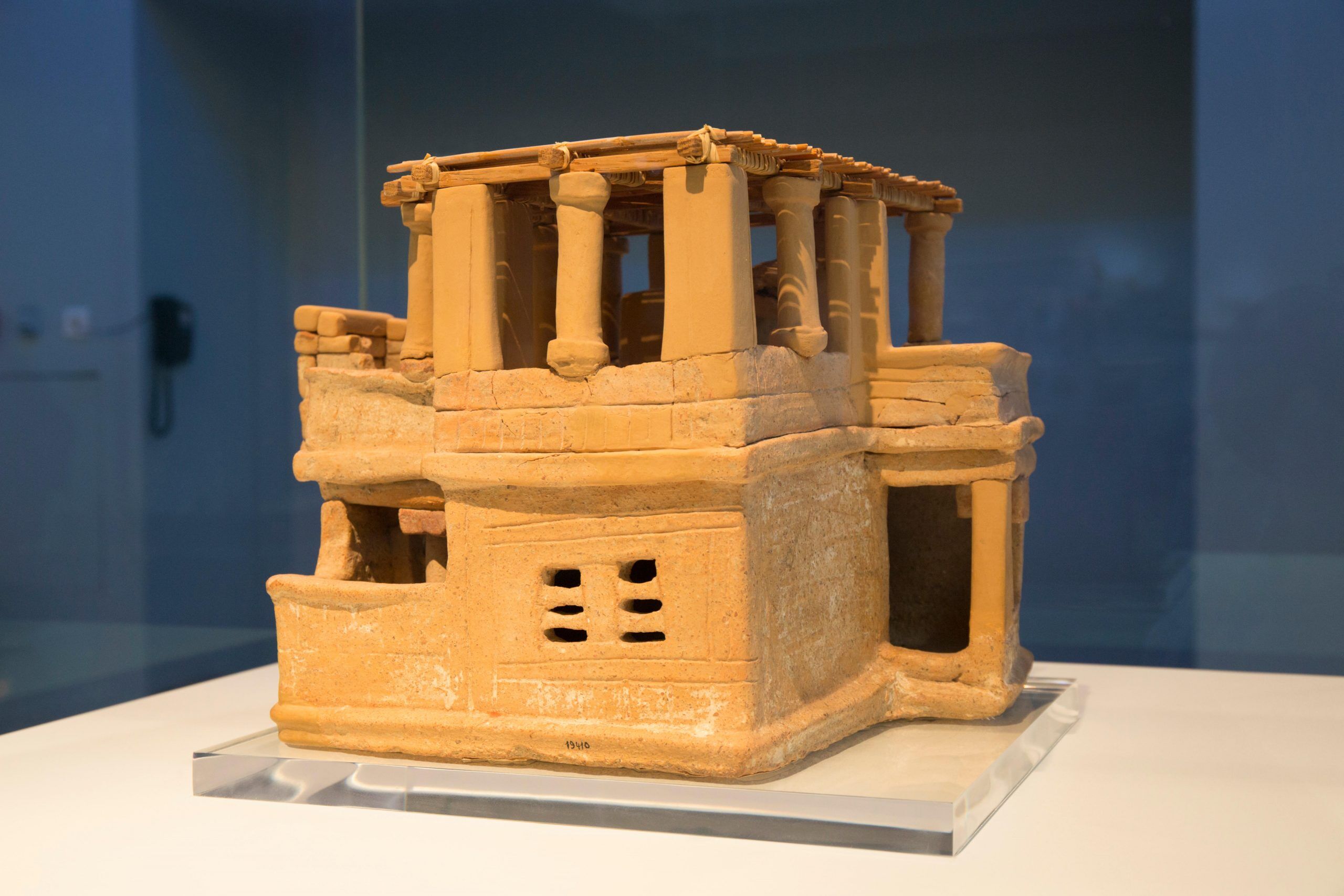
The Zou villa is situated on an area of approximately 700 square meters at an altitude of 160 meters, on the eastern slope of a 220-meter-high mountain ridge, elevated above the surrounding area and offering good views over the valley. The ground plan shows corresponding, terraced rooms, suggesting a single building complex. Further wall remnants extend down into the valley towards the Petrolakkos potamos stream, indicating that the Minoan villa of Zou was part of a larger settlement.
Continue on to the village of Piskokefala, descending over 100 meters and about four kilometers into the valley. After turning onto the main road to Sitia, the traffic increases significantly, the road becomes bumpy due to numerous potholes and cracks, a strong headwind picks up, and everything is shrouded in dust. After another two kilometers downhill, Sitia and the north coast are reached.
Option 2: Kato Zakros-Chandras-Ag.Spiridon-Sitia-Kato Zakros | 98 km | 2.429 vertical meters | Hors Catègorie

[2] Kato Zakros- Chandras- Ag. Spiridon– Sitia- Kato Zakros: This is a remote and low-traffic route on the western flank of the Sitia trench. From Sitanos via Chandras and Ag. Spiridon to the north coast and to Sitia. On a narrow, winding country road we go 31 Kilometers through the barren landscape with low shrub vegetation, individual pine trees and Kermes oaks, past olive groves, vineyards vegetable and fruit cultivation. Coming from the medieval hamlet of Voila, turn right at the playground on the northern outskirts of Chandras and continue, mostly downhill, via Ag. Spiridon and Piskokèfalo to Sitia [Ascent 530m; Descent 1,150m].

The medieval village of Voila is located on a steep hill in the eastern part of the Armenochantradon plateau. In character it is a fortified village with a row of small houses, two small chapels and a central, formerly two-story Venetian residential tower of the Zeno family from the 16th or 17th century. Typical features of a Venetian (fortified) building are the outer walls, which are up to 70cm thick at the base, the vaulted ceiling of the two individual rooms, the carefully crafted band of cordons in the transition to the first floor, the remains of a stone staircase, the carefully chiseled framing of the doors and the small windows, the corner stone frame of the tower and the parapet that probably has surrounded the roof.

The tower was redesigned under Turkish rule in 1740-41, particularly with regard to the location and design of the entrance. The door frame is decorated with Islamic ornaments, several rosettes, two stylized pine trees and a battle axe. The respective fountain ledges of the fountains at the front and back are also decorated with Islamic art elements, and even the original faucet from Ottoman times is still there.
Option 3: Kato Zakros-Chandras-Etia-Sitia-Kato Zakros | 98 km | 2.316 vertical meters | Hors Catègorie

[3] Kato Zakros- Chandras- Etia- Sitia- Kato Zakros: Also on the western side of the Sitia trench runs this route from Sitanos via Etia to Sitia. At the eastern outskirts of Sitanos, turn half left at the Y- fork towards Chandras and Ierapaetra, drive through Sitanos and the medieval village of Voila to Chandras and Armeni.

Olives, wine, vegetables, goats and sheep farming are the wealth of the area. The grapes of the famous Cretan Liatiko are grown here. From Armeni the road leads via Etia, Papagianades and Piskokèfalo over a distance of 31.5 kilometers mostly downhill to Sitia and the north coast. [Climb 420m; Descent 1,030m]

On the plain, just behind the village of Armeni, lies the medieval hamlet of Etia with the 15th century manor house of the De Mezzo family. Built in the style of a former multi-story Venetian palazzo, it is surrounded by the ruins of the associated village. The Venetian Villa is one of the best preserved and architecturally outstanding buildings from the period of colonization by the Republic of Venice between 1204 and 1645/1669.
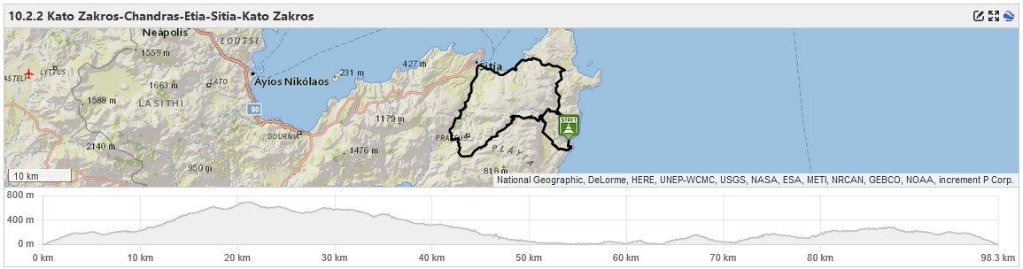
The Circle Closes
10.2-10.3 From Sitia To Paleokastro And Kato Zakros

Continuing from Sitia, the biker will need a little equanimity. For four and a half kilometers towards Agia Fotia you’ll have to manage some bad roads and lots of nervous traffic. Parallel to the coast and over a few hills, the road leads past the village for eleven kilometers east to Moni Toplou until it crosses the Kyriamadi peninsula towards Paleokastro.
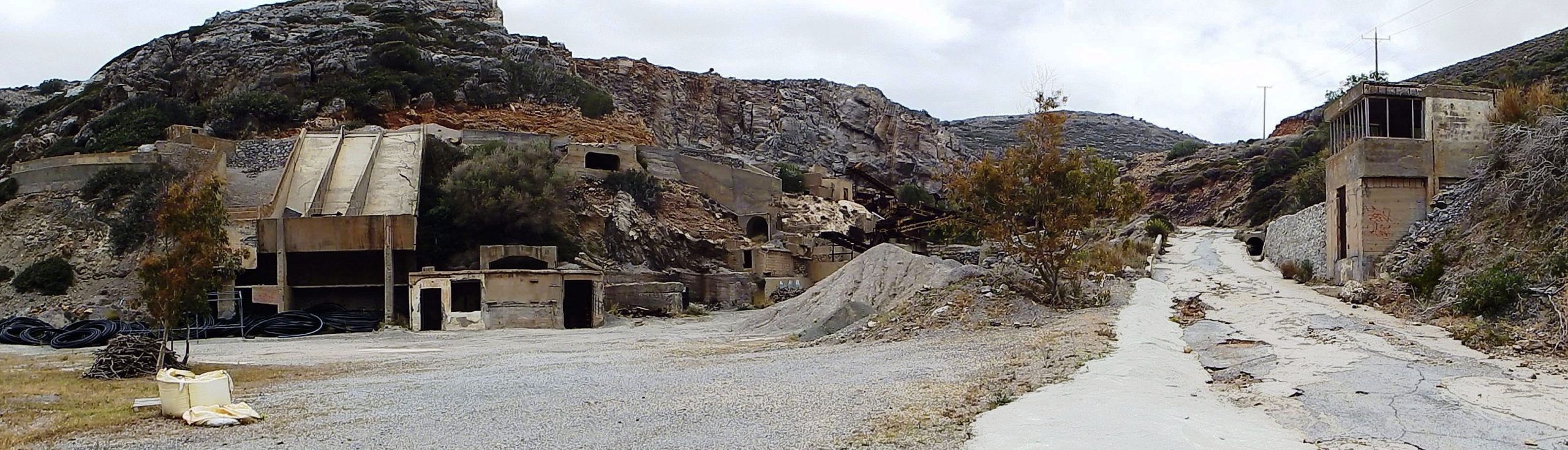
Two kilometers past Agia Fotia, on the way to Kala Nera, the road leads in a long U-curve through a deeply incised valley. Here is the access road to the abandoned “Damari Roukounaki quarry”, which extends further into the hinterland with several extraction areas, revealing the limestone and dolomite of the Tripolitsa strata, ranging from the Upper Triassic to the Upper Cretaceous (200- 66 million years old), as well as the marl of the Miocene rocks of the Paleokastro Formation (7- 6 million years old). The remaining machinery of the gravel pit operation consists of stone crushers, conveyor belts and screens for the production of various aggregates, as well as storage and holding silos.
Continue driving for two and a half kilometers until you reach the Kyriamadi peninsula. Next to the monastery worth seeing is the largely abandoned Dionysos Greek Village holiday resort, an investment ruin and a lost place in which a few residents still remain (see Tour 10.0).

The wind, which constantly blows here from the northwest, pushes the biker up a first hill of 150 meters height. Than, with a whirring freewheel, you race down this race track for four kilometers, past outcrops with sands, marls, limestone bands and conglomerate layers of the Neogene, to the small town Paleokastro.
The Circle Closes – Paleokastro To Andravasti:
The last climb back to the south to Andravasti and Epano Zakros is coming up. The road runs at the bottom of a narrow, south-facing geological trench. You now have already 2,100 meters of altitude and 80 kilometers of strenuous climbing in your legs and you feel them. The good news is that you only have two ascents left to climb until you reach the pass at the village of Andravasti.

The first climb shortly after Paleokastro with a length of five kilometers, 150 meters in altitude and an approximately 6% gradient. The second ascent from Chochlakies via Azokeramos and Kellaria to Andravasti over ten kilometers, 200 meters in altitude and with gradients of up to 10%. The bad news is, the route runs largely in the lee of the towering mountains, so there is no tail wind. From Paleokastro a total of 16 kilometers and 280 meters of altitude have to be covered towards the south before you head steadily downhill back to Kato Zakros.
The Tripolitza limestone of the Zakros Mountains rises to a height of 420m towards the east. To the west, the steeply sloping foothills of the Karidi plateau, interrupted by gorges and reaching heights of up to 600m, form an impressive backdrop. After the village of Chochlakies (gorge hike to the sea possible), the graben widens towards the south into a wide plain. In the fertile valley with the now soft forms of the Phyllite-Quartzite Unit and Neogene sediments, an endless succession of olive groves extends to the horizon.
10.2-10.3 The Alien Hunt
There is an ugly clacking sound when a dog’s rows of teeth clash as it bites into nothingness near the biker’s whirling legs.

So we stood opposite each other, on a road in the middle of nowhere, in a barren landscape and a sea of olive trees that in the light wind leaned towards me with a silvery shine. A chapel with a blue roof shining white next to the cemetery, thorn broom and juniper lined the road and it would have been the right moment to catch butterflies.
But here stood tense and ready to attack, a large, aggressive dog with black, shiny fur, like Cerberus, the fearless guard of the underworld. With my helmet, the mirrored glasses and the silent racing bike, I may have appeared to him like an alien that he sought to destroy. With the fur raised on his neck and back, his mouth open with a fearsome jaw and a deep growl, he seemed unsure how to attack. The bike served as a shield for me.

With every movement he ducked to jump and attack or tried to avoid my shield until I grabbed the air pump sticking out of the backpack behind me, which was my only option for defense. As soon as my shadow grew beyond him, he backed away, probably sensing the effect of the blow. The air pump swung over my head, the cylinder suddenly popping out and hitting him in the head like a whip, causing the pump to break in two. The infernal retreated farther and farther, swayed as if drunk, and then let itself fall heavily to the ground like a sack.
Nothing kept me in this place anymore, left the pump where it lay, nor did I want to wait for my enemy to regain strength, neither to tempt the Furies, at home in the darkest heart of Hades, to take revenge.
The next five kilometers are not among the best memories of my cycling life. Behind every bush, from every house entrance, from every lowland, I saw my enemy rushing towards me. The horror was intensified when I noticed that the road was approaching the place of our eerie meeting, the chapel with the cemetery, in a large arc, and even had a short cross-connection there.

Only the peaceful silence of the small village of Andravasti and the descent towards the deep blue of the sea brought partial recovery. But it was the last time in Kato Zakros, this enchanted place with the extraordinary laid-back atmosphere and the great Cretan hospitality. I left the next day and haven’t returned since.
10.4 Kato Zakros- Sitanos- Voila- Xerokambos- Kato Zakros | 70km | 1.522 Vertical meter | Category 3
70 km | 1.522 vertical meters | Category 3
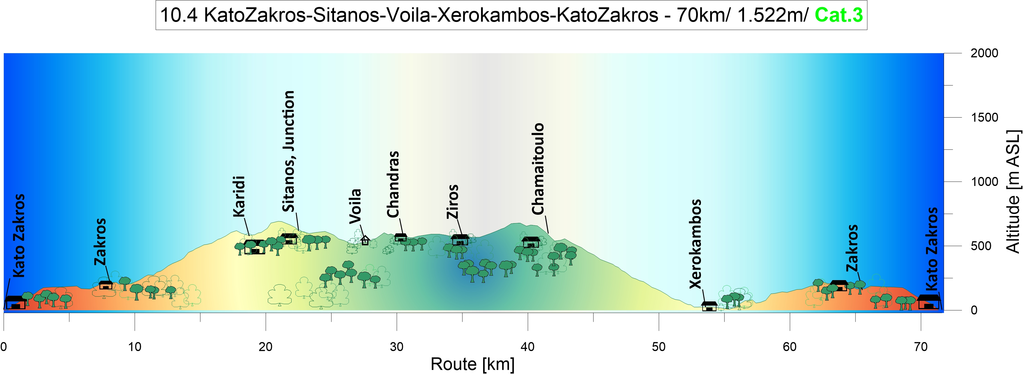
In a wind tunnel: The sun rises above Kato Zakros bay. While the valley is quiet, the wind blows strongly from the northwest across the crests and the passes. The first eight kilometres in western direction to Ano Zakros and the downhill to Xerokambos are easy going. But the climb up the wide sweeping bends to the Ziros Plateau became more strenuous than expected.

The headwind increases to six Beaufort. The guy on his bike pushes himself upward with his heart beating like mad. He travels light while he faces the breathtaking ascents up to the Plateau. Then he dashes downward into the next valley again and is but a small creature rushing along, tumbling into a sudden turn, just to encounter the next steep ascent. The climbing velocity is now on walking speed. Strong gusts drag at his body, trying to overwhelm him, then pushing him towards the abyss. It is sheer agony to climb against this strong and gusty headwind. The life has switched to slow motion. The bees take cover in the shelter from the wind provided by the climber and struggle their way over the pass to the next valley just like him.
So Harry from Nostros Restaurant at Kato Zakros, an ambitious climber himself, was right. “You put the cart before the horses – you have to ride the tour the other way round”

From Kato Zakros to Sitanos, Voila and Xerokambos: Two sweeping curves carry you high above the sea at Kato Zakros. A stop in the centre of the next village, Ano Zakros, to fill up the water bottles at the well. The actual karstic spring is located northwest of the village.
Leaving Adravasti behind, you follow the turnoff to the nine kilometre-long ascent to Karidi and the plateau of Ziros. In narrow hairpin bends with ascents of up to 12%, the road winds its way up towards the pass at 700m above sea level. The path is lined with limestone, marl, some violet slate, and the sparse vegetation of maccia.

Curve after curve, I climbed the steep ascent at high velocity. Then, loud and clear, a bicycle bell suddenly rings behind me. According to its sound, it belongs to an ancient Dutch ladies‘ bike. My only conclusion was: A woman on a Holland bike had caught up with me on a steep mountain road with a 10% ascent, and now she was about to overtake me. I’ve been humiliated many times in sports. Among other things, I was once overtaken by a young mother with a jogger stroller while I was running uphill. With tears in my eyes, I can still see her rocking ponytail disappearing ahead of me.


Nothing was lost, yet. Rising from the saddle and increasing the pace was one thing. I was now clearly spinning in the red zone. But the ringing continued, sometimes more to the left, then more to the right. Without a doubt, Jeannie Longo was at my rear wheel. Then it happened. I had briefly looked away, then the ringing suddenly came from the front. She had passed me. With a mild smile on her face – she stood at the roadside. A Cretan goat. Her bell rang merrily, and not just hers. There were bells ringing all around me, and the goats ran away as I stormed towards Karidi. I must have been a little out of my mind.
Passing through the village of Karidi which is embedded in purple slate, you climb the last 100 meters of altitude leading up to the pass. Then proceed further via the remote and abandoned elevated karstic landscape before the route takes you downhill to Sitanos, a farmer’s village in the fertile valley. Olives, wine, honey, vegetables and cereals have always been the riches of this area. In the centre of the village, turn left and head southwest following the road towards Voila and Chandras for five kilometres.


Voila: Just before you reach an S-curve, the sandy path on the left leads to the ruins of the medieval village of Voila, a mystical place with two refreshing fountains. A fountain with decorations from the Ottoman period and delicious, cold water is located right on the path. Shaded by almond, fig trees, oleander and a big cactus, the other one is situated above the private garden at the southeast end of the village.
The village is dominated by the massive residential tower of „Tzen Ali“. Probably of Venetian origin and dating from the 16th century, it was repaired and decorated during the Ottoman period in 1740-41. The archway shows decorations from this period. The tower served as a country estate for the utilisation of the fertile valley (Plateau of Armenochantradon) and as a base for the leaders of the Janissaries.
It ows its name to one of the most famous of them, Tzen Ali. In the surrounding village east of the path you can see residential houses, stables and storehouses, as well as the ruins of two churches. The well preserved two-nave church of Saint George situated on the eastern slope houses a 16th century gravestone fresco. To the west of the path, a protective wall, irrigation systems, and remains of buildings can be seen in the fields.
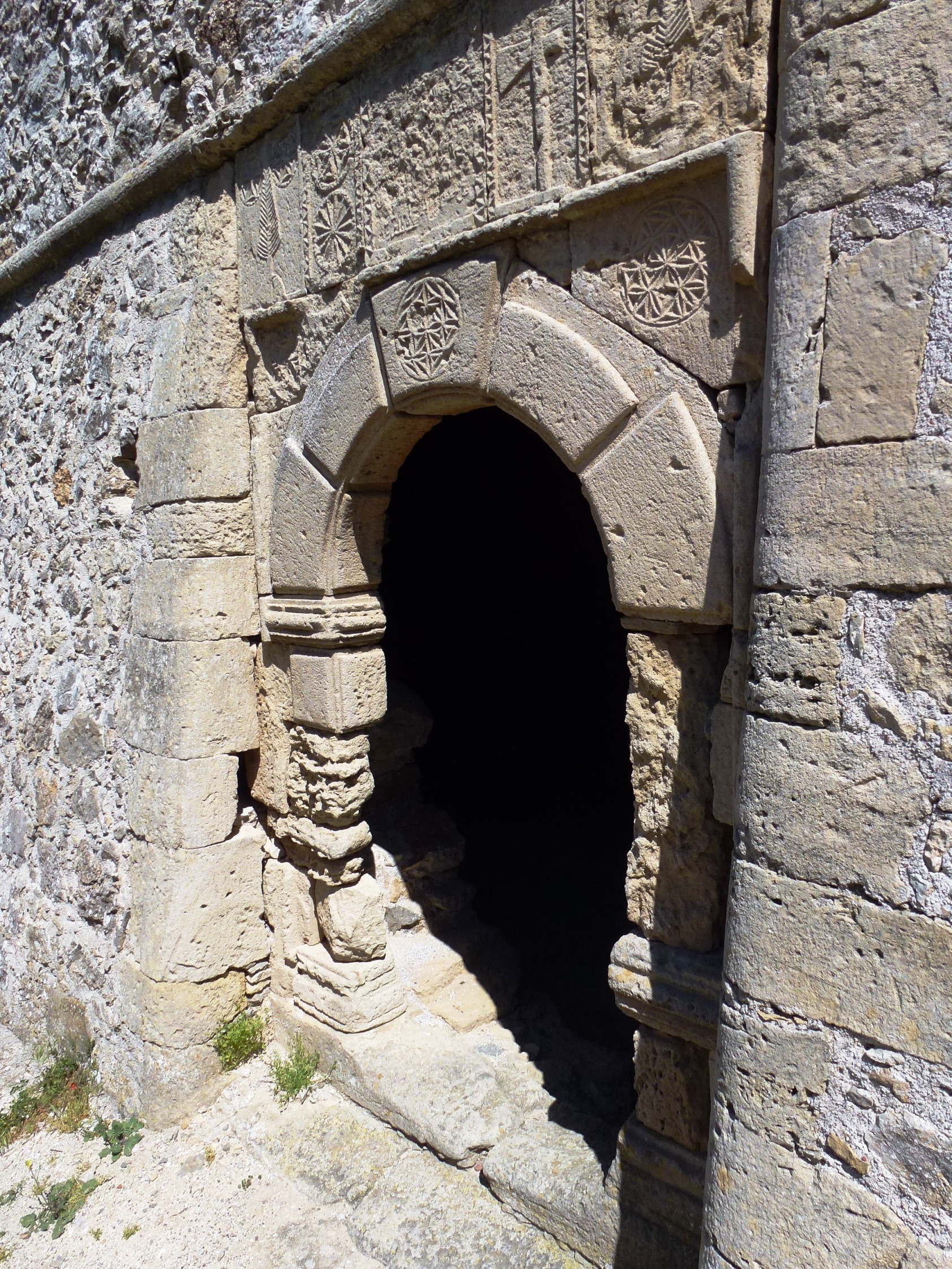

Follow the sandy path to the northwest and you will soon reach the peaceful farming village of Chandras. There is a small playground on the right side of the village entrance. Turn left here at the crossroads, pass by the highly recommendable village restaurant Taverna Katerina, then enjoy the descend and continue eastwards on the plateau towards Ziros, the administrative centre of the region. Because there was something to celebrate that day, someone fired a gun right over my head. The reader will understand that this incident had given me the necessary (adrenalin-based) acceleration I needed for the way south and up the pass (685m above sea level).
The descent to the Libyan Sea is one of the most beautiful in Europe. Featuring wide curves for 16 kms, the well-developed road takes you towards the glittering sea that displays its bright blue to turquoise shades along the way. The road is like an elaborate ribbon, like an ornamentation of the mountain rising up from the limestone and marl that is sparsely covered with maccia. It’s a party, a rush of speed on a technically challenging descent. Watch out in those hairpin bends, they can be very narrow and tricky in oncoming traffic. Xerokambos is a small and quiet coastal village. The houses are lined up along the coastal road, there are two mini-markets, a few taverns, and you can rent rooms or apartments. Special features include the fantastic white sandy beaches, the crystal clear water, and the small secluded coves where no other guests can be seen all day long.
From Xerokambos, the journey continues to Zakros. Following the fantastic descent down to the coast, the last 250 meters of altitude uphill to Zakros are easy to master before the last eight kilometres downhill to Kato Zakros close the circle.

Accomodation: Stella`s Traditional Apartements. About 700m from the beach. Well equipt ensuit Studios and apartements, run by the friendly Ailamaki family. Stella and her husband are globetrotters, mountaineers and himalayan hot shots who (not really) came to rest at this peaceful spot – Kato Zakros. For you it is a lay-back-atmosphere here in this paradisiacal resort with the shady garden and the genuine Greek hospitality. https://www.stelapts.com
Eating: Nostros Restaurant – Terrace at the waterfront. Very professionell and friendly run. Great eating. Fresh fish and grills. My favorite.

11.0 Sitia- Pachia Amos- Mirtos | 76 km | 1.723 Vertical meters | Category 3
Piraeus
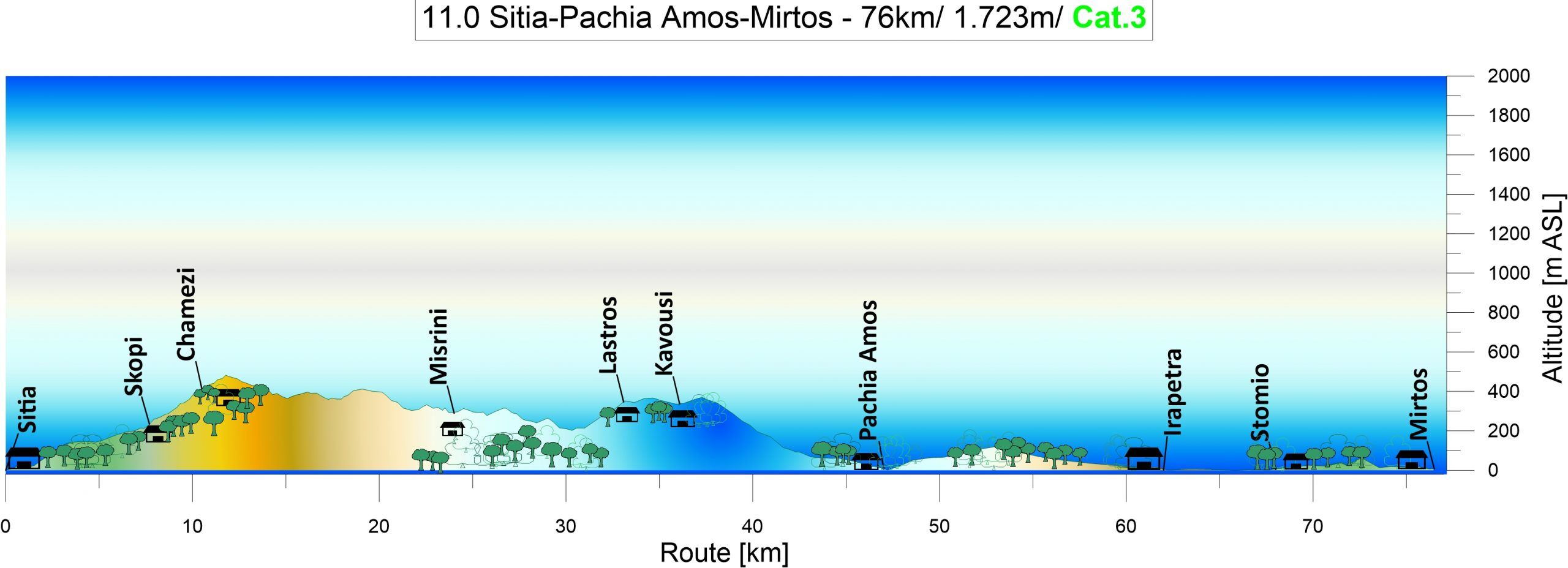
A man of average statue with nothing but a cape, a sword and a pair of cojones fights and kills a huge rampaging bull as much as a half the time. Now how is that possible.
Of course it takes courage, daring, bravado. But most of all of them, it requieres the abillity to understand the nature of the beast you are dealing with. If you can see him with mind, it doesn’t matter how big he is or how hard he charges. He will be putting in your hands. It’s all a matter of knowing, what makes your opponent take. [Leslie Nielsen in „Bad Golf My Way“ written by Henry Beard and David Fisher, 1994]
Should an engineer be tasked with building the perfect harbor, situated not on a river but directly on two seas, centrally located and equally accessible from all countries, and protected from wind, storm, and surf, he would build it according to the model of Piraeus.
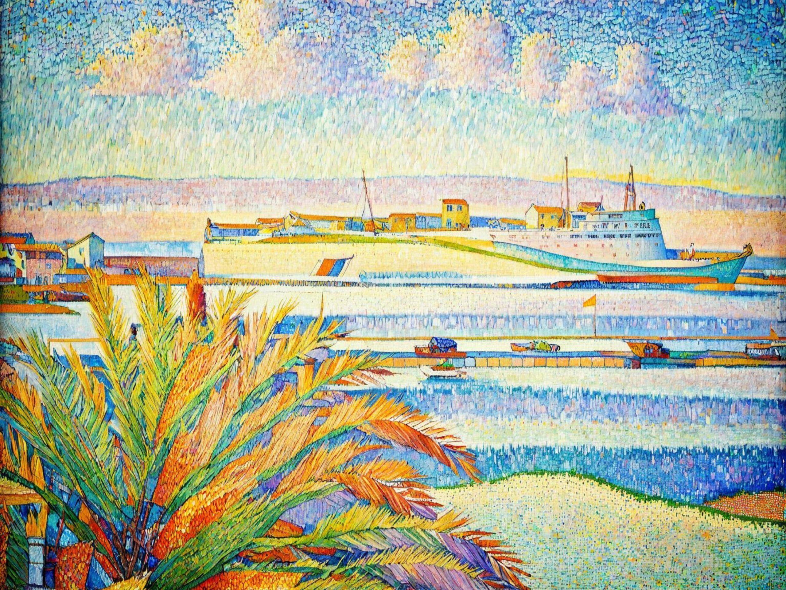
Piraeus, the descendant of great Athens, is home to an impressive number of ships, a fleet. And just as piglets suckling from their mother each seek its own teat, so these giants of the sea are moored backwards to the pier. Their bodies filled with the roar of the engines, the shouts and whistles of the boatmen. The traveler shudders at the sight of this underworld.
But soon the huge shadows detach themselves from the quay, sometimes quite suddenly after a long wait, leaving the careless, the unsuspecting person who wanted to catch one last photographic glimpse of the monster in the face of the setting sun, without his luggage and without his loved ones.
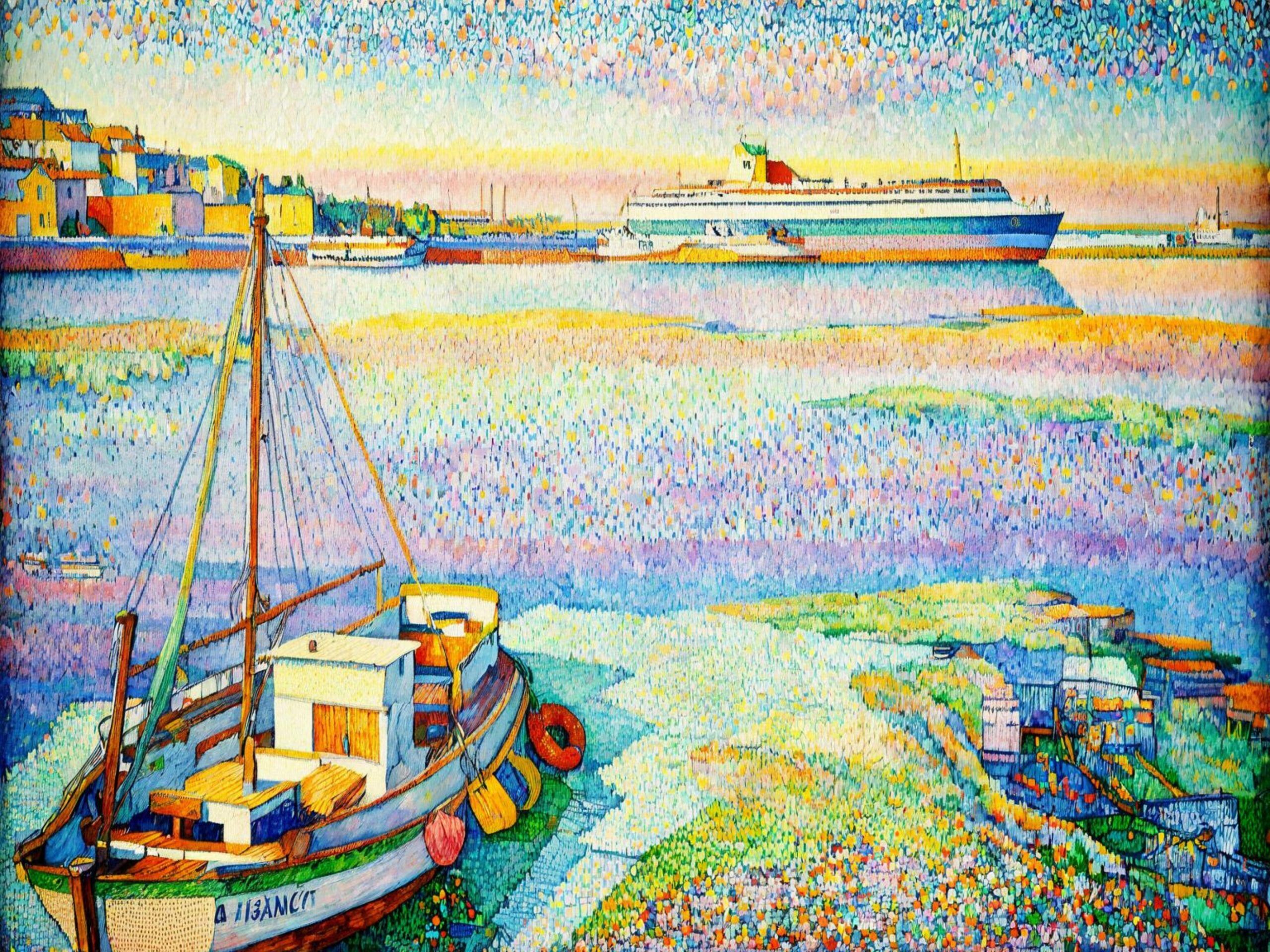
Their destination is the island groups and lands of Thrace, the Aegean, the Sporades, the Cyclades, the Saronic and Ionian Islands; indeed, they sail as far as the Dodecanese and Crete at the very edge of the Greek world. But these steel giants, gleaming in white and blue, skirt the rocky coast of the Peloponnese without even entering a single port. The reason is Sparta.
The Peloponnese War (431- 404 BC): Once upon a time, while in conflict with the land power Sparta, Athens possessed a large and fearsome fleet. Based in the port of Piraeus, it patrolled its island kingdom of allies, protecting trade, ensuring grain supplies, and collecting taxes. But this powerful fleet also awakened the greed for glory, adventure, and quick plunder through the supposedly risk-free conquest of foreign cities.
The Sicily Campaign: With 134 ships, Athens, supported by its allies, marched against Sicily. This gigantic fleet consisted of warships, transport ships, and grain vessels, carrying 5,100 heavily armed men, 1,300 lightly armed men, and 20,000 crew members. The battle for Sicily and the siege of Syracuse (415-413 BC), an ally of Sparta, further reinforced by Themostenes‘ fleet of 73 triremes, 5,000 heavily armed men, cavalry, archers, spearmen, and slingers, ended with the complete annihilation of the Athenian fleet and army.
The Goat Rivers: In 405 BC, they recklessly lost most of their fleet and 3,000 warriors at the Hellespont, at Agiospotamoi, while foraging and resting, i.e., taking a vacation. Athens was defeated, and the walls from Piraeus to Athens were demolished. Remnants of the Themistocles walls can still be seen today on the west side of Zea Harbor, below the road overpass and next to Eetionian Gate of the Ancient Walls of Piraeus at Drapetsona. But now the Athenians have turned the tables, thumbed their noses at the Lacedaemonians, and are building ships for vacationers.
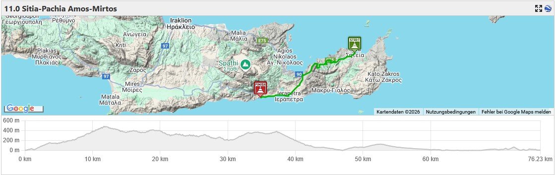
Shipwrecked
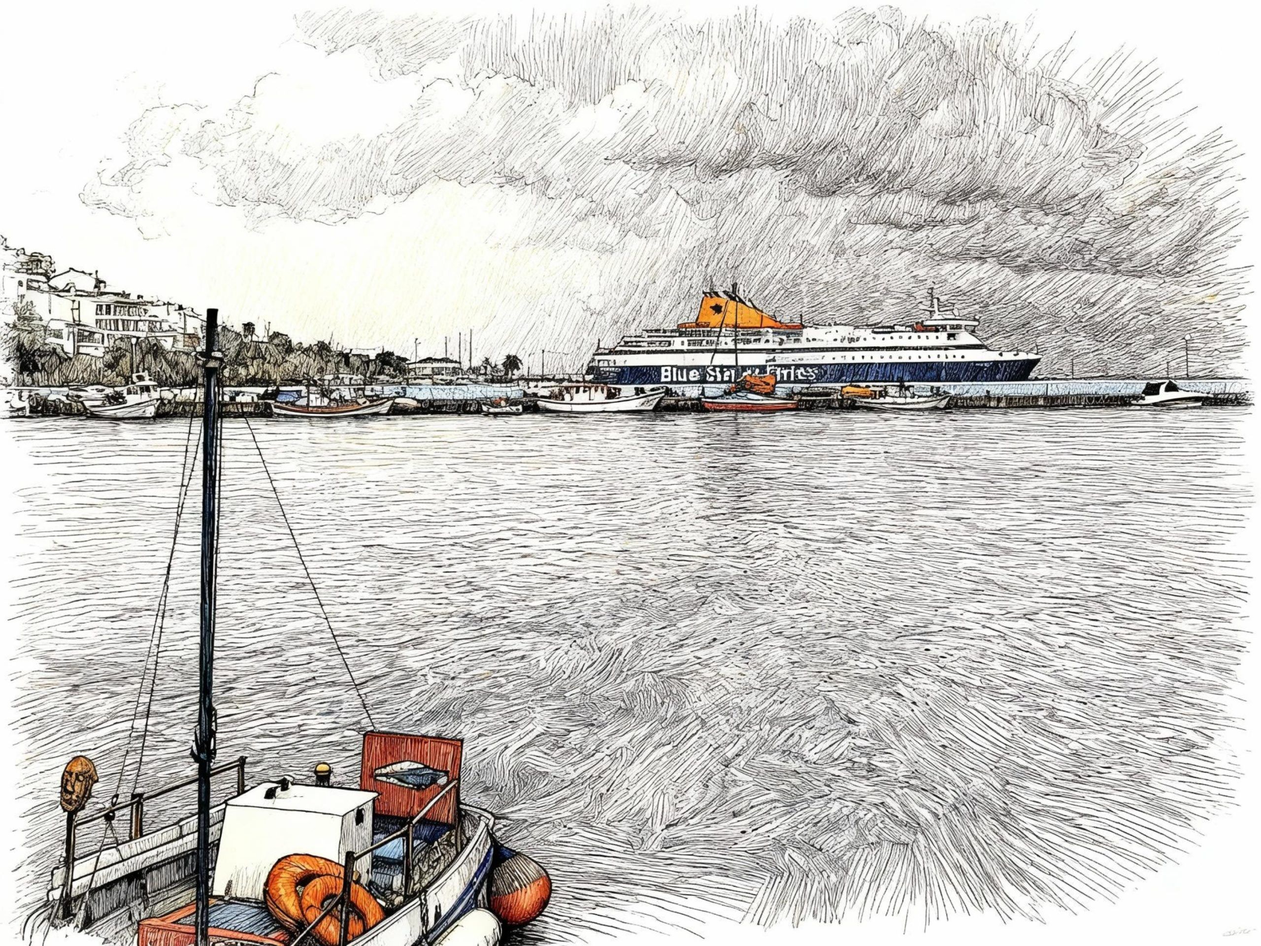
The ship’s Cabin: The moment the door to the front cabin opened and my eyes took in the interior, I knew I had traveled in this cabin before. The window with its narrow sill, the integrated lights, and speaker, the curtains, the two fixed beds, the small table with the telephone. The phone was new, but everything else was identical to the cabin from a trip I’d taken years ago from Lübeck to Trelleborg in Sweden, down to the last detail.
Acrylonitrile butadiene styrene is a fine thing. You wouldn’t believe how many everyday items, from coffee makers to car bumpers, are made of ABS plastic. While my children were playing in the cabin on our trip to Sweden, a small Lego brick flew towards the window and disappeared with a clatter into the gap between the window and the sill.
Now my first thought was to find that piece of Lego in the crack by the window as proof of the ship’s identity – but it wasn’t there. It was perfectly clear that the workers tasked with converting the ship had spared no effort in adding this unexpected find to their Lego collection. Lego is very popular in Greece. The star attraction of the new Acropolis Museum in Athens is a large Lego model of the Acropolis hill, built from more than 120,000 pieces. It now attracts just as many visitors as the Acropolis itself.
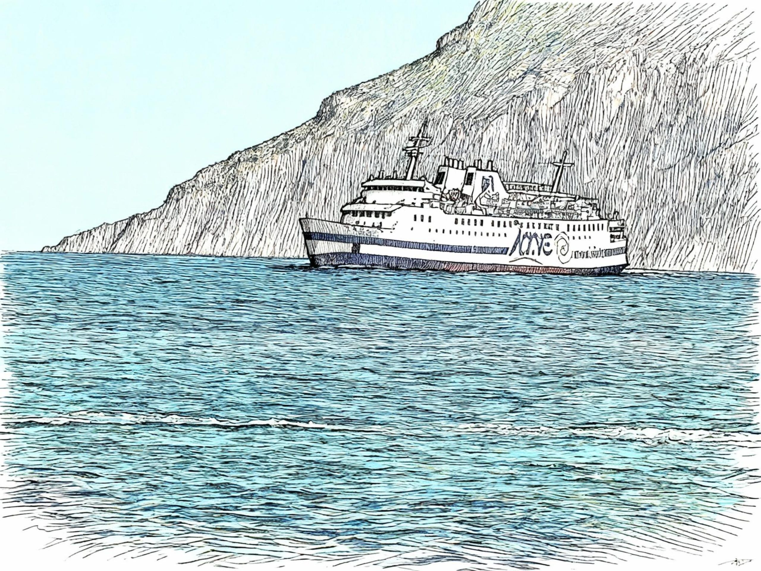
Towed For Scrapping: A restless night, stormy, a rumbling and crashing, then a long, metallic screech. In an instant, I’m on my feet. Across the floor, which now slopes away from the bed, I stagger to the cabin door. But it doesn’t budge an inch. Trapped on a sinking ship, this was my terrible thought. On the sloping ground, I shimmy to the window. In the pale morning light, a strange world unfolds. The bow is destroyed, all the smaller superstructures and the windlass are gone, the railing hangs in shreds as if withered, and a wisp of gray smoke drifts across the ship from somewhere within the hull.
With a weary roll, the bow swung over the horizon, the ship’s hull tilting sharply to the side, as it dived into the rough sea, propelled by an unknown force against the wind and the white foam, accompanied only by the screeching of the sea’s ravens. Then I saw the mooring line that connected the ship, through the haze, to a white dot and red hull at the edge of my vision.
The wrecked ship was obviously on its way to a scrapyard in India or Turkey to be gutted and dismantled, with me trapped on board. In horror and with shaky knees, on the verge of a deep faint, I crawled into my bunk, unable to think clearly or make a plan due to my despair.
Help, help! Awakening from unconsciousness, I heard voices, indeed, a flurry of activity. Jumping up and banging on the door was one swift movement. I shouted, „Help, help! There’s a shipwrecked person here!“ and yanked at the door with all my might, and it burst open. In the corridor stood people, clearly ready to disembark, and judging by their belongings, prepared for a beach holiday. A certain astonishment lingered in their faces.
The Tour
From Sitia to Chamezi | 12 km | 590m ↑ / 110m ↓ | Category 3
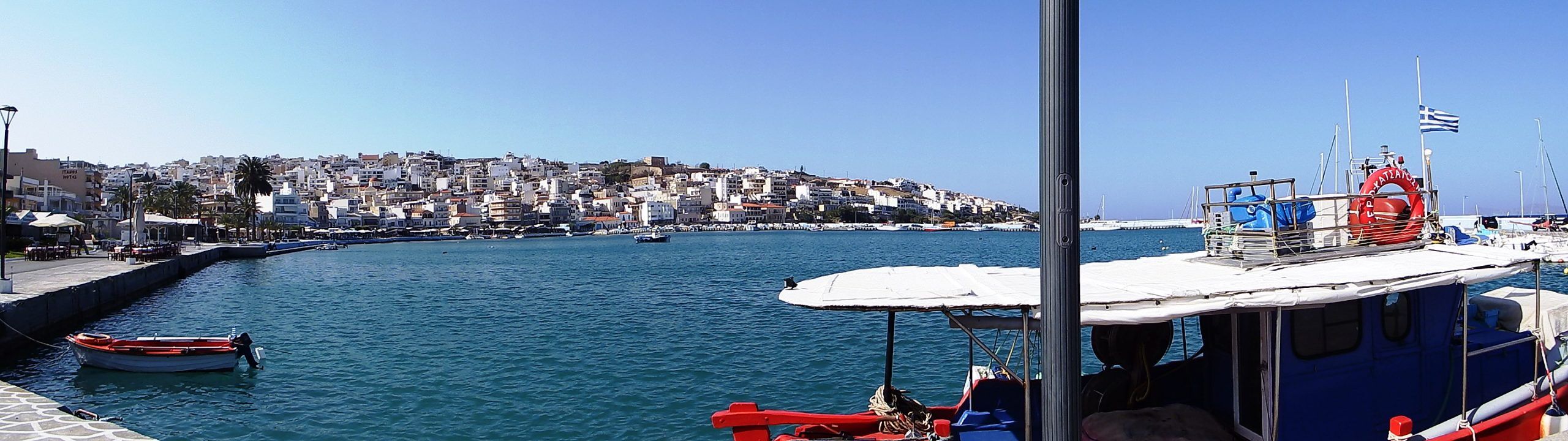
Sitia isn’t a large city, so the options for leaving are quite varied. The first is the liveliest, loudest, and most eventful. Along the waterfront, then a sharp right through the city’s narrow streets to the roundabout. Fruit vendors are unloading their wares into street stalls, and before you know it, accidently, you’re queuing at the fishmonger’s. Past cafes, the mini-market, the pharmacy, the real estate agent you drive finally to the gas station.
Here, you’re immersed in the spectacle of bustling activity and the modernist rituals of motorized transport. As a cyclist, you now have to step onto the stage as an actor to express your enthusiasm or displeasure with your fellow human beings‘ driving skills, often loudly, through body language and gestures.
The route continues uphill, past the police station, to the Sitia National Stadium. Two long, sweeping S-curves carry you out of the city, and after 3 kilometers from start, you reach a plateau at an altitude of 110 meters and the city limits.
At this point, the access road for Variant Two also joins the main road coming from the ferry port. From Sitia, this low-traffic road leads west, in a wide arc past Sitia Airport, towards Agios Nikolaos, Irapetra, and Heraklion.
Three geological strata from two different eras, the Paleozoic and Mesozoic, lie close together here. The Plattenkalk, with limestone, marble, dolomite, and schist, forms the lowest layer, geologically extending from the Middle Jurassic to the Upper Eocene. The Phyllite-Quartzite Unit (Upper Permian to Carnian of the Upper Triassic) contains schist, marble, and quartzite. Finally, the Alpine limestones of the Tripolitsa Beds extend from the Upper Triassic to the Upper Cretaceous. All of this is embedded within the Miocene rocks of the Kastri Formation, which include conglomerates, sandstone, and clay.
Consequently, several small cement plants are located directly within the extraction area for limestone, clay, and quartz sand. With a gradient of just 2%, this magnificent 5.5 kilometer long cycling route leads westwards, unfortunately often against the prevailing northwesterly winds.
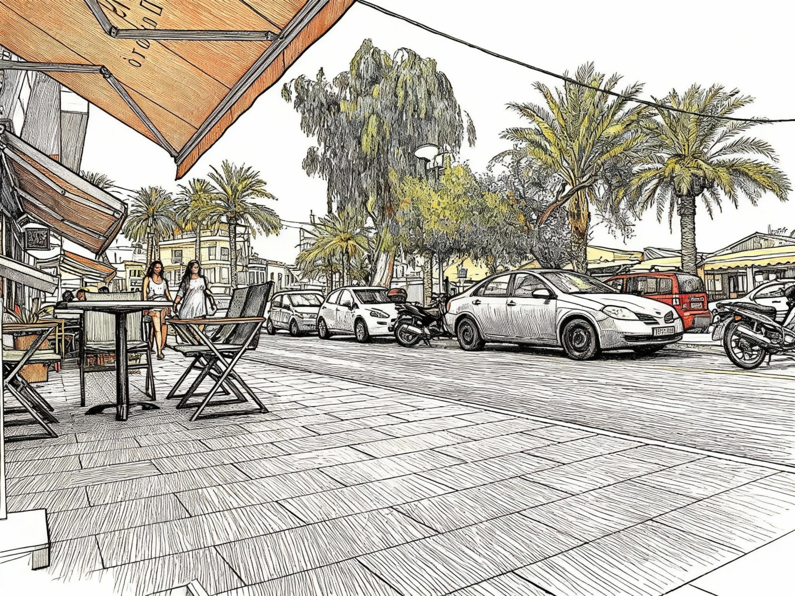
Option three is the shortest. It leads from the hotel lobby onto the street, then to the right and exactly 20 steps to Caffe Mitsakakis. It’s still cool, and there are few passersby on the harbor promenade. The inhabitants of Sitia are dressed for winter in long coats and thick, padded jackets. After the morning sun, dark clouds are now gathering over the mountains in the southeast, and a thunderstorm raged over Katsidoni. The bright white of the houses climbing the hillside, the red roofs, even the purple of the bougainvillea are shrouded in gray shadows. The palm trees bend in the freshening wind, and the sea darkens. It’s high time to order a second coffee and then leave before the storm hits.
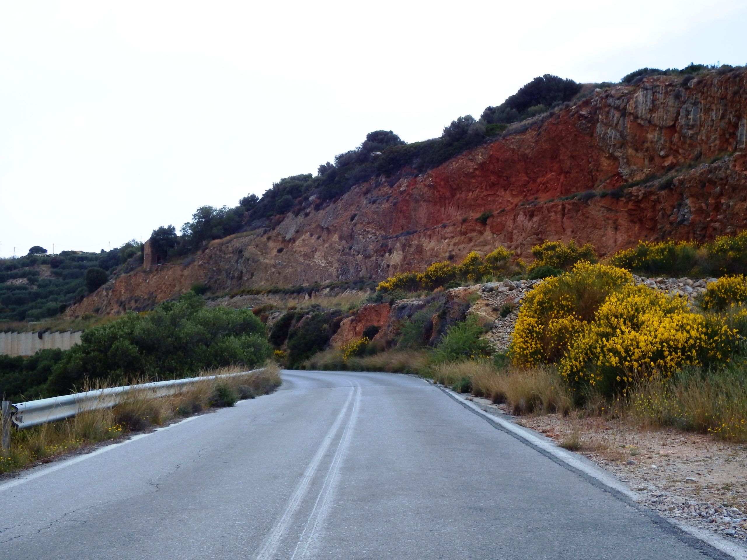
This tour leads from Sitia, parallel to the north coast, to the village of Pachia Amos, and from there to Irapetra and Mirtos on the south coast. The blue ribbon of the road winds along in gentle curves, seemingly at a leisurely pace, between olive groves, past a small chapel with a water tap in the courtyard, through valleys of oak and chestnut trees, past yellow broom, over rushing streams spanned by artfully constructed bridges, and, from time to time, the view opens up to the sea. Then you climb to the next village. The road narrows between the white houses, curves around gray walls, plane trees reach in with branchy fingers, past the kafenion, the white walls close in, and you think you’ve reached a dead end, until a sharp bend takes you out of the labyrinth.
But this tour is a beast. The first nine kilometers climb 480 meters in altitude with an average gradient of 4.1%, a constant uphill climb to the summit just beyond Chamezi. From the city limits of Sitia, follow the E75 highway for approximately two kilometers and then turn onto the „Old Road“ towards Skopi and Chamezi. The route runs parallel to the river valley until you reach the next village.
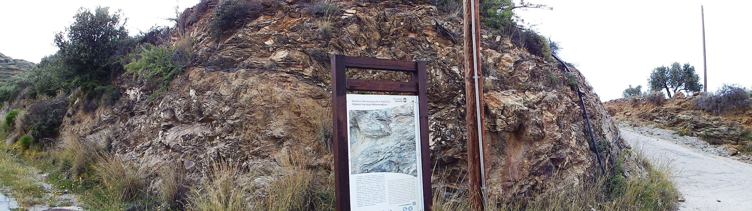
Shortly before Chamezi, an outcrop of Variscan metamorphic rocks can be found by the road, containing gneiss, mica schist, amphibolite and metaclastics, a tectonic component of the phyllite-quartzite nappe, the oldest rock found on Crete and dating to the Upper Carboniferous (300 million years). The road continues uphill between two hills. Passing phyllite schist, olive trees, pines, and cypresses. The Church of Afentis Christos greets you from the hilltop at Chamezi.
The Oval House Of Chamezi (MM I)
Imagine a good friend is moving house and you’re one of the chosen ones to help. After making your way to the fourth floor of his home, an old back problem forces him to the bed, leaving you to carry box after box down alone for the next two hours. All the other helpers arrive later.
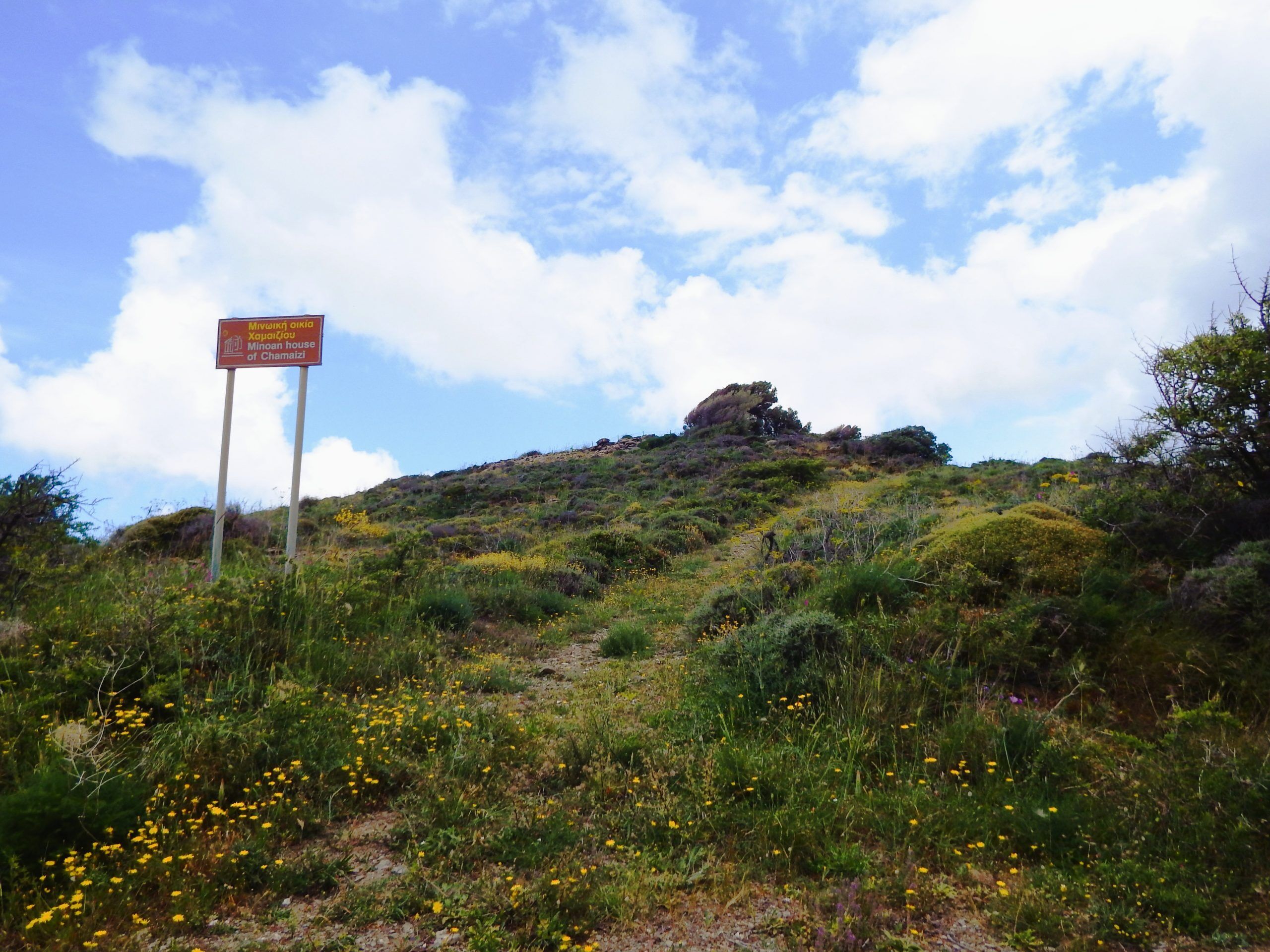
Imagine a good friend is building a house, but it’s more of a communal fortress. As a Middle Minoan engineer, you calculate the volume as follows: (Sum of wall length * wall width * wall height from 2m to the roof, plus a one-meter parapet above the accessible roof, because it’s a fort) equals a wall volume, minus the mortar joints, of 112m³. This corresponds to approximately 291 tons of building material plus mortar. In this case, the readily available natural stone is calcareous phyllite schist, located directly west and northwest of the planned building site. A mountain peak, 500m high, which clearly dominates the surrounding area. Strategically, a good choice. But now, let’s get to work. Mortar, water, wood, and clay soil are still needed.
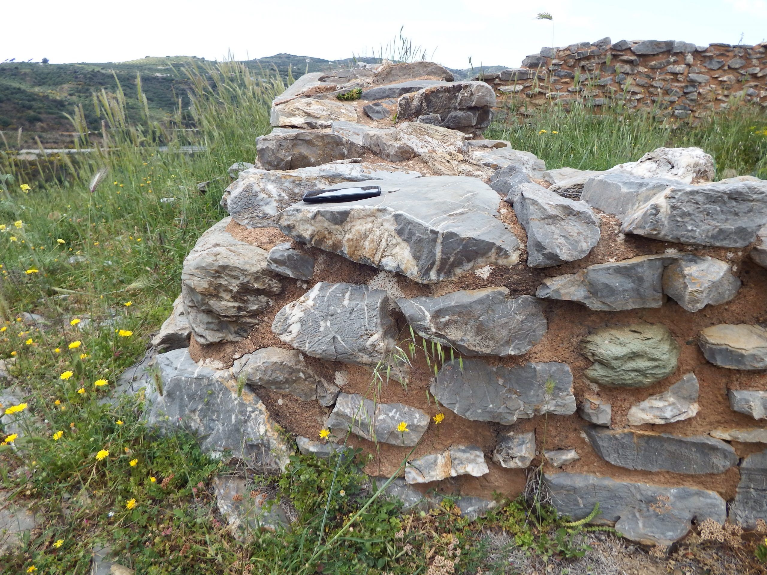
The natural stones are hewn in such a way that you only have to carry about 20 kg each way, from the quarry to the center of the house on the mountaintop. There was certainly a temporary construction gate in the northwest, through which the material was transported from the quarry to the fortress. Here you can clearly see the preparation for the cross-shaped bond of stones in order to later close this opening in the fortress. Allow 10 minutes for the round trip. It’s strange, there are many masons on the construction site, pressing the delivered stones into the prepared mortar, covering them with more mortar, and building the walls. But as the carrier, you’re alone.
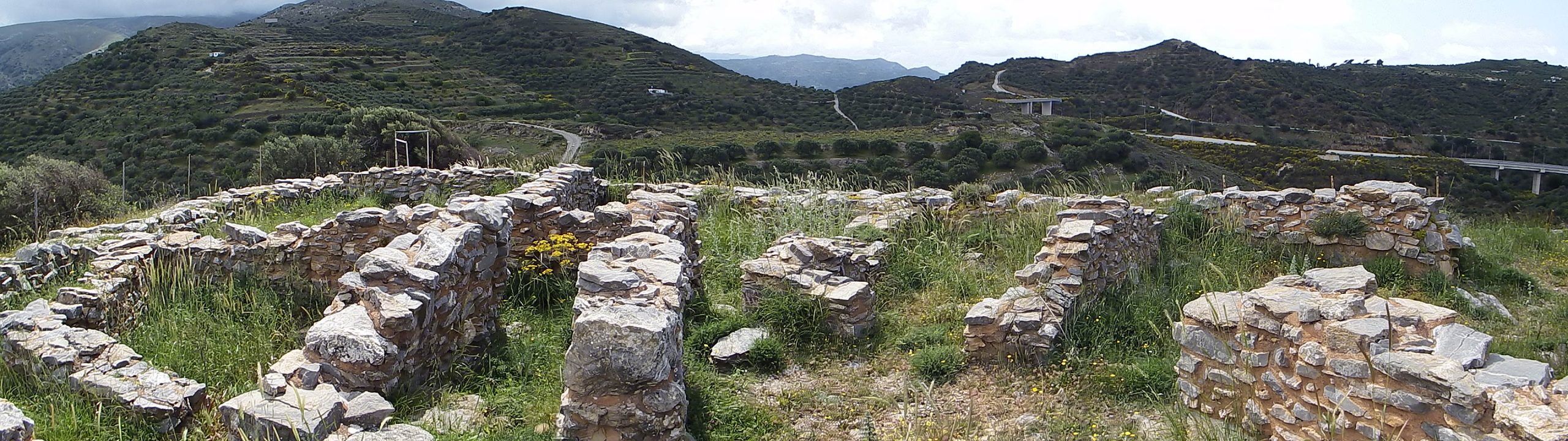
With approximately 290 tons of rock, transport would take about one and a half years until completion. By then, this fortress might be superfluous. Because speed is essential. The builder apparently had to decide on the construction of this fort on the mountaintop at short notice due to a current threat. There isn’t even water, so a cistern must be planned and built first.
In the event of a threat from otherwise friendly humans, time is precious. For the naked ape, there are a number of reasons for this: the struggle for good farmland, envy, aggression, the lust for fame, adventure, and quick plunder through the supposedly safe conquest of foreign territory, with the enslavement or extermination of the former owners. Chimpanzees have a similar predilection for such activities when it comes to destroying a neighboring group.
This construction project requires precise planning and organization regarding personnel deployment, the sequence of individual tasks in the construction process, and the construction techniques used. Transport routes, scaffolding, material usage, and details such as mortar curing time must be taken into account.
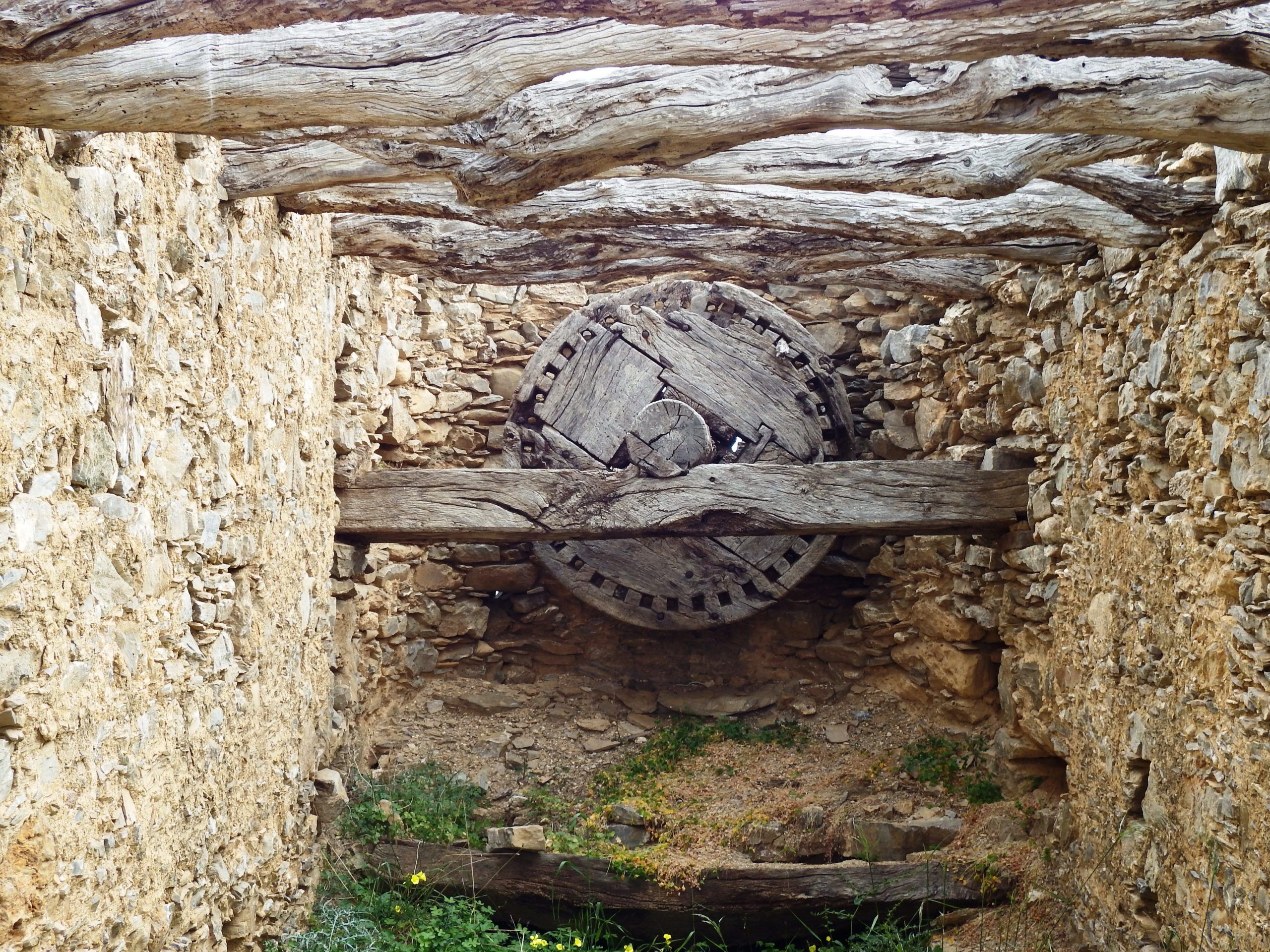
For the walkable terrace roof, using traditional construction methods with tráves, messodókia (supporting beams), skísses (filling logs), phoundómata (dry brushwood), piloródoma (layer of soil) and possibly slate slabs, approximately 18m³ of wood, 15m³ of clayey soil and 4m³ of thin-slab slate are required. A roof construction method that can also be seen at the old mills to the right of the access road to the oval house, even though the earth layer is now made of concrete.
When time and fear are truly pressing, and money and motivation are no object, construction proceeds during daylight hours, seven days a week. No single worker can manage this alone, so work is done in day shifts. With 12 porters, six in the quarry, six bricklayers and scaffolders, and four suppliers of water, mortar, and wood, working in shifts, the fortress is ready for defense in approximately four weeks.
See for yourself. The oval house, which was probably more of a fort, is located on the 501- meter- high Souvloto Mouri (Pointed Hill) near Chamezi. Dating from the Early and Middle Minoan (MM I) period.
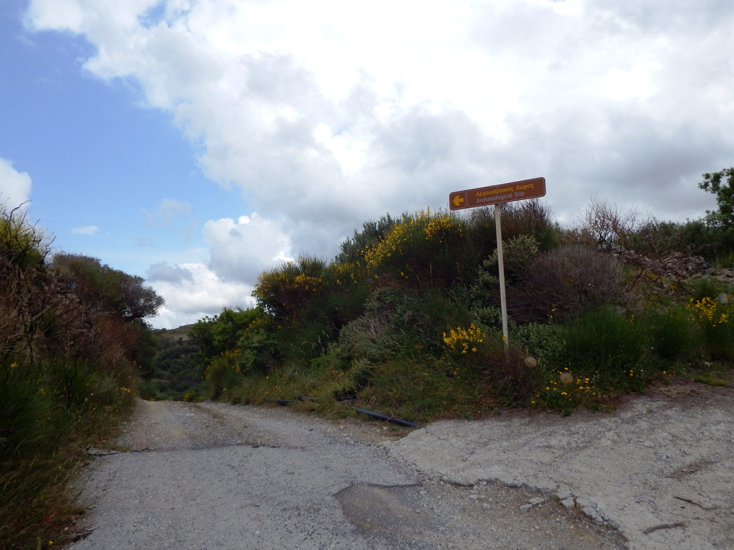
From the outskirts of Chamezi, drive 1.4 km and for 110 meters in altitude uphill on the „Old Road“ in a southwesterly direction, over the highway bridge, to the next junction to the left, signposted: „Minoan House of Chamaizi“. Turn left here and continue uphill to the next junction with the two old windmills on the right. Go straight ahead over the crest (not towards the windmills), downhill for 40m on gravel, then a sharp right, and finally another 700m on asphalt to the foot of the hill with the Oval House.
Heading back west towards Pachia Amos, you will first need to drive back along the „Old Road“ in direction of Chamezi for a short distance. At the intersection to the Oval House, turn right and continue for approximately 430 meters towards Chamezi until you reach the entrance to the E75 highway. After about 1 kilometer, the new road (E75) merges back into the „Old Road“. Otherwise, you will have to drive against the flow of traffic on the one-way street to reach the highway.
From Chamezi to Mochlos And Altsi | 25 km | 790m ↑ / 840m ↓ | Category 3
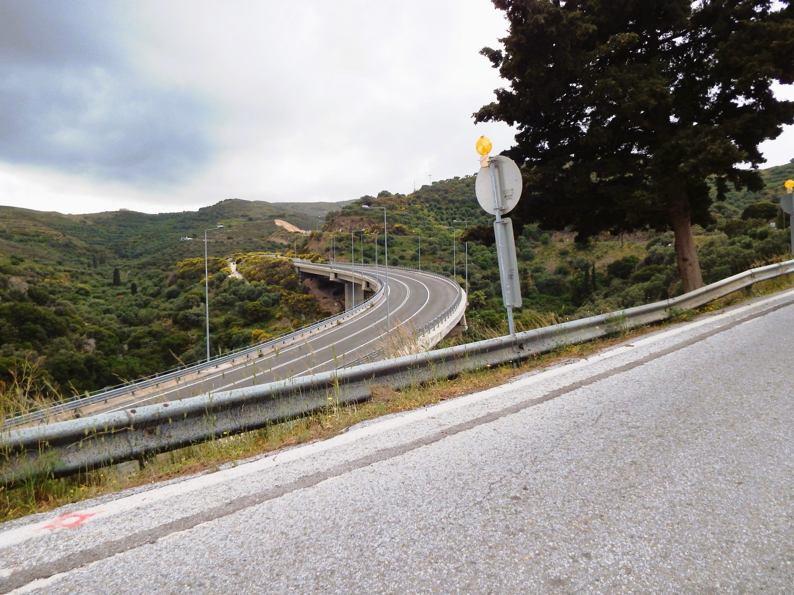
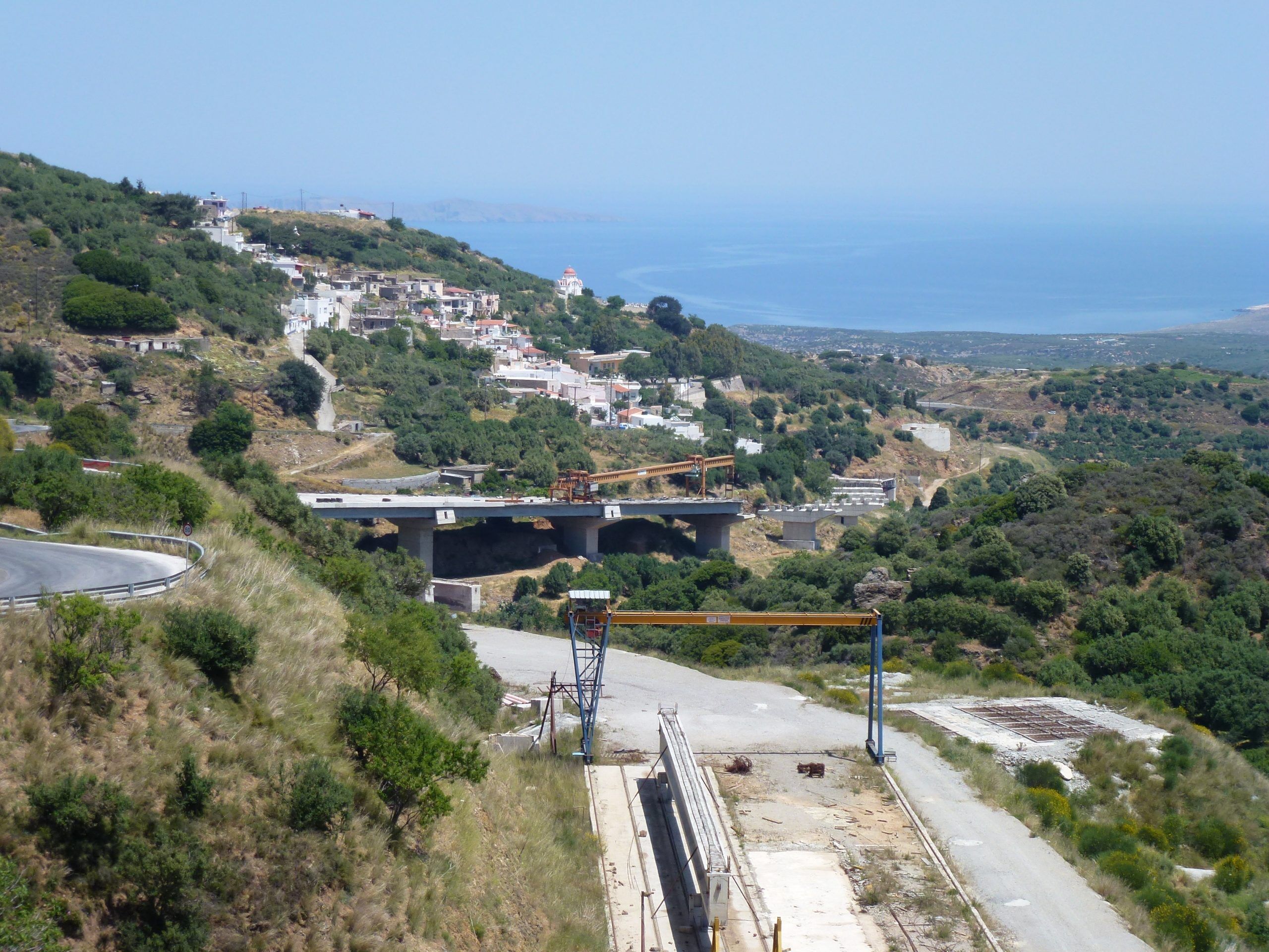
Tour Summit: After passing through Chamezi, the summit of the tour is reached at approximately 480m altitude. From the outskirts of the village, it is 900 m in a southwesterly direction to the E75 motorway, which becomes the Old Road after just one kilometer. The original Old Road leads here in a southwesterly direction, in an S-curve over the new motorway, passes the archaeological site of the Oval House and ends shortly afterwards as a non-drivable one-way street in front of the motorway (Chamezi exit from the west).
The route, a rollercoaster ride of 18km and 700m descent, passes through the villages of Exo Mouliana, Meso Mouliana, Mirsini, Tourloti and Sfaka, descent to the lowest point so far at 220m altitude, above the coastal village of Mochlos. After another 5.5km and a 200m climb, the turnoff to Altsi is reached.
AI at work: This tour was classified as easy by the mathematical algorithm, taking into account tour length, gradient, elevation gain, and road conditions. However, a few unforeseen factors are not considered: the author’s mental and physical condition, the influence of the weather, and especially the wind, which is usually a headwind.
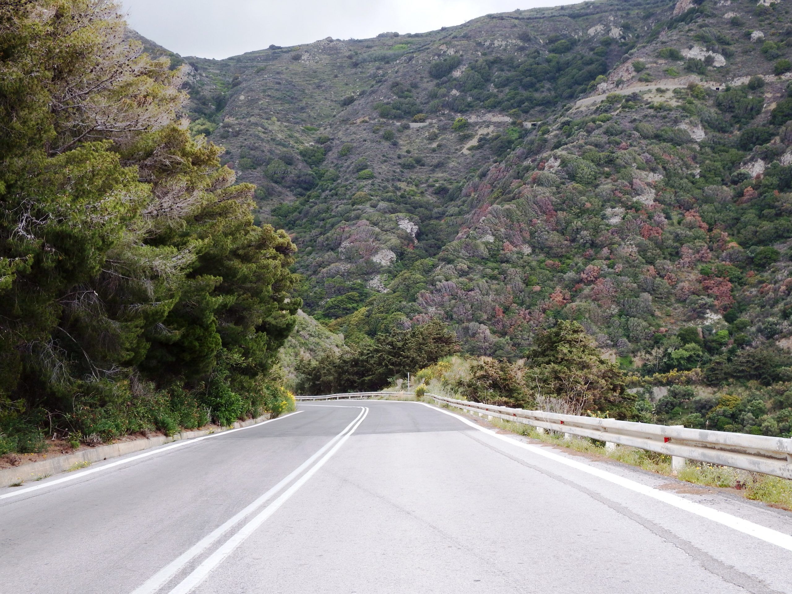
The distribution of the elevation gain is also not taken into account, whether it’s a continuous climb on a well-built road with a consistent gradient, or a series of constant ascents and descents in hilly, winding terrain, or even an industrial road that runs straight for kilometers with a 15% gradient to the mountain ridge and was built only for high-powered trucks. The presence of wild dogs, crocodiles, dragons, or the quarry’s security Service is also not considered.
I’ve done this route three times and each time I’ve reached the destination as a dehumanized corpse, as an alien. The circumstances are easy to describe.
The road is a blue ribbon that comes alive the moment a racing bike tire touches rock and asphalt. It twists, it breathes, it waits for the moment of mental inertia and exhaustion to destroy the rider. A pothole in the shadow of a world of melted licorice bathed in blazing sunlight, a bump in the road on a fast descent just as your nose starts to itch unbearably, a bend covered in gravel and slippery as ice.
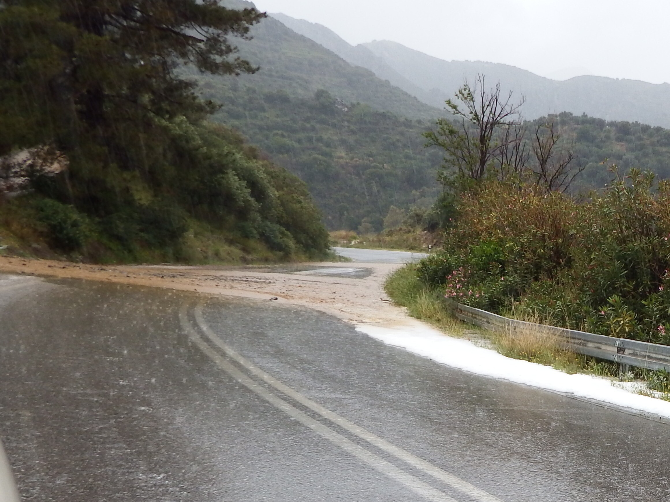
Yet this wild, stirring monster is most charmingly framed by the „landscape.“ Much has been written about this Greek landscape, and all of it is legendary and true. Pines, cypresses, oaks, chestnuts, olive trees, plane trees, shrubs, flowers, grasses, red roofs, white walls, blue shutters, bougainvillea, violets, and church steeples. All of this sways in the wind, casts shadows, and speaks: „Mine is the trembling, the gleaming, the dazzling of the light.“
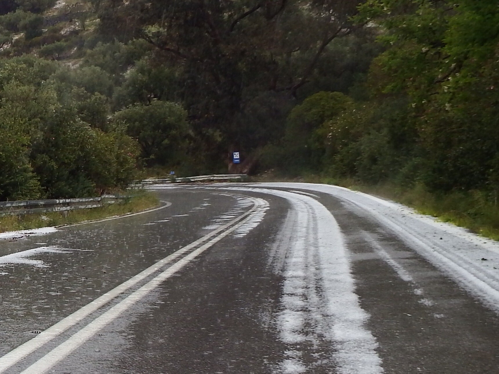
So you, the wanderer, are cradled and caressed until, quite unexpectedly, amidst all these passing colors and songs, the end of the world approaches. The sky darkens. The wind drives the clouds, so that the sun, like a glaring finger, skims across the road. Thunder and rumble announce the storm. The mountains are shrouded in mist, the sky is pitch black. Shadowy figures haunt among the trees; trolls, and witches whisper. Tumult. It is an evil spell that hurls lightning and makes hailstones pelt down. Mud fans flood the road, hailstones lie like freshly fallen golf balls, and the descent becomes impossible.
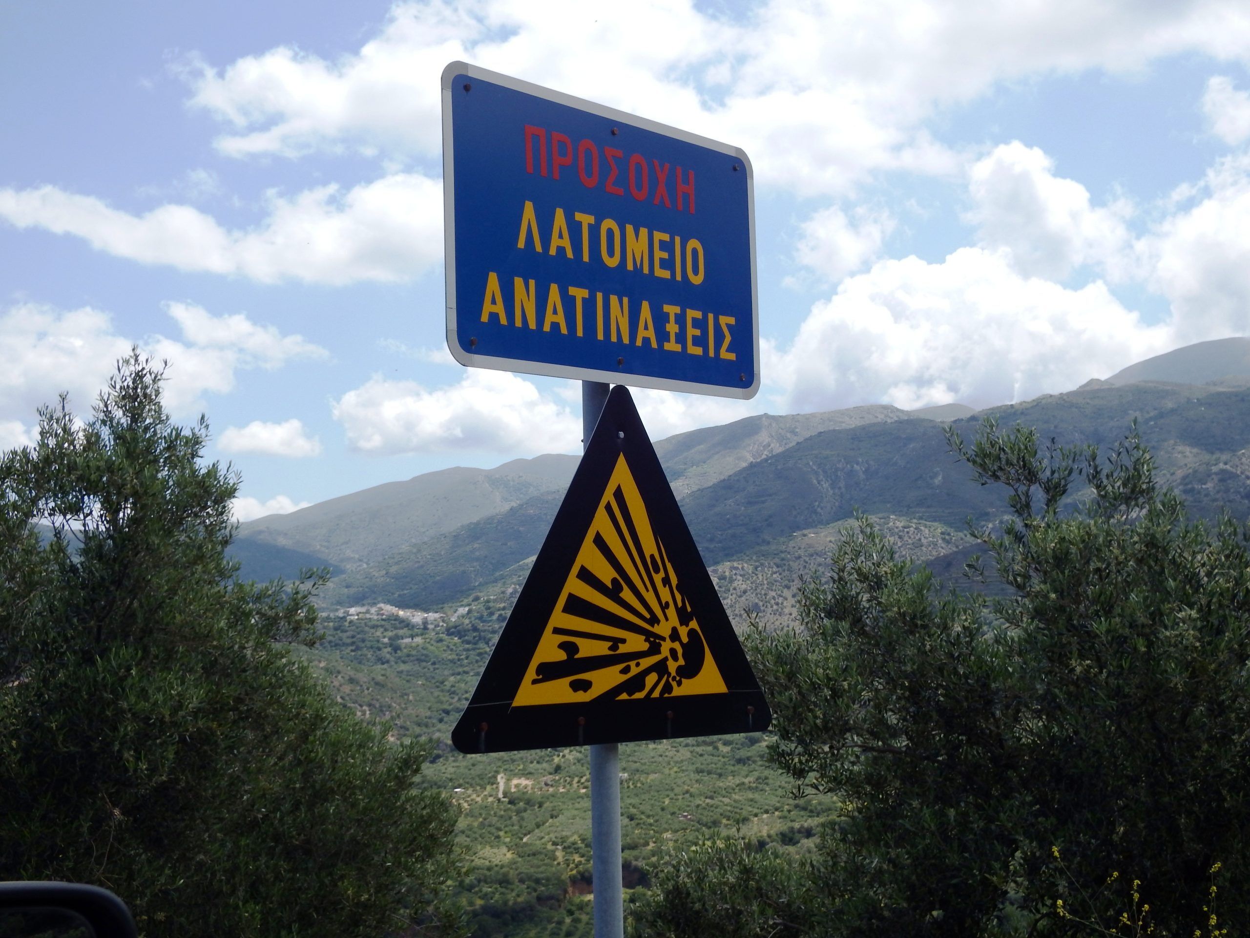
Gypsum mining at Altsi. This is the site of a significant open-pit gypsum (calcium sulfate dehydrate – CaSO4*2H2O) mine. After processing by crushing and fractionating, the gypsum can be loaded directly onto ships via two loading bridges in Altsi Bay, with a loading capacity of 700 tons per hour. The operator is LAVA Mining & Quarrying S.A., part of the Heracles Group Athens, a member of the Swiss Holcim AG (now LafargeHolcim Ltd.), one of the world’s largest building materials producers. https://www.lava.gr/en/products/gypsum/
Gypsum is one of the most important mineral building materials and aggregates. From dental models to aggregates for Portland cement, there is a huge market for it. Without gypsum, the production of ready-mix concrete, and thus all modern building construction, would be impossible due to the otherwise insufficient curing time.
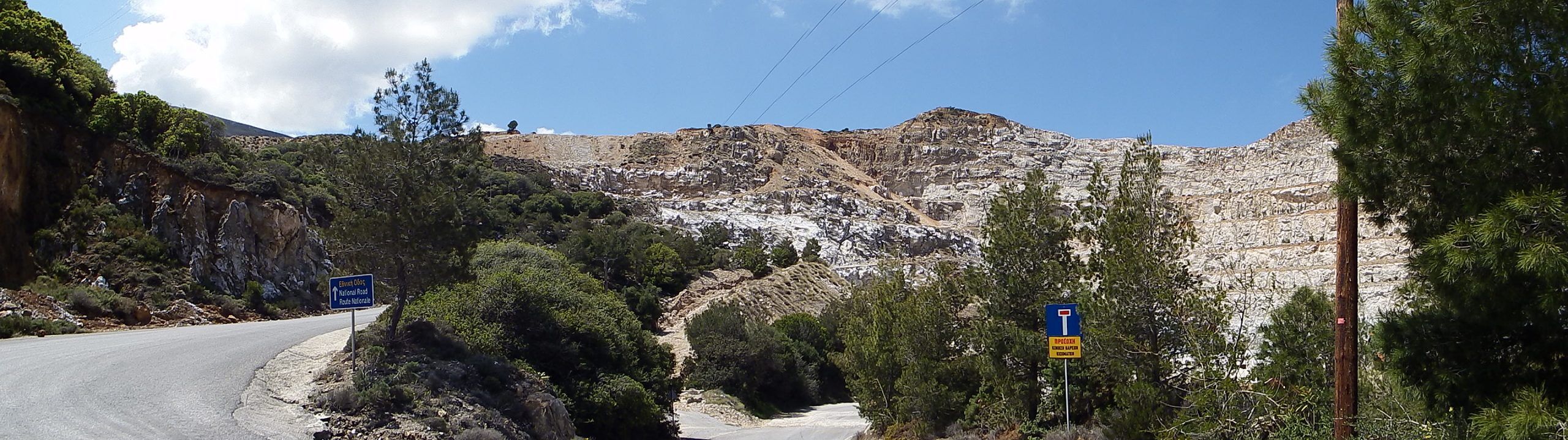
These are lagoonal deposits of the Sfaka Formation of eastern Crete, containing gypsum, rauhwacke (a residual of gypsum), and dolomite of the Tripali Unit (Tripali Mountains, eastern Lefka Ori). They date to the Late Triassic (Carnian, Norian). The considerable thickness of the gypsum deposits is due to tectonic activity. The current area of the quarry is approximately 0.8 km².
The stability of the open-pit mine slopes is the most important safety precaution for mining operations. The average slope gradient in Altsi is approximately 45°. A slope inclined at 45° appears very steep to us. A road of this gradient would have a „100% gradient sign“ on it. At the same time, rockfalls, landslides, slope failures, and the dislodgement of large boulders must be reliably prevented.
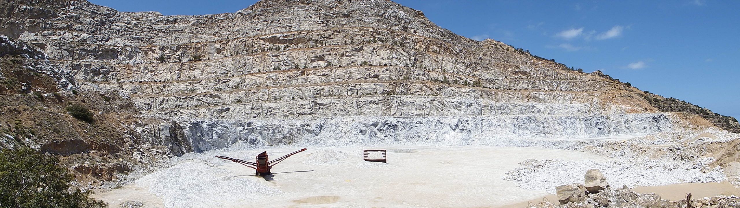
The aim is to design the pit slopes to be both safe and steep. To achieve this, the waste rock and the gypsum in Altsi are extracted in approximately 10-meter-high steps and 5-8-meter-wide benches, so that any eroded debris collects on the bench platforms as a catch area. The walls of the steps are considerably steeper, at 60-70°, than the average slope of the mine wall.
For mining, it is crucial to reach depth as quickly as possible and to plan for the steepest possible slope. Every degree less steep significantly increases extraction costs. Expanding open-pit mines (pushbacks) during ongoing operations presents the same challenges. Surveying and monitoring complement the safety concept.
From Altsi to Irapetra and Mirtos | 40 km | 415m ↑ / 740m ↓ | Category 3
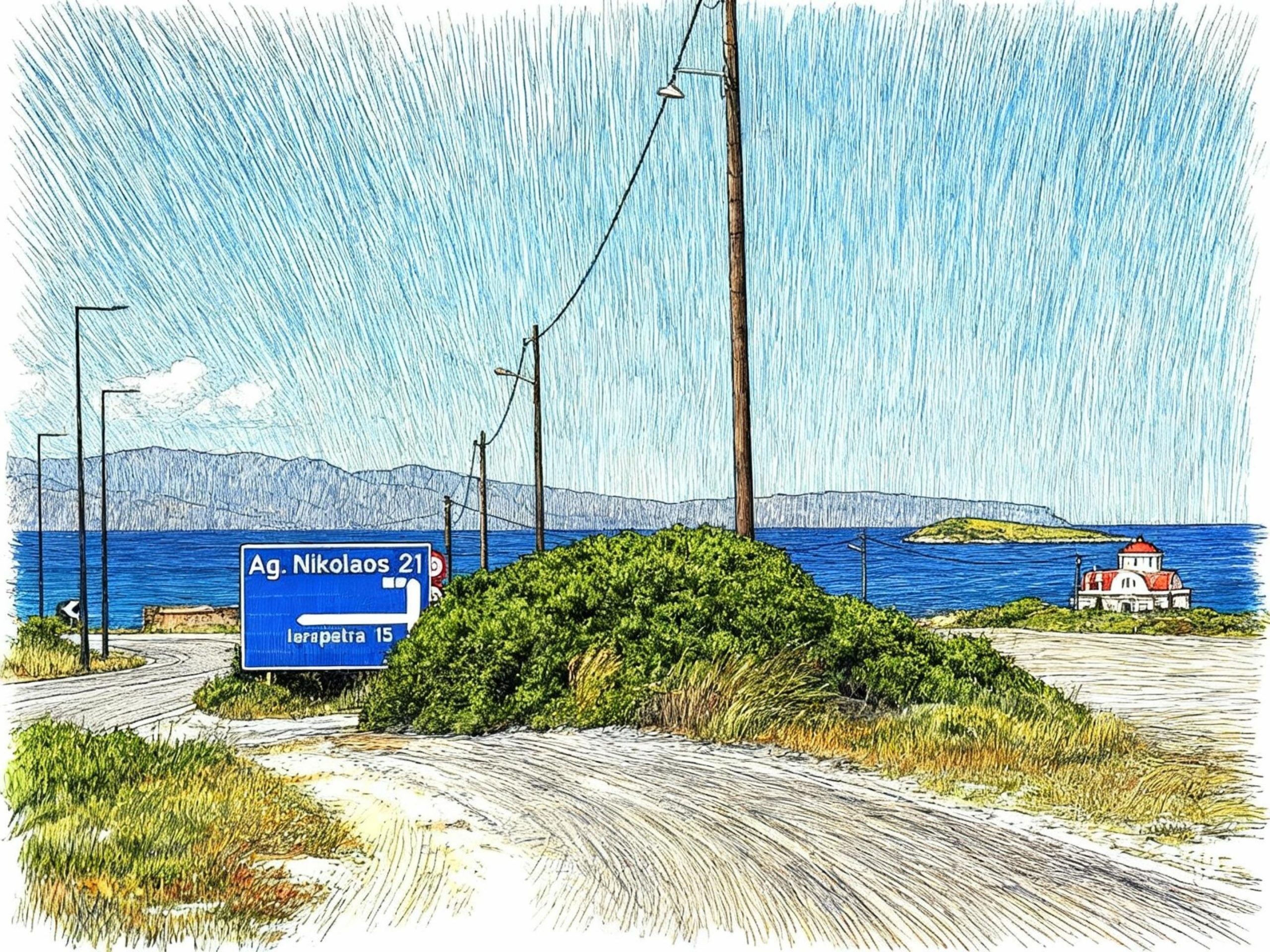
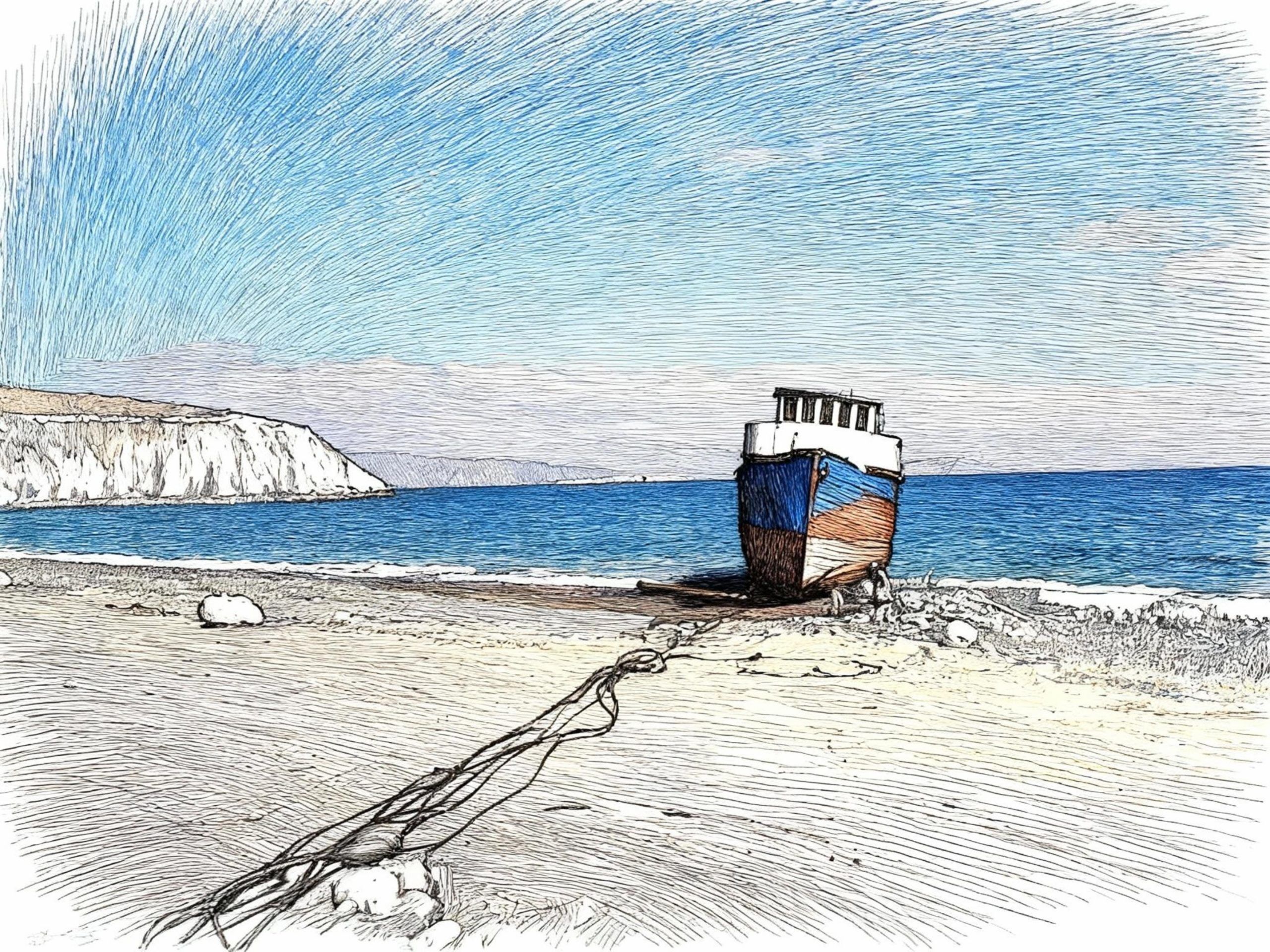
From Altsi there is a short climb of one kilometer and 50 meters in altitude, Then you drive downhill continuously for a distance of 10 km and 400 meters of elevation to the north coast at Pachia Amos.
The narrowest point of the island is now crossed by a 14km long road to Irapetra. Passing through the villages of Gra Lygia, Stomio, Nea Anatoli, Amoudares and Neos Mirtos, you reach Mirtos after another 14km. So Zeus wills.
Have you ever considered taking a Mediterranean cruise? The cruise lines‘ promotional videos show you alone with your loved ones at the bow (Titanic), by the pool (La Dolce Vita), in the restaurant (with Mel Gorham/ Blue In The Face), and on island excursions (The Tempest). All this with 1,000 passengers and just as many crew members. And this is already considered a luxury liner.
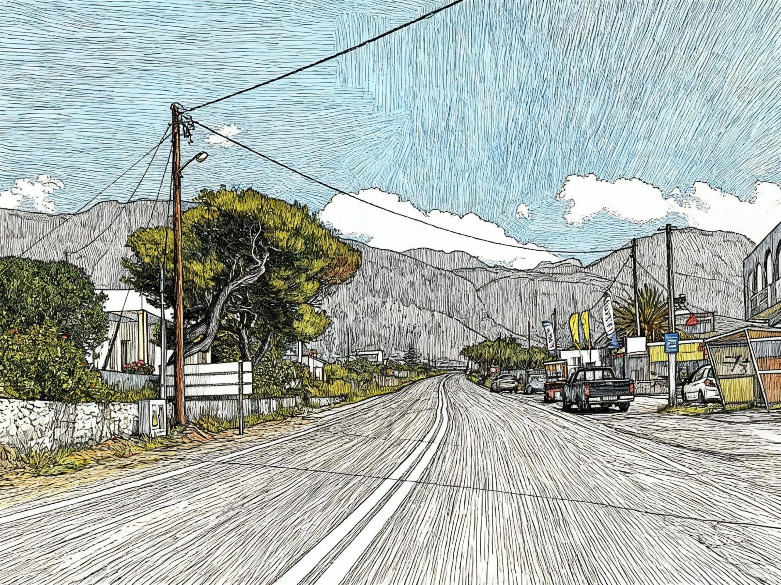
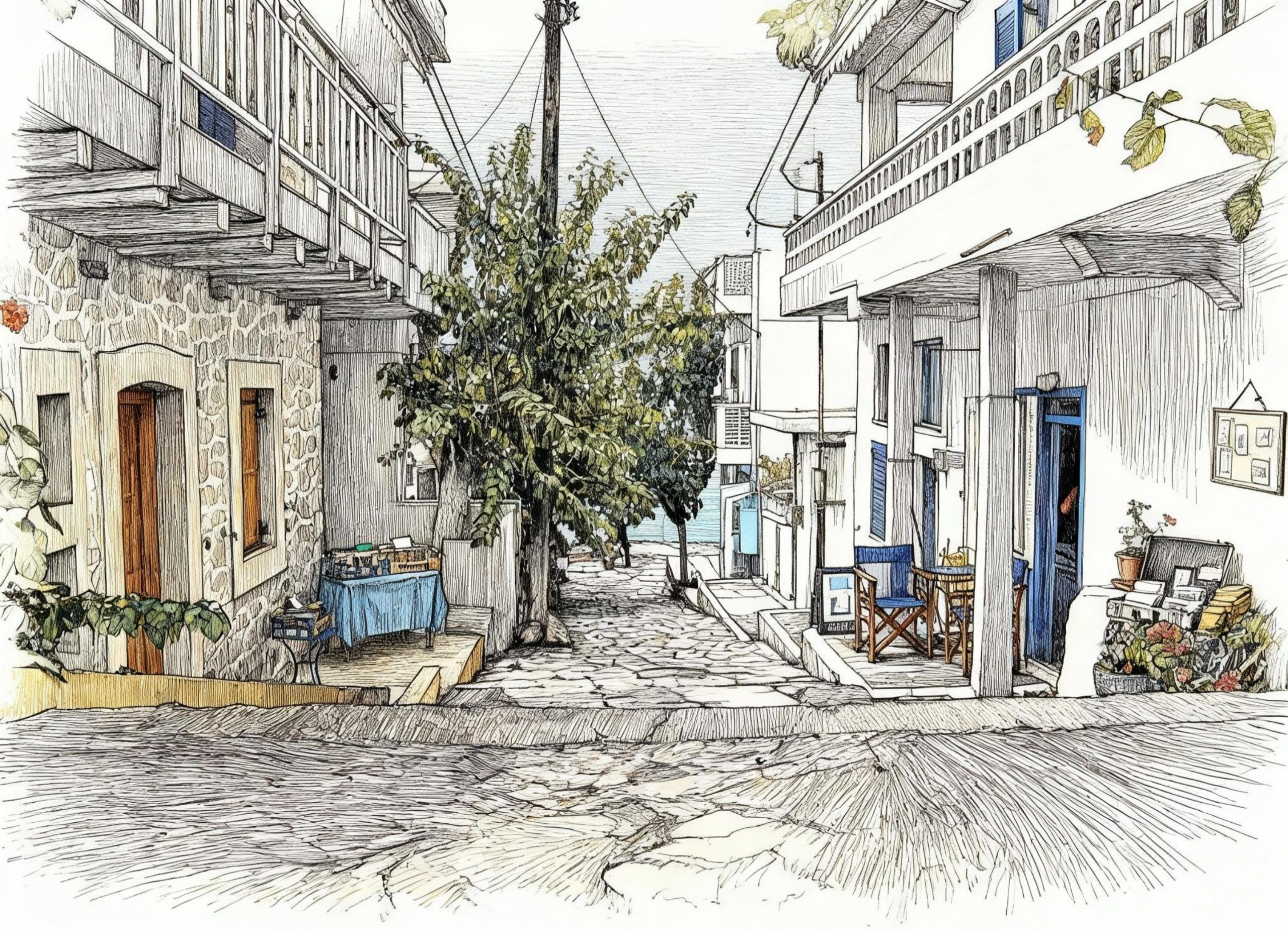
Before you decide on the “All In White Dress” (you are surely a red wine drinker) or the “Smoking” with white shirt, French cuffs, bow tie and patent leather shoes or a “Cocktail Dress” for dinner, think about Mirtos.
You can, for example, stay at Pavlos‘ „Big Blue“ and be your own ocean captain. There’s no need to plan any shore excursions. Open the door of your spacious and tastefully furnished apartment, hop on your bike, in your rental car, or on a bus. Go wherever you want.
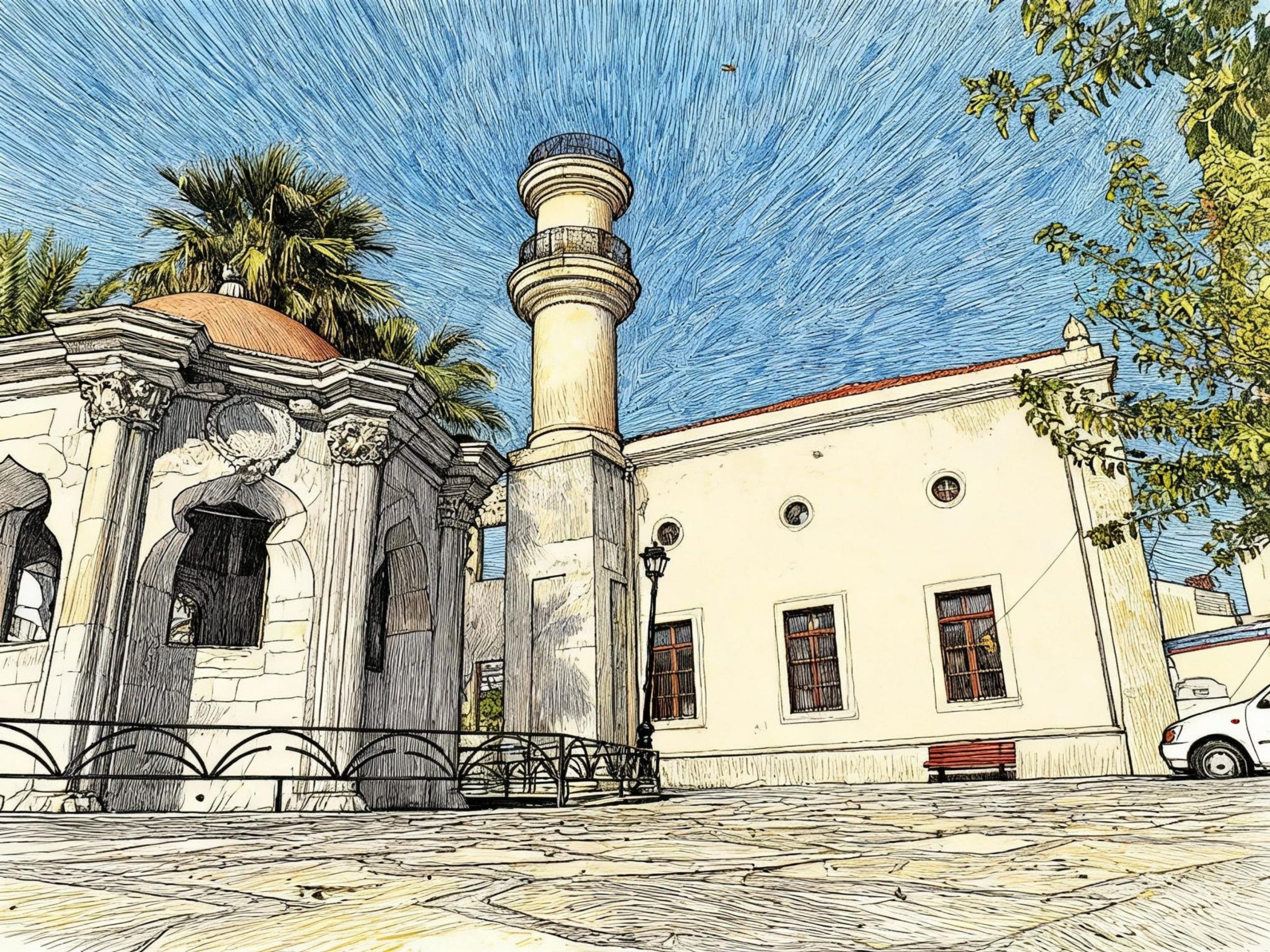
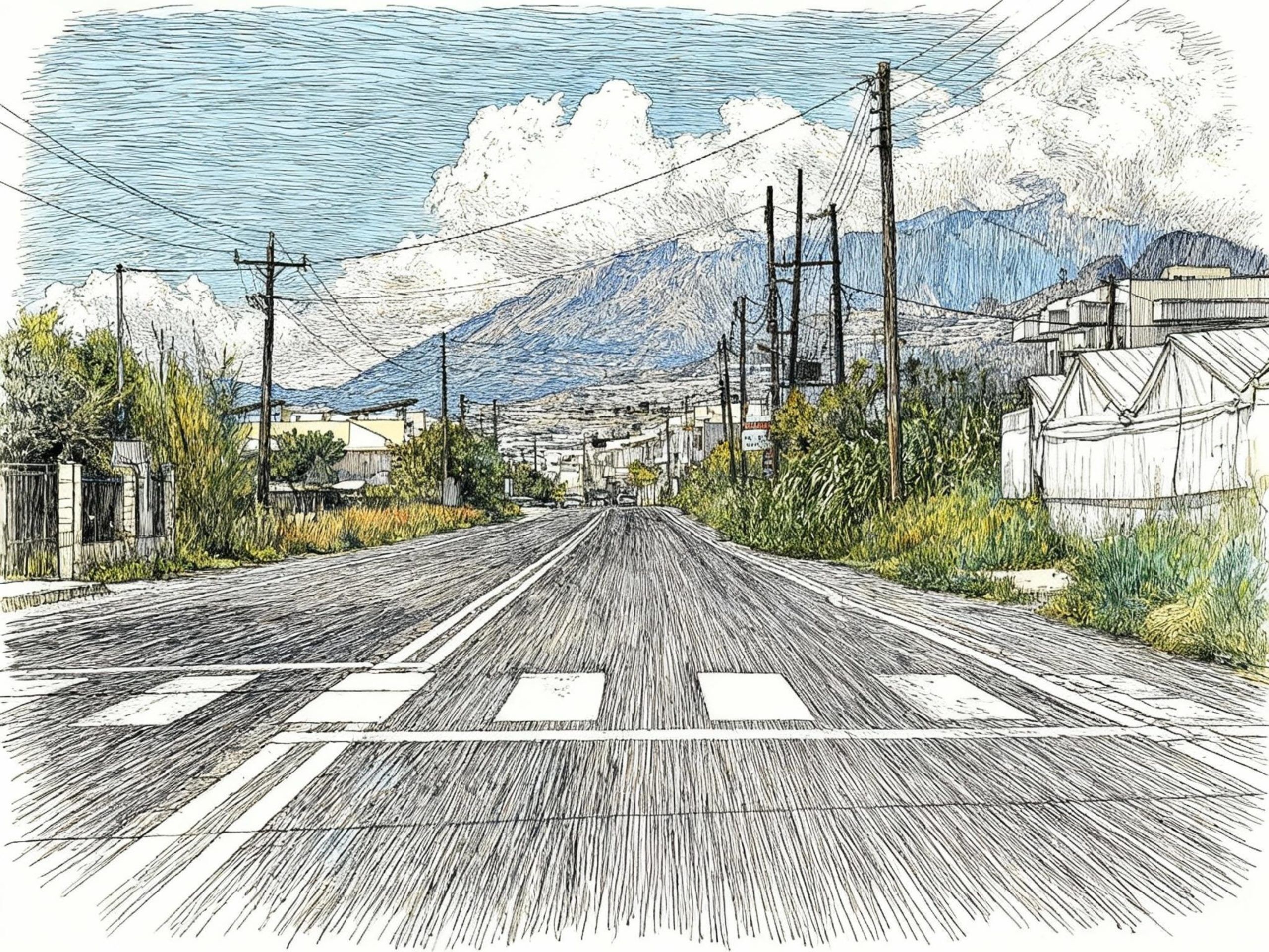
Eastward to Irapetra, westward to the coastal villages of Keratokambos and Tsoutsouros, to the picturesque Ano Vianos, or northward to the Sarakino Gorge, to the Selekano Alp and the beautifully situated mountain villages of Males, Anatoli, Kalamafka, Meseleri, and Makrilla, and all the way up to the Lassithi Plateau. The tables will already be festively set when you return. I recommend a Vidiano Old Vines Single Terroir Melampes (Amygdalos) from Iliana Malihin to accompany your meal. You won’t miss the noise of the rattling anchor chain next to your cabin bed in the early morning.
There may be many interesting lectures on the history of the Greek islands on the cruise ship, about the Minoans (2600-1100 BCE), the Greeks and the Romans, the Byzantines, Crusaders, pirates, as well as the Turks and Venetians of the Middle Ages.
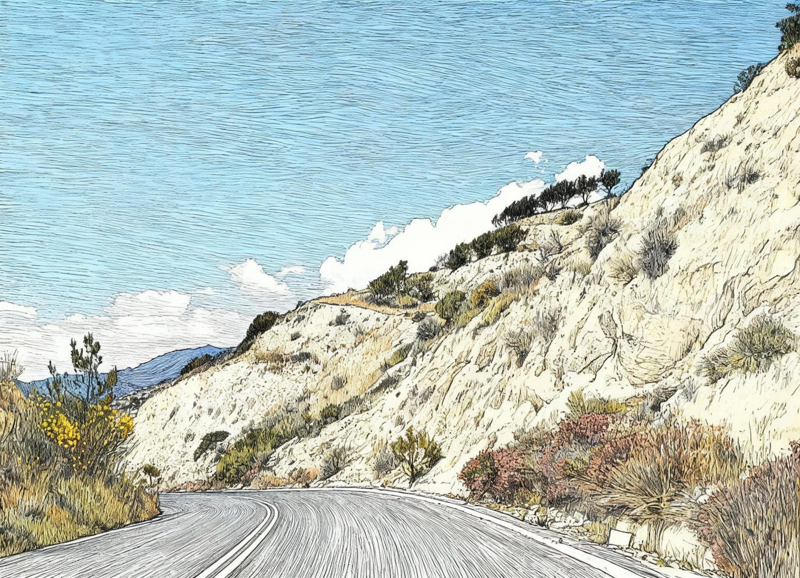
My recommendation, on the other hand, is „An entry into Cretan everyday-day-life“ by Frangiskos. And as an added bonus, every Greek will gladly explain Greekonomics to you. All that matters is hot asphalt, steep climbs, alpine mountains, blazing sun, and a parched palate. The antidotes are: Fresh Cretan spring water, Greek coffee, Cretan country cuisine, wine, Tsikoudia, and the Mediterranean lifestyle at Mirtos.