


8.8 Mirtos- Selakano- Prina- Mirtos | 76km | 2.041 Vertical meter | Category 3
76 km | 2,6km dirt road | 2.041 vertical meters | Category 3

„I have wandered the world, climbed the most treacherous mountains, crossed deserts, sailed the vast ocean, and sweet sleep has rarely softened my face.
I have worn myself out through ceaseless striving. I have filled my muscles with pain and anguish.
I have killed bear, lion, hyena, leopard, tiger, deer, antelope, ibex, I have eaten their meat and have wrapped their rough skins around me. And what in the end I achieved?“ The Epic Of Gilgamesh 2750 BCE – Book X, A new English version by Stephen Mitchell, S176, 2004.
We cycled up to Omalos in stormy weather with rain and snow. There we stopped at the Taverna Gigilos to warm up our freezing limbs. A couple of racing bikes were parked in front of the inn, covered with the kind of rain capes that French postmen usually wear. Inside the inn sat their owners, five ravenous Italian randonneurs who invited us to their table.
When they asked about our tour, I unfolded the map and started my remarks by saying: “From here to …”. But at the very moment my index finger hovered over the city of Chania, the chief randonneur lost his temper, jumped up from his chair and snatched the map away from underneath my hand with a rapid movement, so that my index finger did not land on the map, but in a greasy spot on the wooden table. A dull gargling sound crawled up from his chest, then a scream, sharp as a shepherd’s knife, a cry that made the marrow freeze in our bones: “WE BIKED ALL OF THIS”! And in wide sweeping gestures he moved his hand back and forth across the entire map, making the breadcrumbs fly off the table in all directions.
We had to admit that the 700 kilometers we covered in one week were paltry compared to the 3,000 kms of the Italians. Aside from their little mental quirks, we admired them. In only three weeks they had completely circumnavigated the island on the Old Road, then crossed it several times and conquered all the plateaus. I can still hear them ranting about our bikes, outside in the drifting snow: “Hollow section rims, pha! That’s the youth of today – hollow section rims in the mountains”.

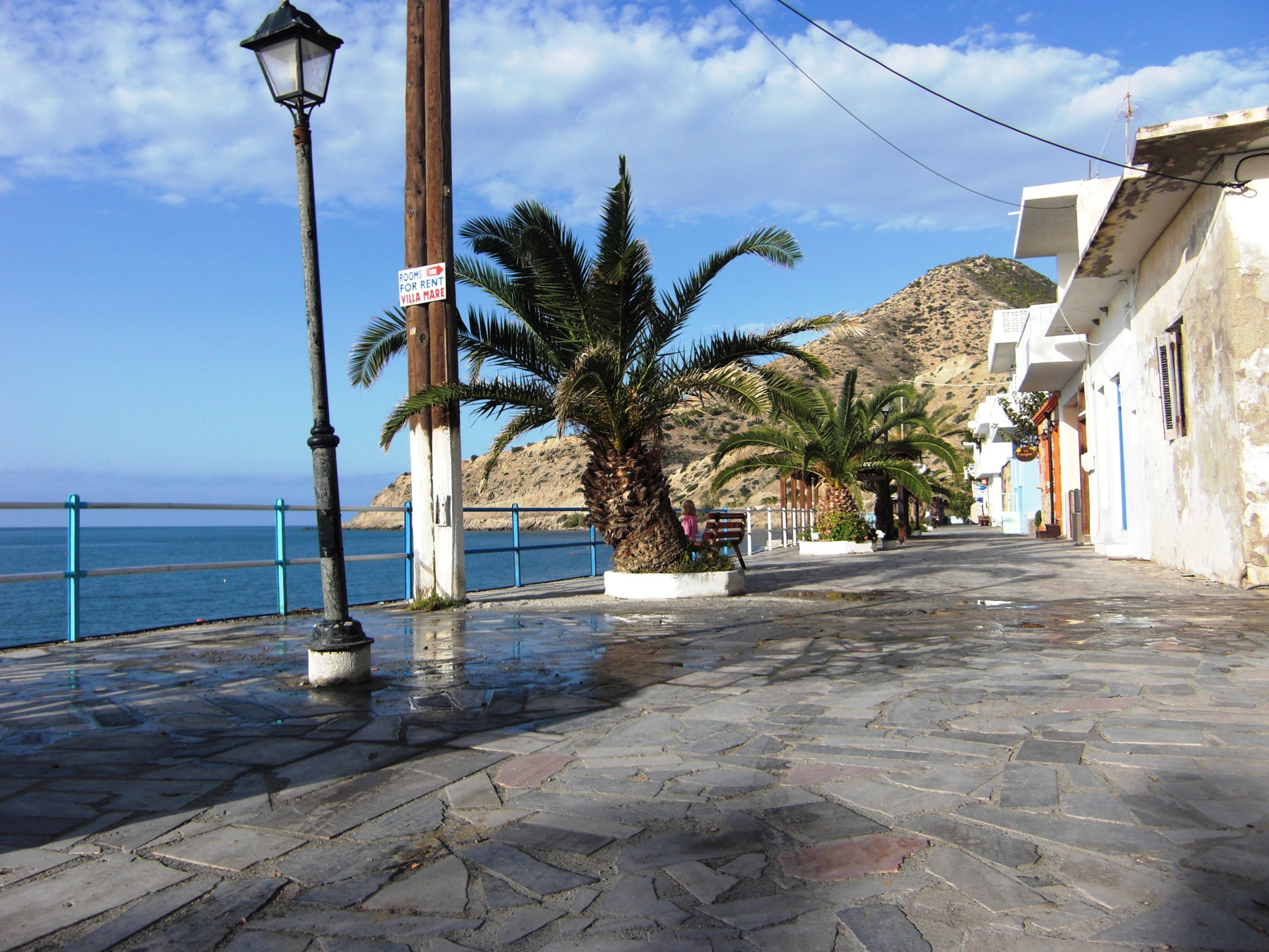
Well, not every cyclist shares the ambitious aims of a randonneur and ows a gladiatorial heart. So my description of this tour through the eastern part of the island goes out to the connoisseurs, to those who turn their faces towards the sun, enjoy the glittering of the big blue on a clear spring morning, spot the lone white sail on the horizon, and love a mild breeze. If you appreciate a hearty meal with the wine brought here from Touplo Monastery, when the evening air is filled with the buzz of laughter and voices, and the alleys of Mirtos are bathed in the golden light of the taverns and shops, this tour is for you.
If you approach Mirtos in spring via the coastal plain from the east, the first thing you’ll see is the peaks of the Dikti Mountains rising up above the horizon, and soon the whole mountain range seems to sway gently on the waves of the Aegean Sea. Like the banners of an army, the snow-capped peaks glow above the blue water and the valleys are filled with cold, fast-moving water. I wanted to see all this.

The first climb leads to the alp of Selakano, situated at 900 meters above sea level at the bottom of Mt Dikti. The main road towards Ano Vianos leaves the village in a northerly direction, parallel to the valley of the river Psoriaris which flows into the sea at Mirtos. After approx. 1,4 kms you turn right towards Mithi and Males. After another 3,5 kms you reach the village of Mithi on a steadily ascending road at 200 meters. For about 1.5 kms, the road now winds its way downhill through the Miocene marls, sands and conglomerates leading to the valley crossing of the Psoriaris.

Cut deep into the Pindos limestone, the Sarakino gorge follows to the west. Provided the water conditions in the gorge permit, this adventurous hike takes about 2,5 hours. In spring, sudden rainfalls can cause the water level to rise quickly and make climbing over the slippery rock blocks a dangerous challenge. For the complete ascent of the gorge, I recommend that you pack a pair of sturdy boots, a change of clothes, weather protection, a towel and a first aid kit. If need be, an alternative route back down to Mirtos is provided via the Males to Mithi road east of the gorge.
The beauty of the gorge with its steeply rising cliffs already unveils along the first 700 meters, which are easy to master. You can enter the gorge via the narrow path to the left of the Mirtos waterworks which is lined with reeds, olive, carob and fig trees.
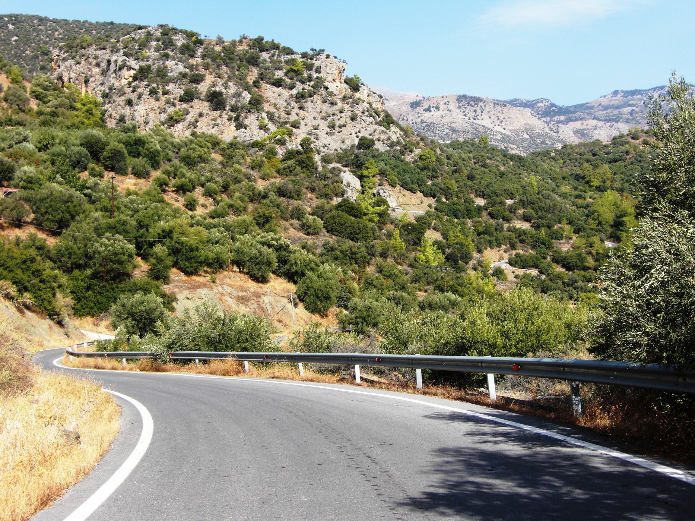
After crossing the river, the route proceeds uphill on a winding road through the olive groves that features ramps with gradients of 8-12%. Just before you reach the crossroads towards Males and Christos there are some challenging hairpin bends to be mastered, which are best done on the outer line. At the crossroads, turn left towards Christos and after 1,5 kms turn right into the steep ascent leading to the alp of Selakano.
The climb continues, but the surrounding landscape appears to have changed as if by magic. Only minutes ago you cycled through olive groves, past hissing irrigation pipes and small fruit and vegetable fields in blurred clayey marls and sands, and now you enter the alpine mountain world of the Pindos limestone where the air is crisp and cold.


In a narrow, arched curve, the road quickly rises up high above Christos and sticks to the steep slopes for the next few kilometers. Then, featuring an average gradient of 8%, it heads northwest towards the foot of the Dikti massif and the alp. A few pines and fir trees line the route which runs partly on asphalt and partly on short gravel roads with eroded sections and small offsets. Olive trees, grasses, herbs, autumn squill, sand crocus (romulea bulbocodium) and goatbeard (tragopogon sinuatus) now adorn the path.
Then the view opens up and in the circle of the snow-capped mountains you can see the scattered houses of the alp of Selakano. Proceed until you get close to the houses, then turn left and go past the small tavern “Stella” until you reach the fork in the village.
The alp itself is quite unspectacular. The true charm of the magnificent mountain scenery can only be discovered on a hike through the remaining pine forests above the village or on wanderings in the direction of Mt Afendis Christos (2.141 m), Mt Dikti (2.148m) and Mt Lazaro (2.085m). A connection to the Katharo plateau can be found at Males.


On the way back down to the road to Males and Christos and especially for the passage above Christos, mountain bike riding skills are required on the steep ramps. For racing bikes, it has proven useful to adjust the saddle height in such a way that you can also shift the center of gravity behind the saddle to maintain control when standing in the pedals.
Driving on a narrow ramp with a gradient of up to 20%, I tumbled into a sudden turn, just to encounter a huge truck driving uphill, loaded with precast concrete components. I have encountered such monsters carrying large chunks of lime or building supplies – including a road tanker – on several occasions and jumped off my bike or even off the road with my bike to avoid a crash. Once I fell on a scrub on a scarp, another time I was lucky to land among a group of goats at a watering hole three meters below the road. The truck tires grind on the side of the road and send behind some gravel and dust. And the truck engine roars: “There’s no room for a little worm like you!”

After reaching the road from Christos I proceed to Males. The large mountain village is beautifully situated on the north-eastern slope of the mountain range at approx. 600 meters above sea level. Greek tranquility and serenity characterize the atmosphere, and this attitude to life is best experienced when you stroll uphill and downhill through the narrow lanes and pay a visit to the Kafenion. At the church of Panajia Messochoritissa in the center of town you can admire some frescoes dating from 1413 which have faded somewhat over the years.
Connection to the Katharo plateau: Just before you reach the village of Males, a steep, ribbed concrete road on your left leads to the village of Katharo or the Katharo plateau respectively. It first takes you in a westerly direction and then towards the north. On this eight kilometer route to Katharo you have to master about 1.000 meters of altitude. After approximately three kilometers, the paved road turns into a gravel road.
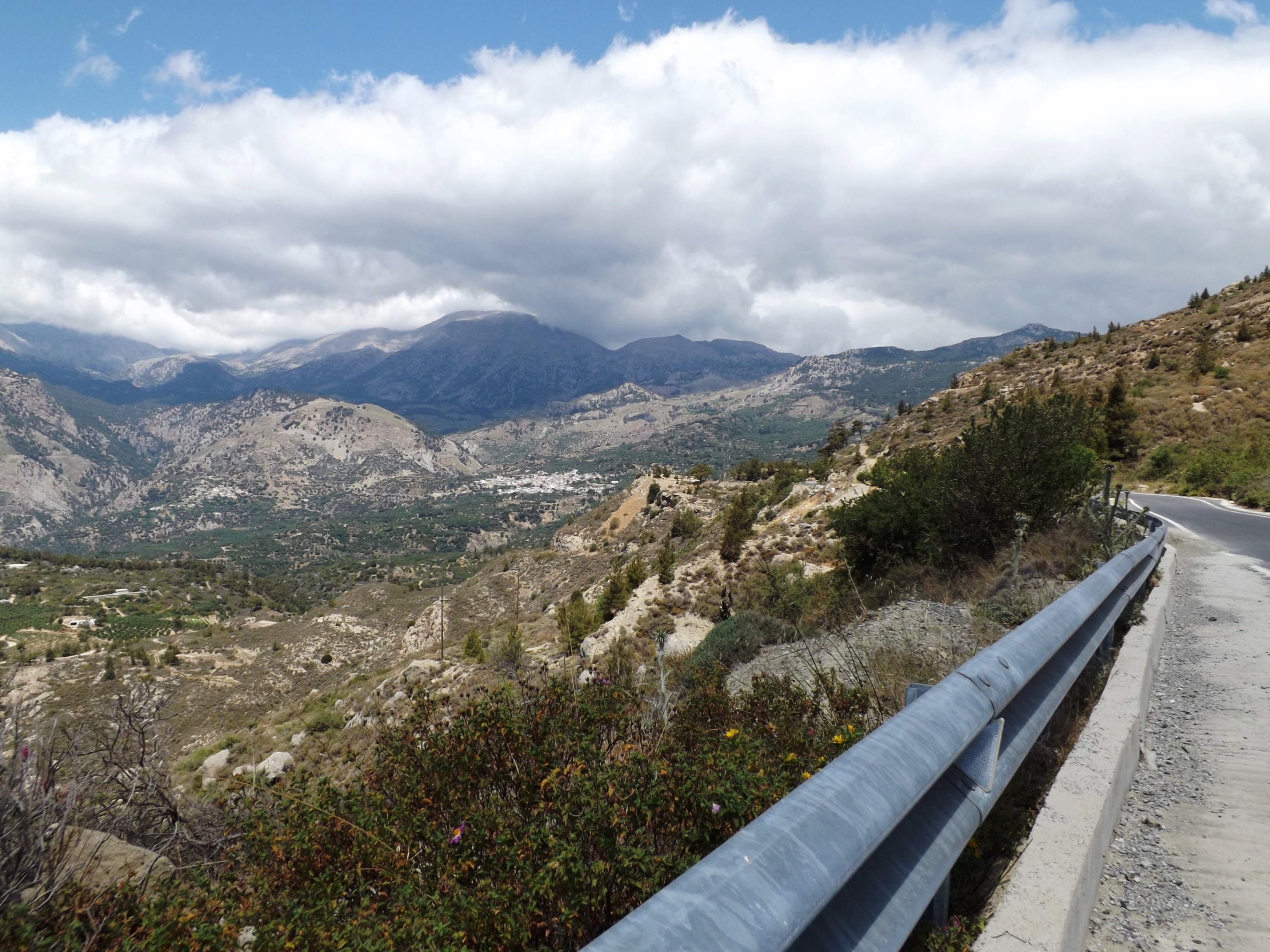
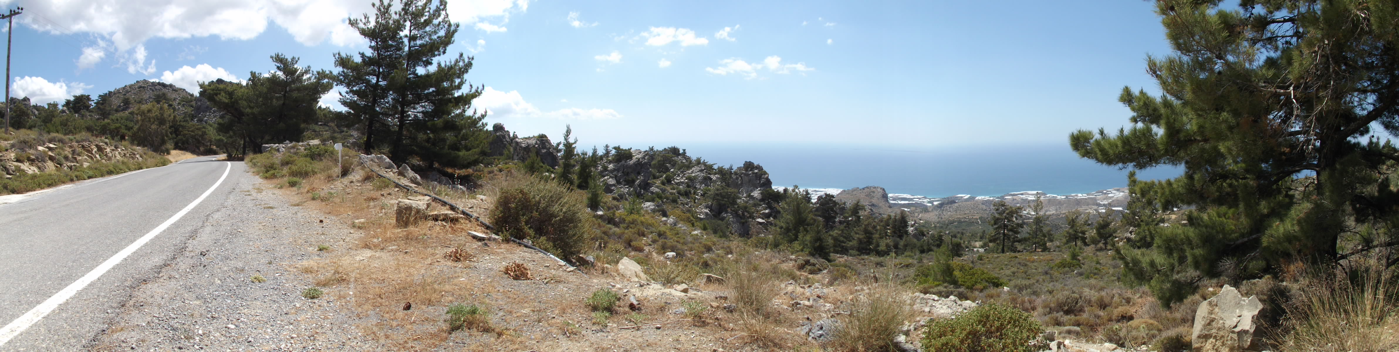
If you look out to the east and to the southern coast from Males, the grand “teatro spettacolo grandioso”, which our Italian colleagues had been raving about, will unveil. And it is truly spectacular! For the next 15 kilometers to Kalamafka, you will ride on the contour lines of 600 meters and 500 meters and discover one of the most varied and scenic training routes I have ever encountered. Featuring an average ascent of 3%, the first seven kilometers leading up to the pass at 700 meters take you steadily uphill. But the changing theater scenes are the ones that enchant you, while you master the uphill and downhill stretches.
Sometimes the impressive Lassithiotika mountains tower above you during an exhausting ascent, then the view opens up again, and you can look far across the coast and the sea while you rush along a curvy road at high speed, past the Miocene conglomerates and clayey marl.
From the pass, the panoramic road runs downhill on a nine kilometer stretch via Anatoli to Kalamafka. Irapetra is located in the southeast and Crete’s largest reservoir is halfway up. The Bramiana dam was built in 1970 as a water reservoir for agriculture. Today it is an important biotope and wetland for plants and waterfowl.

Once you leave Kalamafka, a steep 10% slope will challenge you for about one kilometer. The marl, sandstone and limestone layers reveal themselves. Crossing the hilltop, you’ll rush down at high speed to the village of Prina and down to the T-junction at the well-developed road that leads from the north and from Istro to Meseleroi and Irapetra in the south. Turn right here and follow the wide curve to a 1,5 kilometer ramp that has a gradient of up to 10% in store for you. Knowing that this will be the last serious climb, a mountain sprint is now the order of the day.
The route proceeds quite unspectacularly via Meseleri and Makrilia, through olive groves and vegetable gardens, past old windmills, and down to the small town of Irapetra, which is surrounded by tomato and banana greenhouses.
Our big play has only one more scene to go, and it’s good that the curtain will come down soon because it unfortunately has an ugly modern ending. We immerse ourselves in the “Anthropocene”, whereas I prefer the geological synonym “Psychozoicum”. To be honest, it is more in keeping with my experiences in dealing with my fellow human beings.


The coastal road leading to Mirtos via Gra Ligia, Stomio, Nea Anatoli, and Ammodoures is the traffic artery of this agricultural area. It makes even an experienced bike messenger break out in sweat. The region’s prosperity is based on the agricultural trade; there are countless greenhouses, factories of fruit and vegetable merchants as well as car dealerships, workshops, furniture and electronics retailers. Large trucks line up at the warehouses – and unfortunately they also drive around like busy bees, searching for the next beehive, always wrapped in heavy, greasy clouds of exhaust fumes.
Ahead of me and behind me, engines roar and drivers honk their horn. Directly in front of me, cars turn into the street from the left and right – just like bumper cars at the fun fair.
To top it all off, a GIANT shepherd dog barked straight into my ear. His drooling mouth wide open, he stood on the loading area of a pickup truck and his sticky mucus hit my face and helmet when the driver made a reckless overtaking maneuver; exactly what I need to fit in with this new stage aesthetics. It’s a good thing that all of this happened inside a big cloud of dust that somehow calmed the chaos, otherwise I might simply have freaked out or something may have exploded inside of me. In a nutshell, the last 10 kilometers from Irapetra to the final 50 meter ascent just outside Mirtos are sheer hell, at least in the evening rush hour. But this last short elevation separates the chaos in the east from the tranquility in the west. So I cleaned up my face as well as I could and happily entered Mirtos.