


3.0 Chora Sfakion– Anopoli– Ag. Ioannis– Chora Sfakion | A Story Of A Vendetta
A Story Of A Vendetta
So I ran him through with my bronze-tipped spear as he came,
back from the fields. I lay in wait of him at the roadside
with one companion. A dark night obscured the sky:
Nobody saw us. Unperceived, I robbed him off his life.
(The Odyssee 13.167-70; Homer – A New Translation By Peter Green; University of California Press, 2018)
„Nemo me impune lacessit“
In the all-hiding shadow, leaning against the rough limestone masonry, the murderer lay in ambush. The death of the Big Geórgios was decided. On his way from the alpine pasture through the pine forest, in the dust of the road to his village, he would face his fate. He pushed the long barrel of his rifle through the crack in the wall, carefully considering the position of the sun, so that no reflection of the metal would reveal his hiding spot. It was a family affair. More precisely, a redress for the shed of blood, between his family and Geórgios‘ family.
There were no laws for Geórgios. He stood in the shop that was just a long corridor with a door, stuffed to the ceiling with everything the village needed. At first, he was indecisive, almost shy, but then he stuffed the nuts, the bread, and the wine into his shepherd’s bag, and left – without a word and without paying.
When the old owner faced him, Geórgios just grabbed him by the shoulder and pressed him onto the chair by the cash register where the cheese was cut and the owner always kept a knife. Until one day when the owner took the knife which was only suitable for cutting cheese but not for an attack. Poor old man – Geórgios seemed to embrace him but he stabbed his shepherd’s knife through his back and into his heart.
The Old Man trembled, like a thin tree does when a large saw separates its stem from its roots in just a few strokes, and when Geórgios released him from his embrace, he fell to his death.
Accompanied by lament, Geórgios stepped out into the street. And the lamentation turned into a scream, a cry that went from the shop to the street, from one to another, into the houses where they cooked, weaved and grinded – eerie and shrill, louder and louder, again and again: “Aristeídis is dead and there stands his murderer!”

They all rushed into the street and were now facing Geórgios.
He picked up a huge stone from the side of the road, like you carry a sheep on your forearms, rolled it into his hands, lifted it high above his head with a grim groan, and his figure grew into a giant, and he threw the stone into the crowd. In horror, dismay, and fear, they scattered in all directions and the stone rolled down the road.
Three policemen came from the mainland to investigate and interview everyone. Geórgios was acquitted in court because he had acted in self-defense.
The Story of a Vendetta: The devil turned into an eagle and rose from his eyrie at the gorge, high above the plain and the village where everyone was sound asleep. He spun strands as fine as silkworm threads and tied them to the sleeping people’s hands, feet, heads and thoughts, while the silkworms ate mulberry leaves with a quiet smacking sound. He pulled on one thread or another to check them and thought himself into their dreams.

The sun blinded Geórgios when he stepped out of the pine forest, and, walking across the karst surface, turned towards the village. When he reached the bend with the defile, a giant came up to him and punched him in the chest with his fist, so that he could not breathe. He struggled desperately for air, for when the bullet hit him and shattered his sternum, it also shredded his lungs and, emerging from his back, took a piece of his spine with it.
His legs still moved forward, while his upper body, torn backwards, crashed to the ground and fell into the dust. His legs buried beneath him in a bizarre contortion, he lay on the ground in a muddle, like scrawny pieces of wood, torn from the trees by a storm.
The Giants: Then the murderer stepped in and noticed the astonishment in Geórgios’ eyes, for the latter saw the giants from his mother’s fairy tales, the leviathans with frightening grimaces, long hair and beards, huge eyes, and snake feet, the monsters that Gaea, the earth, had born, and that tore him to the ground: Peloros, Alkyoneus, Porphyrion, Ephialtes, Eurytos and Enkelados. He saw himself, his mother, and felt – as he did in the past – the fear in the all-encompassing dark of the night, while the blood left his body.
The Time had come under enormous pressure, a book full of pictures in the dust of the path, its pages tangled, browsed and whirled around by the wind – then opened individual pages. He recognized his sheep and called all of them by their names, the patient, the timid, the blind and the limping one. He saw the faithful old ram, the beehives, trees and vines, the steaming milk into which he poured the rennet, the fat loaves of maturing cheese, the wick that he dipped into the hot wax to wrap it layer by layer, and the gold-colored honey flowing from the centrifuge as the oil from the press. Then the pages of the book came loose, crept under him, pushed and lifted him high into the air, then they throw him headfirst onto the floor, dead.
The Devil, though, took two earthen bowls and put them on a weighing scale. He poured Aristeídis blood into one of them, and Geórgios’ blood into the other. The old man’s blood was lighter than Geórgios’, so that the scales were out of balance.
The devil nodded, knowing that the people down there who lived next door to one another would now bring death to others in the village. At least two more had to die in order to bring the devil’s scales into balance.
For there were the beehives owned by Geórgios’ family, whose flight holes were sealed with clay, so that after a few days all the bees died, just like the vines in the vineyard of Aristeídis’ family, north of the mountains, which that had just started to blossom when someone tore them out by the root – a whole row of about 70 Vilana vines, now dried out and scattered across the hill.
The Goat Bell: The Bell that Aristeídis’ son had forged for his bellwether rang for the last ones the devil put in the balance before everything dispersed, as there were no men left to protect or kill. They had fled from the revenge of the others and from imprisonment, fled from the hard labor in the quarry, to suffer early aging and an early death – far away from the pastures, cattle and mountains, far away from their families. It was an enchanting bell, because its clapper was not attached to the bell’s bridge with an eyelet, as usual, but as a joint with a round head, anchored in a matching receptacle inside the bell body, so that the clapper could move around in all directions. And it did – striking against the wall of the bell body, it played a melody so beautiful that everyone stopped in amazement when the sheep came down from the mountains, back to the watering place and to be milked.
The Mountain Time Trial - 3.0 Chora Sfakion– Anopoli | 12 km | 900 vertical meters
Mountain Time Trial | 12 km | 900 vertical meters

I could have burst into tears on this stretch of road, this increasingly steep gravel path that throws all the heat of the sky at us. … No breeze refreshes the glowing forehead, which has to bend over the handlebars over and over again, and can no longer believe that this mountain road will eventually end. … On the last switchback, my legs push into the dusty pedals like a machine, my body pushes the cranks around with its last strength, and it feels as if the narrow cranks were made of tough, liquid lead and no longer want to be pushed around … [Kurt Stöpel – Tour de France 1932, Verlag Harry Bartels, Berlin 1952; Covadonga Verlag 2004]
The Mountain Time Trial: Push yourself to new limits on this steep Mountain Time trial. I’ll hope that you are free from giddiness! First there is the salty smell and the rushing waves at the shore of enchanting Chora Sfakion, but then there are only barren limestone slopes, the serpentine road and bent guardrails which try to grab you with their iron-sheet-fingers. But this is just the beginning!

While you ride through Chora Sfakion, the road climbs steeply through the village towards Imbros and Chania. At the outskirts, just before you reach the medical center on the right, the road to the villages of Anopoli, Aradena and Agios Ioannis branches off to the left. Proceeding a bit uphill through narrow lanes, the road soon widens, and, with a gradient of 5%, follows the coastline towards the west. After two kilometers you cross the Ilingas Gorge in a wide U-turn. Then, after going uphill for another half a kilometer, you reach the bottom of the steep slope and the first bend of the time trial at 100 meters above sea level.
Nervously, my fingers move on the brake lever. The climb to the first hairpin bend is moderate, and so I dash into the steep inner curve much too fast. Parking cars block the way, people with parasols and beach accessories scurry past. They are on their way to the beaches in the west.

In an endless rocky desert of platy limestone, marl and sparse thorny bushes, the road now continues traverse to the slope and winds itself up to the second switchback at a gradient of 7%. Coming in through the wide and flat outer curve and with maximum acceleration on the straight, you climb a 400-meter path with a gradient of 11% up to bend 3. On the following two straights of 300 meters and 400 meters the route gets a little flatter until you cross the 200-meter contour line at curve 5.
Featuring four narrow U-turns (6-9) with gradients of up to 15%, the road is now carved into the steep slope. As you lift yourself up from the saddle, your silhouette dances on the road, following the winding path, curve after curve, steep section after steep section. Every grain of sand, every stone, every oil stain, every crack and every fragment of the road merge into a bright band that is greedily swallowed up by the shadow rushing on ahead of you. You have only completed six kilometers and reached 300 meters in altitude, but your legs are already burning from the extreme stress and high speed.

From the shadow in front of me a runner breaks free. Effortlessly, he sprints up the slope, the curves and the traverses with gradients of 5-7%. He turns to me and smiles. My breathing has turned into a moan, the heat rising from the asphalt has dried out my mouth, my tongue sticks to my palate, a sip of water drips from the corner of my mouth, and as if from far away I hear him shouting: “Go Nick, go!”.
It’s Dogan the boxer, my mentor if not Athena herself. He smiles, runs with ease, and pulls me along, faster and faster for the next two kilometers and up the counter slope to curve 13. The road now climbs towards the west in six sharp turns. The hairpin bends are connected by 200-meter to 300-meter straights with gradients of 5-8%. Standing up and going at a high cadence, I, too, climb effortlessly now. I lift from the saddle just ahead of the bend, and, shifting up a gear, I count and double the number of crank revolutions in the U-turns all the way up to the straights: 8, 16, 32, 64; then, I shift one gear down, and, back in the saddle, push forward with high frequency.

We are now face to face with Mount Kastri, because the road turns directly into the steep slope to the northwest and ascends to the big final on a 600-meter stretch with a gradient of approx. 12%. There is a short flat section, followed by the brutally steep ramps ahead of the 20th bend featuring gradients of up to 18%.
The mountain ridge with the pass and the antenna and power poles is towering high above the road, and you are well above 500 meters in altitude now. Nothing could be more delightful than to see the power cables leaning downward from the masts to the opposite side, an unmistakable sign that the pass is reached. Time to mobilize all your strength one last time. The path now turns downhill for some 250 meters, and at high speed you leave the 21st bend to manage the gradient of 4% on the 1-kilometer mountain sprint up to the plateau at 570 meters above sea level. Your body bent tightly over the handlebars, you go over the pass and get fast and faster for another two kilometers as you ride across the flat plateau. Fields, olive trees and orchards fly by until you happily reach the village of Anopoli in the karst valley at 580 meters in altitude.
3.0 Chora Sfakion– Anopoli– Ag. Ioannis– Chora Sfakion - Aradena and Aradena Bridge
Aradena and Aradena Bridge
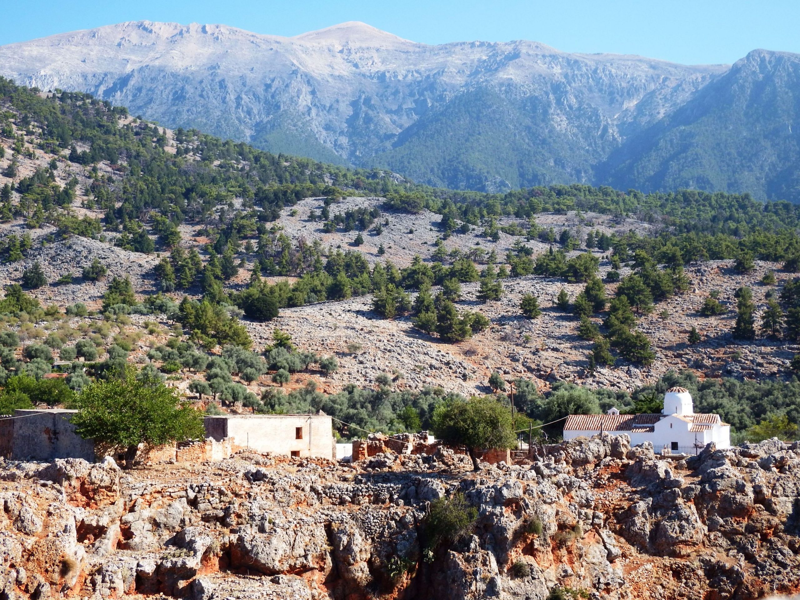
Aradena: With the snow-white peaks of the Lefka Ori mountains gleaming in the distance, the picturesque village of Aradena adorns the deep gorge. Just as brightly, the little white 14th-century church of archangel Saint Michael illuminates the steep slope. Built with ancient stones on the foundation walls of a Paleo-Christian Basilica, it was designed in the shape of a Byzantine cross. The interior is decorated with Byzantine frescoes and bears witness to the past, including the history of the city-state of Aradin, an ally of Pergamon in Asia Minor, which was once situated here.
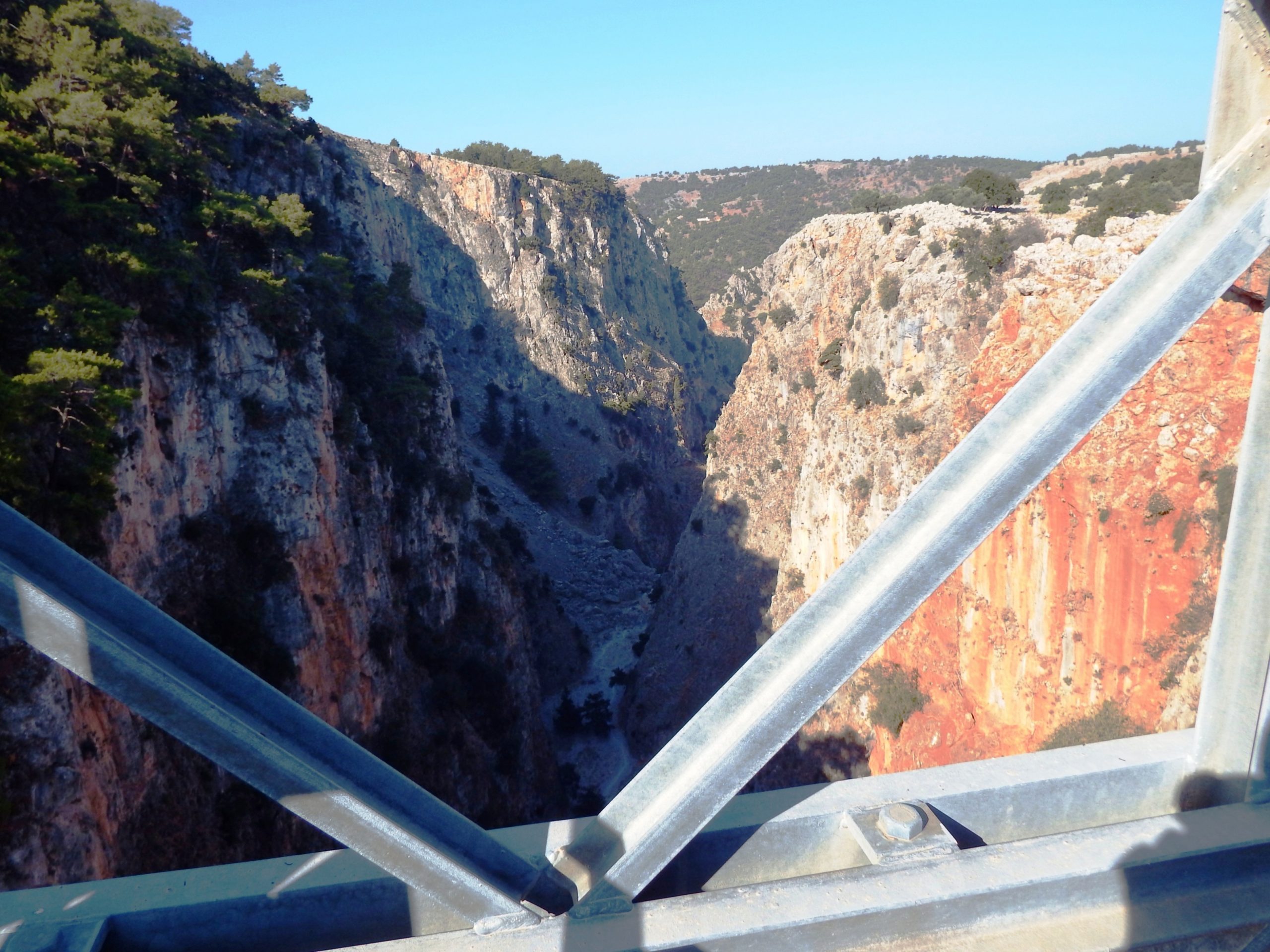
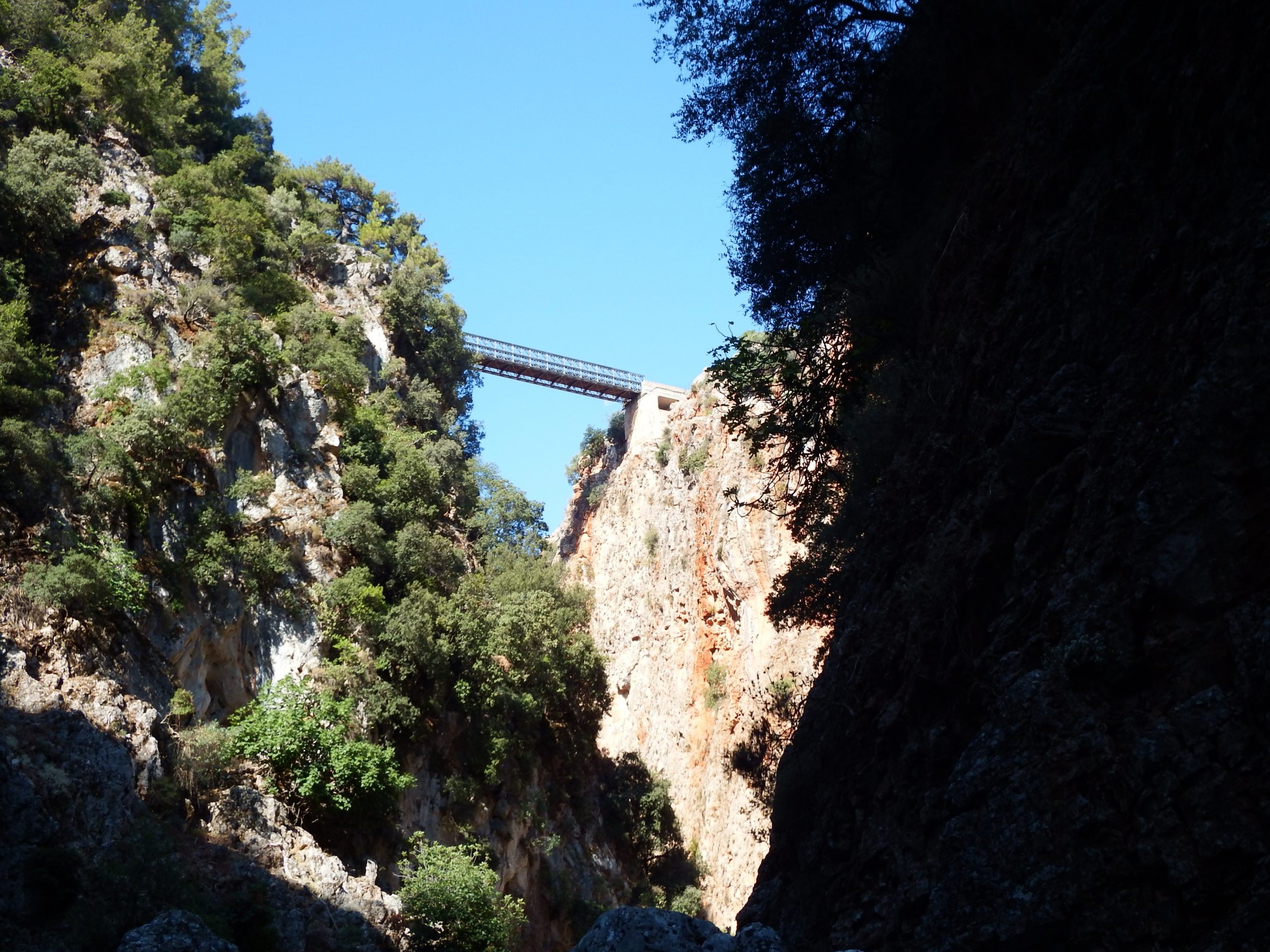
Aradena Bridge: The Aradena Gorge is spanned by a Bailey type truss bridge made of steel. Its supporting width is 84 meters, the length of the actual steel construction is 65 meters, and its height above the deep gorge is 138 meters.
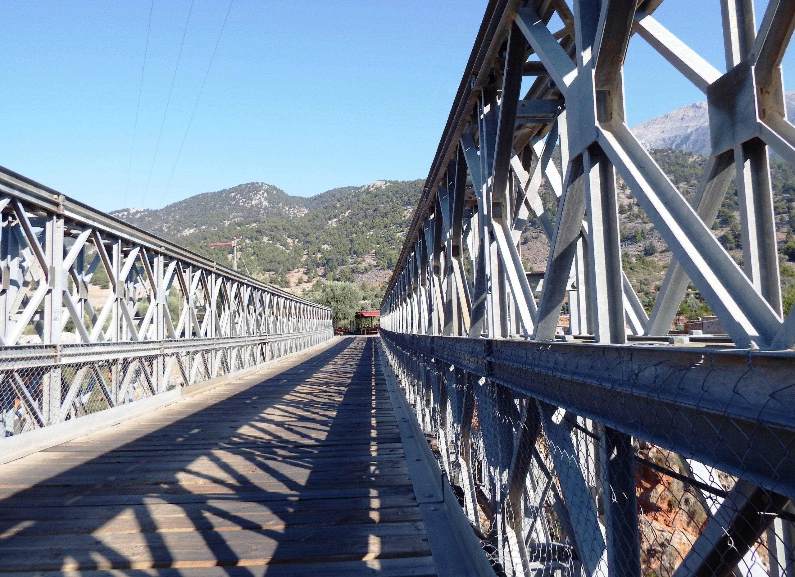
A Bailey bridge can be built from prefabricated standard truss elements without the aid of heavy equipment. It can be pushed over the obstacle to be bridged via roller bearings. You always connect so many bridge elements that the bridge can be pushed over the obstacle in balance or with a sufficient counterweight on the production side. To avoid a lowering of the bridgehead due to the bolt connections of the individual segments, an angular, upward-pointing “launching nose” in lightweight construction is applied at the foremost section, so that the bridgehead can safely be placed on the opposite bridge foundation. Instead of bolts, they used screw connections at the joints of the Aradena Bridge’s elements on the upper and lower chord, thus achieving a stronger connection of the individual segments and low deflection.
The 65-meter assembly line required to pre-assemble the necessary bridge length is still clearly visible today: It’s that straight section of road on the access side in the alignment of the gorge crossing. The unloading and storage area for the bridge elements used to be to the right of the assembly line.
Pavlos Vardinogiannis (1926-1984), a member of the Vardinogiannis family from the neighboring village of Agios Ioannis, initiated the bridge construction. His four brothers founded the Motor Oil Company in the shipping and oil business, one of the most financially successful dynasties in Greece. Pavlos Vardinogiannis studied law in Athens, was elected to Parliament in 1956 and became a minister in the government of G. Papandreou in 1964. After the coup and during the dictatorship he lived in exile. He returned to Greece in 1974 and was re-elected to Parliament in 1977.
Thanks to his initiative, the first gravel road link between Agios Ioannis, Chora Sfakion and the north of Crete was established, and with the financial support of his brothers, the bridge over the Aradena Gorge was built – in an area where goods were still transported on centuries-old mule tracks (Kalderimi) until the 1960s.
3.0 Chora Sfakion– Anopoli– Ag. Ioannis– Chora Sfakion - A Hike In The Aradena Gorge
A Hike In The Aradena Gorge
Welcome, dear audience, listen to the wind blowing through the gorge and rustling in the pines and oaks! Yes, the planking of the bridge starts its drum roll, this is the opening tune. Step into this spectacular and grandiose gorge. Tremble at the breakneck climbing sections, shudder at the sight of mummies and skeletons, marvel at the wonders of nature in the cabinet of curiosities – only here, in the Aradena Gorge!
The Aradena Gorge may be one of the lesser known gorges of Crete, but is all the more spectacular. So, take off your cycling shoes and slip into a pair of light trainers for a short and easy hike in the Aradena Gorge. When you stop for a break at the Aradena kiosk, it is advisable to ask the shop owner to store your bike inside his rooms. Under no circumstances should your bike be left unattended or without being well and safely locked.
The gorges, which are mainly cut into the limestone, were formed by the strong uplift of the mountains opposite the coastline, along a fault running from Chora Sfakion to Paleochora to the west. The gorges themselves were formed by drainage and karstic weathering along existing faults as well as by the fracture tectonics associated with this uplift of more than 500 meters, which has been going on since the late Miocene.

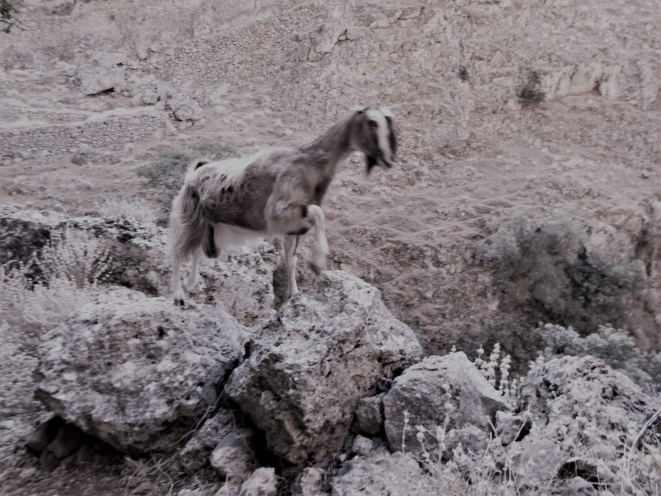
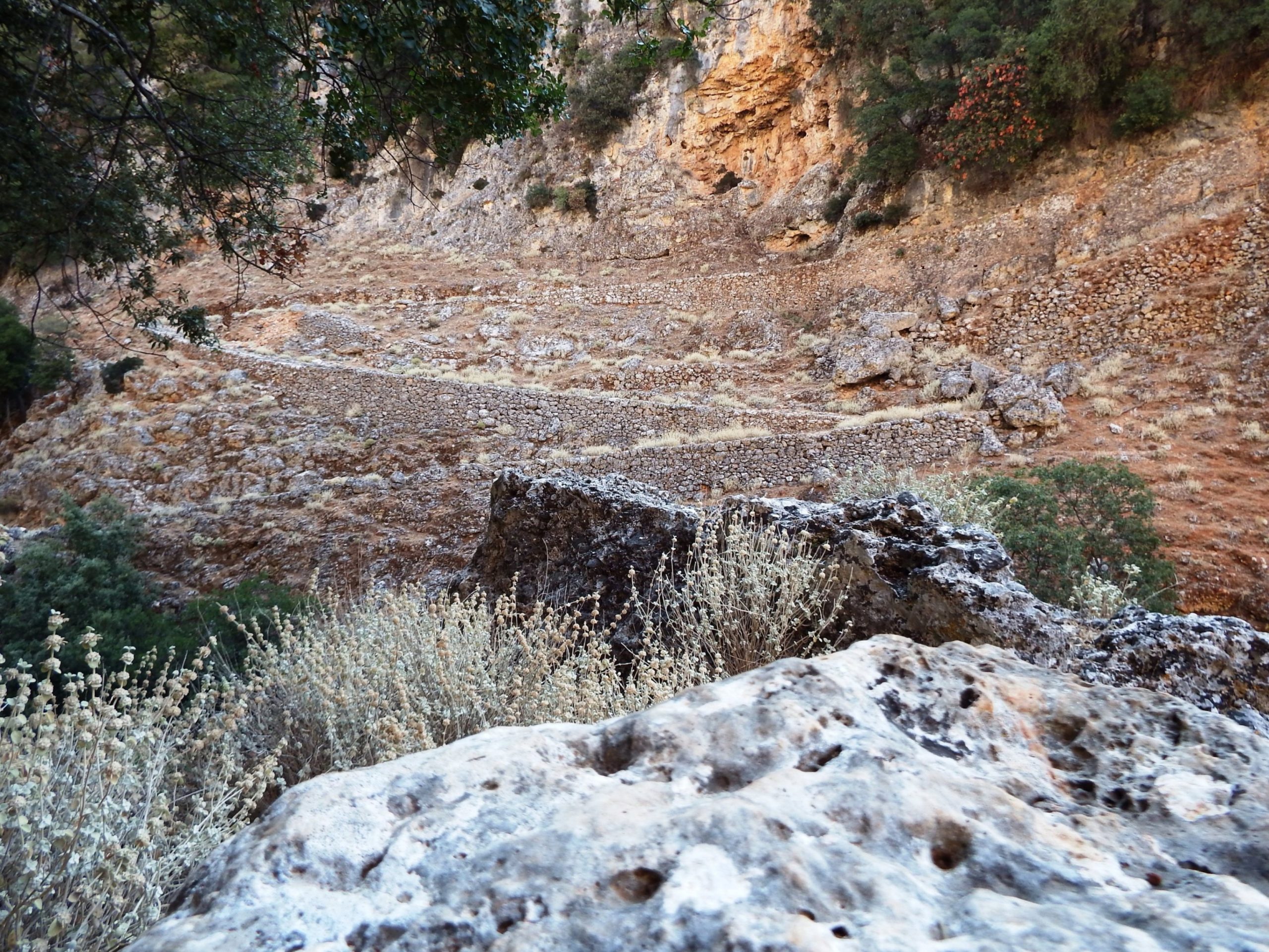
A Hike in the Gorge: Walk past the car park directly behind the kiosk and the ruins of the old oil mill on the western side of the gorge, then towards the north through the largely deserted village. When you approach the church and cemetery, turn left until you reach the gravel road running northeast. Follow it to the end of the village, where the paved mule track leads down into the gorge in narrow bends.
It’s shady and cool at the bottom of the valley. The soaring rock walls are up to 200 meters tall, and above the crypt, the bridge spans the gaping gorge at a dizzying height. Every rattle of a car crossing the bridge is amplified and echoes down into the mysterious silence of the underworld.
The walls of the gorge are cut into the sporadically overgrown limestone (Plattenkalk). At the bottom of the valley, where oleanders, pines and oaks adorn the slopes and the scree on the rocky ground, you can find thyme, sage, savory, chaste tree berry, lavender, oregano and capers, but also endemics such as ebenus cretica, linum arboreum with its yellow flowers or delicate ricotia cretica.

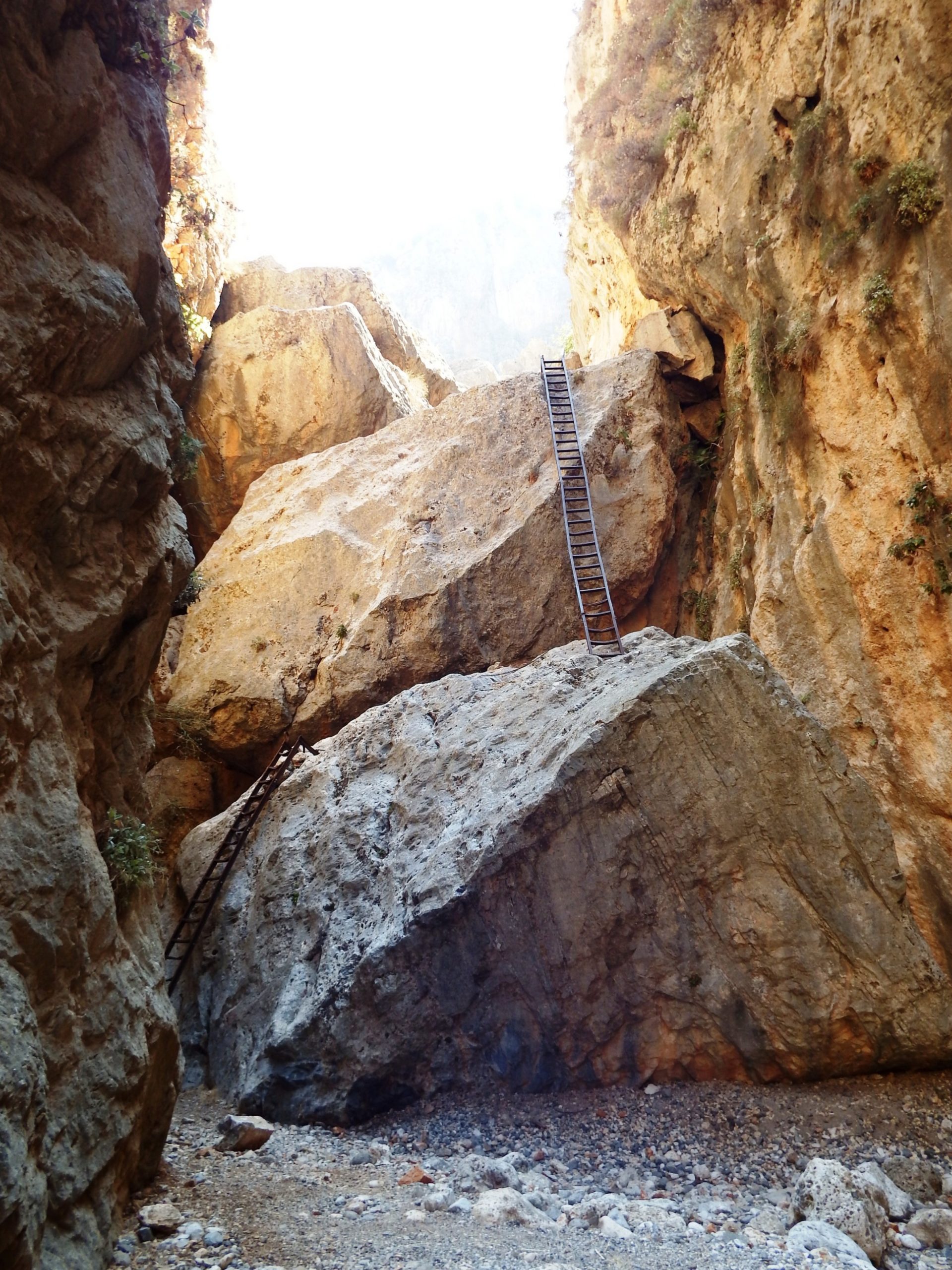
After half an hour of hiking, the first spectacular descent is reached via two huge limestone blocks that have fallen into the gorge. The descent of about 12 meters is made via two iron ladders (or, alternatively, by a walkable detour). In the past you had to hurdle this place with ropes and along an iron chain.
Proceeding coastwards, you’ll climb, slide and jump over some more large limestone blocks. Markings help you find your way, but are missing in some places, so you may have to climb back a bit from one or the other dead end.
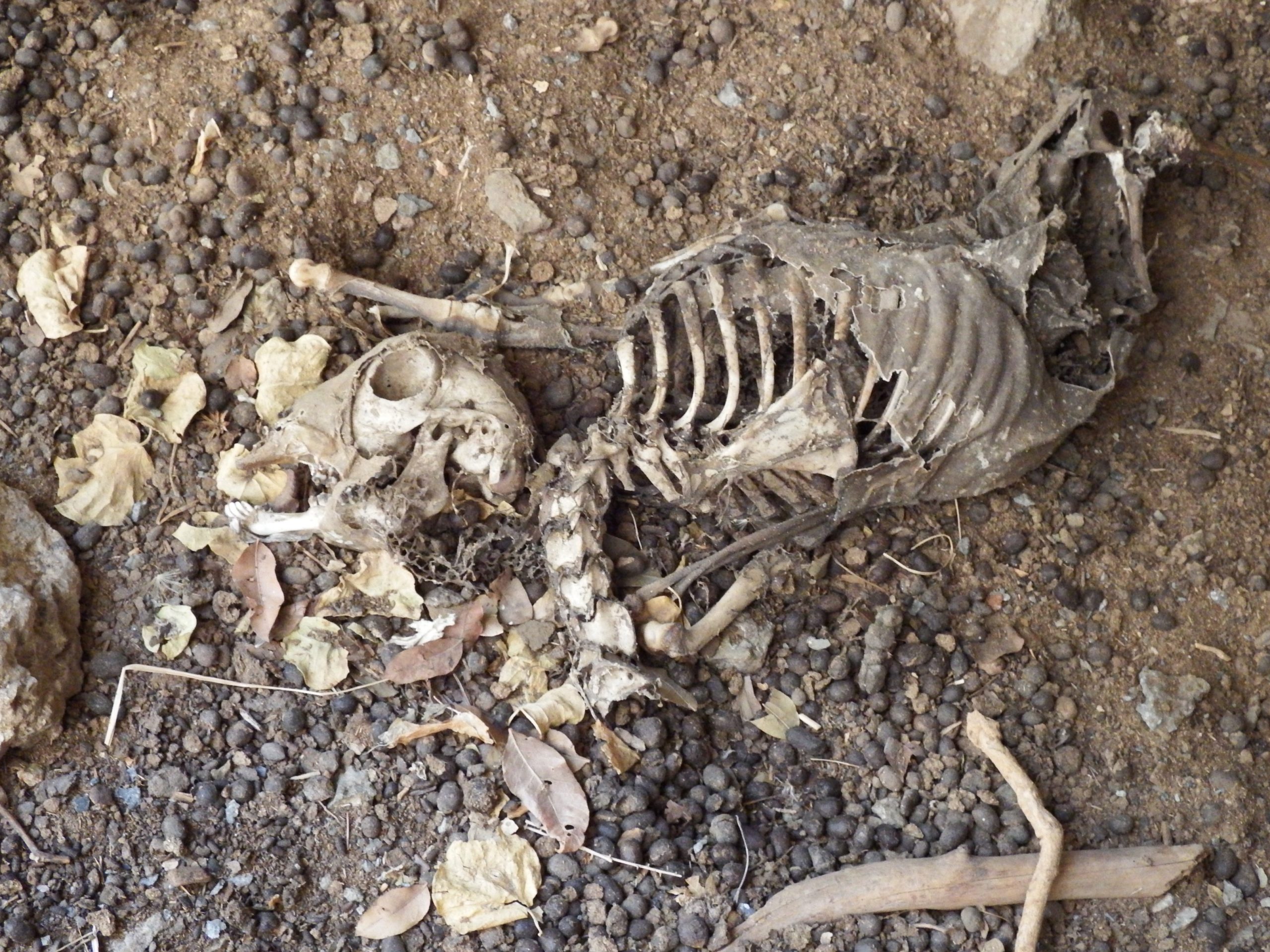
So … Bearded vultures circle already over the gorge in search of animal carcasses or a lonely hiker on a steep ridge in the middle of nowhere.

For those who know the way, the canyon hiking tour up to Marmara Bay takes approximately two to two and a half hours. The hiking tour through the canyon is definitely not suitable for children or people with a physical disability. I recommend that cyclists who wish to master the complete biking tour turn back shortly after the ladder passage.
As it can get extremely hot in the lower part of the gorge, sufficient water supplies are essential. You’ll be rewarded by the colorful marble grottos along the coast of Marmara Bay, into which you can easily swim from the beach.
3.0 Chora Sfakion– Anopoli– Ag. Ioannis– Chora Sfakion - The Tour To Agios Ioannis | 3 km | 220 vertical meters
The Tour To Agios Ioannis | 5 km | 200 vertical meters

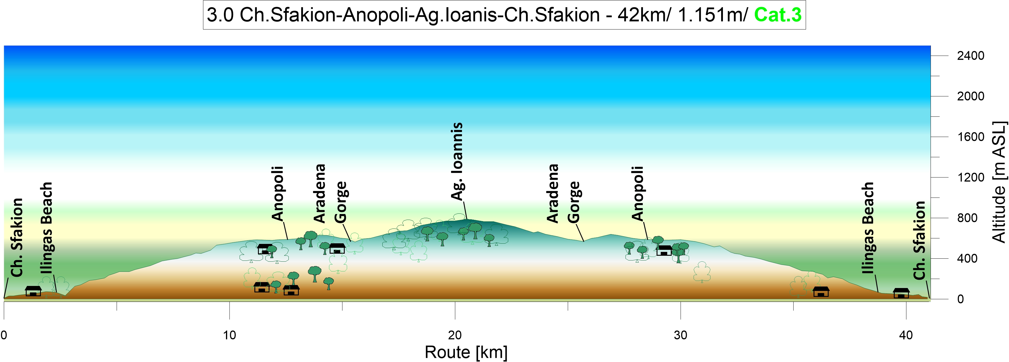
To Agios Ioannis: The weather has changed, fog rises up, and after crossing the Aradena Gorge you enter a completely different, alpine world. For five kilometers, the path from Aradena winds itself through a limestone scree dotted with juniper, rockrose, spurge (euphorbia acanthothamnos), herbs and grasses. There are still a few olive and cypress trees on the plain, and on the slopes a pine forest accompanies the road that ascends 200 meters in altitude while leading up to Agios Ioannis at 780 meters above sea level.
The karst valleys are adorned with green pastures featuring olives, juniper, wild flowers, herbs and grass. Here and there, pyrus spinosa, a very branchy wild pear tree shows off its glowing white blossoms as if to light the way and guide you through the fog.
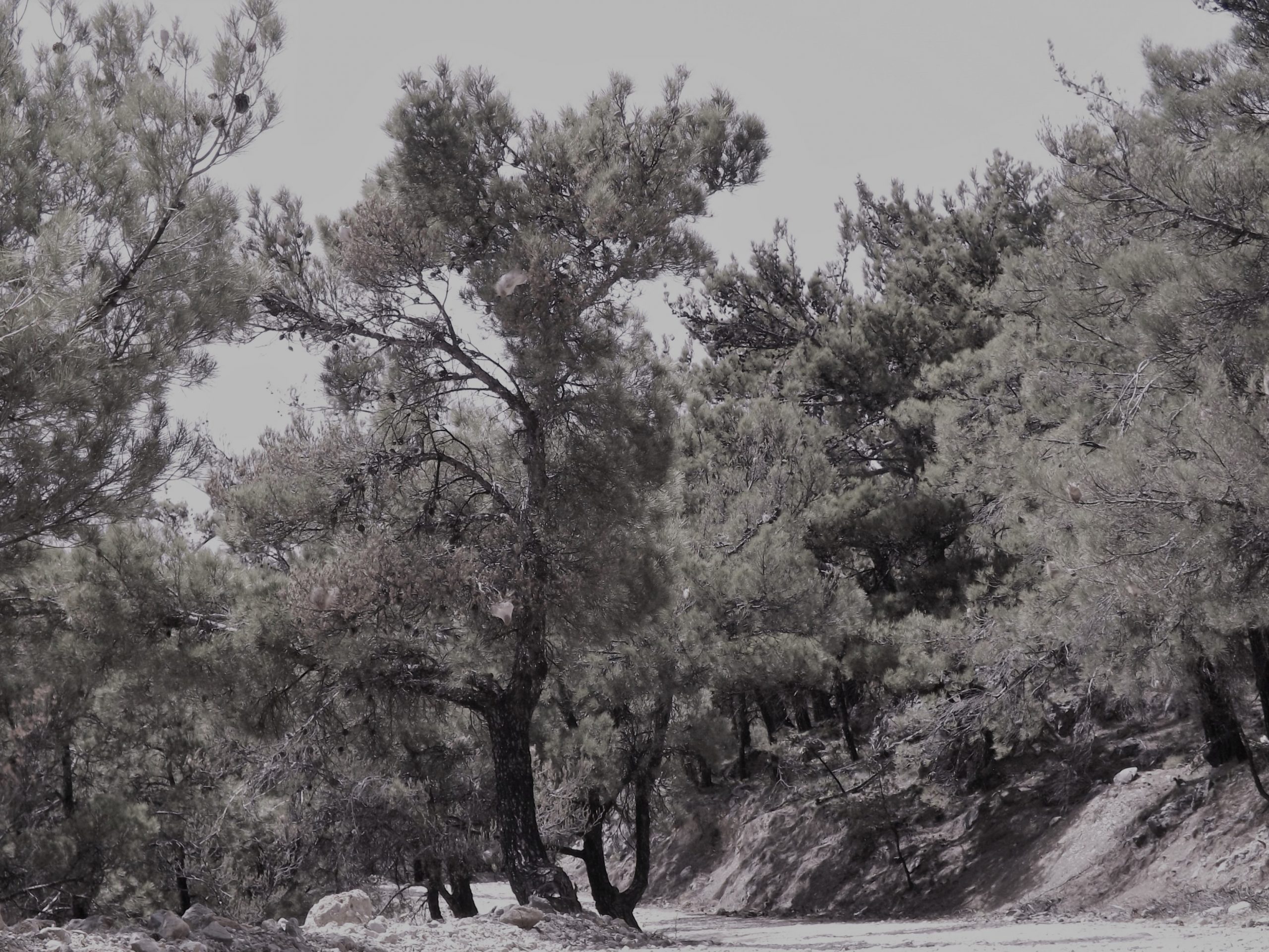
In the north, the barren Mount Kefala and Mount Koutska, still covered with snowfields, disappear in the clouds, and the warmth rising up from the road makes for a peculiar contrast to the cool wafts of mist from which sheep appear and disappear again like aliens. And just as suddenly the first scattered houses of the mountain pasture of Agios Ioannis emerge from the fog.
A Days Adventure: The 12-kilometer ascent to Anopolis, the three kilometers to Aradena, a three-hour detour into the Aradena Gorge, the five kilometers to Agios Ioannis, and the return journey to Chora Sfakion add up to an enjoyable and adventurous day trip of about seven hours, including breaks. In total there are 42km and 1,151 vertical meters to be mastered. Go for the adventure!