


8.4 Mirtos- Thrypti- Orino- Chrysopigi- Bemponas- Sitia | 93km | 2.801 Vertical meter | Hors catégorie
93 km | 2.801 vertical meters | Hors catégorie

When shall we three meet again, In thunder, lightning, or in rain?
When the hurly-burly’s done, When the battle’s lost and won.
That will be ere the set of sun. Where the place?
Upon the heath. There to meet with Macbeth.
I come, Graymalkin! Paddock calls. Anon.
Fair is foul, and foul is fair.
Hover through the fog and filthy air.
(Macbeth; William Shakespeare)
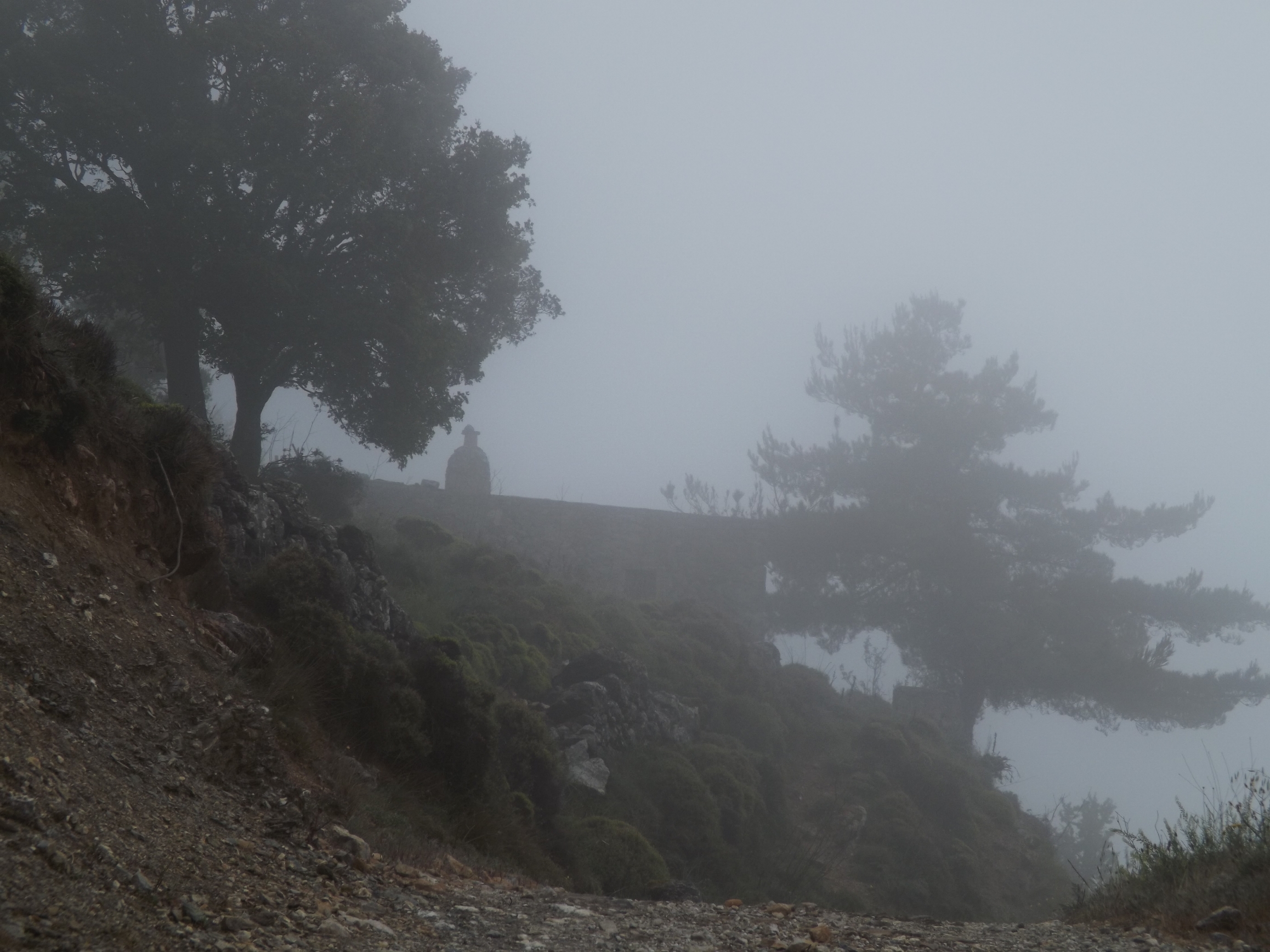

The path is lost in the darkness, the pines veiled by the mist. The wind is like a whisper from the cobweb, that is the forest. The prophecy must be fulfilled, there’s no way back. Too steep the narrow ridge, so close to the abyss, and slippery the wet ground. You are trapped in Cobweb Castle.
Up to Thrypti: In a magnificent landscape, the rough concrete road coming from Kato Chorio winds upwards in narrow curves from the Ierapetra ditch into the Thrypti mountains in the north-east. As if the route wished to prevent your ascent, fissures, cracks and deep tracks pull at the wheel and handlebars. The ribbed concrete road seems to breast those who embark on the adventure.


Leaning closely towards the steep wall of Tripolitza limestone, the road climbs up the rock wall leading into the mountains with gradients of eight to ten percent. After six kilometres of exhausting climbing, the rough path turns into an asphalt road, which now swings eastwards for another four kilometres to the Thrypti alp at 850 metres in altitude. The pine forest is covered in fog, with young oaks glowing brightly in the green surrounds.

Nestled in lush gardens where fruit, vegetables, and, most importantly, wine grows, the houses of Thrypti pop up from the mist. Suddenly i had a taste impression of spice and fruit flavours next to alcohol, and I was close to ordering a glass of local Vilanawine in Thrypti’s only tavern to refresh my palate.
To Orino: From the car park with the water tap and the map, the E4 signs point the way through the village to Orino. For about one and a half kilometres, the concrete road still leads you through the village, then the gravel road begins, just ahead of a bend with a signpost to Mount Afendis. Proceed straight ahead on the dirt road with the power poles and do not follow the right-hand bend.
Through the slate of the phyllite- quartzite- unit, the route goes steadily uphill on the gravel road until, to the north, and through the deep, steep-edged Kavousi Gorge, the view opens up far down to the Ierapetra ditch and into the plain of the northern coast around Pachia- Amos.
After another one and a half kilometres you reach the pass at an altitude of about 1,000 metres where the gravel road branches off to Mount Afendis Stavromenos [1.476 metres]. A hike up there means an ascent of 500 metres in height, and you’ll have to manage about five kilometres in each direction.
The gravel road from Thrypti to Orino is certainly not suitable for racing tires, but you can easily ride on it when using Cyclecross tires. Their road bike version, up to a width of 31 mm, is the perfect tyre for this tough job. Uphill gradients and narrow bends are often concreted, but there are a few eroded stretches, especially on the descent to Orino, where you have to get off your bike and push it for a short while.

I recommend you carry a pair of light sports shoes in your backpack, so that you can comfortably stretch your legs for a while. Long cycling shorts, a fleece shirt, a wind vest and rain jacket are also recommended for the weather conditions and low temperatures in the mountains.
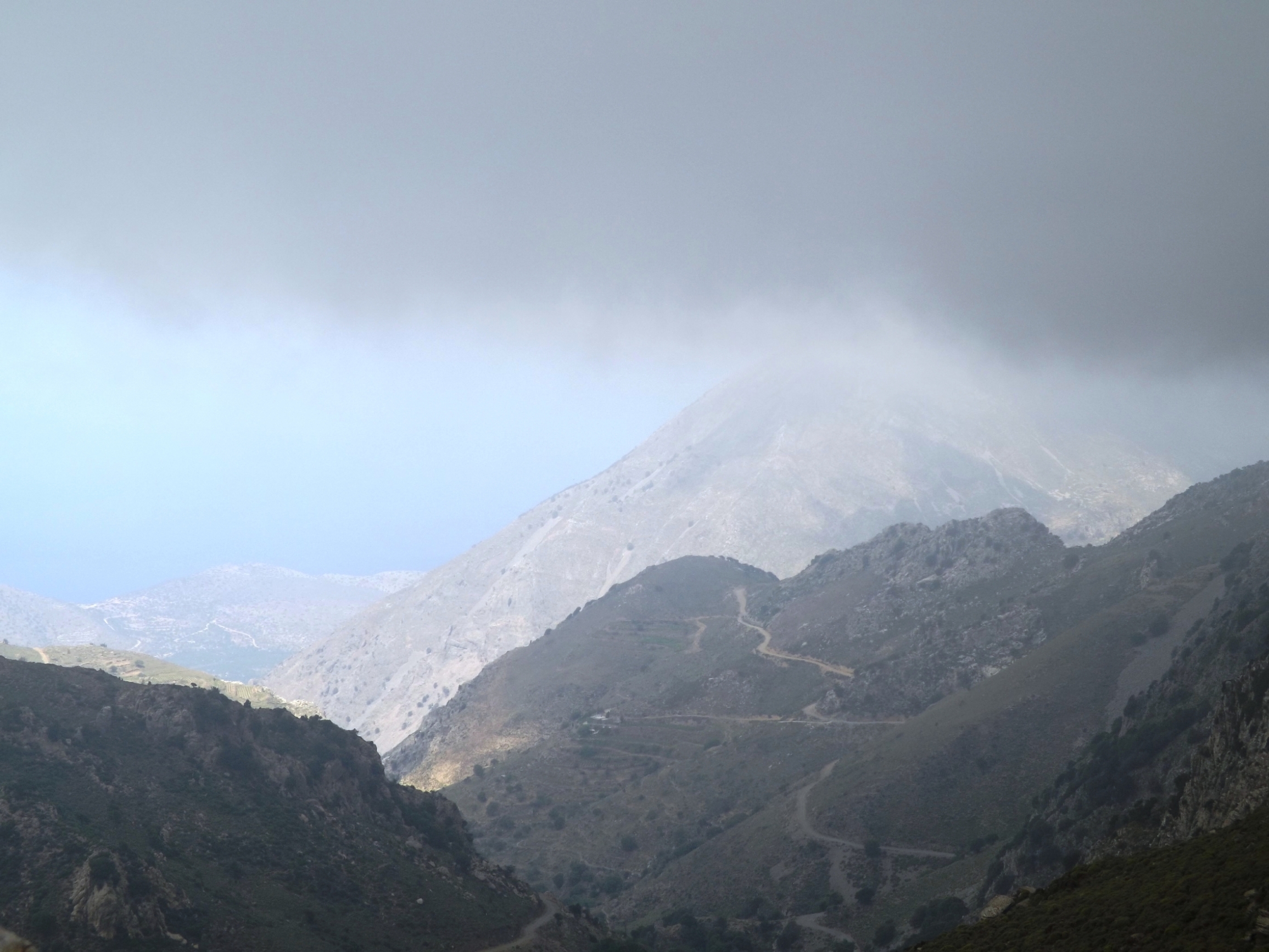
Orino: The fog rises, the sun bathes the beautiful landscape in a warm light, and after a four and a half kilometre descent from the windy pass, the first white houses of Orino stand out against the green surrounds.
Irises and violets bloom along the way, and there is a smells of sage, mint and thyme. From the slopes, you can hear shepherds shouting and sheep bells ringing all over the place as the sheep run down to the watering holes.
Make a short stop at the highly recommended Kafenion, then leave Orino at the northern end of the village and turn east.
Taking in the magnificent panorama of Mount Afendis Stavromenos and the mountain plateau around Orino, you will now climb some 100 metres in altitude in wide serpentines leading to the pass at 740 meters. The asphalt band bends down from the heights into the valley, and you rush through the fantastic alpine landscape of the Thrypti mountains, gently embedded in the soft shapes of Tripolitza limestone, past juniper, flowering orchid and crocuses.


It is like a dance with a recurring sequence of steps you have to take: Adjust the speed before you enter the bend, keep an eye on the inner curve, and, more inclined than actually steering, start at the very outer edge, then pull inwards towards the centre of the curve, firmly clamping your buzzing racing bike with your knees, and, gently held by the centripetal force, glide back to the outer edge and out of the curve with increasing speed.
Since you left Orino, you have covered five kilometres on asphalt. Next are another three kilometres of gravel road, largely easy to drive on when using cross tyres. Only in the steep hairpin bends with eroded draws and loose gravel it may be necessary to get off your bike briefly.
A short break at the little church of Panagia Kapari, shaded by oak- and cypress trees, situated only 100 meters off the path in the vineyards and olive groves. From here, you can look far down into the valley and to the south coast around Koutsounari and to the foothills of the Thrypti Mountains.

Stavrochori: Finally you will spot the village of Stavrochori in the valley below.
It’s very quiet, everything has calmed down. Then the sound of voices is carried up from underneath. A mother and her child playing, a dog, a motorcycle, a call, and the birds are singing again. Time stood still for a short while.

Chrysopigi – Bemponas: At the village entrance to Chrysopigi I had a short tête-à-tête with a ready-mix truck, which left me powdered with dust, as I was trapped between the truck and the garbage bin. The dust caused me to choke up while, when I was breathing again, I was next to the garbage bin and inhaled a full load of indescribable scents.
I was longing for some fresh air. Fresh and crisp as on a mountain alp. For those who started early in the morning and still have enough energy, the six kilometre drive and 400 metres of altitude difference up to the Bemponas Alp and the pass at 800 metres are worthwhile. On the outskirts of Chrysopigi the gravel road branches off to the west. The first serpentines are not passable, but then the path improves. Cross tyres are also required here.
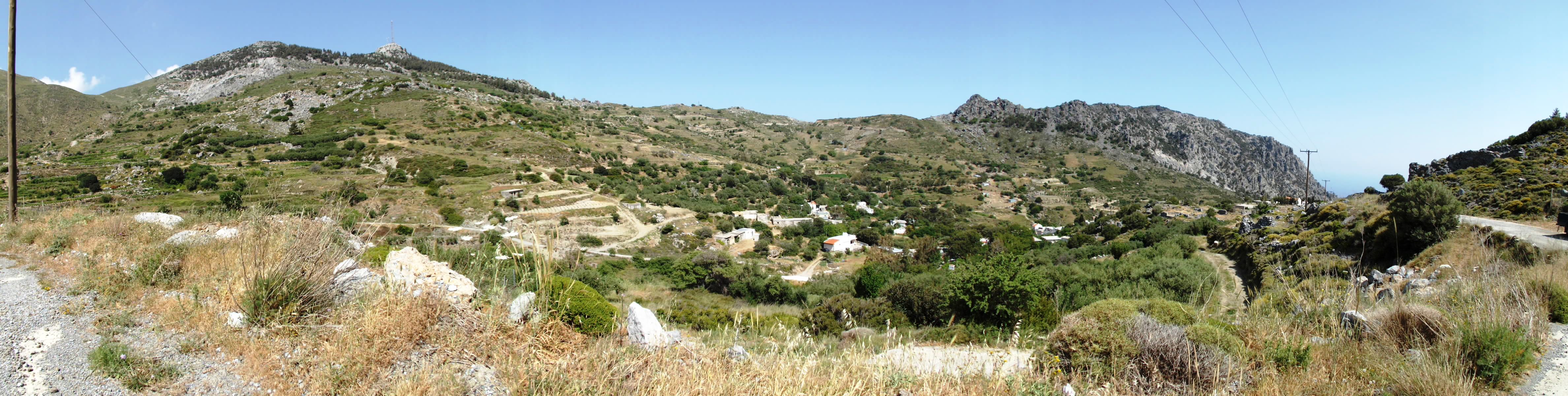
From the western slope of Mount Askordlia [1.237m], passing juniper, olive, fig, and carob trees, the path leads up through the picturesque valley that rises up steeply to the west, enclosed by the surrounding mountain ranges.
The limestone flanks of the Thrypti mountains in the southwest and the Orno Oros mountain range in the northeast directly rise up to 1,200 metres. At the end of the valley you reach the village of Bemponas: a small church, a few houses with vegetable gardens, vineyards, and olive trees on the terraced slopes. Boasting wonderful views of the northern coast but also eroded stretches, the last 500 metres (0.3 miles) of the route from Bemponas up to the pass are a real challenge again. The view down into the Kavousi gorge and to the north coast is simply fantastic. Like in a big theatre, the gorge opens up to the Gulf of Mirambello, where the coastline from Pachia Amos via Kalo Chorio and Ammoudara to Agios Nikolaos is dotted with sparkling bays.

Over The Pass To Sitia: Leaving Stavrochori to the east, the route proceeds downhill for another kilometre. Next, along the south-eastern flank of the Orno Oros mountain range via Chrysopigi, is a 12 kilometre passage featuring moderate gradients.

You’ll ride up and down through green valleys, but always uphill until you cross the pass at 640 metres. Now you can look forward to a winding 18-kilometre descent. From the limestone mountain range, the road now leads through the soft landscape of the phyllite- quartzite- unit, then deeper down into marl and sand layers. For about 45 minutes, a fast descent takes you constantly downhill via Skordilo, Paraspori, Achladia, and Piskokefalo until you reach Sitia.
Sitia is a small, tranquil harbour town that has retained its Cretan character. Restaurants and cafes line the coastal promenade. Head to the south-eastern part of the harbour to find some excellent eateries. Cretan snails with rosemary in olive oil and wine as well as the fish specialities are highly recommended, along with wine from the monastery of Toplou. In the evening, when people stroll in to party and have dinner, the tranquility transforms into a lively buzz.

Accomodation: Itanos – Platia Iróon Polytehniou. Sober hotel atmosphere, centrally located on the main square, rooms predominantly featuring sea and city views.